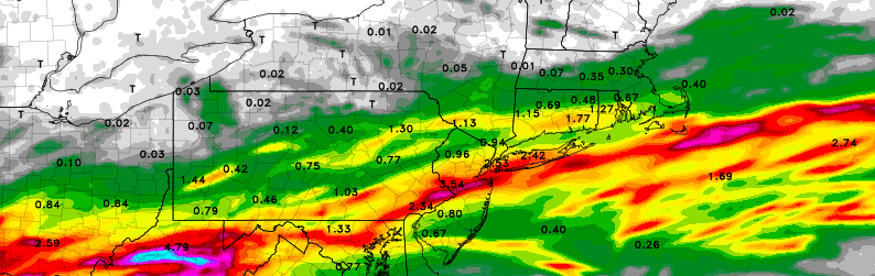
Major rains possible through Tuesday, may impact fireworks

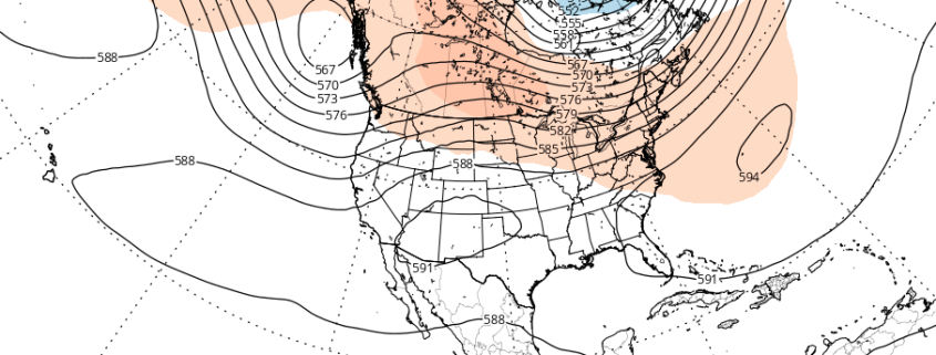
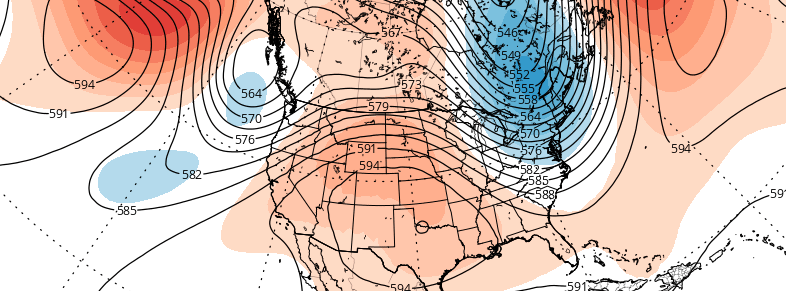
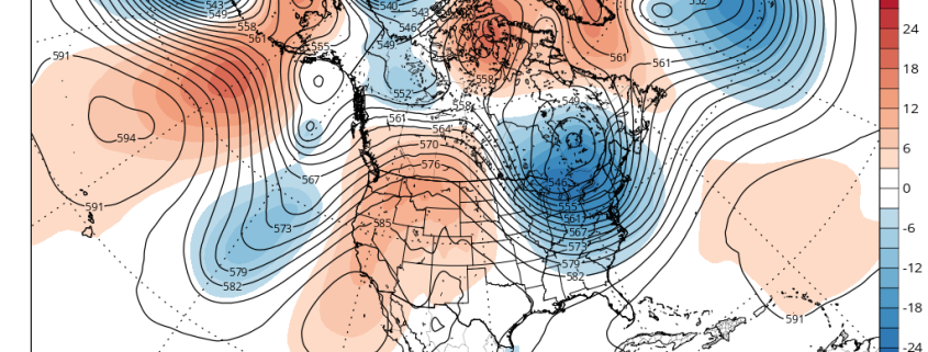
A well advertised frontal boundary, and associated low pressure system, are forecast to move toward the area from Monday Night into Tuesday — and it may impact fireworks displays. While forecast models have fluctuated a bit with the exact placement of the storm system, the overall signal for heavy rainfall potential has been quite strong. Over the past 24 hours, models have come into further focus in regards to the eventual evolution of the storm system in our area.

A large plume of moisture will move northward through the Southeast States, eventually meeting up with a very pronounced frontal boundary and temperature/pressure gradient from the Ohio Valley into the Mid Atlantic states. Meanwhile, a disturbance moving along this gradient will provide ample lift for precipitation to develop. The juxtaposition of these features will lead to steady rainfall, spreading from the Ohio Valley to the Mid Atlantic on Monday.

Read more

Atmospheric pattern may support periods of heat by mid July

Warmer temperatures have returned this week, with highs reaching back into the middle and upper 80s. But the pattern still has yet to change to support any type of heat waves — and it doesn’t look like it will over the next week or so. Another cooling trend during the latter half of next week will bring an end to the month of June. For those who are looking ahead to the warm, hot days of summer, or trying get a heads up on any excessive heat for crops — this may escalate the amount of questions in regards to how this summer will turn out. Are there any changes expected to the atmospheric pattern over the next few weeks?

A ridge amplifying over the West Coast early this week will lead to a large trough over much of the Central and Eastern US for the later half of this week and into the July 4th holiday weekend. This pattern evolution can be largely attributed current +PDO influence and MJO progression during neutral ENSO conditions thus far this meteorological summer. This pattern should continue for another couple of weeks, before any significant changes take place to support more heat over Northeast US..

Ahead of this large trough this week will be a slow-moving cold front that could cause some showers and thunderstorms with possibly some heavy rainfall from late tonight through Wednesday. After this cold front moves passed the region, high pressure builds in briefly for Thursday with temperatures near average in lower or 80s. Then more embedded disturbances moving around this trough could provide more chances for showers and thunderstorms on Friday and then possibly over the July 4th holiday weekend.

Read more

Premium: Cooler than average trend to persist through June

While many long range forecasts have been banging the “heat drum” for several weeks now, that heat has yet to materialize in any fashion throughout the Northeast United States during the first few weeks of meteorological summer. The next few weeks, additionally, are unlikely to offer any chances for prolonged heat or above average temperature departures.

In fact, there are growing signals, from both the hemispheric pattern evolution and climate phenomena, that below normal temperatures and unsettled conditions may return to the area to close out the month of June.

Read more

Premium Weekly Outlook 6/06 – 6/12: Anomalous ULL dominates the week

Much of this week will be dominated by a large anomalously cold upper-level low moving eastward into the Hudson Bay and Southeast Canada. After a dry day today, a couple of disturbance rotating underneath this upper-level low will be moving across the region on Tuesday and Wednesday. This could give us more clouds and chance for a few showers or thunderstorms each day. Then high pressure will settle in for more fair weather late in the week. But some troughiness will still linger over Southeast Canada and the Northeast through this weekend, with another shower and thunderstorm threat. A more technical discussion for this week is below.

For the rest of this afternoon, temperatures will remain in the lower the middle 80s for much of the region with west to southwest winds and plenty of sunshine. A sea-breeze could develop near the shore and bring temperatures down a few degrees. Mostly clear skies will continue into this evening, then some clouds will be increasing during the overnight hours. These clouds will be from a disturbance passing north of the region, and also streaming northward from Tropical Storm Colin, which will track into the Southeast US later tonight and then out to sea later on Tuesday. Temperatures will drop into the upper 60s to lower 70s. 

Read more