-2")
Public Analysis: Heavy Rains Exit Today, Unsettled and Cooler Next Week
Good afternoon and Happy Friday!
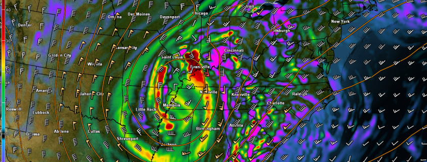
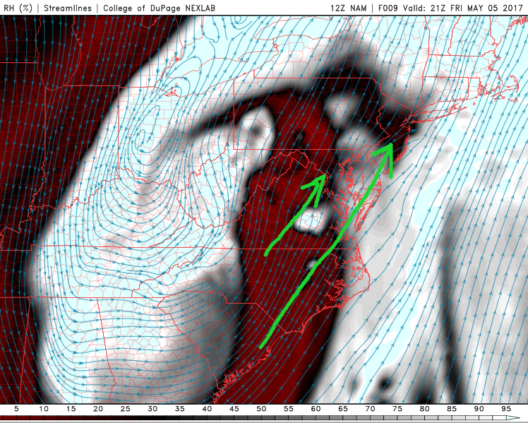
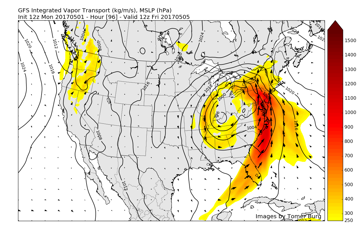
The large area of low pressure that we have been talking about for over a week now is finally making is way through the Northeast, and is certainly making its presence known. As of 2pm, most of the region has seen anywhere from 1-3.5″ of rain over the past 6 hours or so. All of this heavy rain in such a short period of time has lead to street flooding to be quite common in areas with poor drainage that also saw some of the heavier 2.5-3.5″ amounts. Flash flood warnings are currently out for portions of central NJ, Northeast NJ, Long Island, and southern Connecticut. While street flooding will be possible across portions of northeast New Jersey, Long Island, and Connecticut due to training of very heavy pockets of rain, more significant creek, river flooding is not expected at this time-though a few isolated cases may be possible as totals may approach 4″ in some isolated locations later this afternoon.
Please pay close attention to you local National Weather Service office for any information on Flash Flood Warnings or statements over the next few hours. Additionally, exercise caution when driving through heavy downpours and if you do encounter flooding of roadways-DO NOT attempt to cross that area of water no matter how deep you think it may be. We have seen upwards of 10 reports already of people trapped in vehicles, which required rescuing! Turn around and don’t drown!
As we work our way through the rest of the afternoon, dry air will begin to work its way in from the southwest and will work to effectively shut down the heavy rains. Mostly cloudy conditions are expected the rest of the afternoon as the rain tapers off from west to east by around 3-4pm. Temperatures may be able to rebound slightly into the low to mid 60’s across the area as a warm front begins to work its way up from the south just behind the bulk of the rains. As this warm front continues to move north through this evening, some more shower will be possible over the region, but heavy rainfall with these showers appears unlikely as the atmosphere will contain significantly less water vapor than it did this afternoon. Temperatures this evening will remain quite warm as the area will be within the warm sector of the low pressure area moving through Pennsylvania.
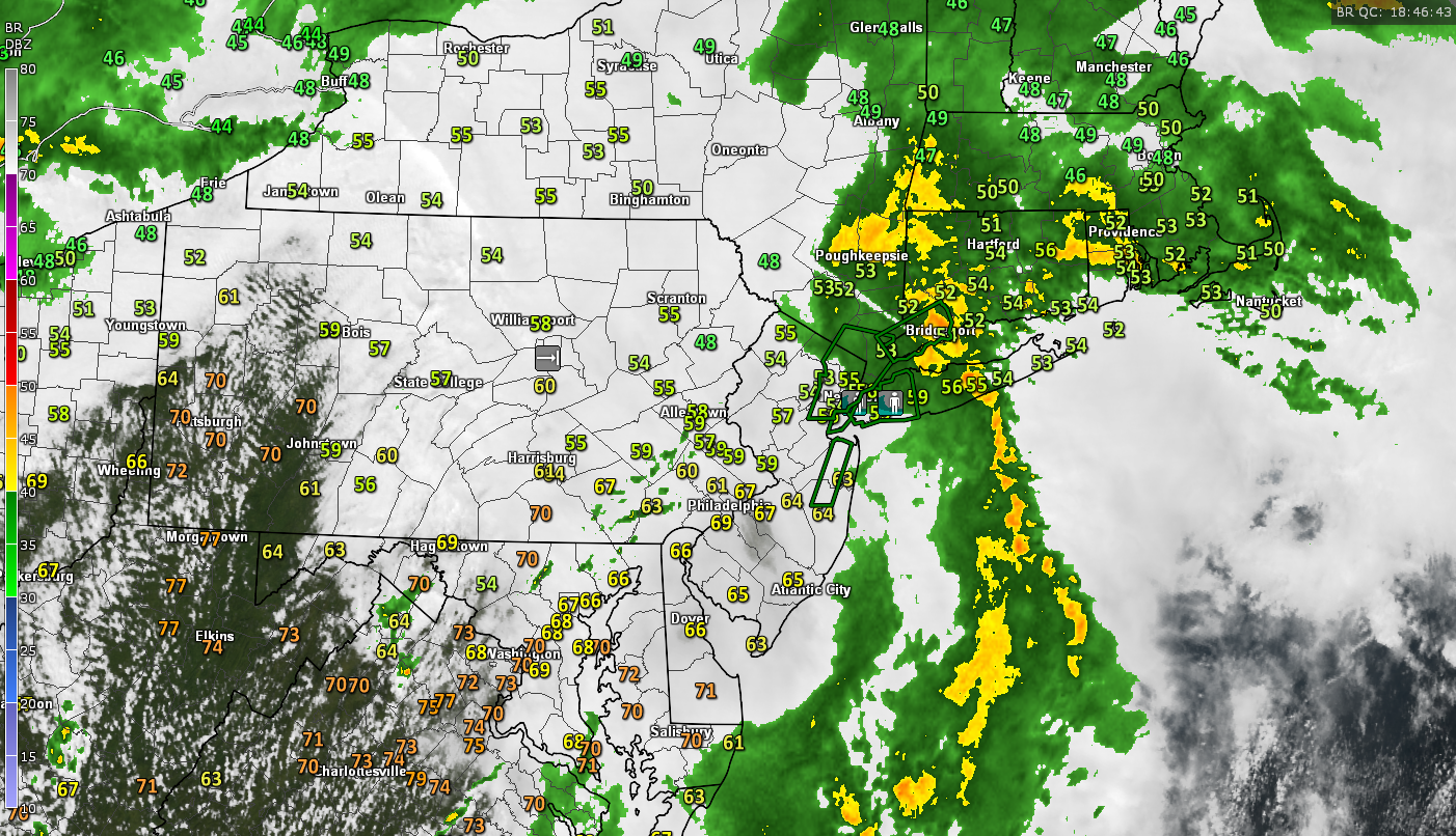
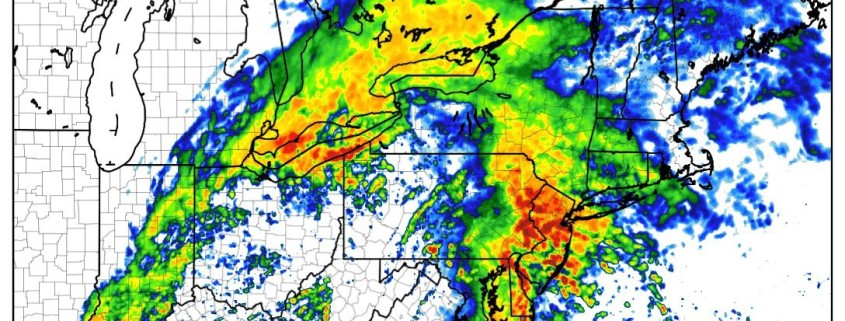
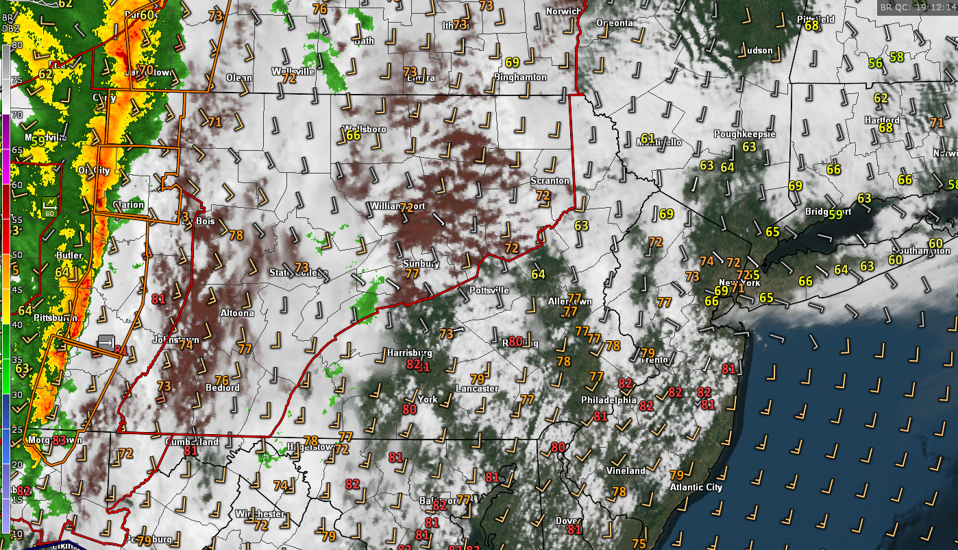
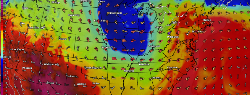
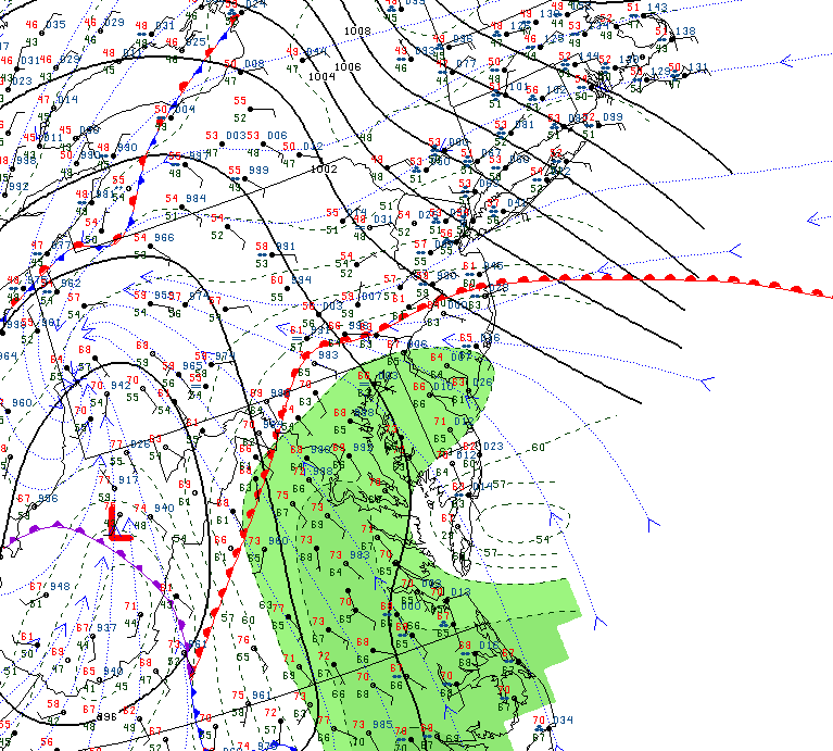
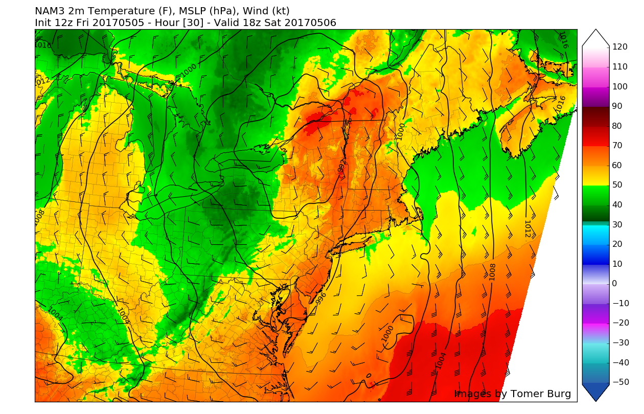
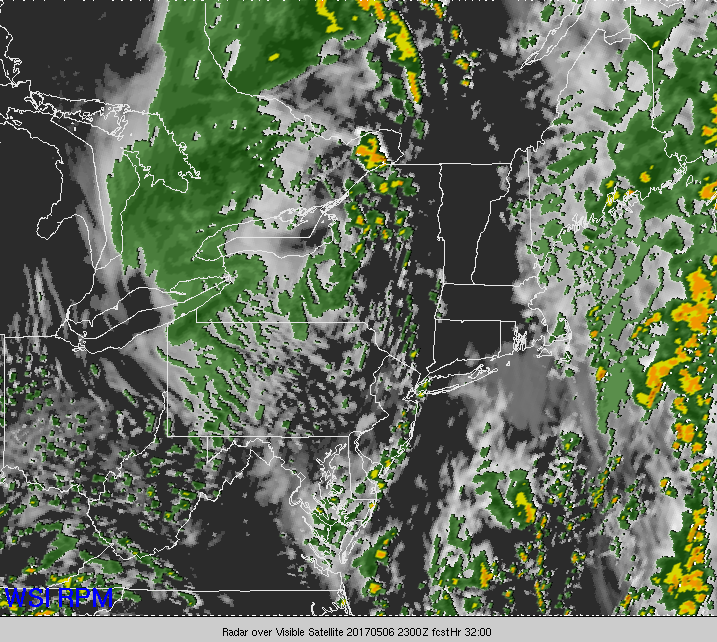
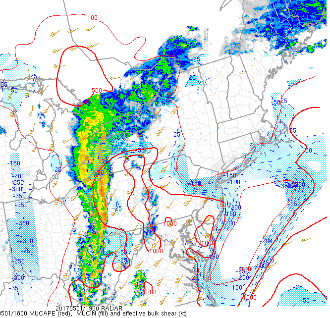
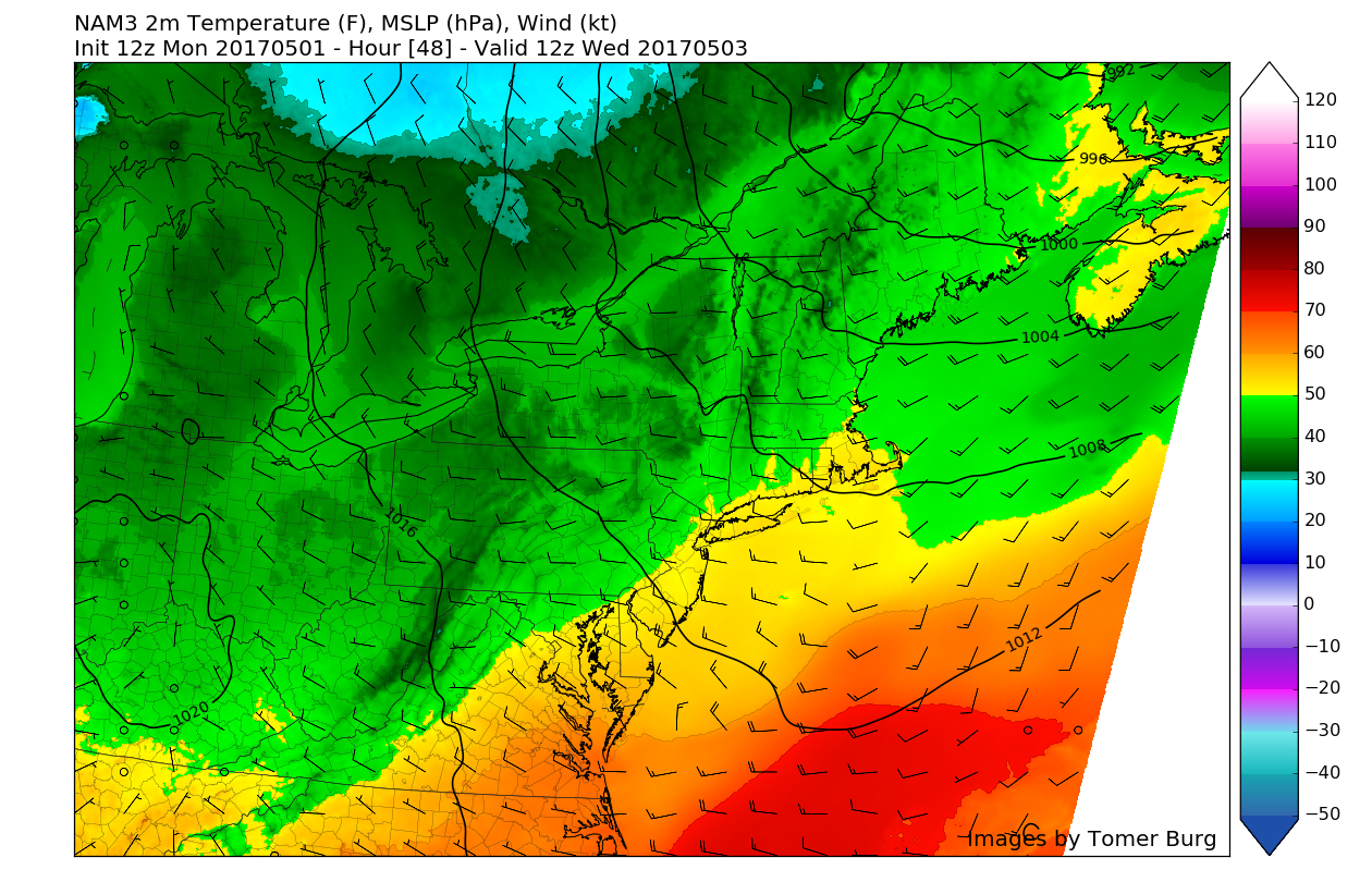
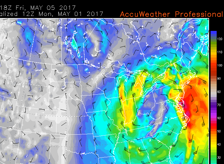
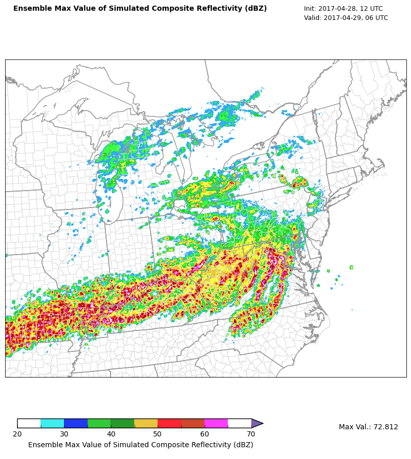
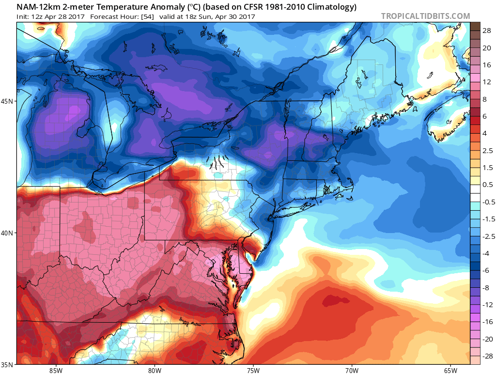
Latest regional radar mosaic, surface temperatures, visible satellite imagery , and NWS Flood Warnings (in green) showing the heavy rains finally pushing out of the area (Courtesy of GREarth)
Saturday and Sunday
The unsettled pattern will continue through the evening hours and into tomorrow as the negative NAO block helps the storm’s remnants stall out and decay over our area for at least the rest of the weekend. Tomorrow should start off relatively warm underneath partly cloudy skies and light southerly winds as the warm front continues to move north of our area. Depending on how much clearing we see tomorrow, some areas could reach highs into the middle to upper 60’s by late afternoon, while the rest of the region sees highs generally in the low to mid 60’s. Some residual energy associated with a cold front will likely move through the area late tomorrow afternoon or early evening, and bring the potential for some more showers and even an isolated thunderstorm depending on whether or not the area sees enough clearing earlier in the day to support some buildup of instability.
Cool and drier air will funnel in behind the cold front early Sunday morning, so any remaining showers and thunderstorms will likely taper off from west to east once again. As we get to daybreak on Sunday, another cold front will be working its way east, so expect some broken clouds to start off the day, but cloudiness should gradually increase as a the cold-core of the upper level low that will have stalled over the region begins to sink to the south and towards our area. This pocket of colder upper level temperatures will harbor a more unstable environment, so some showers will be possible during the afternoon. With the cooler air being reinforced by two cold front on Sunday and cloudier weather likely, highs should remain in the upper 50’s to lower 60’s during the day.
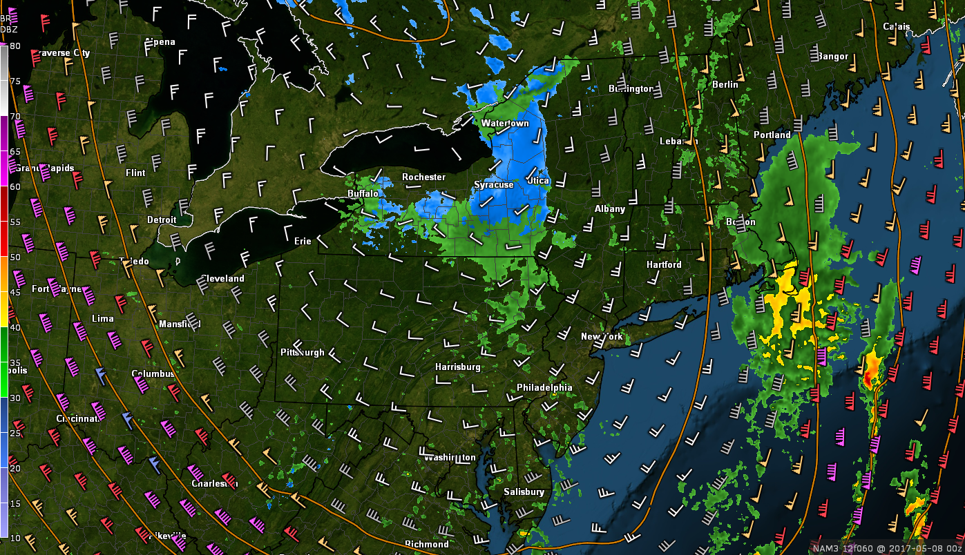
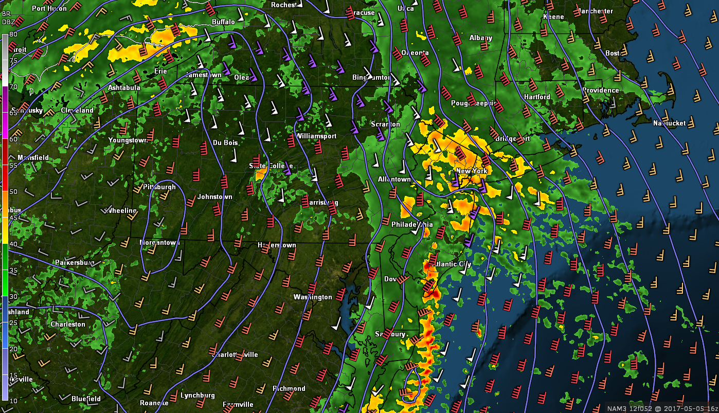
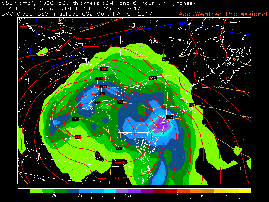
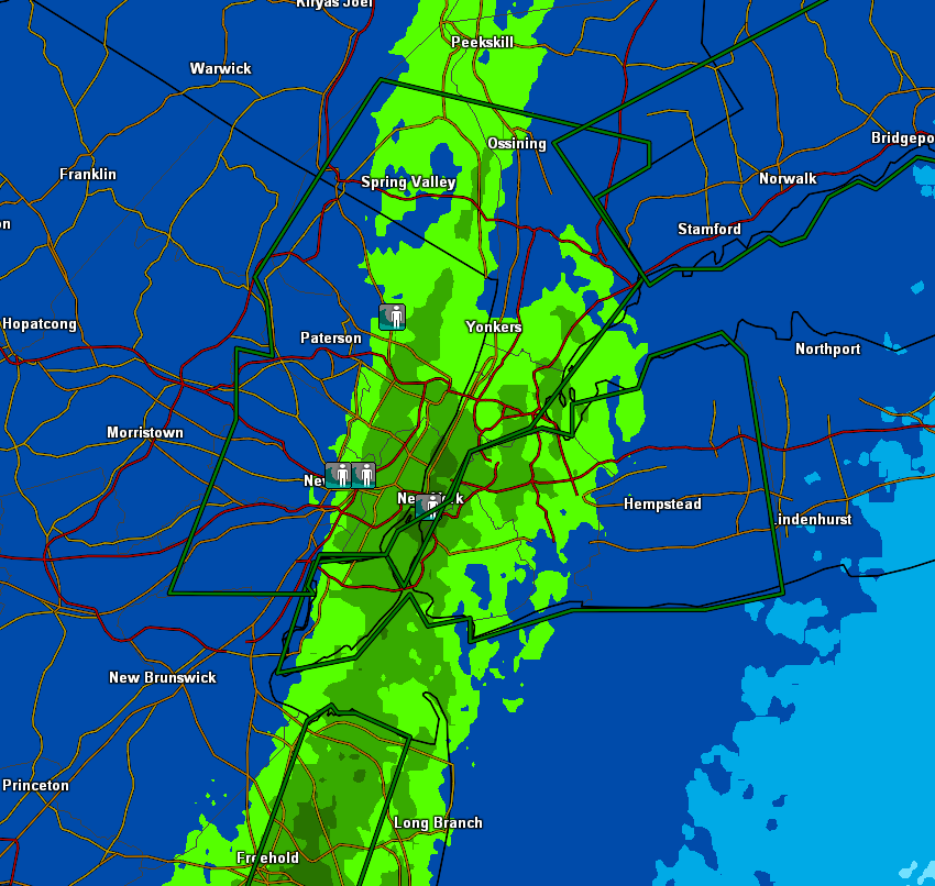
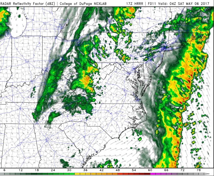
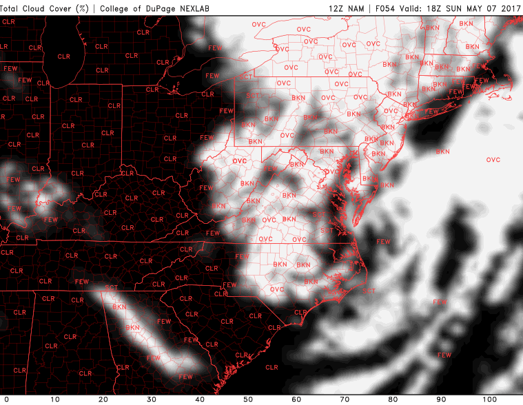
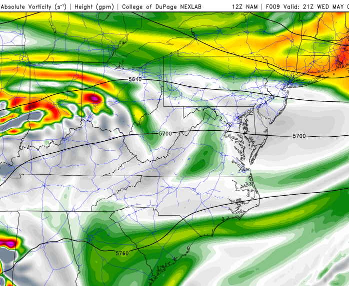
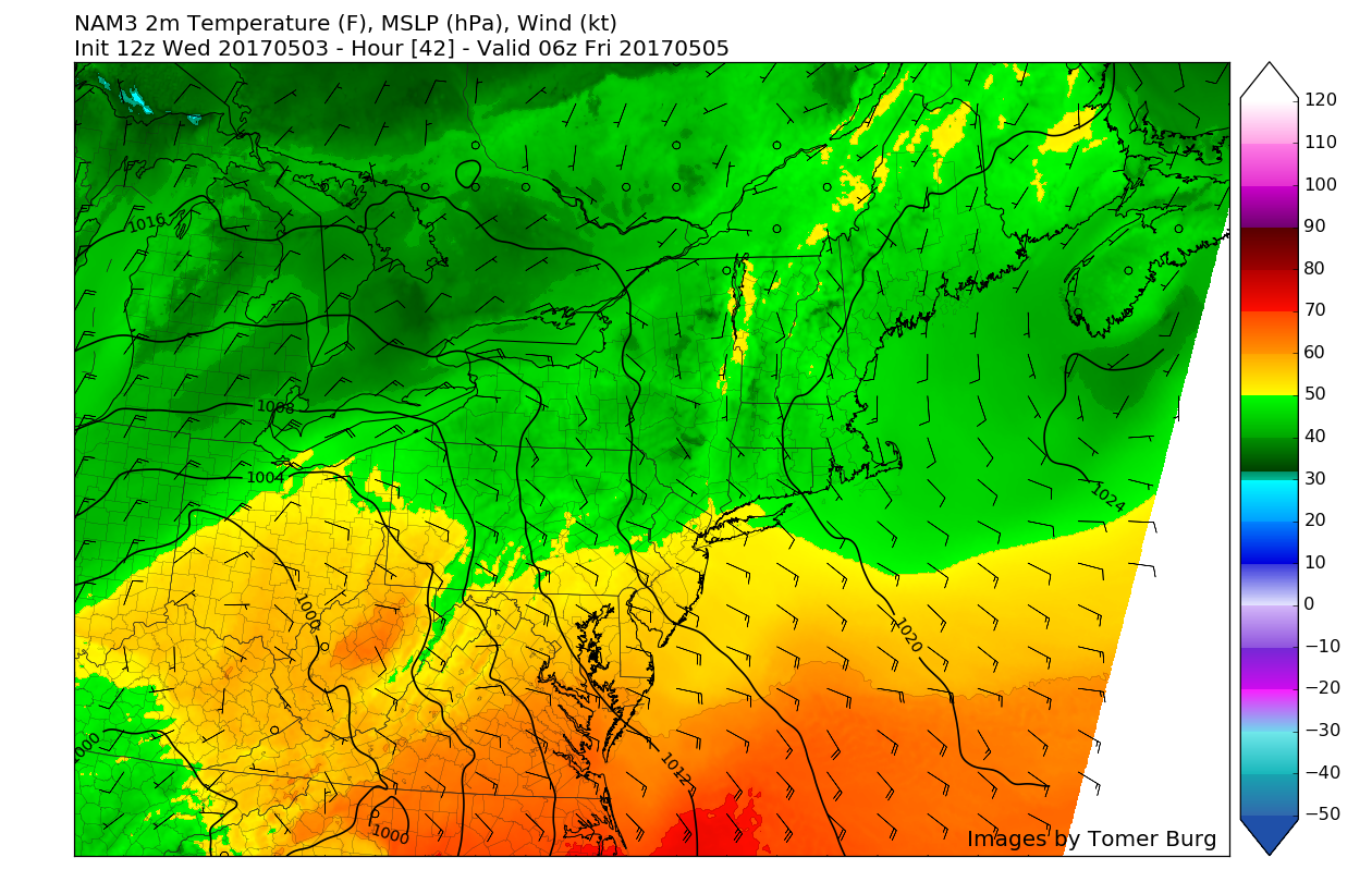
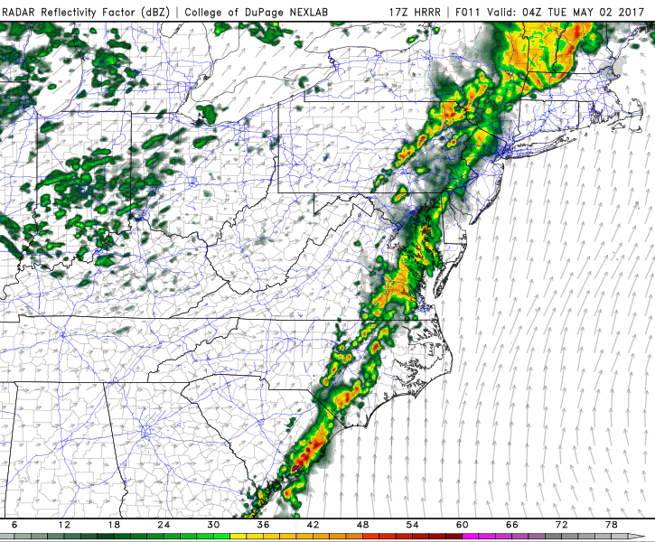
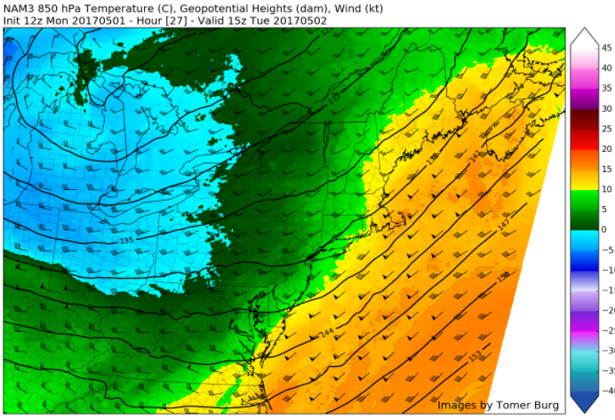
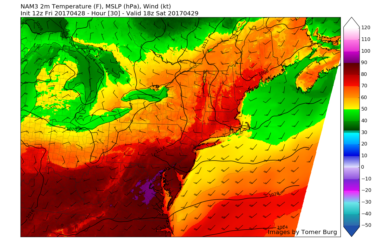
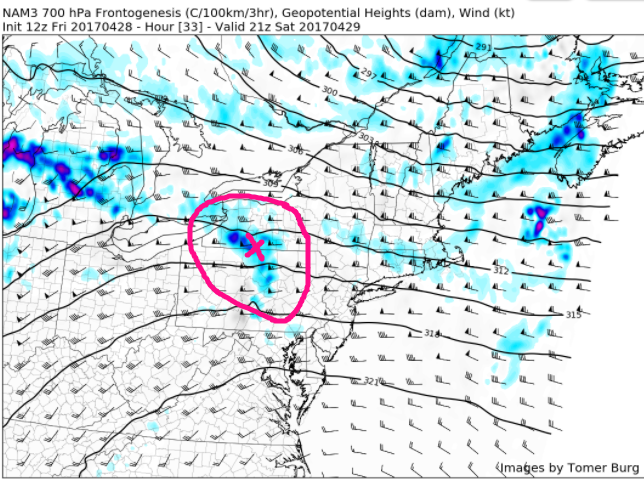
This afternoons high resolution NAM model, showing unstable conditions underneath with rain/snow showers possible for locations to the North and West (Valid 8pm Sunday)
Extended Range
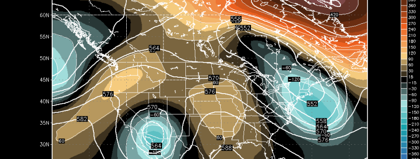
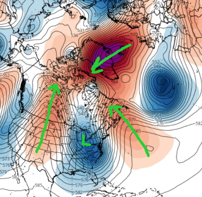
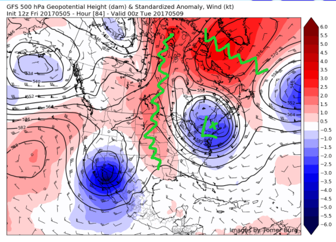
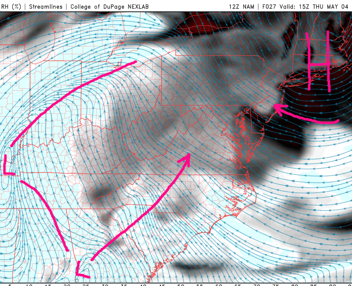
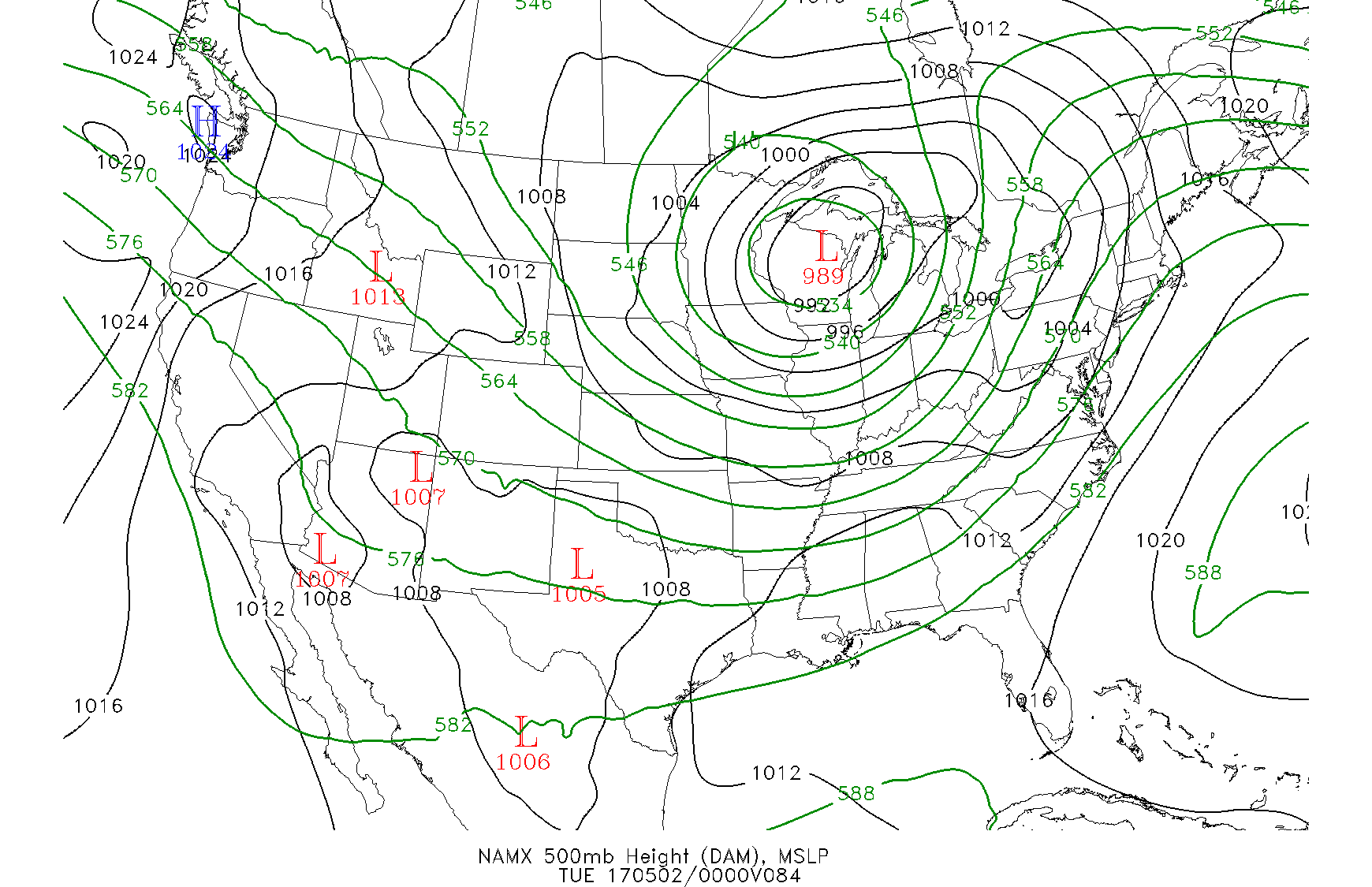
The latest computer model guidance consisting of the American model, the Canadian model, and the European model, all show the negative NAO continuing into next week and even strengthen the block while bringing it back further west. This will keep a large upper-level low trapped over the Northeast, which will ensure that cooler weather stays locked in place. This large upper level low locked in over the region will also be capable of swinging multiple disturbances around the base of the low, and possibly back into our area.
For the most part, each day early next week should be relatively similar, with early morning sunshine giving way to cloudier conditions with the threat of some showers by later afternoon and evening. Given the cooler temperatures in the upper levels of the atmosphere, some ice pellets or event wet snowflakes may be possible for locations to the north and west. Otherwise, each day is mainly looking at highs in the mid 50’s to lower 60’s for highs, with lows ranging from the low 40’s to 30’s possible for inland locations.
No real significant precipitation events are expected in the medium range, however we are beginning to watch the period around Mother’s Day for a potential coastal system. The time to really watch for larger storms or heavier precipitation events in this type of pattern is typically when the NAO block begins to weaken and move away. At this time, we don’t really see the possibility of this happening until around late May. Stay tuned for further updates on the unusually cool pattern over the foreseeable future!
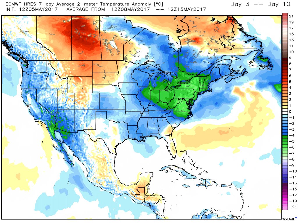
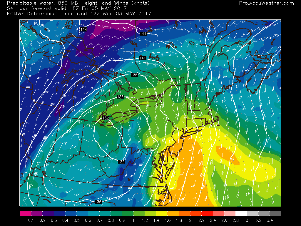
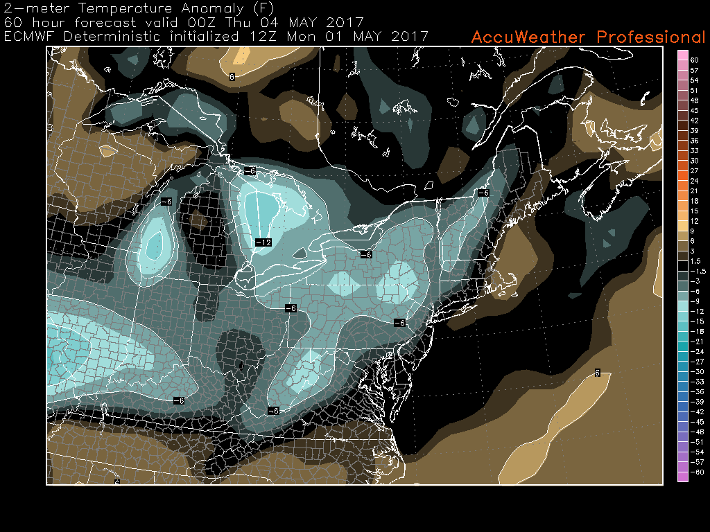
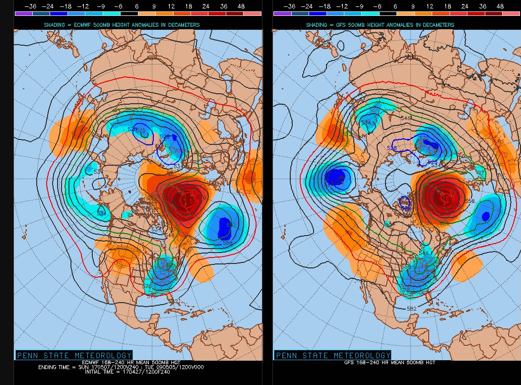
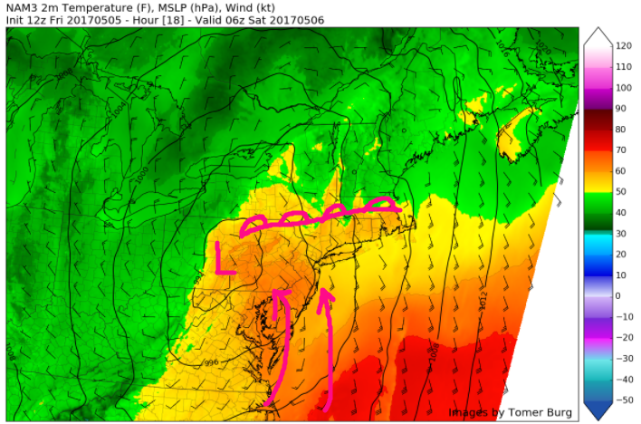
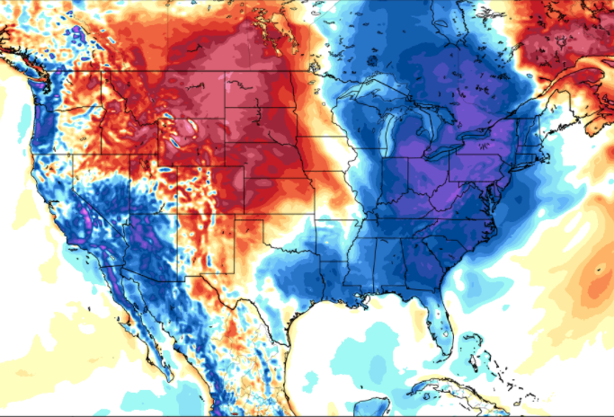
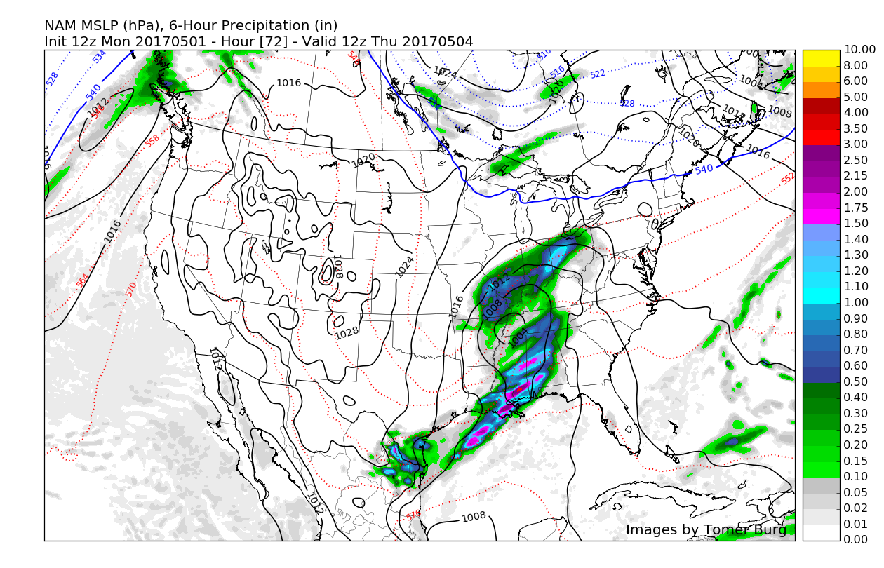
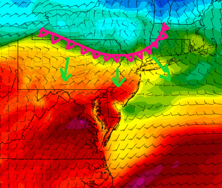
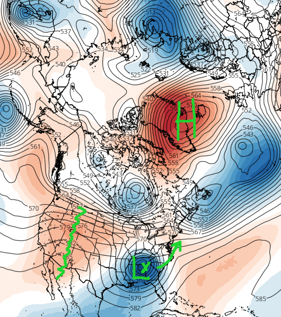
This afternoons European model showing below-normal temperatures over the next week for the Northeast US, courtesy of a large upper-level low parked over the region (Image Credit: Ryan Maue)
For more information and posts like this one, make sure you sign up for Zone Forecasts — where multiple detailed articles, videos, and interactives are posted each day. Also, come interact with our staff and many other weather enthusiasts at 33andrain.com!
Have a great weekend!
Steve Copertino
