-2")
Public Analysis: Unsettled Weather Along a Series of Frontal Systems
Good afternoon and Happy Friday!
Earlier this morning we saw some light showers pass over the northern sections of the NYC metro with some localized reports of light sleet/freezing rain mixing in. This precipitation was associated with the passage of a mid-level warm front that passed through the region at around 9am this morning. Colder air near the surface allowed localized areas to see some very limited mixed precipitation, but while the radar this morning may have shown some areas of heavier rain and/or mixing, most of this was not able to reach the surface due to a very dry wedge of air in the lowest few thousand feet of the atmosphere.
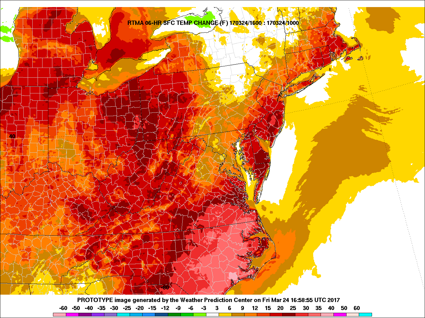
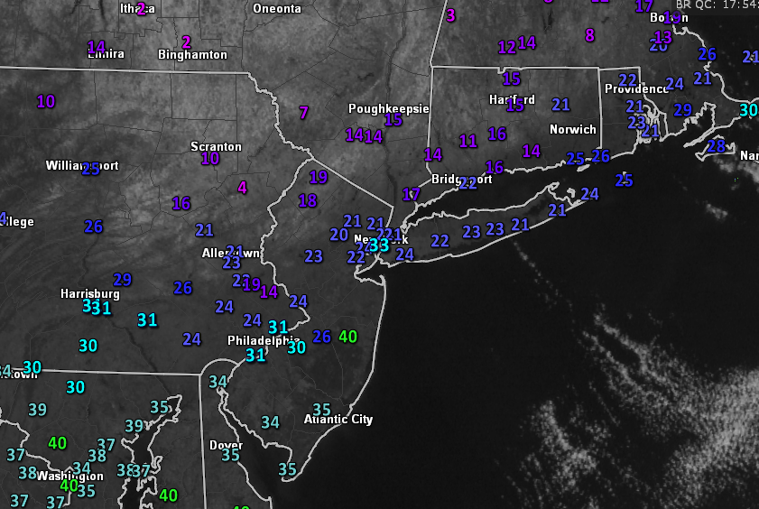
As the lower levels began to warm to above-freezing levels across the entire area, precipitation became predominantly rain, except for elevated locations in Connecticut and Massachusetts. Temperatures have warmed a good 12-15 degrees after the mid-level warm front, in conjunction with southwesterly winds have brought in a much more seasonable airmass for this time of year. Even though we have warmed quite a bit over the past few hours, there is still a pretty stark temperature gradient over the region, with portions of southern New York and Connecticut remaining in the upper 30’s, while the NYC metro area and locations to the south are in the mid 40’s and lower 50’s as of 1pm.
Any remaining light rain should begin to taper off as the front that triggered this precipitation quickly exits off to our north and east. With clouds likely lingering throughout the rest of the afternoon, temperatures shouldn’t be able to rise all that much from where they are right now, so expect highs to be generally in the lower 40’s to mid 50’s, with the higher temperatures being located to the south.
As we head into the evening hours, not much clearing is expected as another frontal system approaches the area with increasing clouds ushered in by a stout southwesterly flow. Due to the amount of warm air being pushed into the area overnight, we may see temperatures increase throughout the evening hours, possibly into the mid-upper 40’s. Some showers are also possible into the early morning hours as moisture advection also begins to steadily increase.
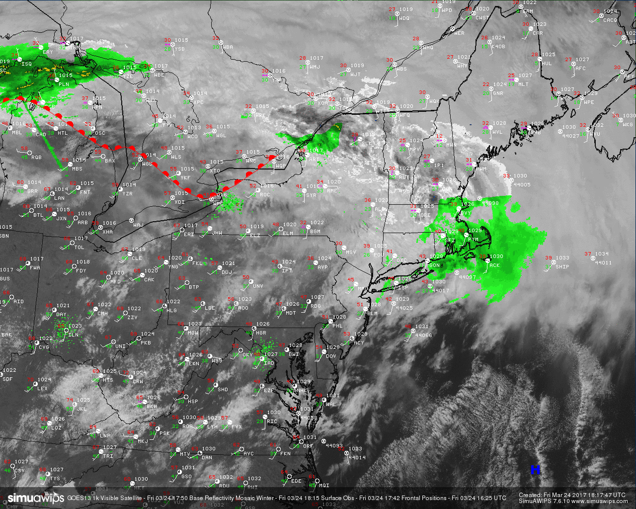
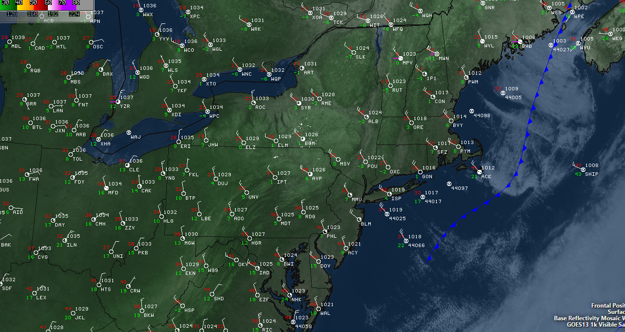
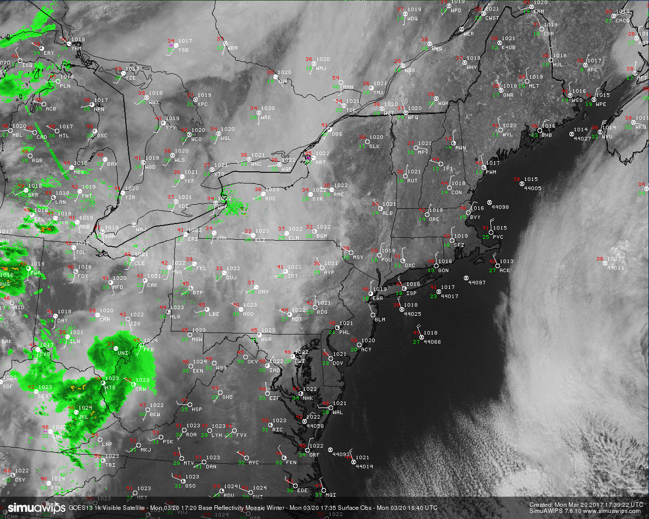
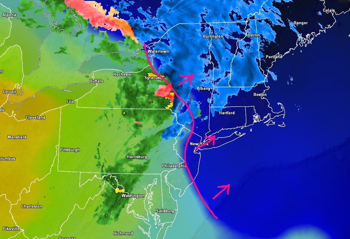
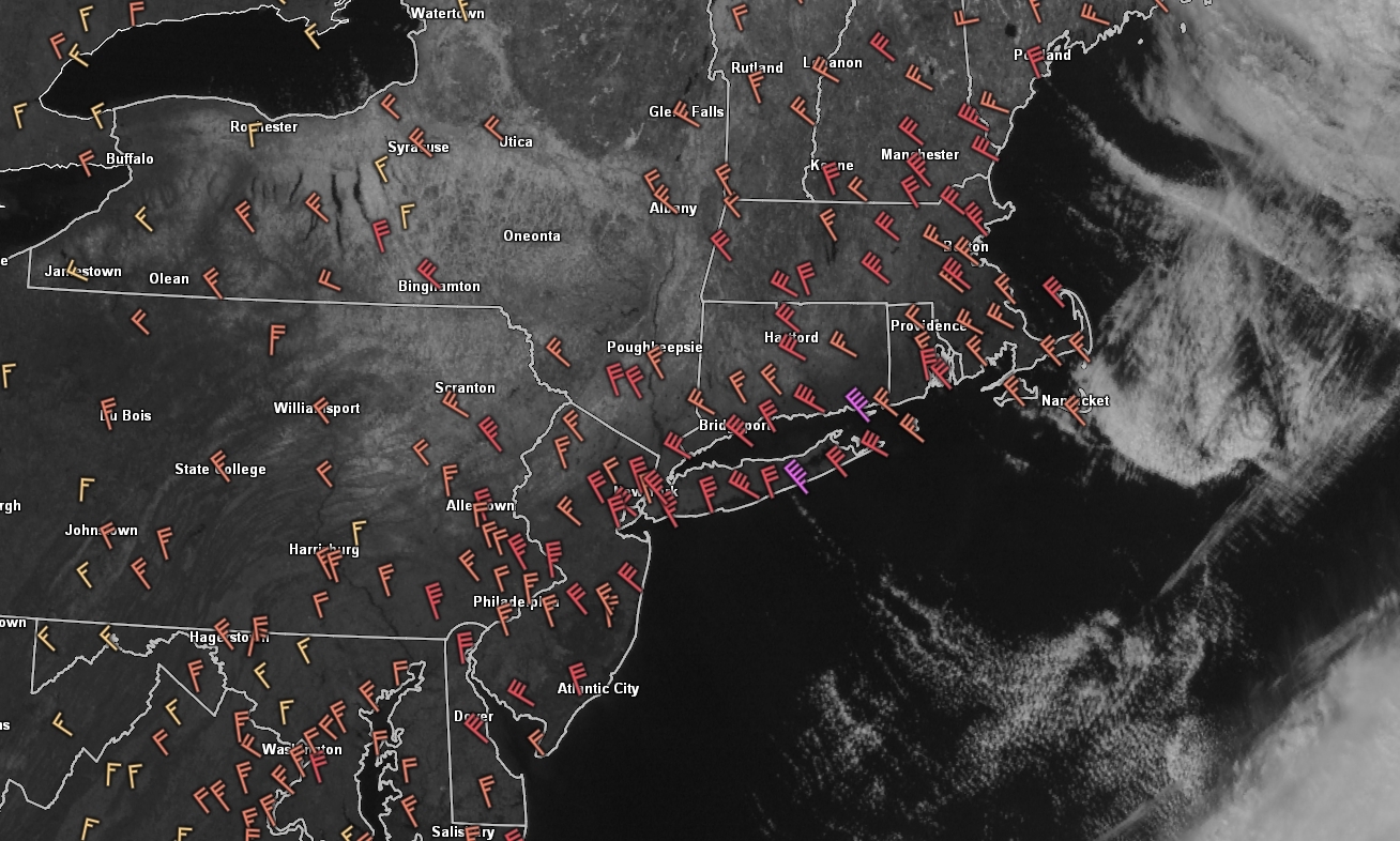
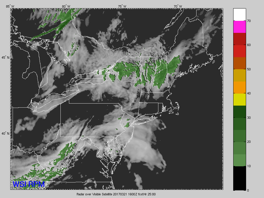
Current view of radar, surface observations, visible satellite imagery, and frontal positions over the Northeast. (Courtesy of Simuawips)
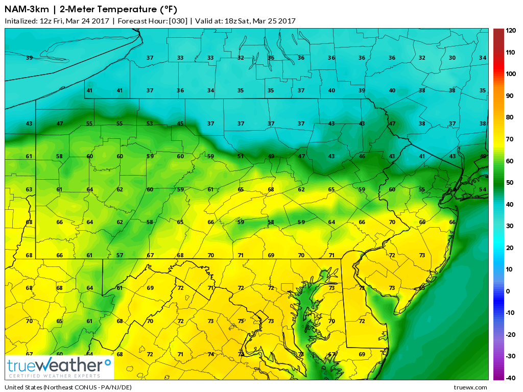
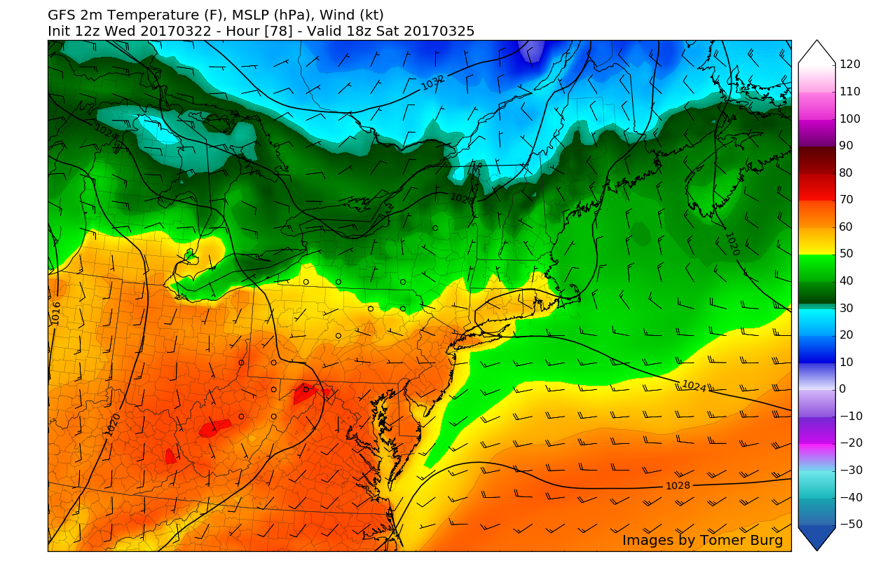
As we move into tomorrow, a complicated gradient will begin to take place as the frontal system that will be responsible for this evenings temperature rises begins to lift to the north and eventually stalls out. Where the frontal system decides to stall out will be crucial in determining just how warm temperatures get tomorrow. The latest computer model guidance is indicating that temperatures should be able to rise into the upper 50’s and the lower 60’s across much of the area by early tomorrow afternoon. As will be the theme over the next few days, locations like SE PA and Central and Southern New Jersey all have a better shot of reaching the mid to upper 60’s tomorrow-with lower 70’s possible in some locations. As mentioned, this will create quite a temperature gradient with areas south of the front seeing Spring-like conditions, and those to the north seeing much cooler temperatures in the 40’s.
The aforementioned frontal system will then have the potential to sink back to the south by the mid-afternoon hours tomorrow as a strong Canadian high pressure system strengthens and introduces a backdoor cold front. This front will continue to sag south as the cold, dense Canadian air brings temperatures back down to the 30’s and 40’s tomorrow evening.
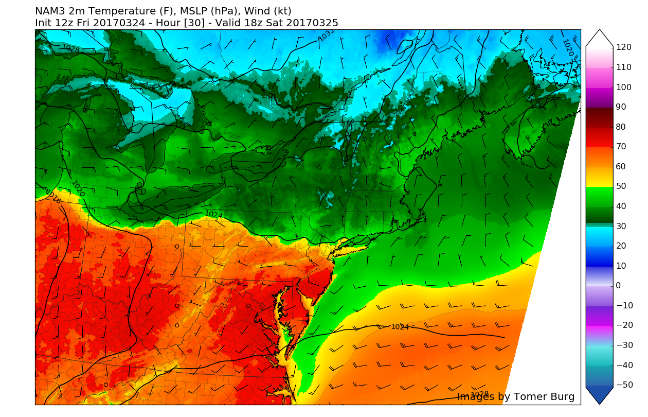
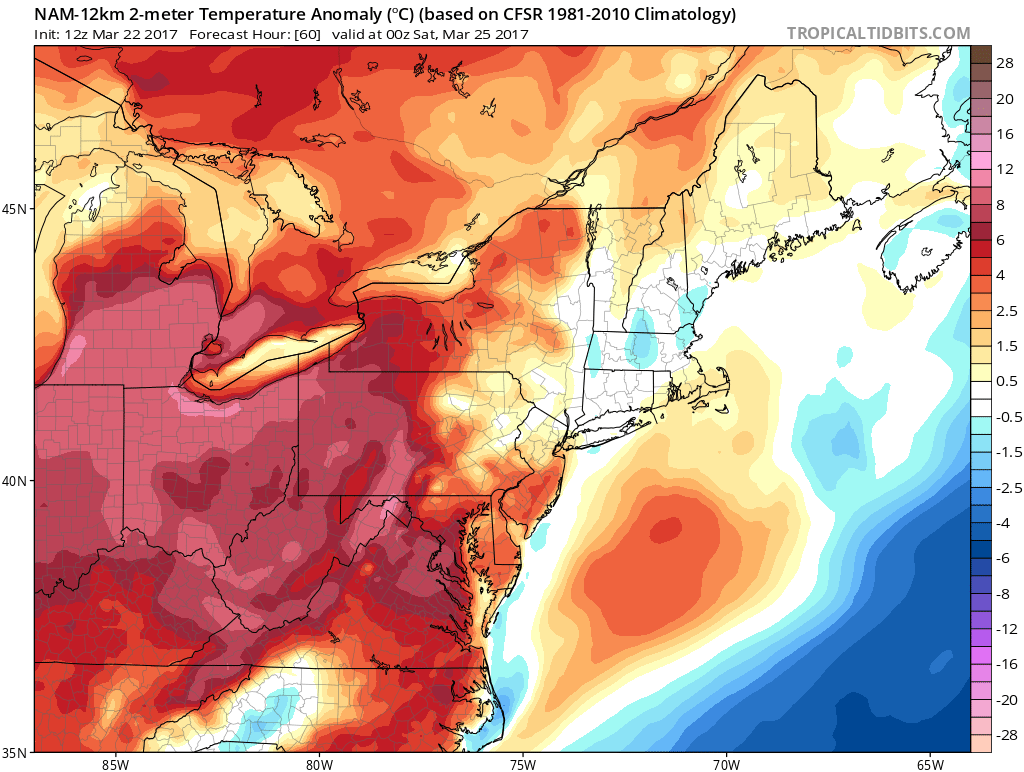
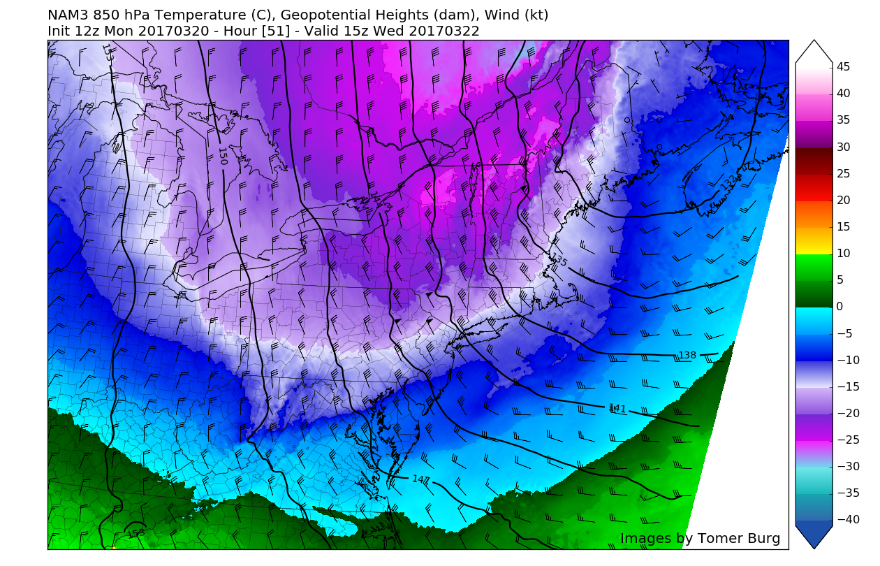
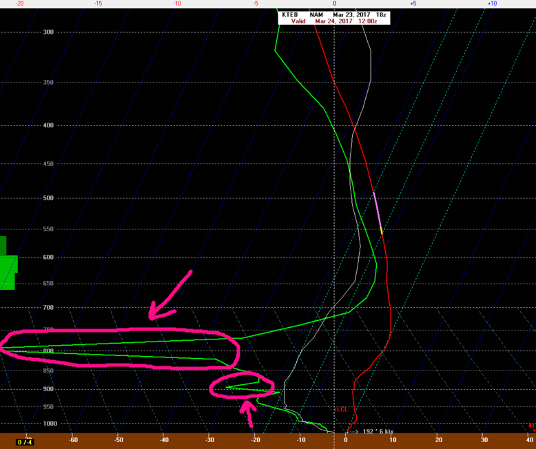
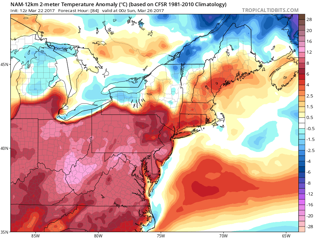
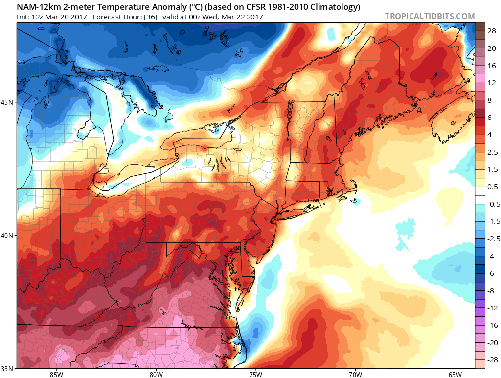
3km NAM valid tomorrow afternoon showing the stalled frontal system over SNY, with cool temperatures to the north and much warmer temperatures to the south of the front
This cold front will then stall out over southern Pennsylvania and Maryland on Sunday morning, so this will allow the colder Canadian air mass to block any warm, maritime tropical air that lies just to our south. Unfortunately, it looks like Sunday will be a more dreary and unsettled day. with the potential for showers and mostly cloudy skies existing throughout the day. After finally getting some above-average temperatures again on the board, we should drop down to at least 10-12 degrees below-normal by Sunday afternoon. So be prepared for tomorrows warmth to be very brief and enjoy it while you can!
This frontal boundary should remain draped over the region on Monday as well as Tuesday, as a few waves of low pressure begin to move along the front. Each one of these waves will bring some chances at some more steady rain threats beginning on Monday morning. Temperatures should remain quite variable as the front lifts north, and then eventually sags back to the south as each impulse of low pressure moves over the area.
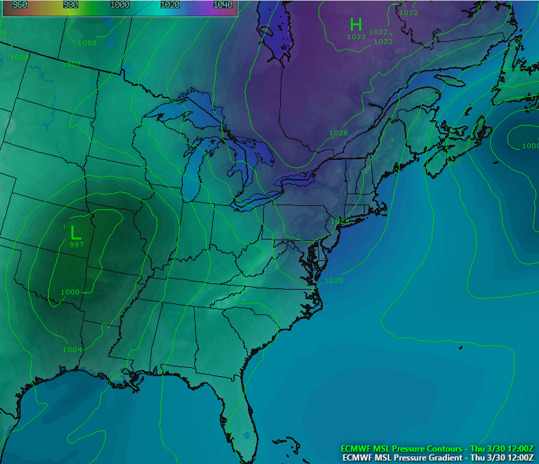
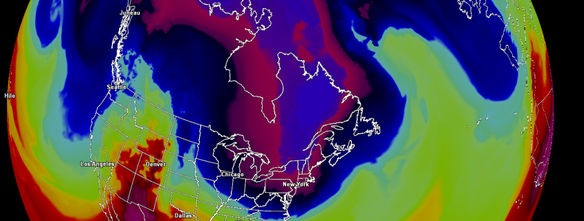
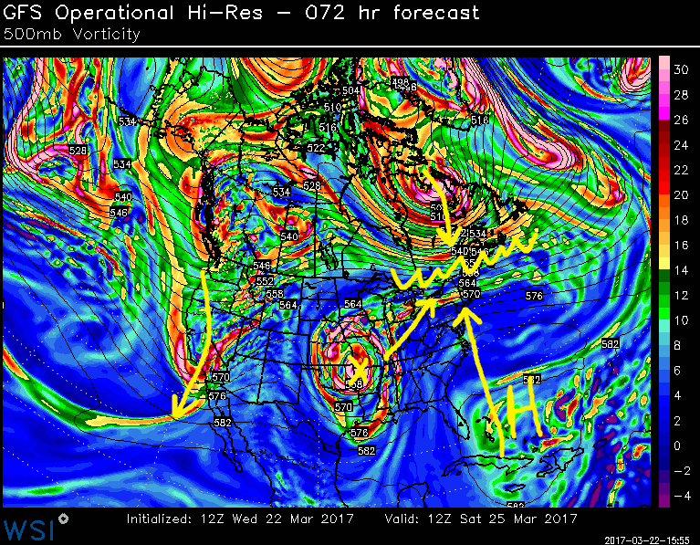
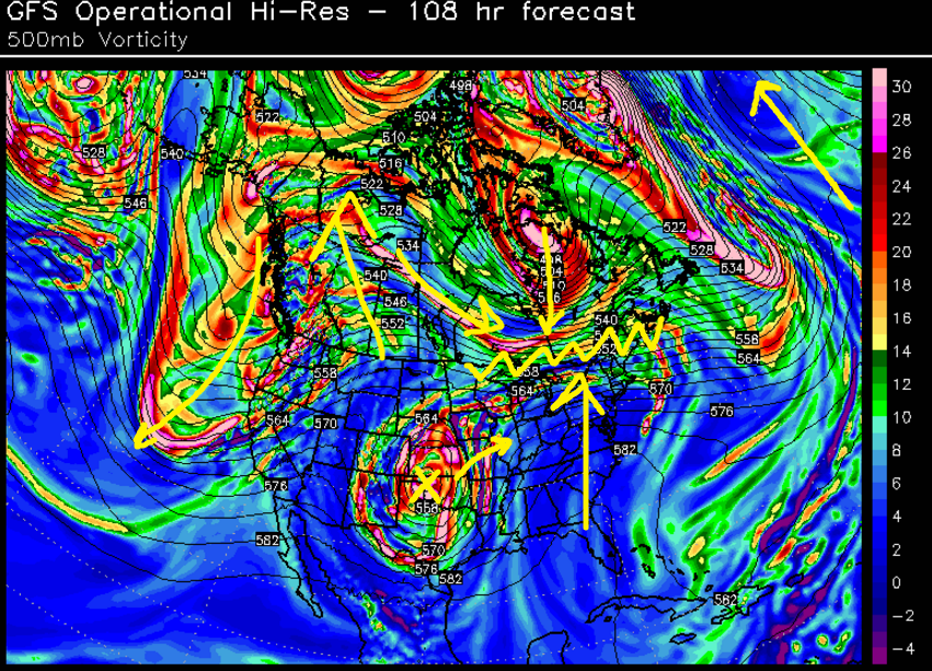
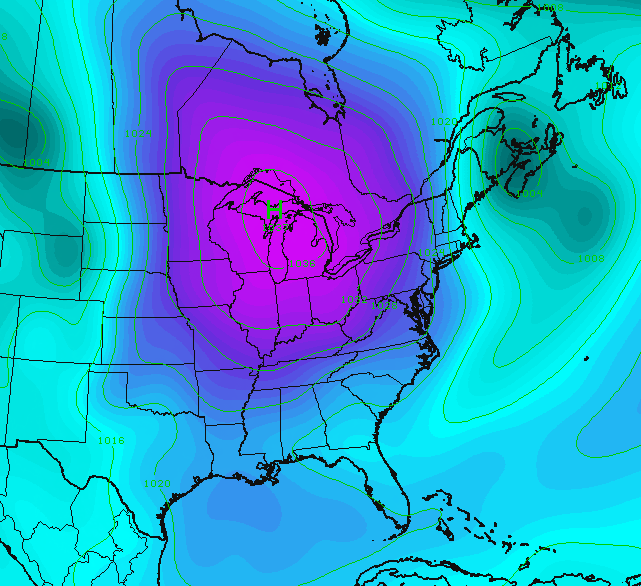
12z ECMWF model showing a more stable pattern later next week as a Canadian high pressure system dives to the south (Valid Thursday morning)
Finally, things looks to stabilize later in the week as another Canadian high pressure system is forecast to take over and clear out any pesky leftover frontal systems. This high pressure system should be able to usher in more seasonable, or even slightly below-normal airmass before an active storm track to our south and west takes over by Friday and into Saturday.
We will have more on these upcoming systems and make sure to check in over the next few days for updates as these frontal systems can change quite quickly!
For more information and posts like this one, make sure you sign up for Zone Forecasts — where multiple detailed articles, videos, and interactives are posted each day. Also, come interact with our staff and many other weather enthusiasts at 33andrain.com!
Have a great weekend!
Steve Copertino