-2")
Public Analysis: More Dreary Weather Likely Thursday, Improvements This Weekend?
Good Evening!
Most of the area saw a rather damp and dreary start to the work week today as areas of moderate to heavy rainfall moved over portions of the Mid-Atlantic and Northeast. This is due in part to a large upper level system over the central part of the country that will be gradually strengthening and progressing eastward over the rest of the week. This should allow for more damp and unsettled conditions down the line, especially on Thursday and Friday. A break from this pattern may be possible by the time we reach the Memorial Day Weekend, but this will all depend on the evolution of the previous systems this week.
—————–
Today Into Tonight
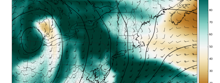
Most of the tri-state area and portions of southern Pennsylvania saw a rather damp and cool day today with highs only reaching into the mid 50’s to lower 60’s. Though much of the area saw rain today, the heaviest bulk of the rain was concentrated to portions of central and southern New Jersey, where localized amounts over 2″ were seen. Further north totals were more in the trace to half-an-inch mark, especially in northwestern New Jersey, southern New York, as well as Connecticut. The rain has begun to pull away from the area, with only coastal sections of New Jersey and Long Island still stuck under steadier showers. Drizzle is likely to last for some locations until after dark, but overall conditions should begin to improve despite mostly cloudy skies. Some clearing may take place towards the late evening hours, or early tomorrow morning, but the cloud cover should be able to hold overnight lows into the lower to middle 50’s for much of the area, including the coast.
A cold front will pass through the area later this evening and usher in a much drier, but also temporary air-mass from the north and west that will work to end any lingering showers that may exist over the area. An area of weak high pressure just north of the region in addition to the introduction of drier air will decrease cloud cover tomorrow afternoon. A weak wave of low pressure will develop along the cold front that passed over our area and this low pressure will begin to move northeastward by later tomorrow afternoon.
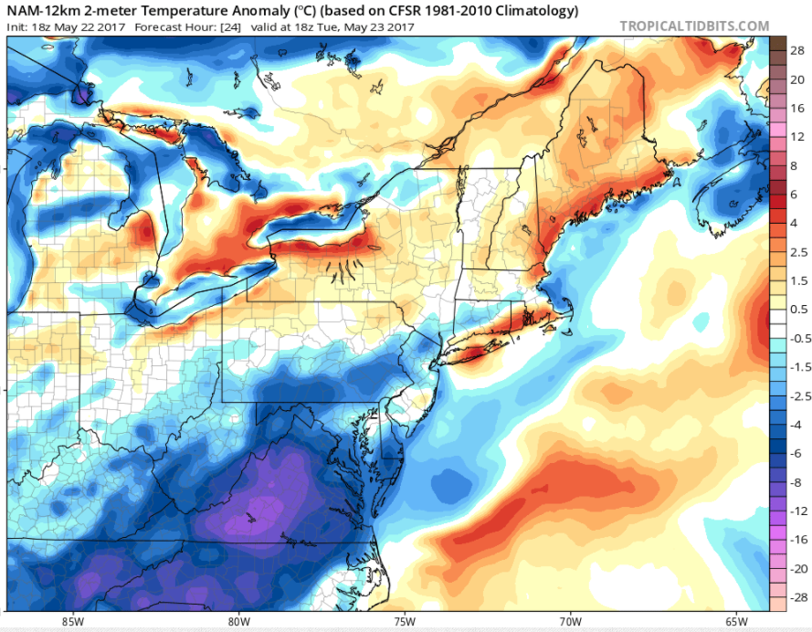
Most of this afternoons model guidance keeps this small area of low pressure to the south and east of the area, but there is the possibility that at the very least this low will lead to an increase in cloudiness, but some rain showers are possible along the coastal sections of New Jersey and Long Island. Highs tomorrow will be just slightly warmer than today as highs are able to reach into the upper 60’s and lower 70’s across the area, and some locations may see slightly warmer highs if they are able to experience prolonged periods of clearing. These highs will be slightly below-normal over much of the region, with departures around 5 degrees below-average. With increased cloudiness and windier conditions possible, lows tomorrow evening will likely remain in the middle to upper 50’s, with the possibility of isolated locations holding in the low 60’s.
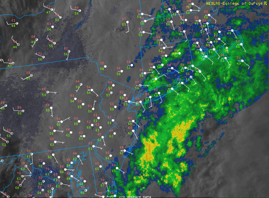
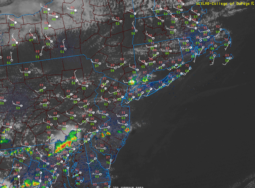
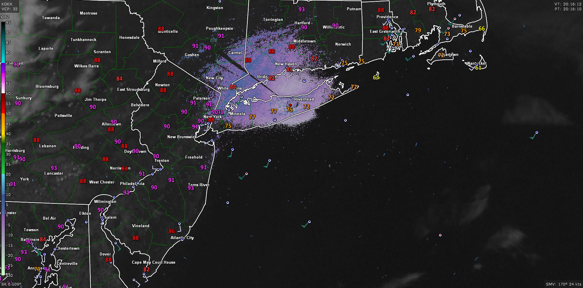
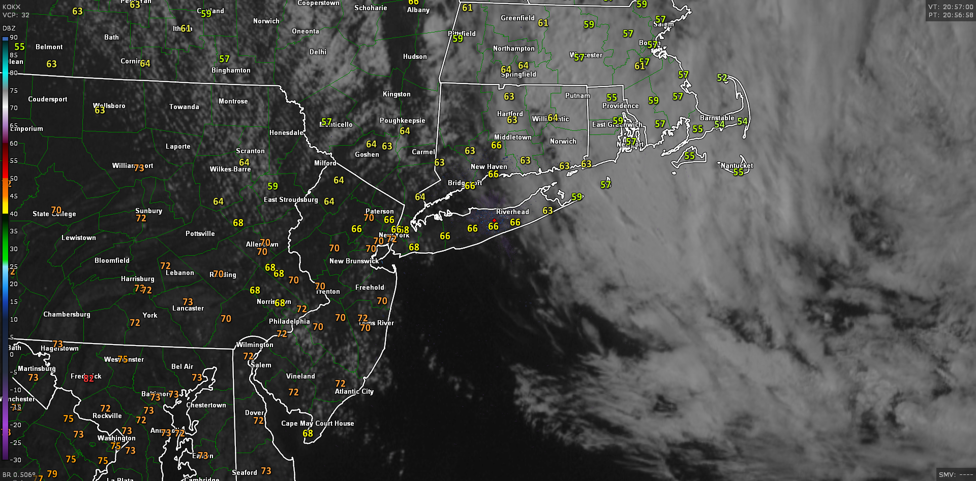
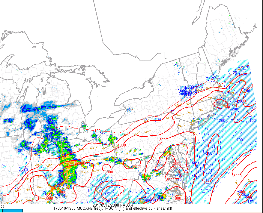
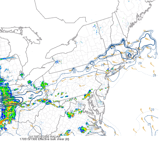
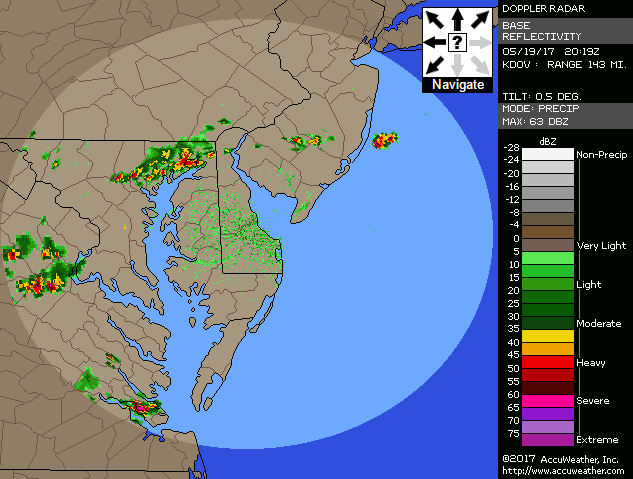
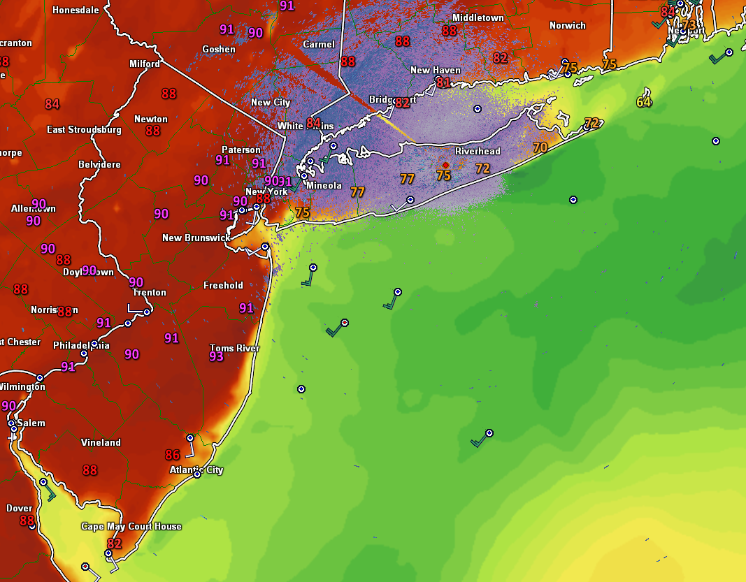
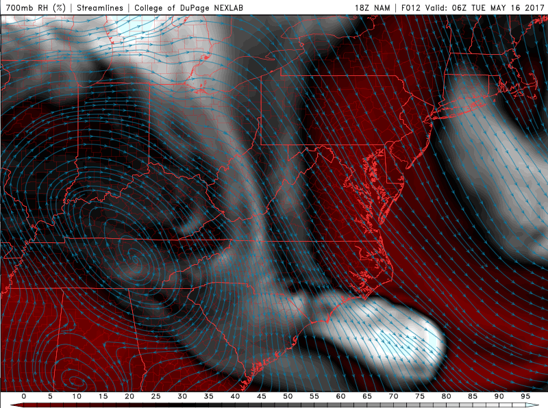
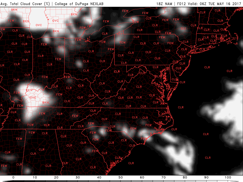
Latest regional radar data, stations plots, visible satellite imagery , and temperature plots as of this evening showing cloudy, cool, and damp conditions persisting over portions of the area (Courtesy of College of DuPage)
Wednesday and Thursday
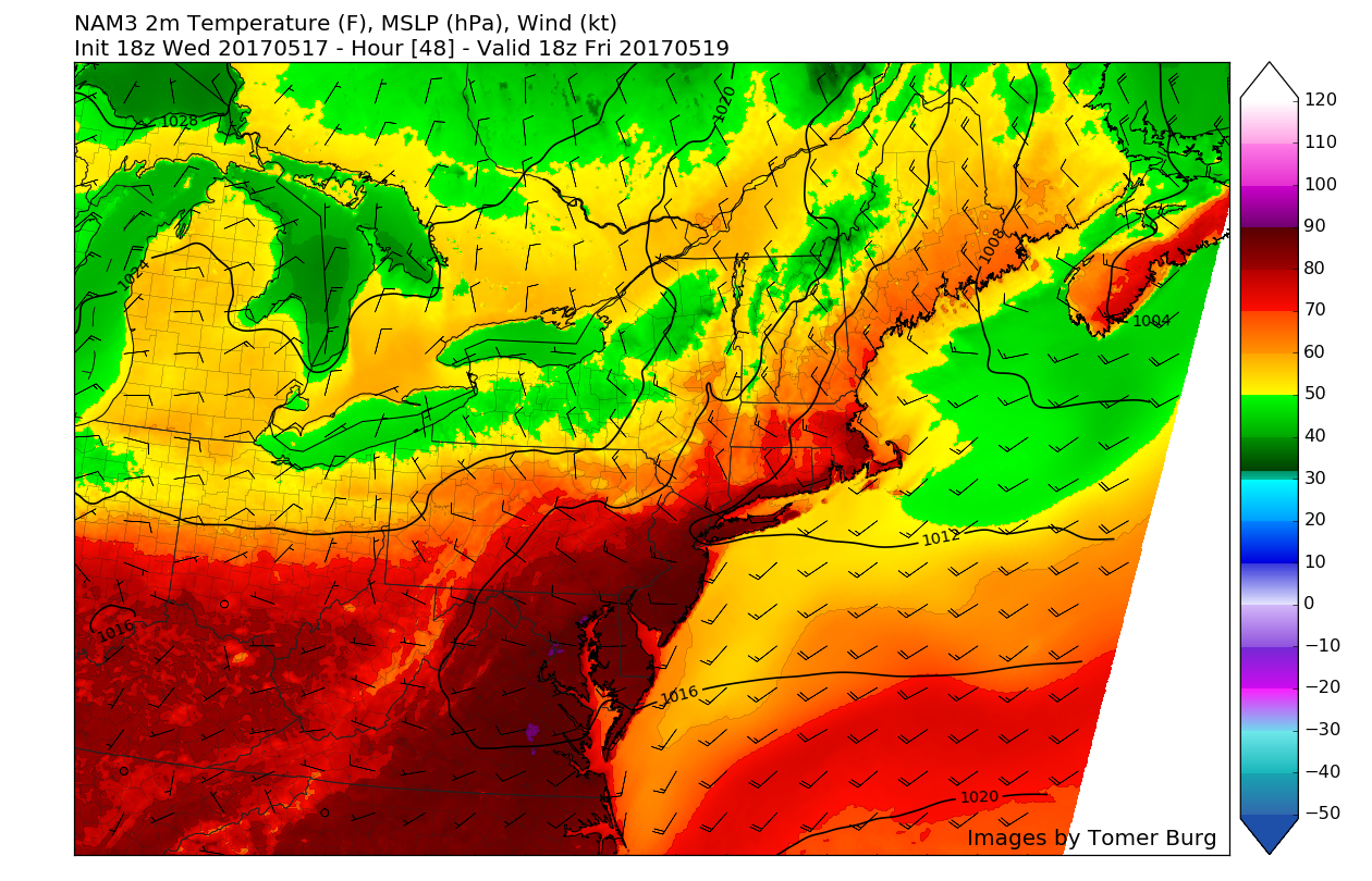
Some light rain showers may linger along the coast on Wednesday morning, but as the weak area of low pressure begins to pull away, any potential impacts will begin to diminish. This will lead to improving skies during the afternoon hours with peaks of sunshine, allowing highs to reach into the upper 60’s to middle 70’s over the entire area.
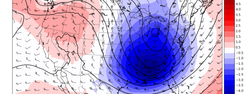
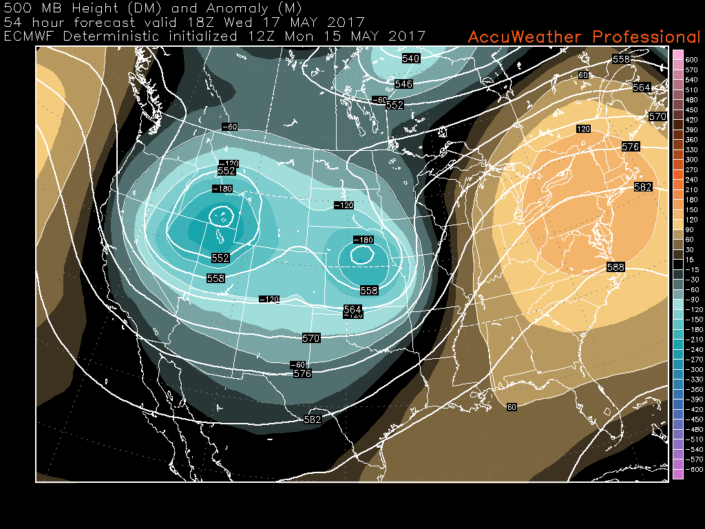
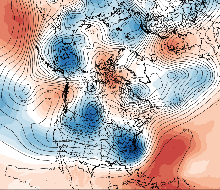
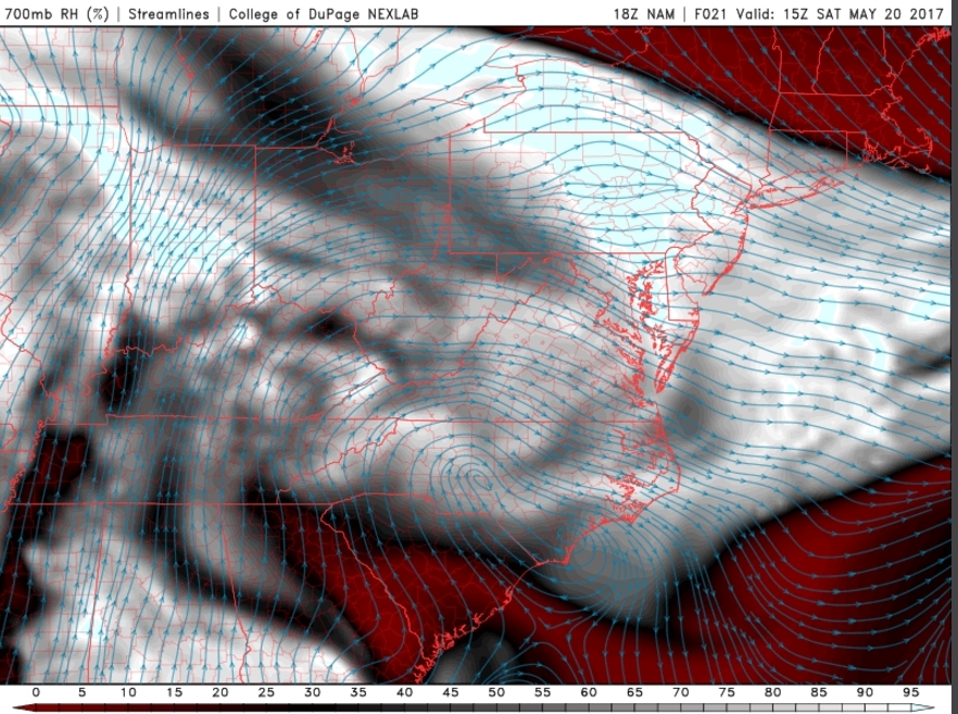
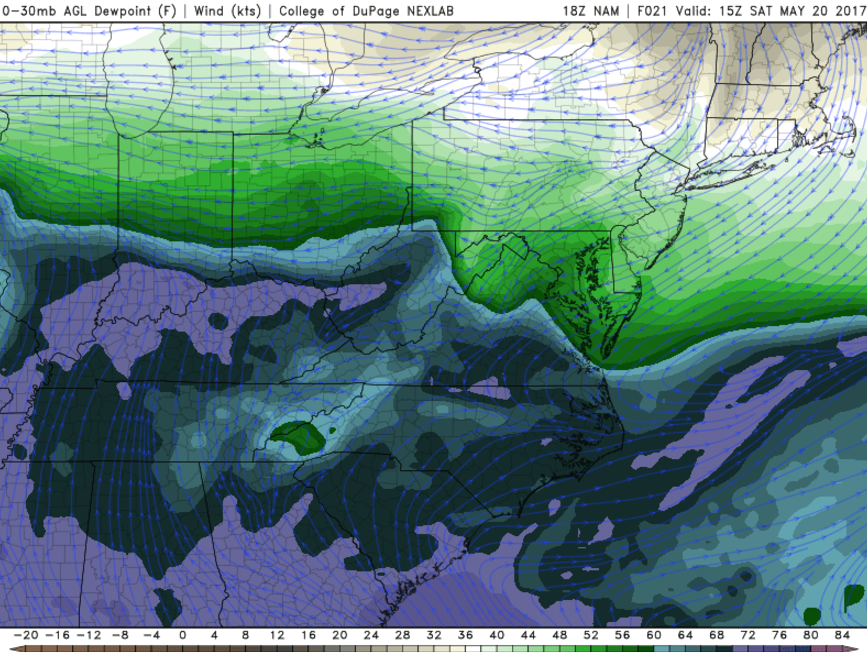
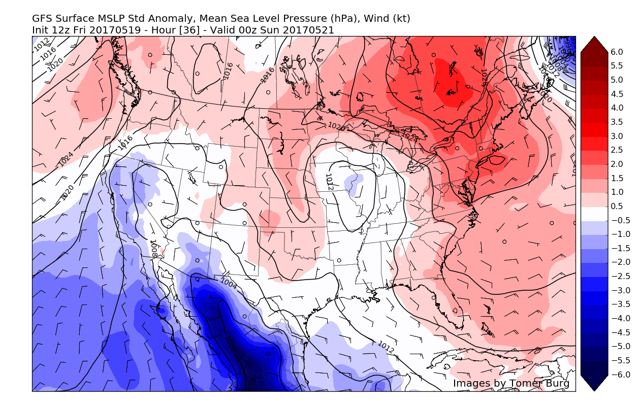
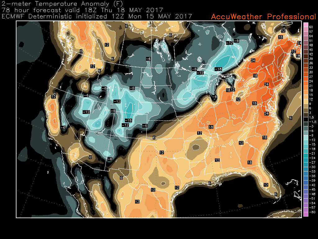
The large upper level low that we have been talking about for over a week now will likely be rotating into the Great Lakes region and portions of the Northeast by late Wednesday evening or very early Thursday morning. As this large system begins to lumber towards us, it will drag up an impressive amount of moisture from the Gulf of Mexico and southwestern Atlantic and begin to transport it northward towards our area. Once this upper level system begins to mature and strengthen, it will spawn a primary area of low pressure over the Appalachian mountains, and potentially another low that may develop just off the Mid-Atlantic coast.
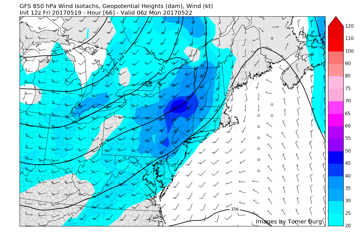
There are some uncertainties regarding this system, but steady, heavier rain is likely during the day on Thursday, especially if the secondary low develops off the coast. However, if the system turns out to mature quicker and becomes more disorganized once it reaches our area, then the rain may be more sporadic and in the form of convection, but will still have the chance to produce some heavy rain.
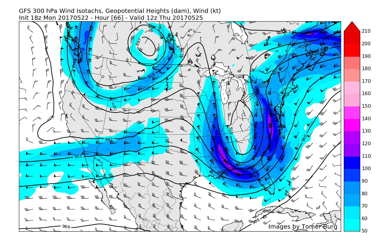
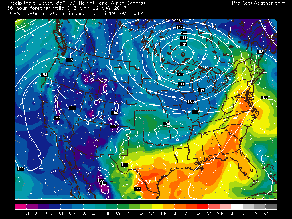
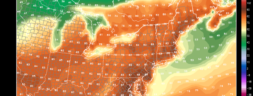
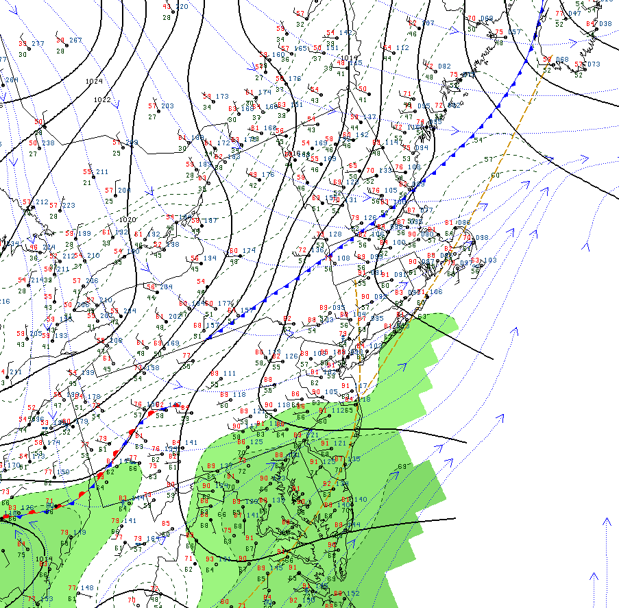
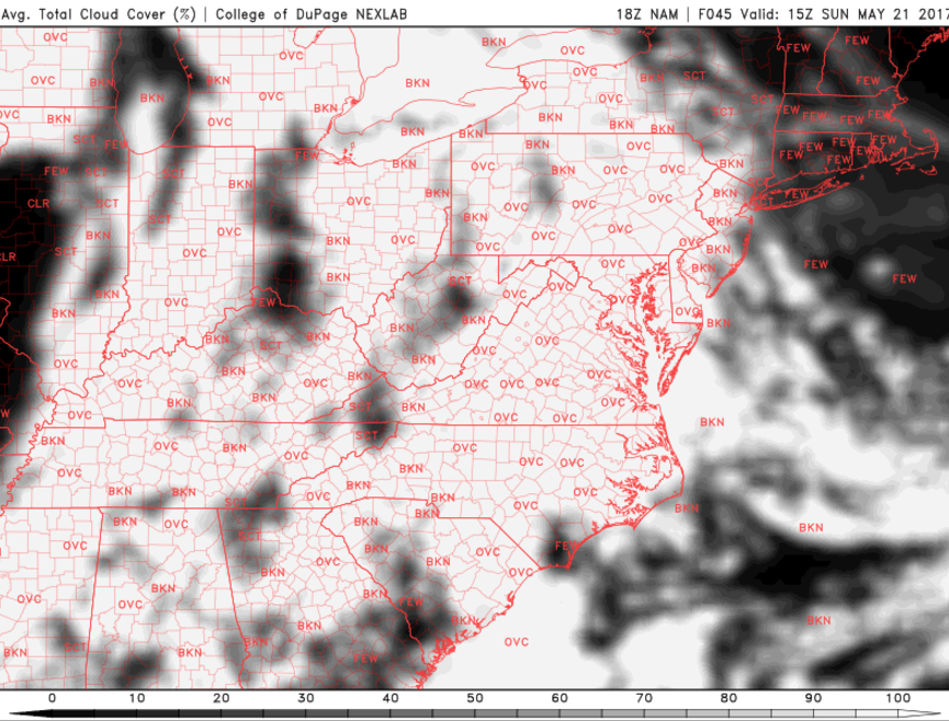
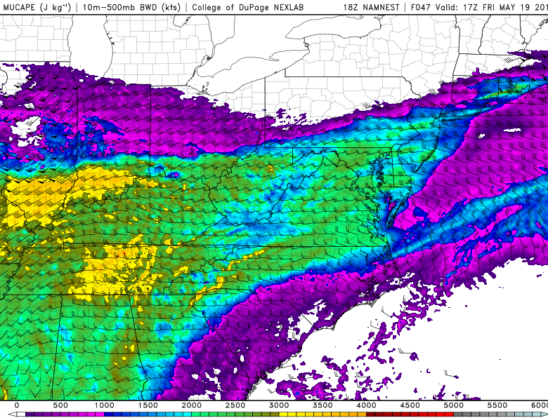
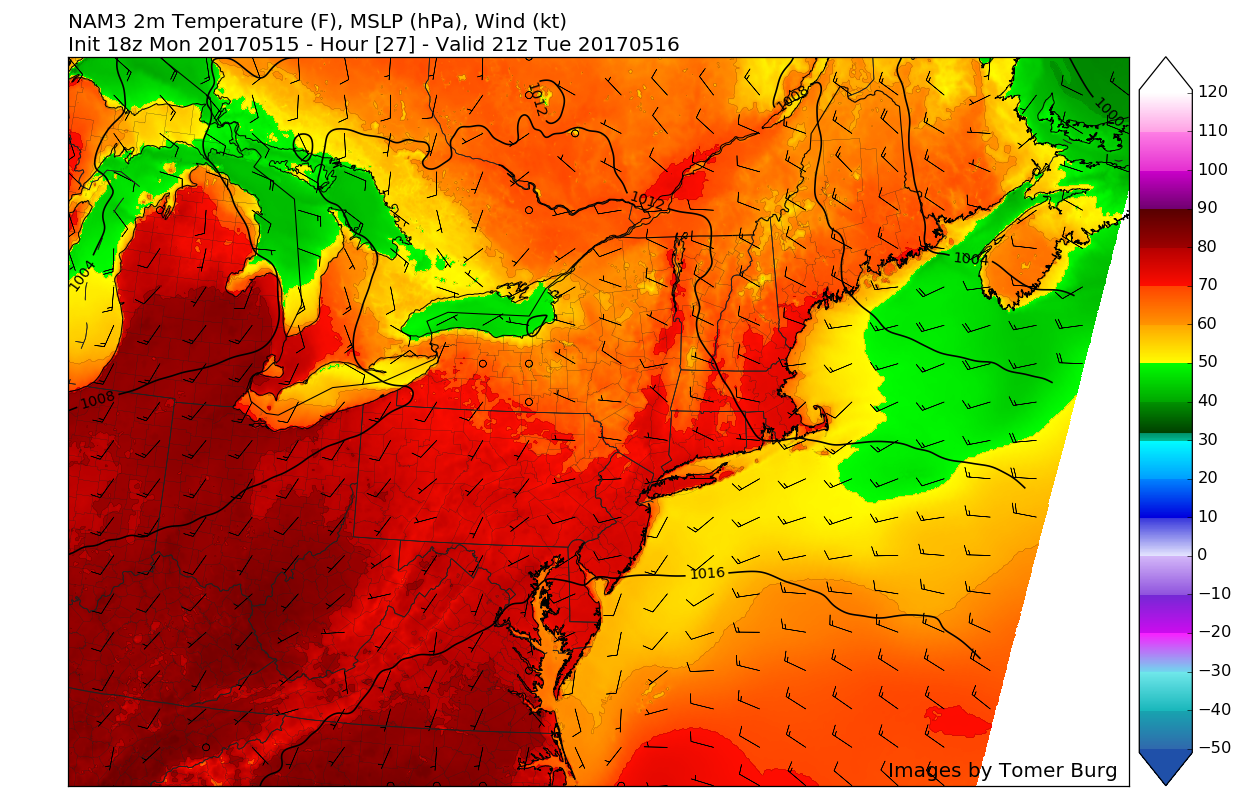
This afternoons American model showing very impressive upper level jet structure that looks to be quite favorable for heavy rainfall over portions of our area on Thursday (Valid 8am Thursday)
Friday and Beyond
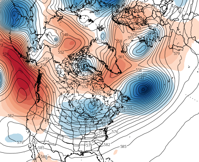
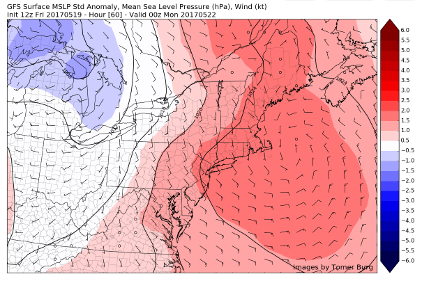
This area of low pressure looks to begin to fill-in and stall somewhere over the Northeast on Friday morning due to the high-latitude blocking that has persisted near the Canadian Maritime region and portions of Greenland. This should allow cloudy conditions, cooler temperatures, and the threat of showers to last throughout the rest of the day as the low lingers around the region during the day.
Some improving weather looks likely for the start of the first big holiday weekend of the Summer, at least on Saturday and no washouts are anticipated each day. So don’t cancel or change any outdoor plans yet!
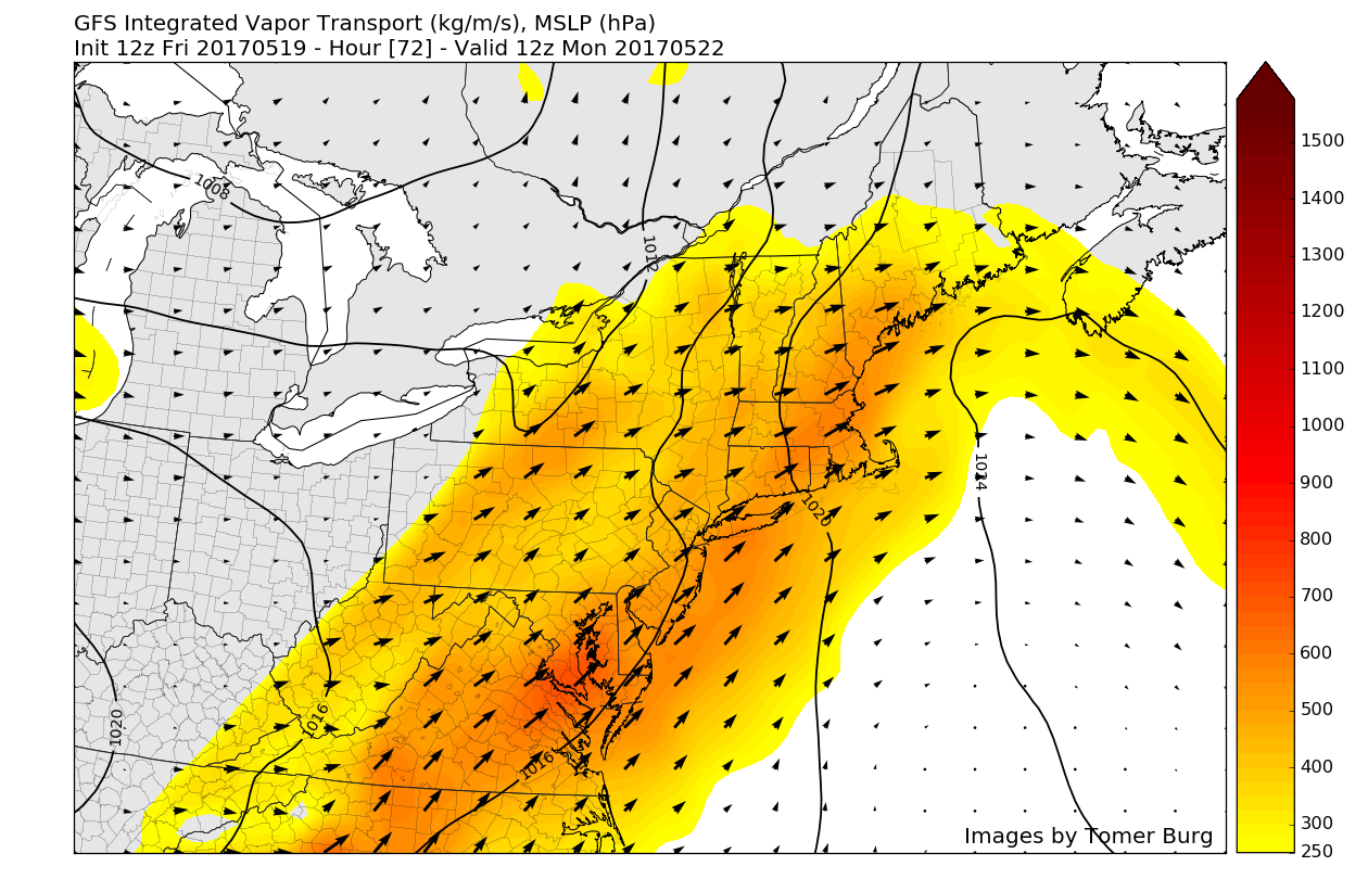
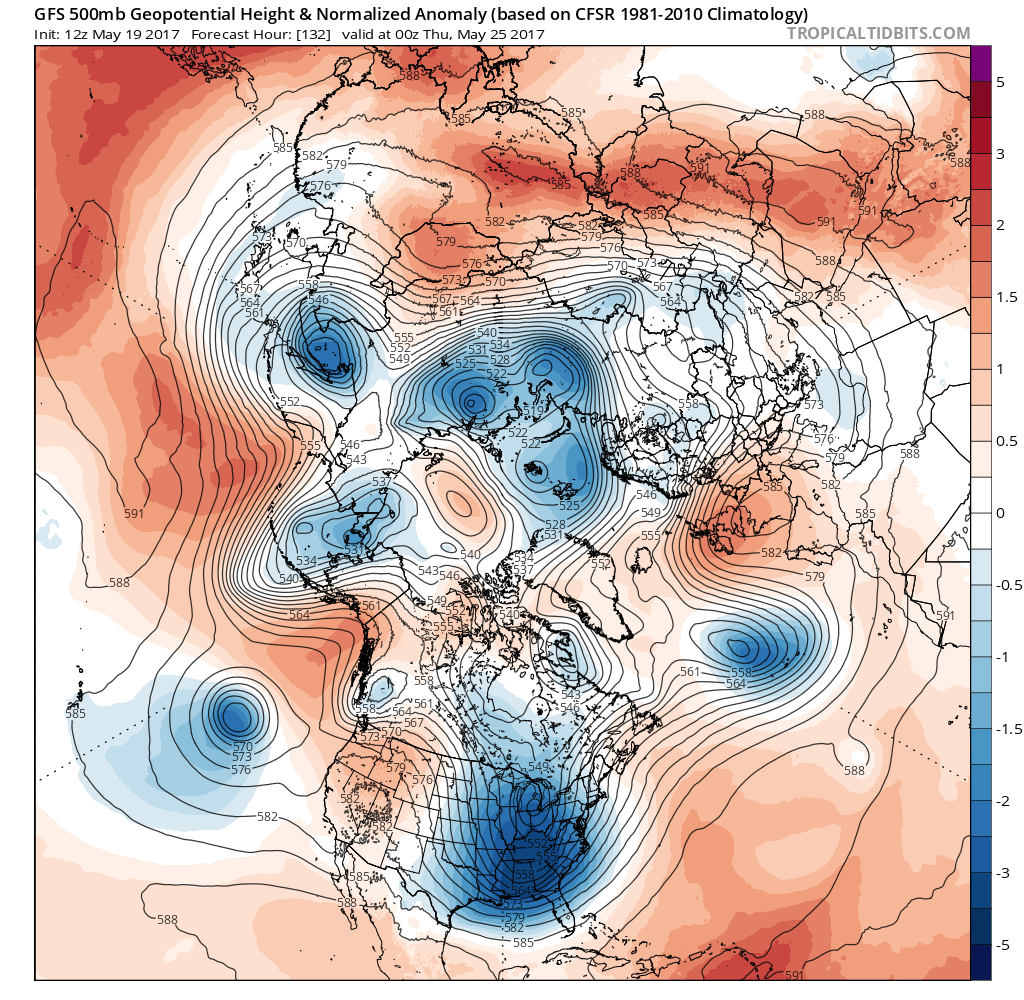
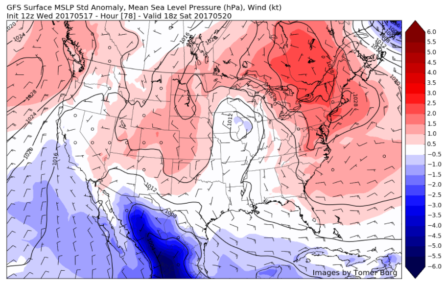
However, there may be some left over blocking and some upper level ridging over the West Coast, which may continue to support a somewhat unsettled and potentially active weather pattern into this weekend. At this time, model guidance is beginning to suggest that another storm system tracking northwest of region, that could bring some showers to the region, sometime on Sunday or on Memorial Day. But more forecast details will likely be fined tuned throughout the week.
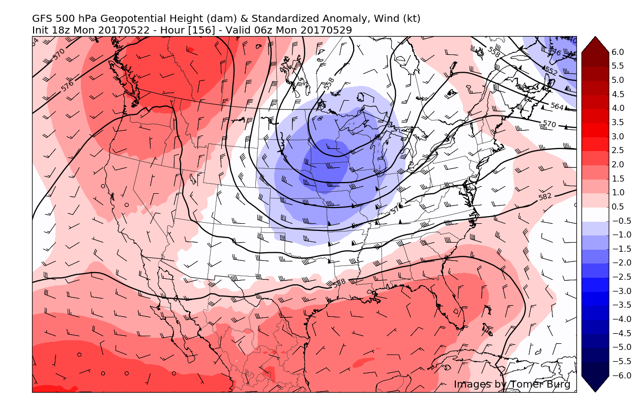
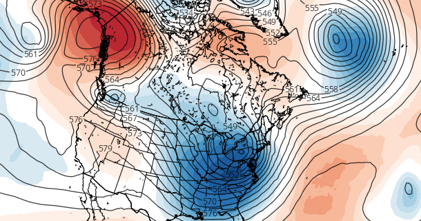
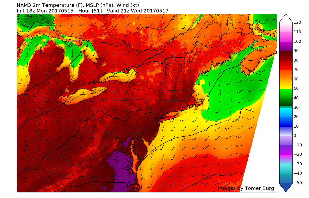
This afternoons American model showing showing yet another potential system working its way down from Canada around the Memorial Day time frame
Stay tuned for another for more updates, with discussion on later this week and Memorial Day Weekend!
For more information and posts like this one, make sure you sign up for Zone Forecasts — where multiple detailed articles, videos, and interactives are posted each day. Also, come interact with our staff and many other weather enthusiasts at 33andrain.com!
Have a great evening!
Steve Copertino
