Thursday Overview: More heat builds through Saturday with scattered t-storms possible

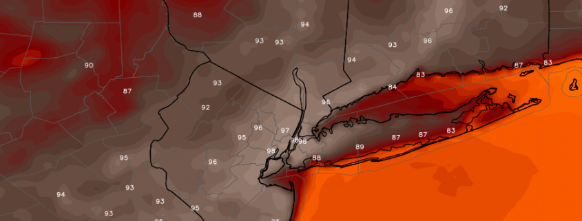
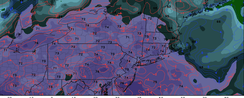
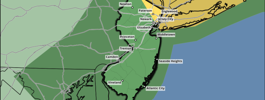
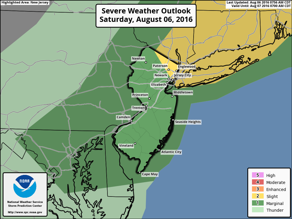
More heat will build through Saturday with a strong ridge over region. More sunshine is expected to mix with clouds this afternoon. This will help temperatures reach into the lower to middle 90s today over much of the area today. But with surface dewpoints in the 70s, heat index values alone will be in the middle to upper 90s. The National Weather Service has heat advisory for NYC for today through Saturday. Excessive heat warnings are also in effect for the Philadelphia metro region through Saturday.

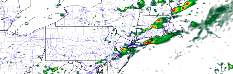
Due to the unstable, hot and muggy airmass, some widely scattered showers and thunderstorms are possible over the next few days, especially during the afternoon and evening hours. The main threat will be some torrential downpours and frequent lightning with weak shear and tropical moisture. Otherwise it will be mainly dry with more sunshine.  Some other highlights over next few days.

Read more

Monday Overview: Beautiful weather starts the week…more muggy by Wednesday

Beautiful weather will continue today with high pressure from the Great Lakes building into the region. It will be mostly sunny with temperatures rising into the middle to upper 80s and comfortable humidity. This weather is expected to continue — as Tuesday will be another gorgeous day as temperatures reach the middle or upper 80s again with humidity still not high. Coastal areas may be a few degrees cooler with some marine influence.

However, more muggy weather and likely more heat will be arriving later this week, with an upper-level ridge building over the region. A frontal boundary and some mid-level disturbances may lead to more showers and thunderstorms with potential for some heavy rainfall beginning on Wednesday. If there is enough sunshine, a more southwesterly flow will cause temperatures to exceed 90 degrees by late this week. Regardless, heat index values alone could still be the 90s with the higher humidity. Some other highlights for today:

Read more

Weekend Overview: Strong to Severe T-Storms Possible Today

Hot and humid conditions start the weekend today, with some sunshine mixing with clouds. A cold front approaching from the west will likely trigger some showers and thunderstorms over the region this afternoon. At this time, it appears some instability with stronger shear and forcing will have a higher chance of coming together over NYC metro, Long Island and further northeast into Lower Hudson Valley and Connecticut for more organized severe thunderstorms this afternoon. Thus the Storm Prediction Center has upgraded to a slight risk for these parts of the region  But some isolated strong or severe thunderstorms are still possible further south and west into New Jersey. The main threats will be strong or damaging wind gusts, heavy rainfall and frequent lightning. One caveat, is if more clouds are around this afternoon hampering instability, then the severe weather threat will be reduced over the region. Stay tuned for more updates this afternoon, as necessary.

Any lingering showers and thunderstorms will come to an end by early this evening, as the cold front pushes through region. Skies will clear overnight with temperatures dropping into 60s in the suburbs to closer 70 over NYC metro. High pressure will over the region providing more sunshine, less humid weather on Sunday with temperatures rising into the middle 80s and alight northwest breeze. Some other highlights.

Read more

Heat returns, scattered severe storms Saturday afternoon

A transitional ridge will build into the area from Friday Night into Saturday, with warming temperatures and increasing moisture expected. While this ridge won’t be necessarily large, it will bring much warmer air in both the mid and lower levels of the atmosphere. This will lead to increasing instability late Friday into Saturday, ahead of an approaching cold front which will be lingering to our north over Southeast Canada.

This front will begin sagging southward on Saturday morning and afternoon, with showers and thunderstorms likely to develop near the area during the early afternoon. Moderate instability in the atmosphere is expected to juxtapose with favorable wind shear to support the development of these strong and severe storms, which will sink southeastward through NJ, NYC and Long Island.

Read more