-2")
Rare July Nor’Easter Possible This Weekend With Heavy Rains and Wind
Good Evening!
Today was yet another in a series of days with below average high temperatures and low humidity. The difference with today, was the fact that we were able to mix out some early morning clouds and have a mostly sunny day across the vast majority of the area, as well as the Northeast. The area of high pressure that contributed to some pleasant and cooler weather yesterday moved directly over the NYC metro area this afternoon, and this further helped to conditions quite pleasant, with light winds generally from the south. With low humidity, clear skies, and a fresh high pressure system over the area, we saw highs limited to the mid to upper 70’s, with a few locations off to the west and north over Pennsylvania and northern New England reaching into the lower 80’s this afternoon. Overall these temperatures were around 5-10 degree below the norm for this time of year, and quite the contrast to the miserable heat and humidity we had over the entire Northeast just a week ago.
As the area of high pressure that was in control for most of the day continues to head eastward, it will begin to kick up more of a southerly flow in its wake later this evening. As it does so, this will lead to increased low level moisture building over the region as well as mid level temperatures increasing ever so slightly. The gradual increase in low level moisture should allow for the development of cloudier conditions for the rest of the evening, which should allow for overnight lows to not be quite as low as they were the past few nights, with temperatures getting down into the lower to middle 60’s across much of the area.
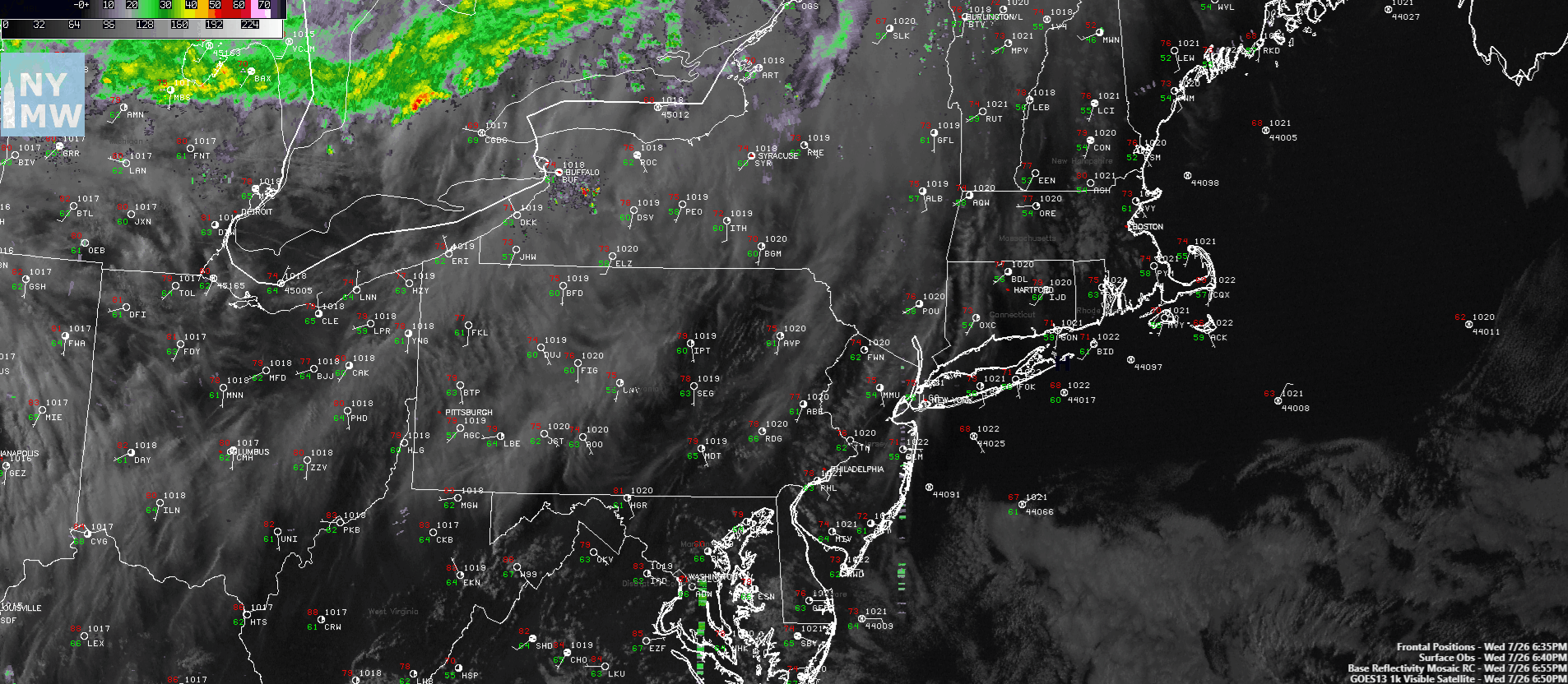
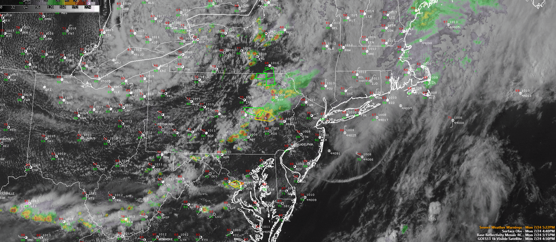
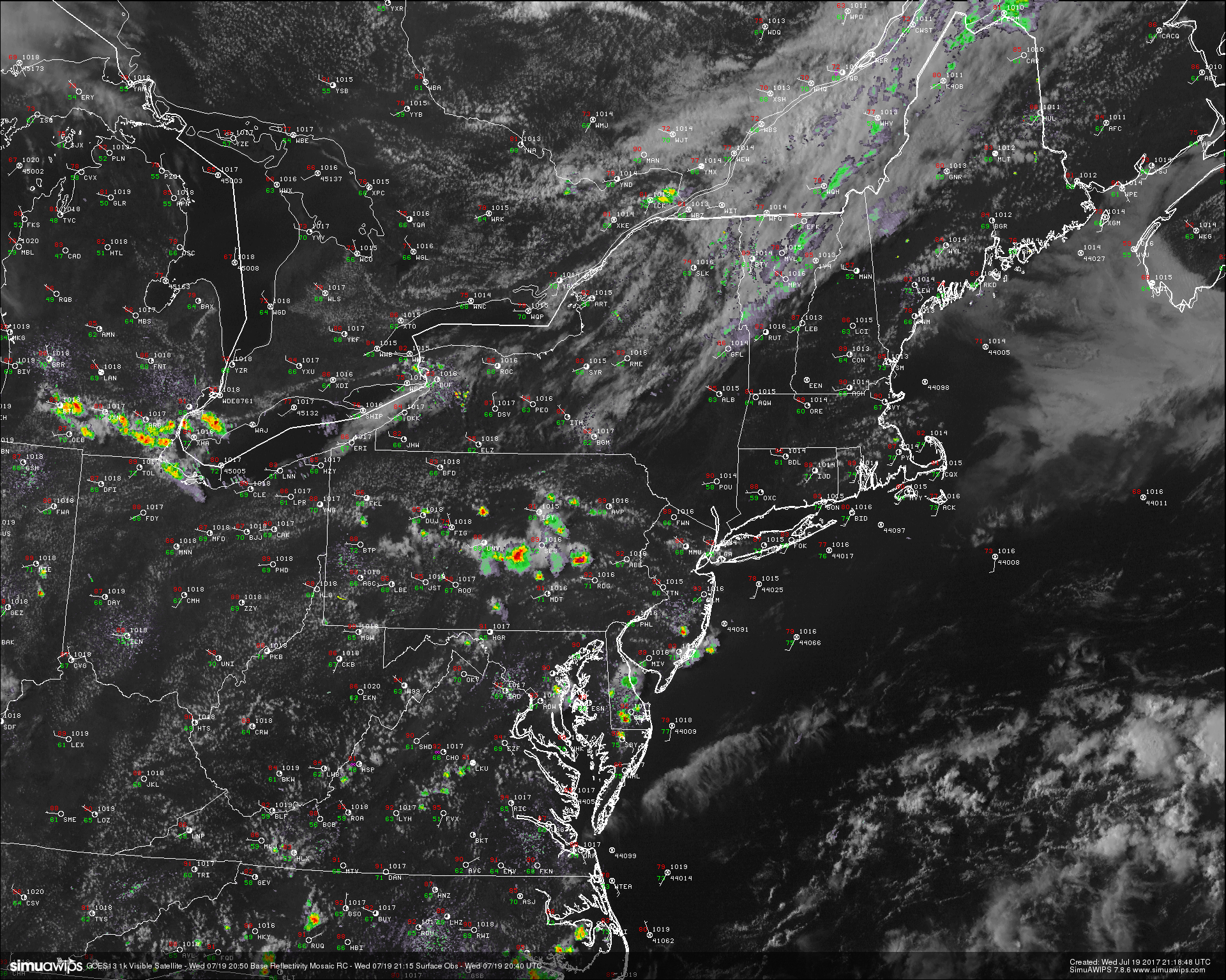
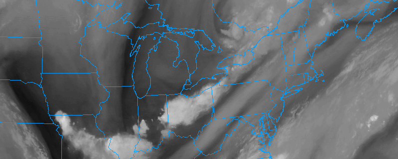
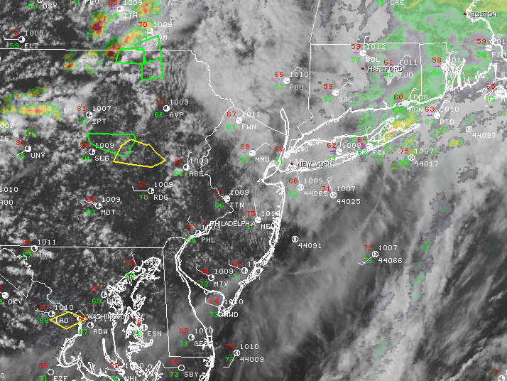
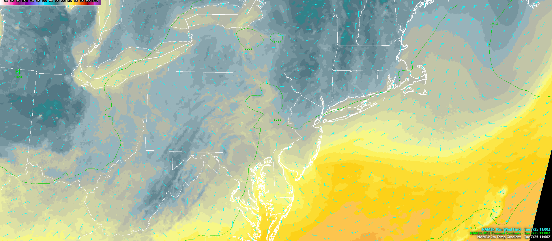
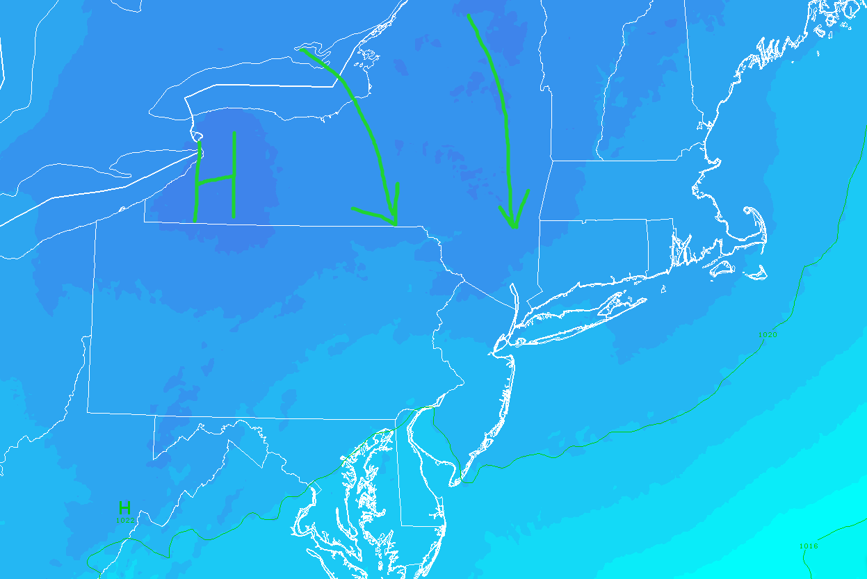
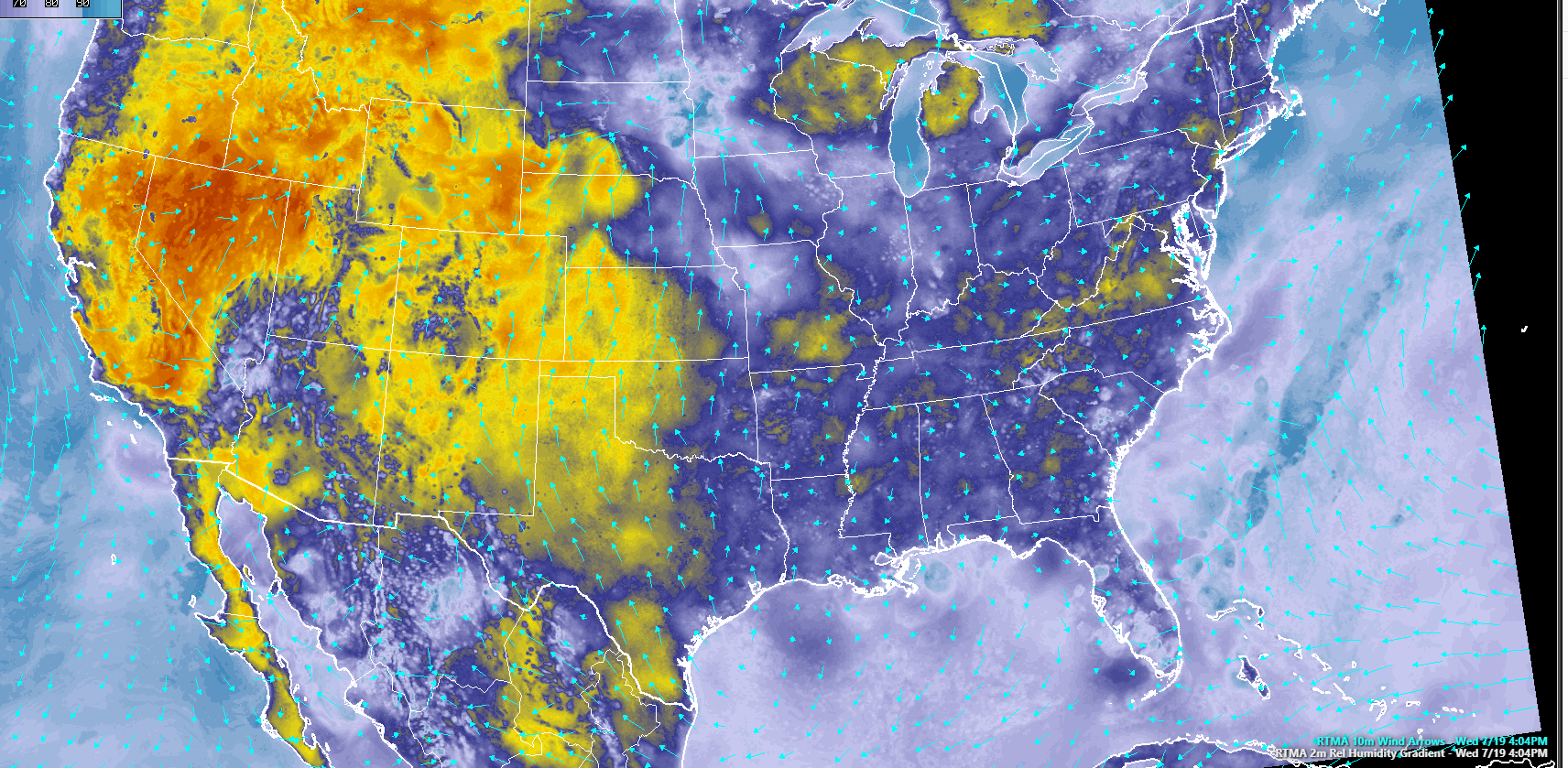
(Click To Animate) This afternoon/evenings latest high resolution visible satellite imagery, regional radar mosaic, and surface observations, showing relatively pleasant conditions with some high clouds beginning to move in as the high pressure to our east gradually fades (Courtesy of Simuawips.com)
Thursday into Thursday Evening
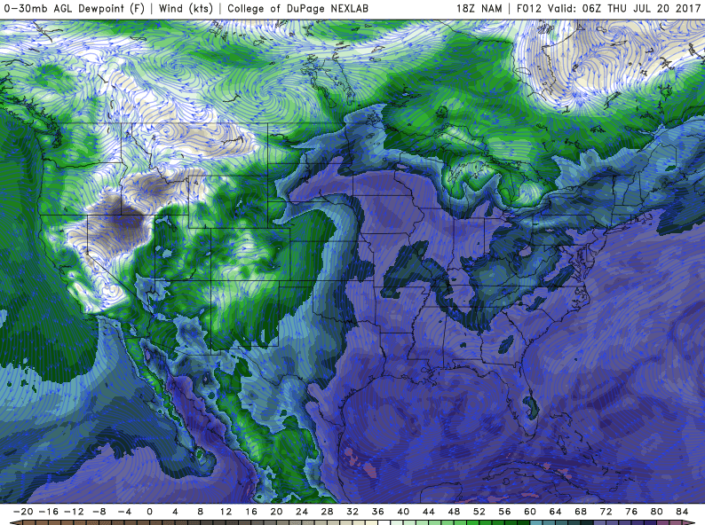
Thursday should start off with mostly broken clouds, with some overcast further inland as the area of high pressure really begins to back off to the east and begins to introduce a brand new moist airmass into the Mid Atlantic and Northeast regions during the late morning and afternoon hours. Additionally, south-southwest flow will also begin to increase markedly ahead of a mid level shortwave that will be located over the Great Lakes region as well as the Ohio Valley. As this south-southwest flow begins to increase, mid level temperatures will begin to increase once again, which should support a round of warmer temperatures by the mid afternoon hours. Despite the possibility of some cloud cover, highs should be able to get into the low to middle 80’s-which will be right around normal for the area during late July. It should be noted that some influence from afternoon sea breeze activity could work to cut highs along coastal sections tomorrow by five or so degrees. In addition to the increasing temperatures, the dreaded dewpoints will once again be on the rise tomorrow afternoon-with values ranging in the mid 60 to lower 70 range, making for a muggy afternoon tomorrow, reminiscent of the days last week.
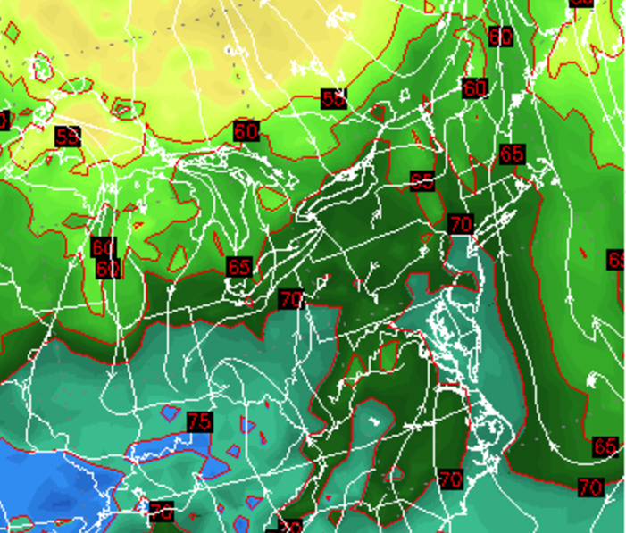
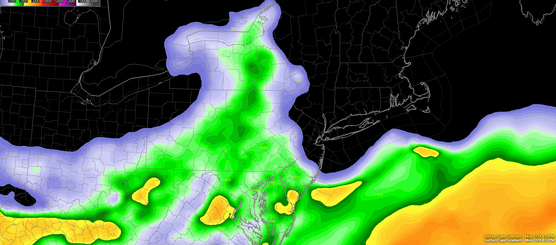
With all of this increasing moisture in the low levels of the atmosphere, we will likely also see instability begin to increase tomorrow afternoon and into the evening hours. Though not as impressive as it looked a few days ago, tomorrows setup should still yield a marginal risk for severe thunderstorms across the Northeastern states as a weak mid level system will gradually work its way east and potentially spark some showers and thunderstorms during the late afternoon and evening hours. The main limiting factors for any widespread/impressive thunderstorm development will be relatively meager mid level lapse rates, as well as any impressive shear to help keep potential updrafts organized and coherent. However, more favorable parameters may come together over portions of Pennsylvania and New York, so those with interests in those locations may have a better shot at seeing strong to severe thunderstorms capable of damaging winds and possibly a brief tornado. Otherwise, any storms that form near the NYC metro area will likely be capable of producing gusty winds, heavy rainfall, and frequent lightning before they gradually fade to the east by sunset. Expect another humid evening with lows ranging in the middle to upper 60’s once again.
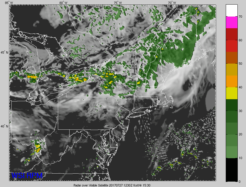
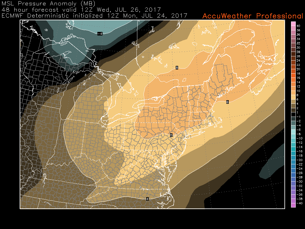
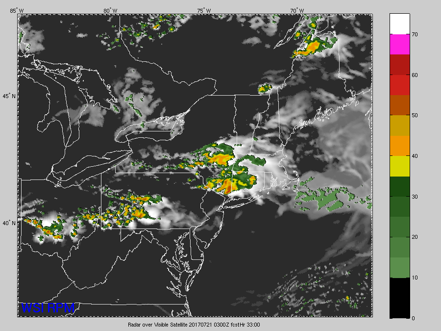
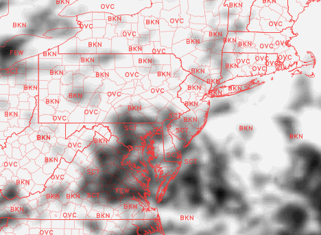
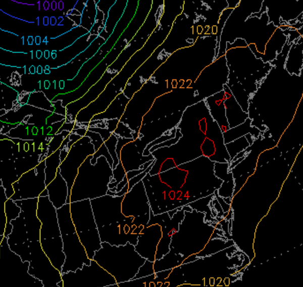
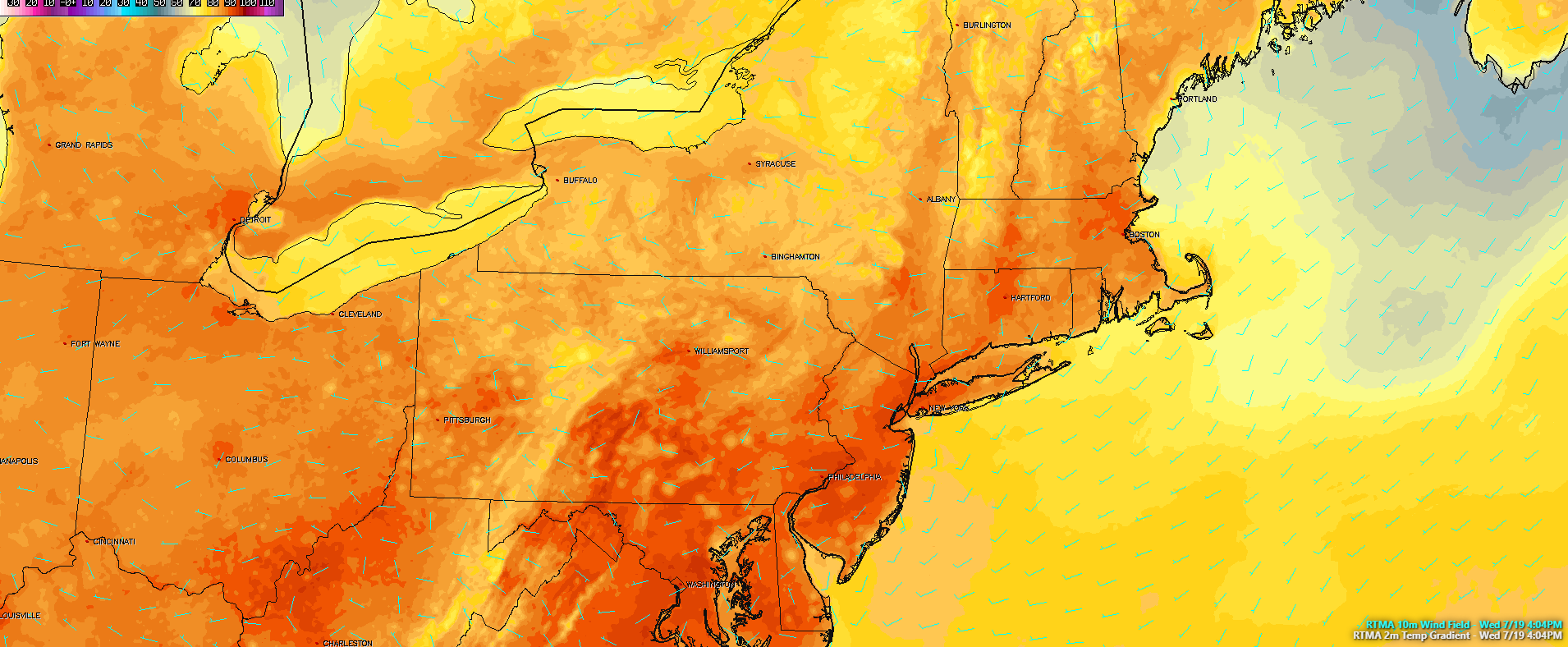
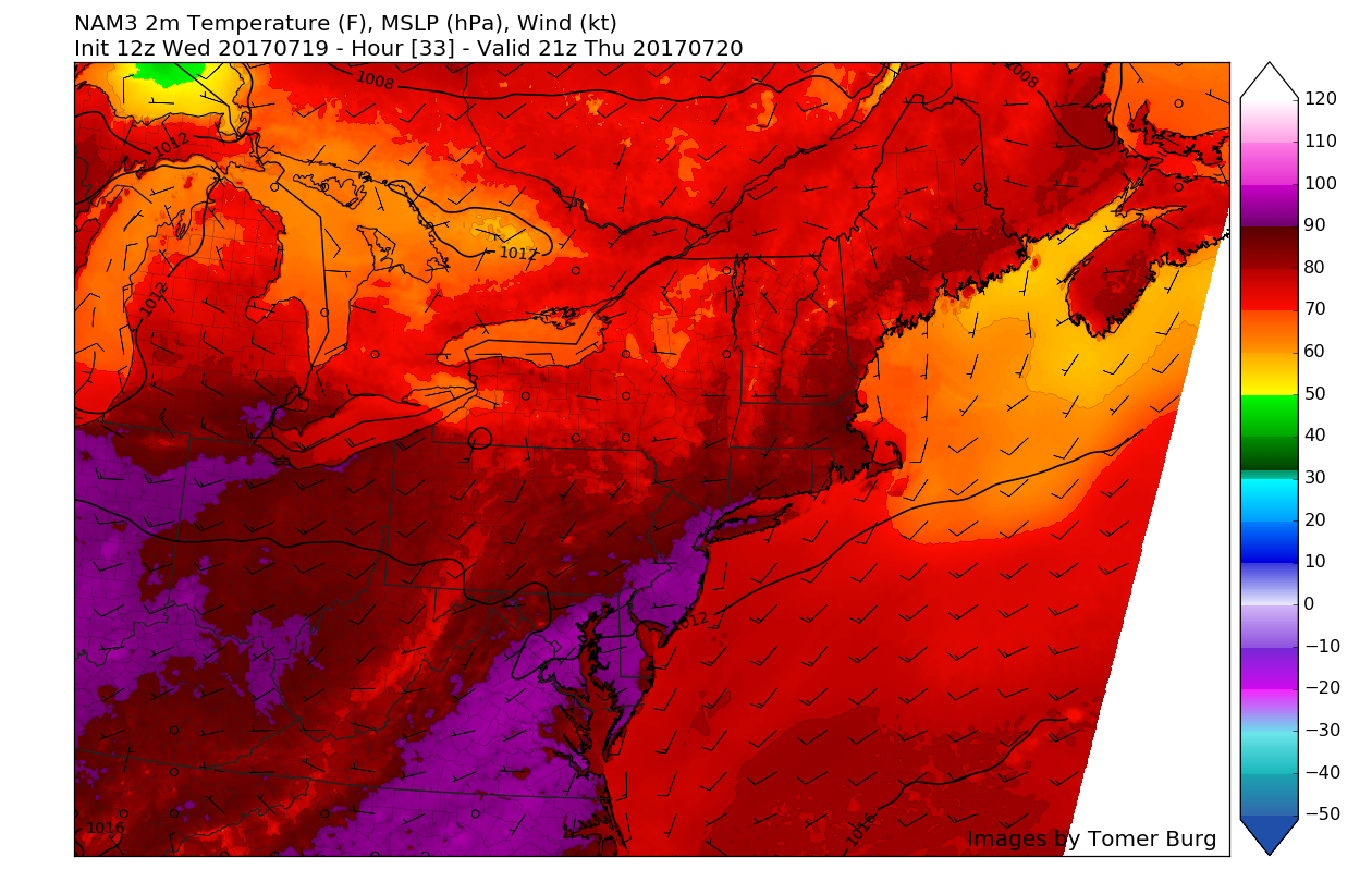
This evenings latest RPM model showing the general evolution of Thursday weather, with some showers and thunderstorms possible. Widespread severe thunderstorm development is not anticipated (courtesy of WSI)
This Weekends Potentially Impactful Nor’Easter
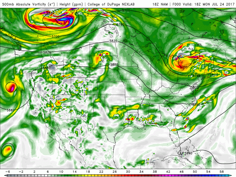
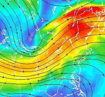
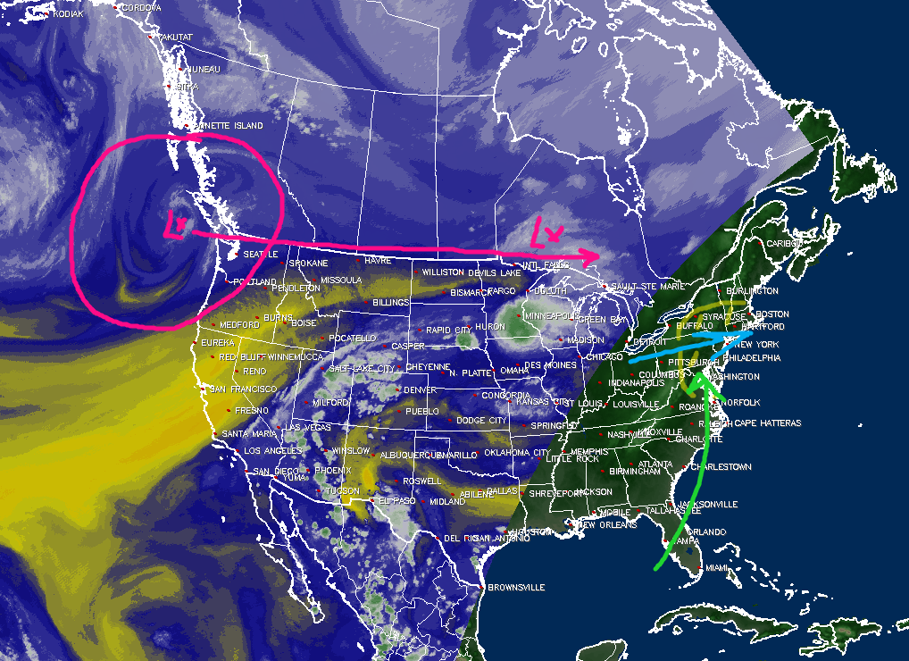
Back on Monday we highlighted the possibility that the Northeast would have to deal with an area of heavy rain moving in from the west during the evening on Friday and into the early morning hours of Saturday, however since that time there have been some marked changes with regards to the duration, timing, and overall severity of this potential system. While the overall main players remain the same, with the initial monsoon energy moving up and around the periphery of the large heat ridge located in the Plains, as well as a small, but potent shortwave diving out of Canada-how these two interact remains to be far from settled at this time.
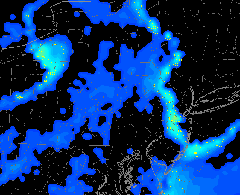
This afternoons model guidance suggests that as the initial monsoon energy heads into the Ohio valley, the potent Canadian shortwave trough will begin to interact with this energy and begin to phase together to some degree. This setup is something we’d typically be talking about in the Winter months, but the overall outcome may wind up being quite similar-just with warmer temperatures this time around. As these mid level systems interact and potentially phase, this will cause a surface low to develop over the Mid Atlantic states during the afternoon hours on Friday. As this surface low begins to become more established, it will have a very warm and moist feed of tropical air pumping into it from the south. Additionally, it looks quite likely that there will be a favorable upper level jet configuration overhead of this system, which should promote a healthy amount of upper level divergence and convergence at the surface levels. In short, when all of these factors come together in just the right manner, its a rather strong signal that very heavy rain will be likely for portions of the Mid-Atlantic.
So what could go wrong? Though this system will have some potentially favorable synoptic support, there are some serious questions that still remain with this system that make this a very difficult forecast. First off, the trough diving down from Canada is whats known as “positively tilted” in nature, meaning that the majority of its energy is located in the bottom left quadrant of the trough, which often allows the system to be progressive in nature. It also does not help that we have been stuck in a rather progressive west to east pattern for the past week or so, with no upstream blocking to help slow things down. This pretty much eliminates the chances of a large, wrapped up system along the coast unless something drastically changes. Next off, the initial monsoon energy out ahead of the Canadian system will be moving quite quickly to the east, and as the Canadian system drops south, it may wind up shearing out the energy ahead. This would create a much weaker and disjointed system that would likely have the heaviest rain offshore.
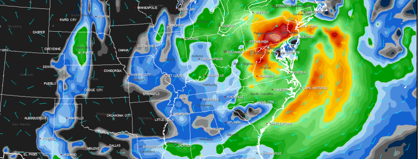
Taking all of this into account and carefully looking at this afternoons model guidance, I have decided to go with a blend of the ECMWF/NAM/ECMWF-ENS/UKMET at this time. This would lean towards a more progressive solution for this system, bringing the surface low from the Mid Atlantic coast, to well southeast of New England. This track would likely still bring moderate to heavy rain to the NYC area, but areas south of NYC would likely feel the brunt of this system (PA/MD/SNJ). At this time, it seems likely that the heaviest batch of rainfall should be able to drop 1-2″, with some higher amounts possible along the coasts of NJ and LI. This system is forecast to exit the region by Saturday afternoon, with some showers and gusty winds lingering around thereafter.
We will be carefully monitoring this system over the next few days and providing updates as needed!
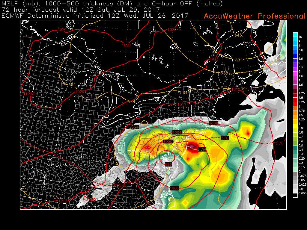
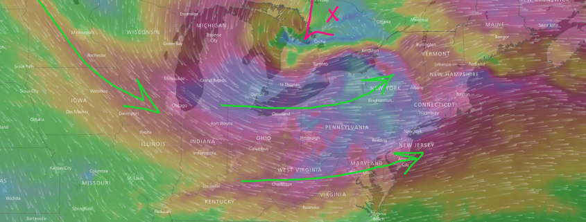
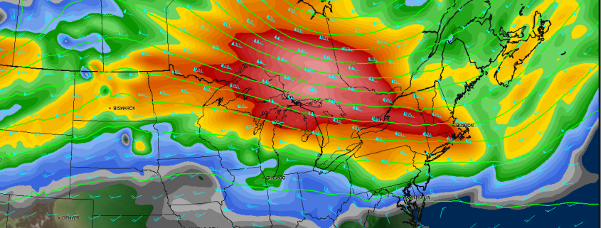
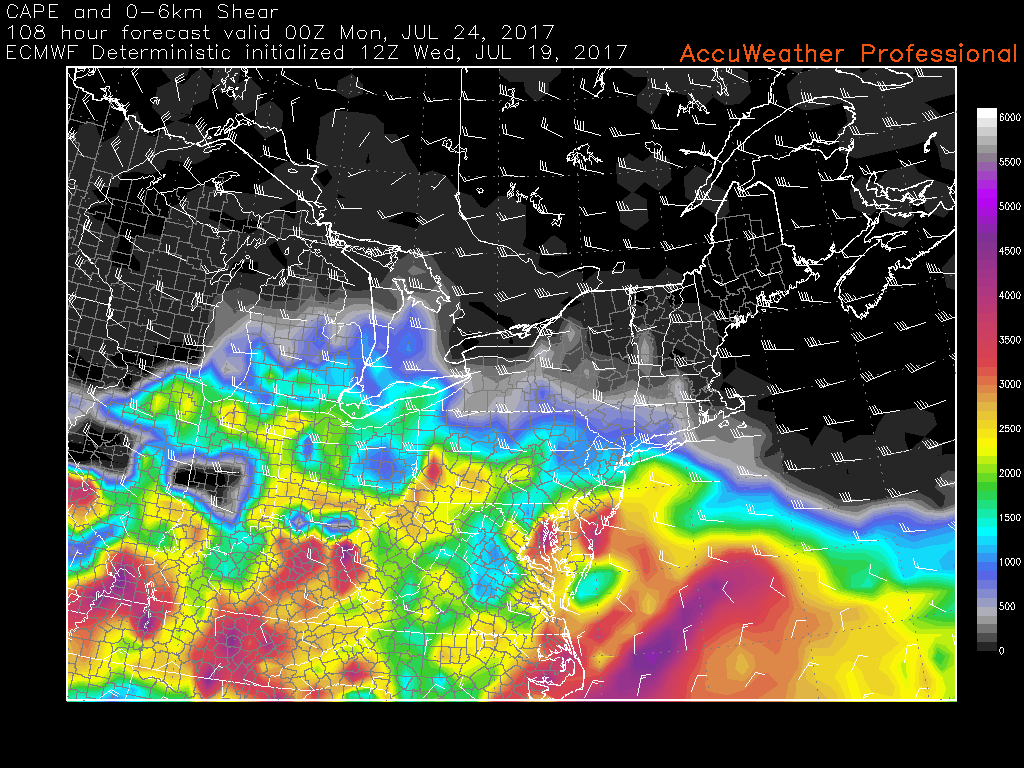
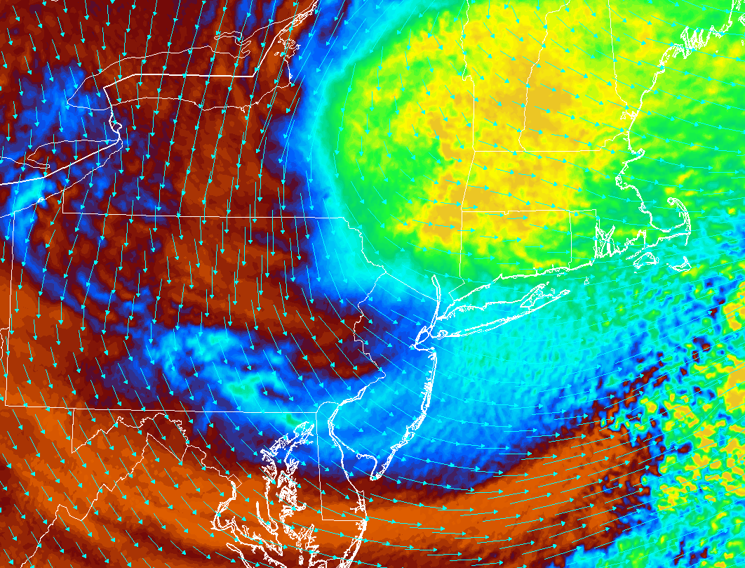
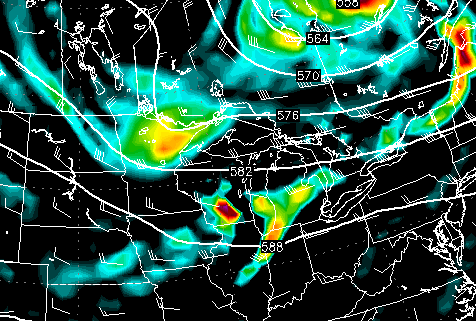
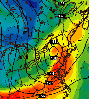
This afternoons ECMWF model showing a rather impressive Nor’Easter for this time of year affecting the Mid Atlantic and portions of the Northeast with heavy rain and gusty winds (Courtesy of Accuweather Pro)
For more information and posts like this one, make sure you sign up for Premium Forecasts — where multiple detailed articles, videos, and interactives are posted each day. Also, come interact with our staff and many other weather enthusiasts at 33andrain.com!
Have a great day!
Steve Copertino