Good Evening and Happy Friday!
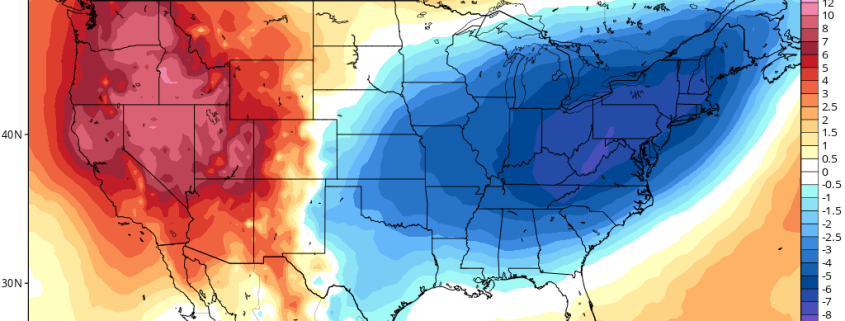
Today has been yet another pleasant and rather seasonable day, and the good news is these conditions look to last well into this weekend. The bad news is that we do appear to be headed into yet another unsettled and dreary period staring late Sunday, and into the work week next week. Additionally, the negative phase of the North Atlantic Oscillation that we have been covering for over a week now looks to bring about another unseasonably cool airmass for the majority of next week. However, in the extended range we may begin to see a switch back to seasonable temperatures and more stable conditions.
———
Recap and This Evening
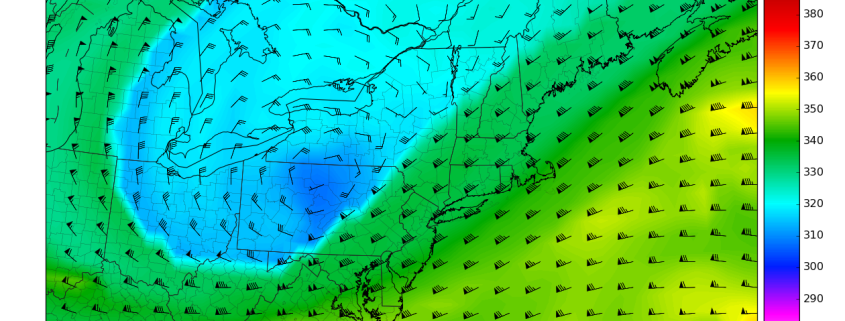
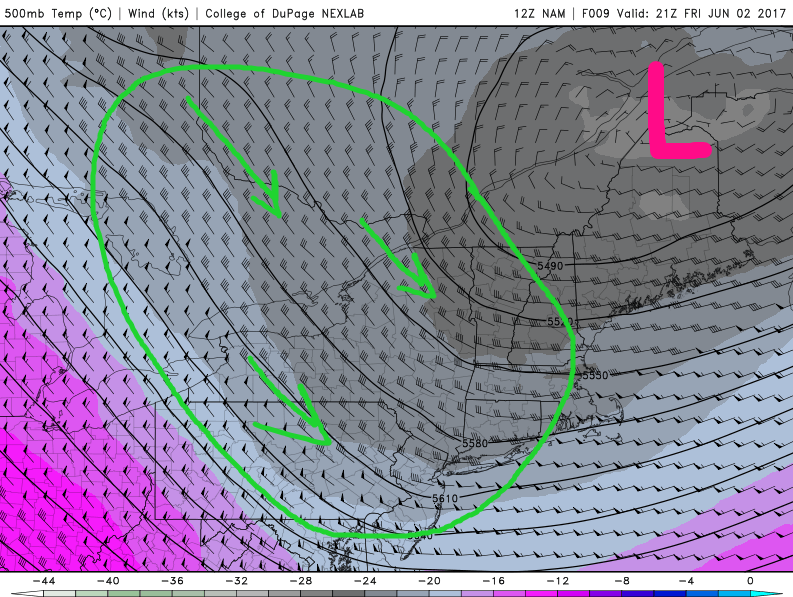
Earlier today we saw mostly sunny skies and light winds from the north and west due to an area of high pressure moving through the Ohio Valley and western portions of the Mi-Atlantic states. Just to the east of the high pressure system, a large upper level low was situated over northern New England and portions of Canada, which was helping to usher in cool and dry air in the mid-levels of the atmosphere. As the day progressed and the surface levels of the atmosphere began to warm up, this caused a similar scenario that we have seen a few times in the past few weeks where the warmer air near the surface quickly rises into the cooler levels of the atmosphere and begins to form clouds.
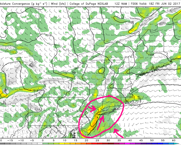
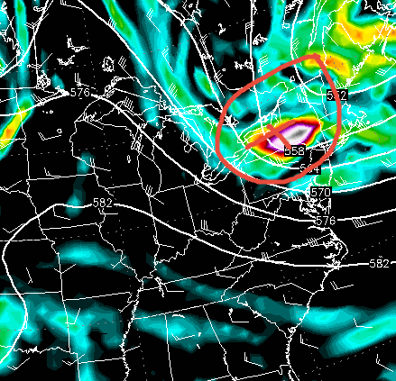
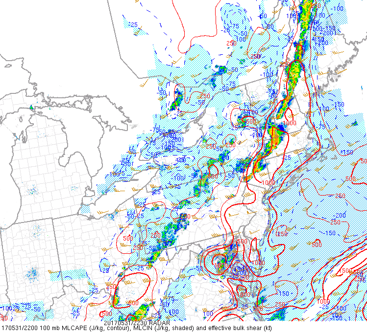
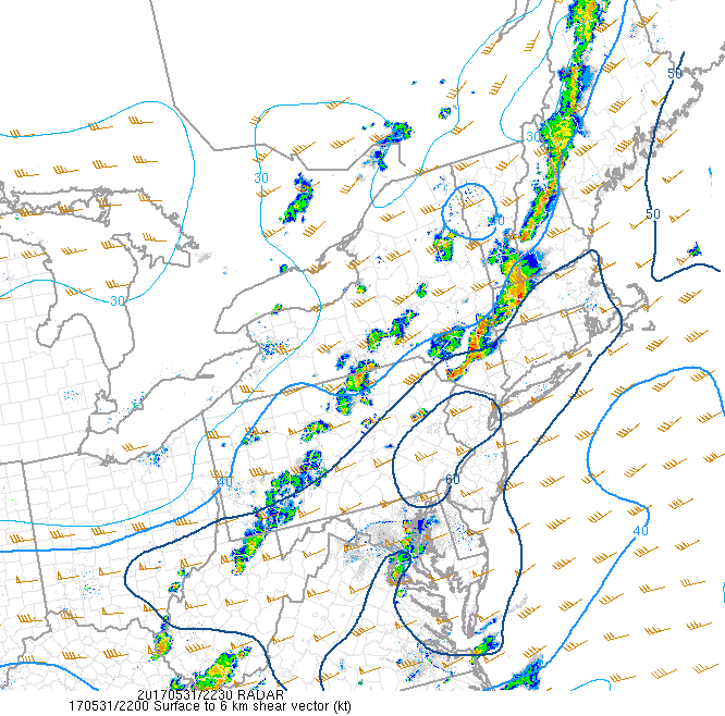
With very marginal upper level support, some converging moisture boundaries over the area, and an area of energy rounding the base of the upper level low, we actually began to see some congested cumulus and ragged cumulonimbus form over portions of New York, New Jersey, and Connecticut. Due to the dry air being entrained in from Canada, these showers and storms were generally pretty tame in nature and did not have muhc lasting power, but due to the cold mid to upper levels, some pea-sized hail and gusty winds were reported mainly to the north of New York City.
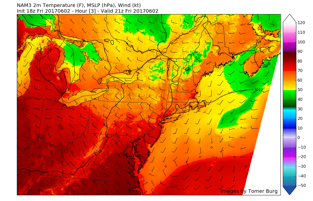
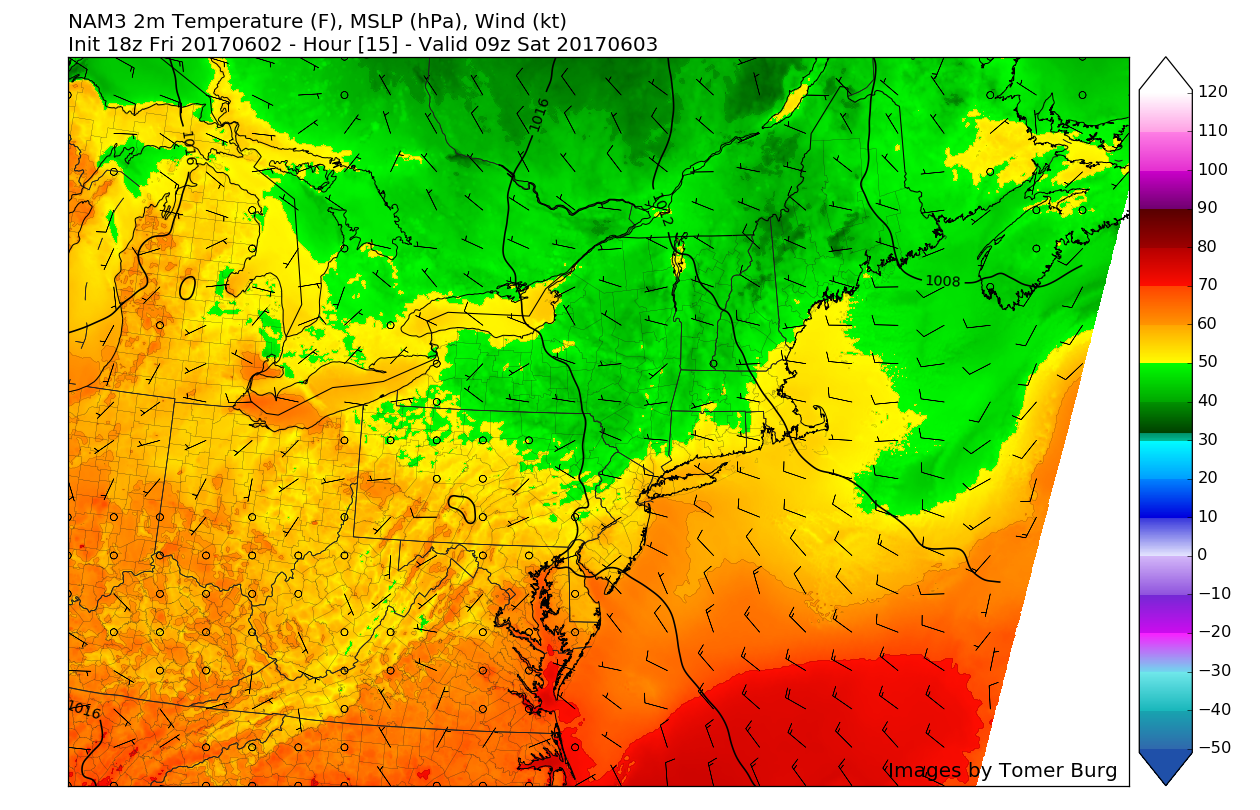
Moving on, with rather abundant sunshine, light gusty winds, and a relatively dry airmass, highs today were able to climb into the mid to upper 70’s once again, with the exception of coastal New Jersey and portions of Long Island. As we move into the evening hours, the breezier conditions left over from a frontal passage will gradually subside. Additionally, skies should begin to clear out quite significantly as dry air and diurnal heating begins to wane over the area. These conditions will be quite favorable for radiational cooling to take place this evening, so expect overnight lows to drop quite a bit with temperature ranging from the low to mid 50’s across much of the area, with 40’s possible in locations north and west of the city.

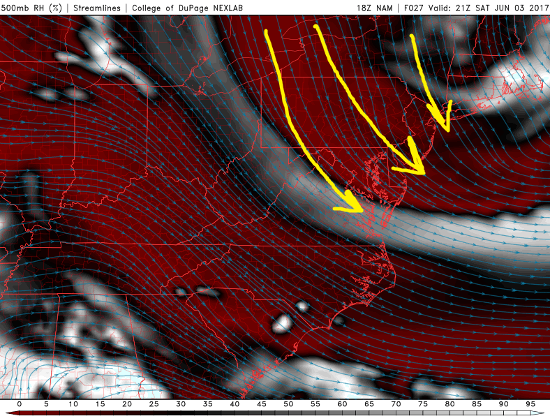
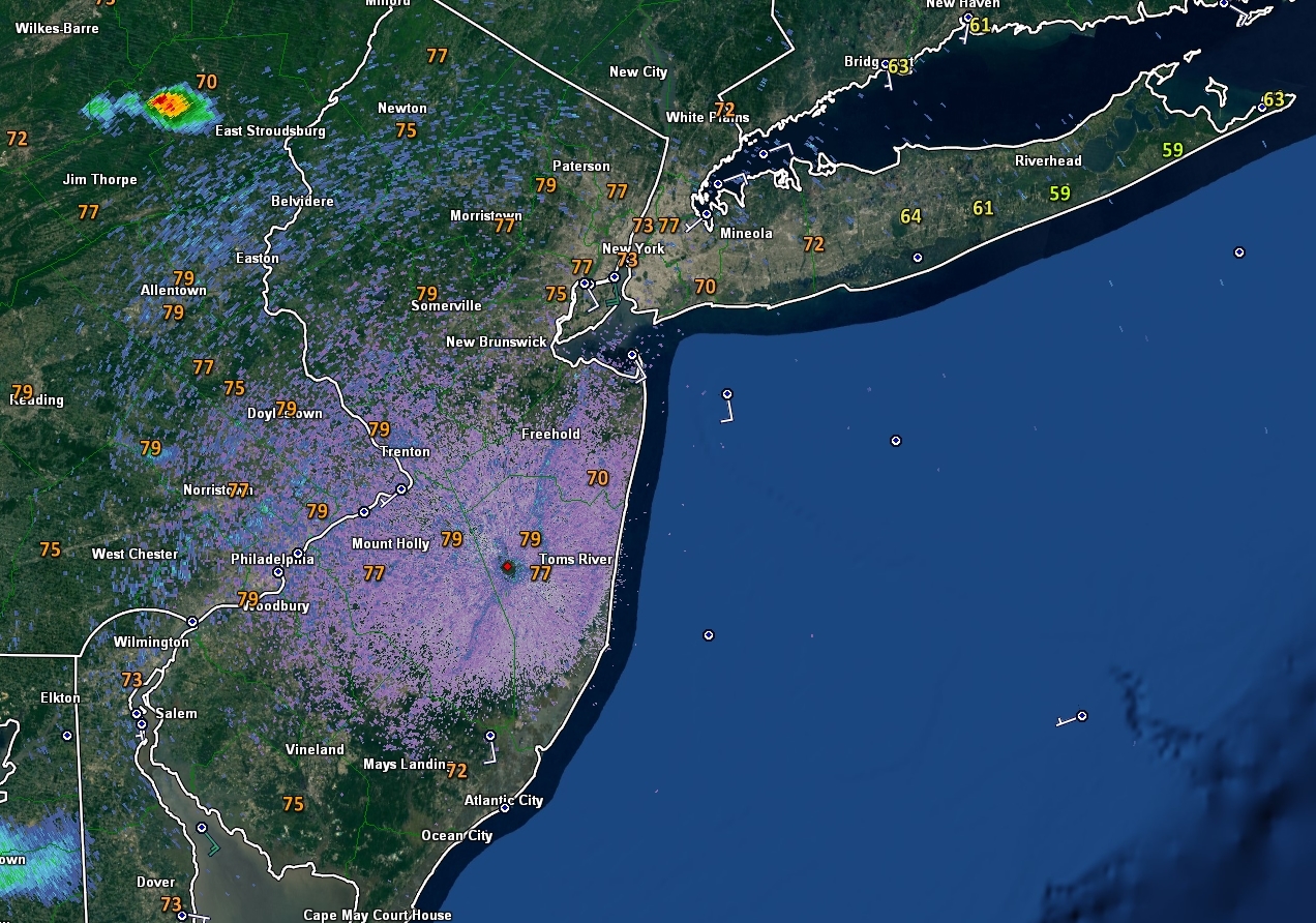
This evenings latest visible satellite imagery, regional radar mosaic, station plots, and watch/warning information. Note the rather tranquil conditions after a few brief showers and storms earlier this afternoon (Courtesy of College of DuPage)
Saturday Into Sunday
As we head into tomorrow morning, another disturbance from Canada will begin to work its way down south, and towards our area. This upper level system may have enough energy associated with it to produce some overcast and showers, but this system will be rather progressive in nature and will likely move out by late morning due to its close proximity to the aforementioned high pressure system exiting to out east. Any rainfall accumulations should be quite light in nature, with more dry air reinforcing itself over our region directly from Canada once again. Gusty winds from the north and northwest behind the tiny, but relatively strong area of energy may become quite widespread over the region tomorrow. As skies clear out and the dry air works its magic, we should see highs climb back into the middle to upper 70’s once again, with the off-chance that some locations may reach the 80 degree mark if the initial disturbance is quicker than currently forecast. Clear to partly cloudy skies are likely Saturday evening, with temperatures falling back into the upper 50’s to around 60 near New York City, and urban areas reaching down into the lower to middle 50’s over much of region.
Sunday looks to start off with mainly clear conditions as marginally dry air from the north and west continue to feed into the region. Clouds will likely begin to increase throughout the day as moisture advances ahead of the third in a series of strong mid level disturbances. As the day marches on, the threat for showers will increase, especially through the late afternoon and evening hours as the mid level disturbance begins to strengthen just to the west of our area. As this mid level system begins to strengthen during the evening hours of Sunday, an area of low pressure will likely form over the Great Lakes region, and this low pressure will be capable of advecting an impressive amount of water vapor over our area, which may set the stage for potentially heavy rains Monday morning.

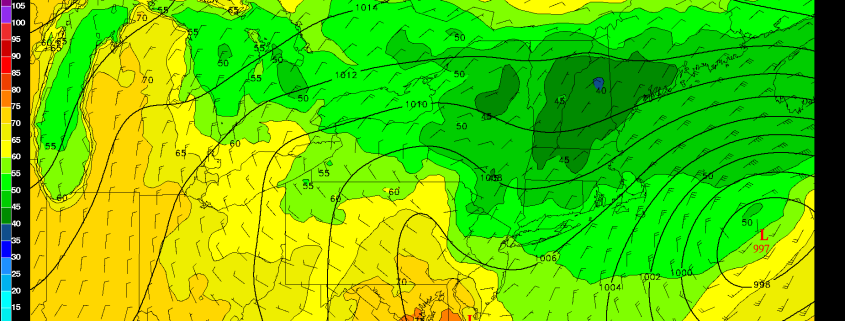
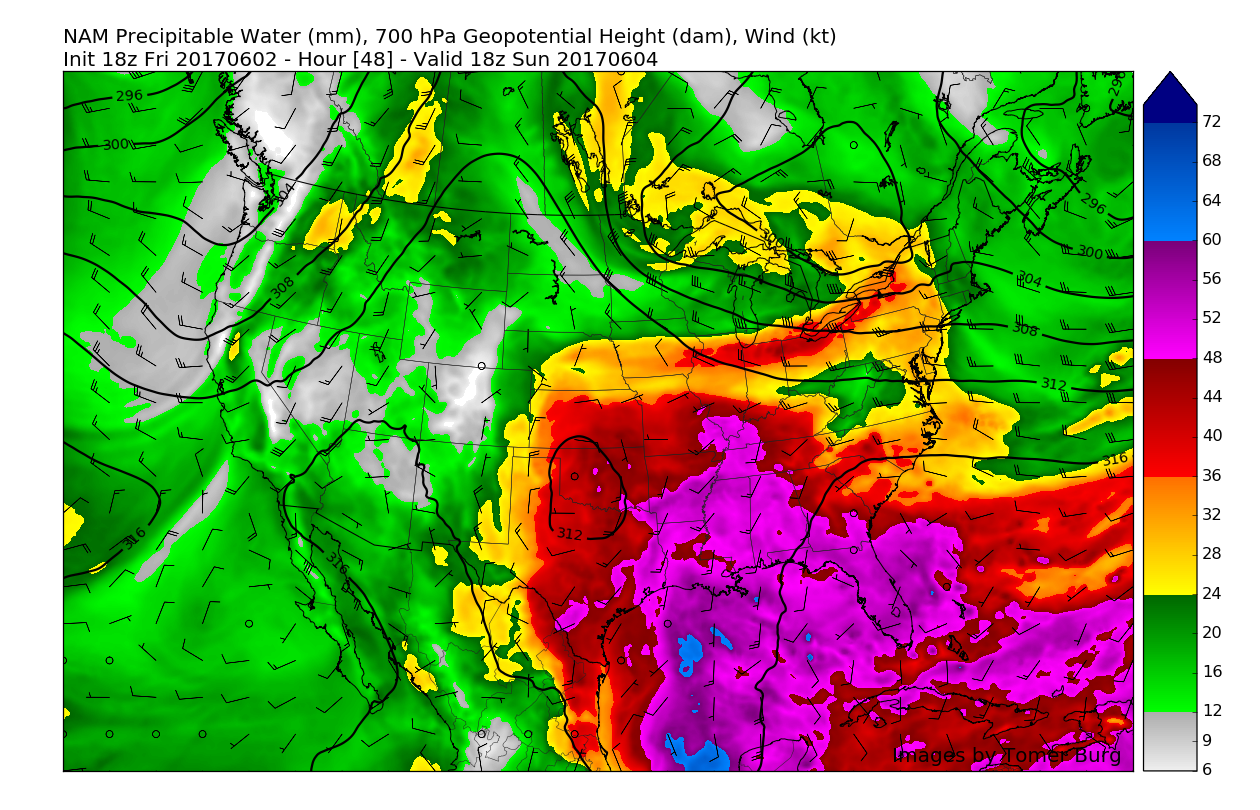
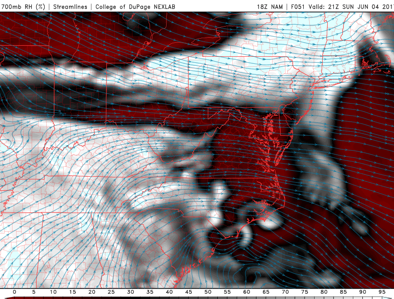
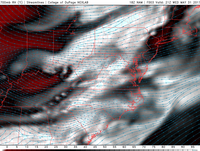
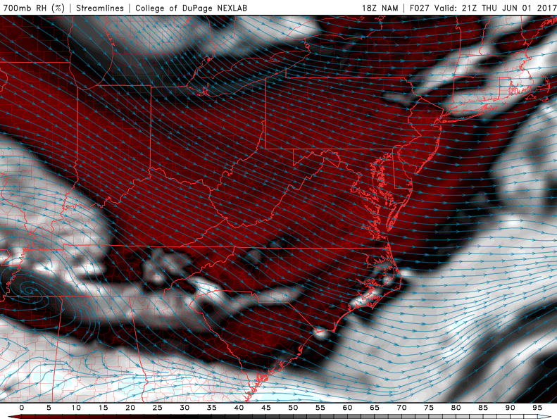
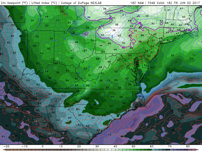
High resolution North American Model showing a very large area of moisture gathering just to the south of a developing low pressure system in the Great Lakes, which is usually a very strong indicator for moderate to heavy rains (Red and pink areas delineate very moist air-mass)
Monday and Beyond
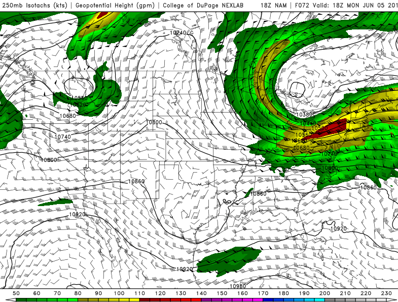
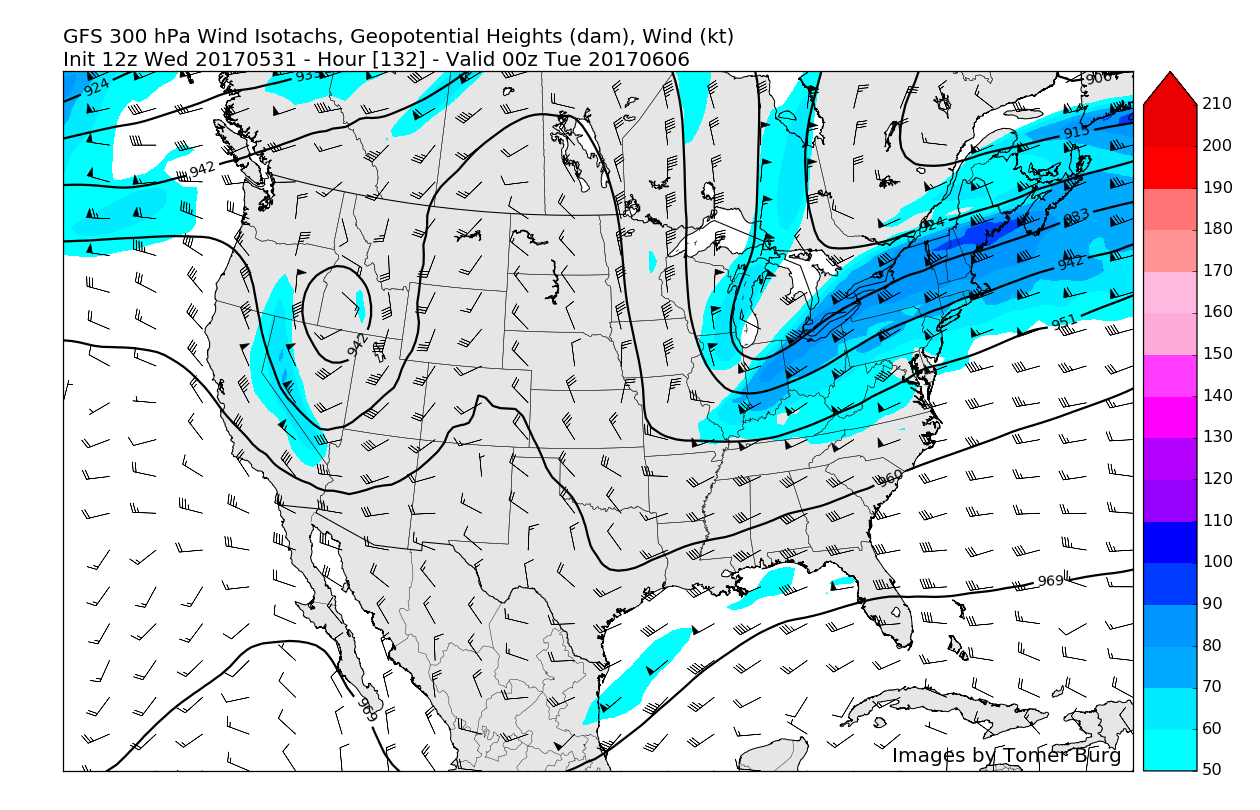
With all this moisture gathering to the south of the area on Sunday and into Monday morning, a strong mid to upper level disturbance strengthening over our area, and a favorable upper level jet streak to the north, the writing is on the wall for a wet and dreary day on Monday, with periods of moderate to heavy rainfall quite likely. The main question in this forecast appears to be just how far north the area of low pressure in the Great Lakes moves as it pushes up against an area of confluence located over Canada. Where this confluence sets up will also likely dictate how much, and where the heaviest rains fall on Monday.
There is a small chance that the confluence-or blocking could be positioned further south than currently forecast, and this would allow for a possible scenario where another surface low redevelops off of the Mid Atlantic coast and enhances the rain potential. Confidence in this scenario is low at this point, but we will provide updates on the storm as we draw closer.
Some unsettled weather with scattered showers and possibly some thunderstorms could continue into Tuesday and Wednesday with the upper-level low still lingering over the Northeast. Temperatures will likely run near or below normal depending on amount of clouds and rainfall each day.
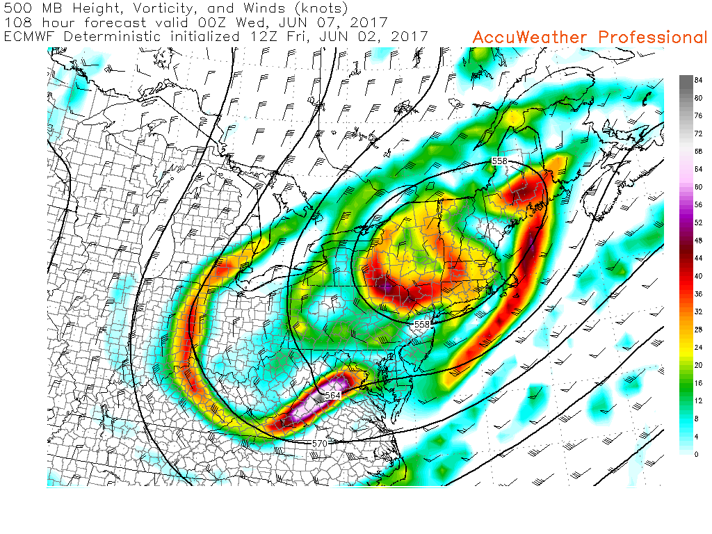
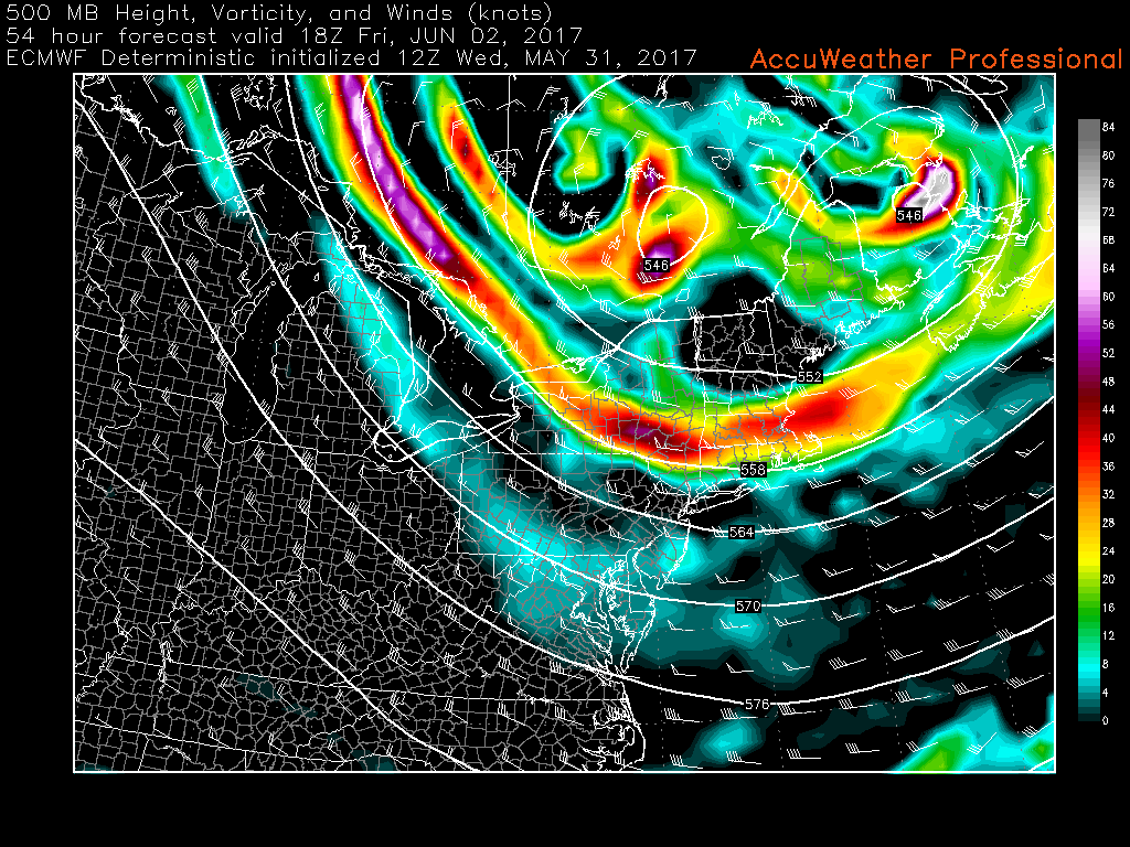
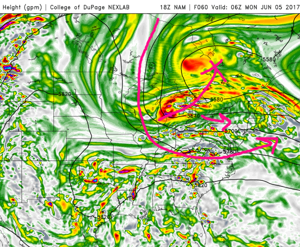
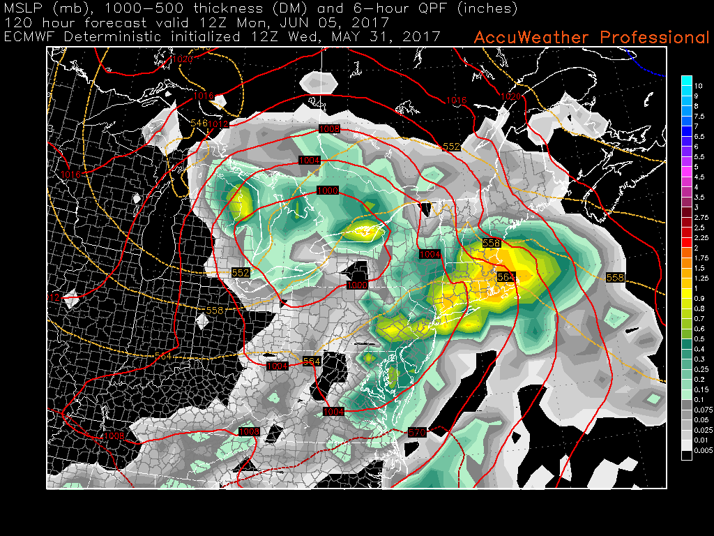
This afternoons European model showing the system that will likely produce a heavy rain threat on Monday still lingering over the Northeast on late Tuesday evening. This system could produce more rain later in the week depending on how long it meanders around
For more information and posts like this one, make sure you sign up for Zone Forecasts — where multiple detailed articles, videos, and interactives are posted each day. Also, come interact with our staff and many other weather enthusiasts at 33andrain.com!
Have a great weekend!
Steve Copertino
-2")
