-2")
Severe Weather Threat With Tornadoes Possible Today
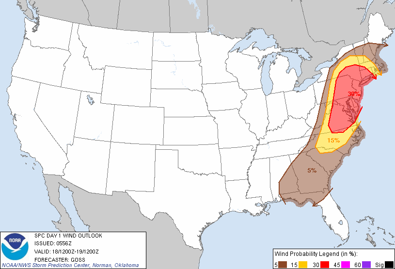
6z SPC Forecast, indicating a 10% tornado probability within 25 miles of a point (top) and a 30% severe wind (58mph gust or higher) probability within 25 miles of a point (bottom).
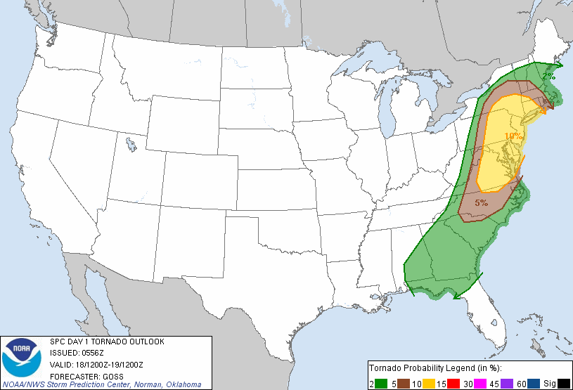
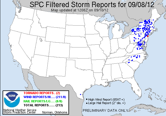
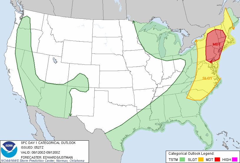
We have one of the most dynamic storm systems for the month of September in quite some time. The Storm Prediction Center has a “slight” risk of severe thunderstorms for the entire Metro area, but even more impressive is the 10% tornado contour and the 30% severe wind contour. There is also a 5% hail contour, but I would honestly be surprised if there were any hail reports.
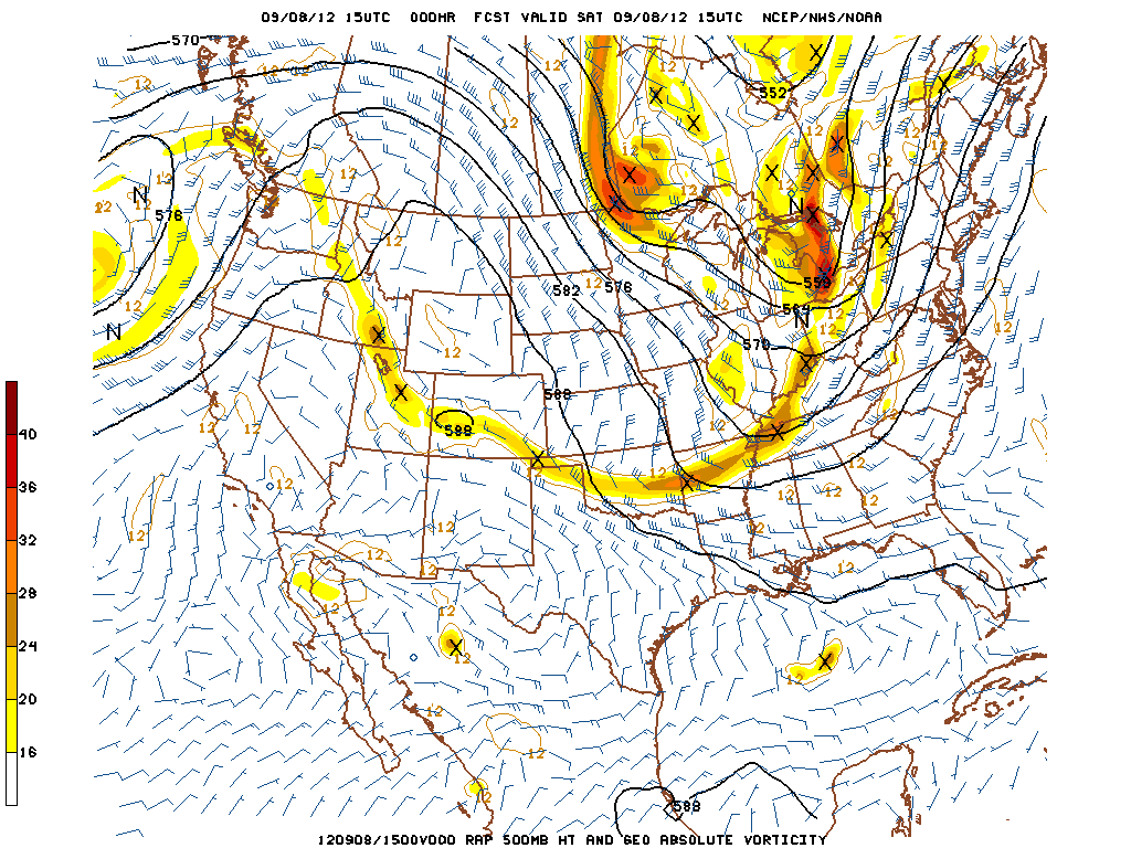
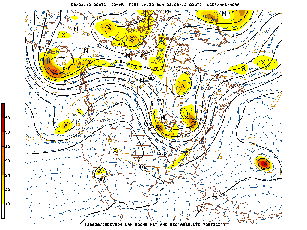
We have a potent, amplified longwave trough diving down into the entire eastern half of the country with an associated powerful shortwave moving through the Northern Great Lakes and into Canada. This trough is phasing with ample tropical moisture to the south, helping to create a powerful, dynamic storm system. There will be a warm front moving across the area in the early morning hours, and a powerful cold front moving from west to east, crossing the Metro area in the late evening hours. There are two primary threats with this storm system: discrete low-topped supercells that may form some weak tornadoes, and a squall line entering the region in the late evening hours helping to produce very strong winds. Click “Read More” below to read full-length post.