Good Evening!
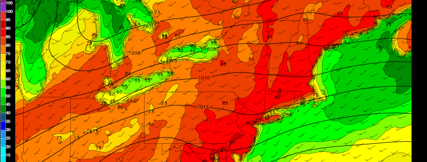
We are finally starting to see the last of the lingering effects of the large Nor’Easter that brought heavy rains, gusty winds, and just dreary conditions in general over the past few days to the entire Northeast. Today was a rather large improvement across much of the area from this previous weekend as clouds began to diminish from west to east earlier in the day, giving way to mostly clear skies. Due to the lack of clouds and a much drier air-mass in place, temperatures were able to climb into the middle 60’s and even the low 70’s across the area. Today was also quite gusty at times across the region due to a rather impressive pressure gradient over the area as a developing area of high pressure began to move in over the Great Lakes and the decaying coastal storm began to slowly move out to the east over the open Atlantic.
As we continue on through this evening, mainly clear conditions are expected, with the exception of eastern portions of Long Island and Connecticut due to lingering clouds from the area of low pressure off of Cape Cod. The area of high pressure over the Great Lakes will move over portions of western Pennsylvania just after sunset, so we can expect any remaining windy conditions to die-off considerably after dark. As the high pressure moves in, it will also usher in drier air throughout all levels of the atmosphere which will allow for rather clear conditions to persist throughout the evening. With clear skies, dry air, and light winds, we can expect temperatures to drop quite a bit this evening through radiational cooling. Low temperatures should drop into the upper 40’s to low 50’s across the majority of the area, with some locations (especially in the Pine Barrens and to the NW) dropping well into the 40’s.

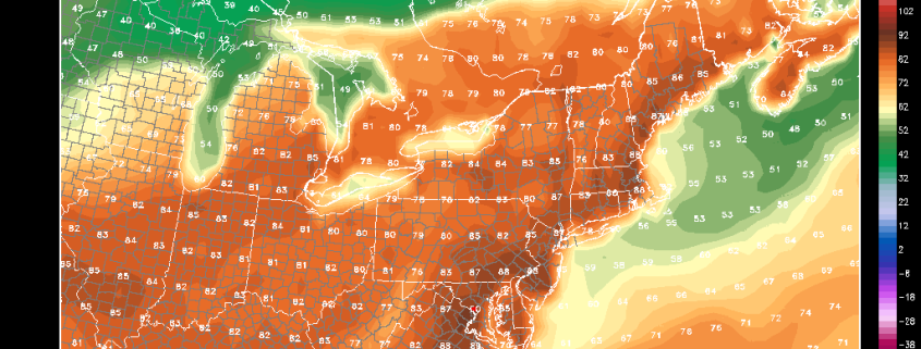
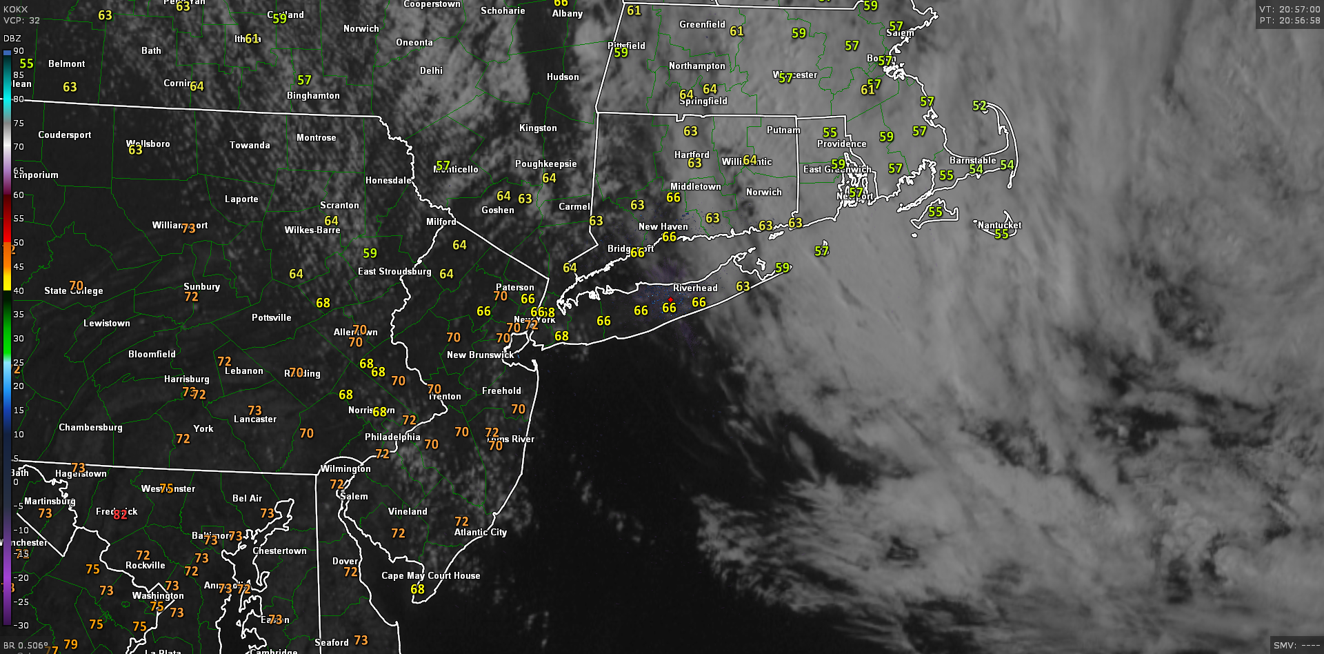
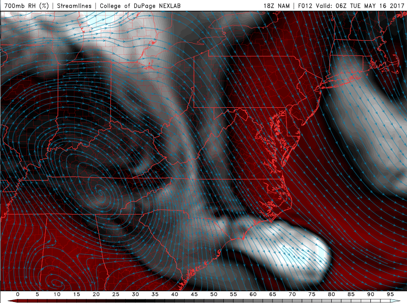
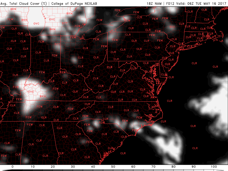
Current regional radar mosaic, surface temperatures, and visible satellite imagery showing much-improved conditions across much of the area
Tuesday Through Wednesday
Tomorrow will be the start of a rather significant warm-up across the region as a strong ridge of high pressure begins to build over our area through the next few days. Tomorrow will likely start off rather cool, but with clear skies and winds shifting from the west, to more southerly throughout the afternoon, temperatures should be able to climb quite significantly. Highs will range from the middle 70’s to lower 80’s across much of the region, with even coastal sections seeing the much warmer temperatures, as sea-breezes will likely hold off until later in the day. The dry and warmer conditions will last throughout the day and into the evening, with the southerly flow aiding in temperatures only falling into the middle to upper 50’s tomorrow night.
As the ridge begins to flex its muscles on Wednesday, we will see much of the same conditions once again, with temperatures quickly rising by late morning and into the early afternoon hours. As mid-level temperatures rise quite significantly, highs will soar well into the 80’s under clear skies and southwesterly winds. Some locations to the south of the city may actually get quite close to 90 degrees on Wednesday, with the most likely spots being in southern New Jersey and Southeast Pennsylvania. Again, the southwesterly flow will limit lows on Wednesday, and possibly keep them in the lower 70’s across much of New Jersey and Connecticut, with coastal sections of Long Island and Connecticut seeing lows drop down in the 60’s.
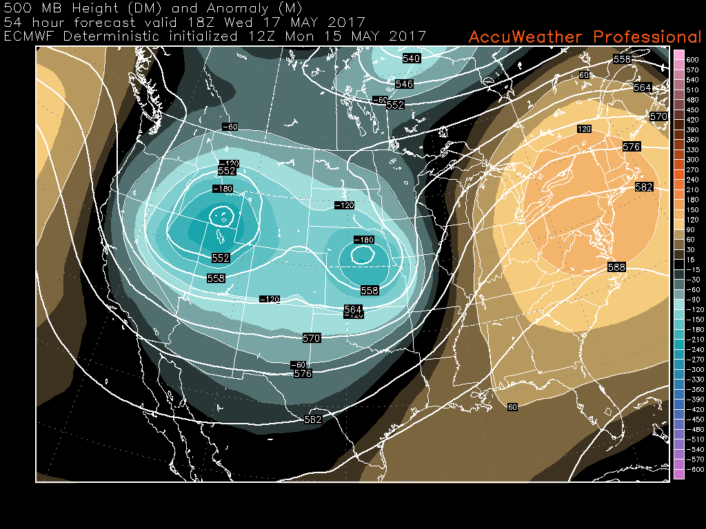
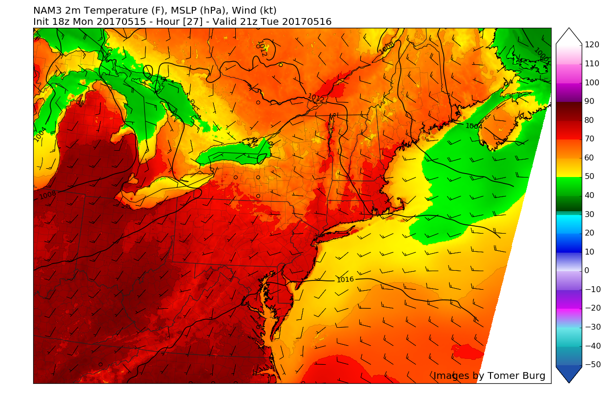
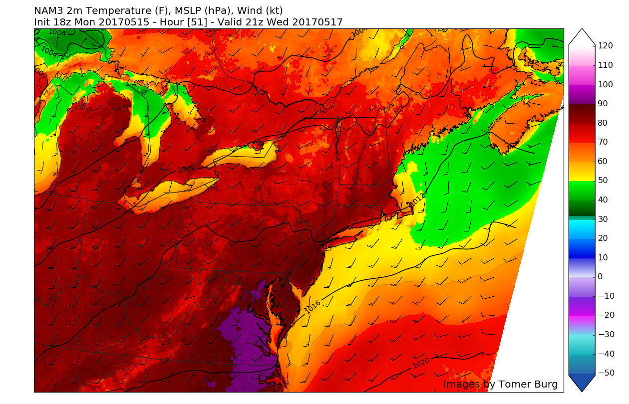
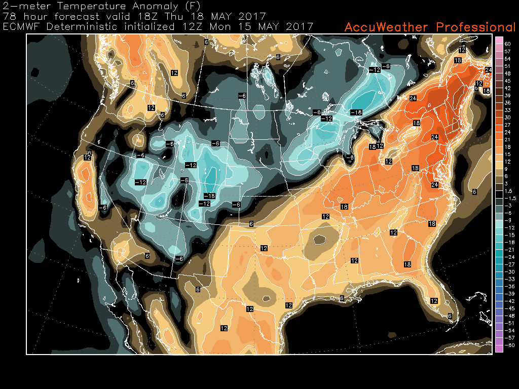
Afternoon European model showing the strong mid-level ridging taking shape over the Northeast United States on Wednesday (Valid 2pm Wednesday)
Thursday and Beyond
Thursday is likely to be the warmest day of the year thus far, with the ridging over our area likely to be at its peak. This should allow mid-level temperatures to become quite high over the area, which will allow for temperatures to once again soar into the upper 80’s and even lower 90’s across the entire area by the late afternoon hours on Thursday. Thursday should be quite beautiful with, light southerly winds, clear skies, however it may become more humid during the afternoon as dewpoints reach into the lower 60’s across the region. These high temperatures will be quite anomalous for this time of year, with departures likely reaching 20-30 degrees above normal. It is worth noting that afternoon sea-breezes will be capable of knocking down temperatures a good 10-15 degrees in a short period of time near coastal sections of Long Island, Connecticut, and New Jersey on Wednesday through Thursday.
This afternoons latest model guidance continues to suggest that a cold front may sweep through the region later in the day Thursday and into the early morning hours on Friday. Whether or not we see any measurable precipitation will be highly dependent on the overall timing of the frontal system, but there will be the possibility for some showers and even some thunderstorms ahead of the front, which could have the potential for some gusty winds and locally heavy rainfall, but at the moment, this activity is not expected to be widespread. Temperatures on Friday and the weekend will likely drop a bit, with highs in the 70’s seeming possible at this time.
Overall, the latest guidance suggest that some high-latitude blocking will return again over next couple weeks. This will support more troughs with periods of cooler or unsettled weather over Northeast and Mid-Atlantic region. So enjoy another taste of summer weather this week. As it will be short-lived again. No prolonged warmth or heat appears to be coming the foreseeable future. Stay tuned for more forecast update through this week!
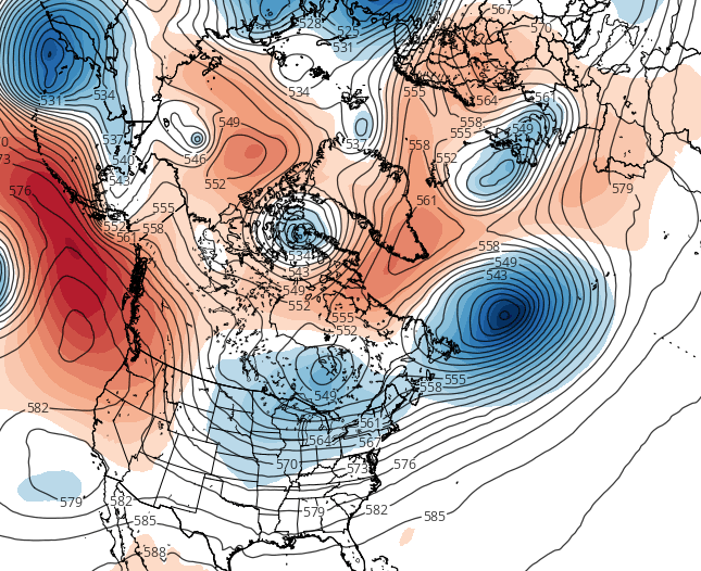
European Model 500mb Height Anomalies, showing a return to high-latitude blocking and a return to cooler weather once again
For more information and posts like this one, make sure you sign up for Zone Forecasts — where multiple detailed articles, videos, and interactives are posted each day. Also, come interact with our staff and many other weather enthusiasts at 33andrain.com!
Have a great evening!
Steve Copertino
-2")