PM All Zones: Squalls today as powerful system passes

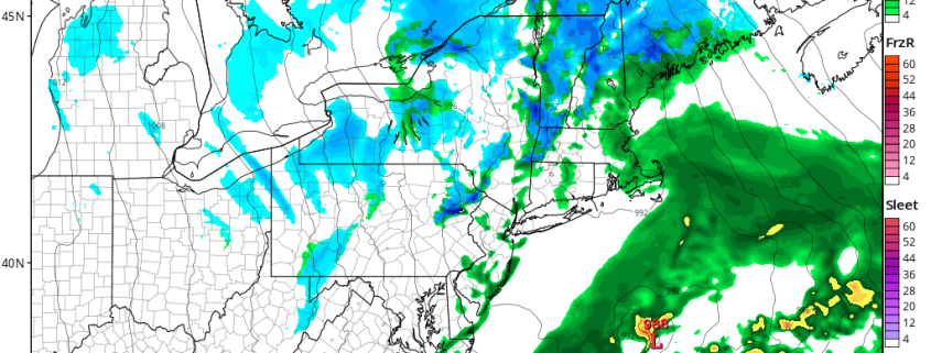
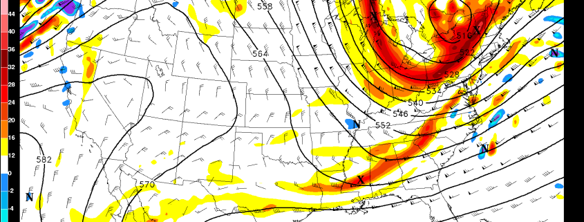
As we move towards the halfway point of the workweek, a powerful northern stream disturbance will move through the region this afternoon. This disturbance began its journey to the Northeast US from the Northern Canadian/polar regions, and it is dropping very far south as a result of a disturbed arctic weather pattern and a strong ridge near the West Coast of the U.S.A. This disturbance will drop south and eastwards through New England tonight.

Most notably, perhaps, is the fact that this disturbance is missing a phase with a southern stream disturbance over the Mid Atlantic states, which would’ve forced the development of a much bigger and more powerful storm system. Nevertheless, its passage this afternoon and evening will lead to the the development of snow and rain showers.

Read more

2/15 AM All Zones Update: Rain or Snow Showers Possible Later Today

A mixture of clouds and sunshine is expected today, as an upper-level low associated with northern stream disturbance,  tracks over Northern NY and New England and southern stream wave moves of Mid-Atlantic. These systems will largely bypass the region with minimal impacts. Then will phase and consolidated into larger storm well offshore and likely bring some heavy snowfall to parts of Northern New England, tonight.

Read more

2/14 PM All Zones: Tranquil weather settles in

A barrage of disturbances which affected the area over the past several days has finally settled down, and high pressure has built into the area today. Blustery winds are also on the decrease, as a strong storm in the Gulf of Maine pulls well off to our east and northeast. One more disturbance will pass the area on Wednesday and Thursday, emanating from Canada and dropping into New England.

While the storm system could’ve been something more significant had it phased with a southern stream disturbance over the Southeast States, it will remain progressive and transient. The main effects from the system will come in the form of a cold front, which will sweep through the Northeast states late Wednesday into Thursday. More snow is anticipated in Maine as the system passes by.

Read more

2.14 AM All Zones Update: Calmer Weather Returns, Midweek Storm Mostly A Miss

More tranquil weather is expected today and tonight, as weak high pressure and some upper-level ridging, builds into the region. A weaker pressure gradient will keep winds on the lighter side. But a couple weak, passing mid-level disturbances may bring more clouds from time to time . After very cold morning in the teens or 20s over the zones, temperatures will rise into the upper 30s to lower 40s this afternoon. Which is pretty close to normal for mid-February here.

Read more