PM All Zones Update: Interior winter storm Tuesday night

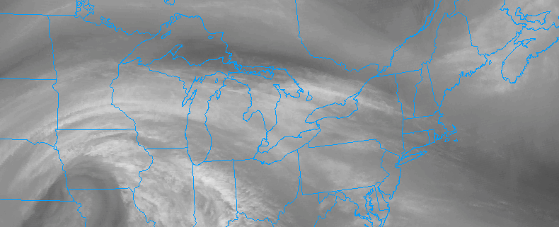
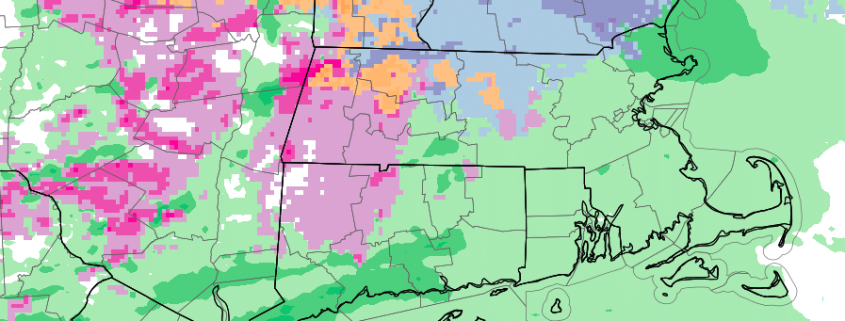
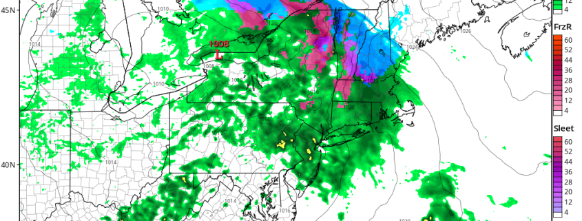
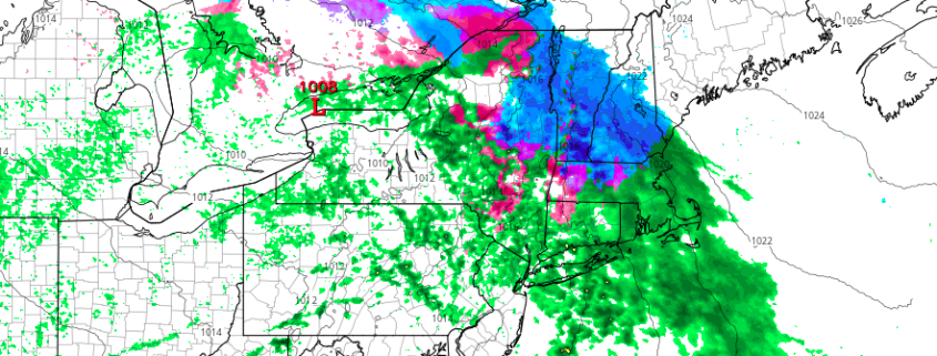
A low pressure area is expected to shift from the Mississippi Valley into the Eastern Great Lakes on Tuesday, bringing enhanced lift and aiding in the development of precipitation over much of the Ohio Valley and Northeast. Much of this precipitation will be driven by a process known as Warm Air Advection. In other words, warming air surging through multiple levels of the atmosphere will be the impetus for precipitation.

It will also serve to ensure that most areas in the Mid Atlantic and near the coast warm up sufficiently for precipitation to fall as rain. Inland, however, a different story will evolve. Cold air from a high pressure to the northeast will settle near the surface, allowing temperatures to fall into the upper 20’s and lower 30’s. A gradual warmup is expected to occur from southwest to northeast, but not before some light wintry precipitation even in parts of Pennsylvania and Northwest NJ.

Read more

Midweek winter storm expected across interior New England

Before we start, to sign up for daily articles (like this one) videos, discussions, interactives and more, contact our team here. 

A fast moving, active weather pattern will continue over the next several days throughout the Northeast US. In the midst of a winter that has been best described as “consistently inconsistent”, another winter storm will evolve in the interior, bookended by warmer than normal temperatures. Low pressure moving from the Mississippi Valley into the Eastern Great Lakes is likely to be the initial impetus for precipitation moving into the Northeast US by Tuesday.

Much of this precipitation will be driven by a  process known as “Warm air advection” — in other words, the movement of warm air through multiple levels of the atmosphere. Lift for precipitation will move into the Northeast as the afternoon goes on, and the middle layers of the atmosphere will gradually warm from southwest to northeast. This will be suffice to change most areas over to rain in the Mid Atlantic States.

Read more

Zone 7/8 Update: Winter weather likely Tuesday PM into Wednesday

A low pressure system moving into the Eastern Great Lakes will bring precipitation into the Northeast US from late Tuesday night into Wednesday morning. As this occurs, warming in the atmospheres mid levels will surge through the Mid Atlantic and New England, changing most areas over to rain. However, cold air in the lower levels (closer to our heads) will hang on fora prolonged period of time in parts of Eastern New York and interior Connecticut and Massachusetts.

This creates concern for the potential of snow, sleet, and freezing rain, as the low pressure redevelops to the south off the shores of Southern New England. Forecast models have trended cooler over the past 12 to 24 hours with the temperature profiles throughout these areas, especially over the mountains of Connecticut and Massachusetts, where the potential exists for notable icing.

Read more

1/16 AM All Zones Update: Tranquil Weather Today, Wetter Tuesday

Tranquil weather continues today, as high pressure shifts east and then off Mid-Atlantic coast by late this afternoon. Plenty of sunshine is expected, with just some high cirrus arriving from the southwest, by this afternoon. After cold start early this morning, a light return southwesterly flow and rising mid-level heights will likely help warm into lower to middle 40s over much of the region this afternoon. Perhaps closer to 40 over the Interior.

Then a storm system with a primary low tracking northwest of the region, may begin affecting the region late tonight. Clouds will thicken and increase, ahead of warm front approaching the southwest this evening. Some light precipitation cold breakout some after midnight, or early tomorrow morning. Depending on how fast precipitation arrives, there could be some light snow, sleet or freezing rain at the start, especially over Northern New Jersey, Lower Hudson Valley zones. For the rest of zones, low-level temperatures will likely be warm enough for mostly if not all rain, with southerly winds. The airmass will gradually warm later Tuesday, so any wintry mix change over to rain by late morning or early afternoon, over most of the zones.

Read more