Zone 2 and 8 7:00pm Update: Snow Ends over Overnight

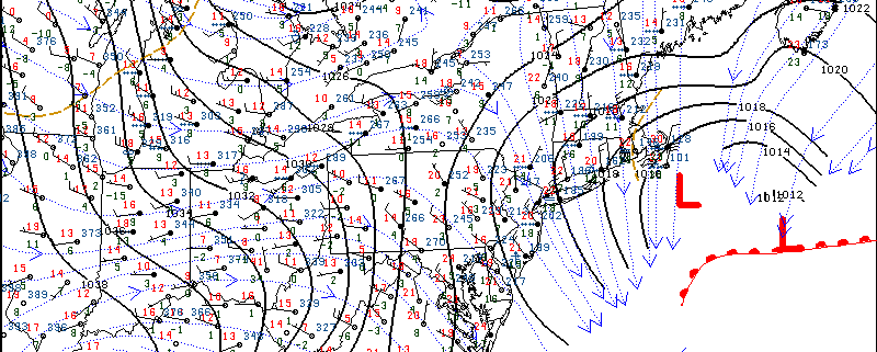
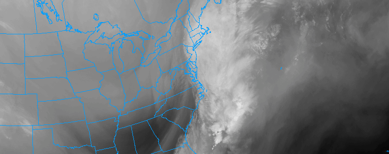
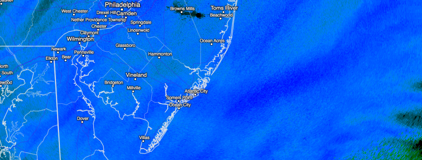
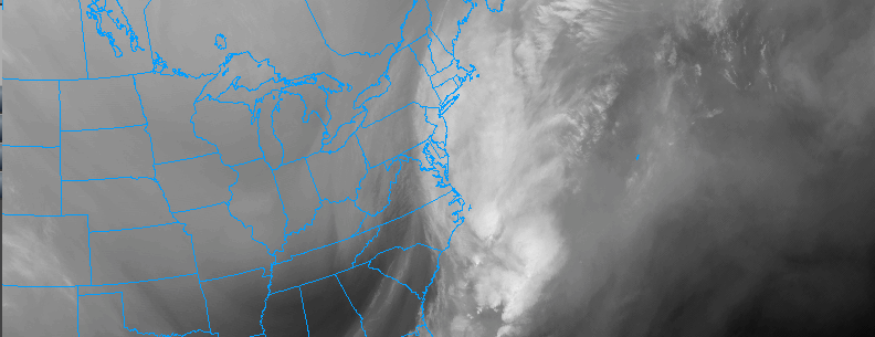
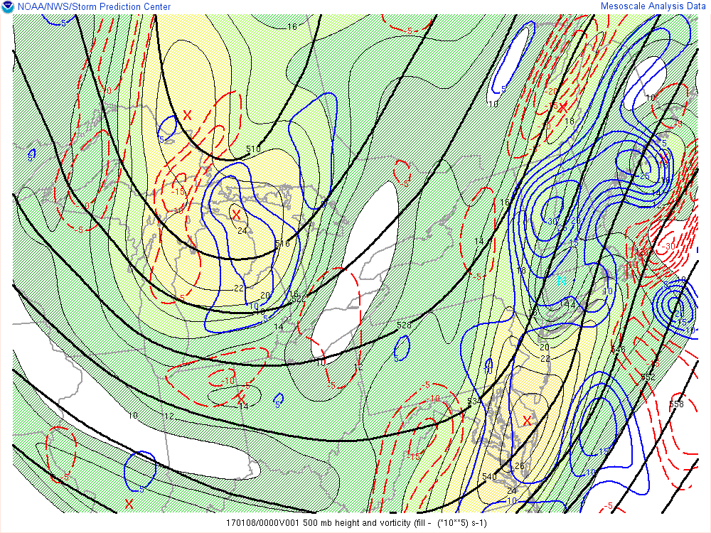
Snow will continue moderate to heavy at times through about 10pm this evening. Strong 700mb frontogenesis and positive vorticity advection could lead to more banding with snowfall rates between 1″ to 2″ per hour. Also snow growth remains large, with very cold temperatures and lift in the dendritic snow growth region. Then snow will begin to tapering off to light snow and flurries and ending overnight. So far snowfall reports have been between 6″ to 10″. Total snowfall between 8″ -12″ over expected over Long Island and Connecticut. Some higher totals up to 14″ are possible over Eastern end of Long Island and Southeast Connecticut. Take more precaution driving on roads throughout the night, as snow and ice will tough to treat with frigid temperatures.

Read more

All Zones Update 11:00am: Snow continuing near the coast

Regional mesoscale analysis shows a developing storm system, which is continuing to move off the coast of the Mid Atlantic states and strengthen this morning. Bands of light and moderate snow have expanded and intensified over the last hour or two, aided by the development of more favorable frontogenesis and lift in the atmosphere. These dynamics will continue to remain favorable over the next few hours.

Snow will continue to evolve from southwest to northeast throughout all zones through this afternoon. The heaviest and most impactful snow will occur across Southern and Eastern New Jersey, Central and Eastern Long Island, and Eastern Connecticut. Here, upwards of 6″ of snow appears likely. Roads and travel will likely be heavily impacted by the snowfall and conditions will deteriorate as the late morning and early afternoon continue.

Read more

Zone 5 (Southern NJ) Update: Significant snow through tonight

Regional analysis suggests the development of a coastal storm will continue over the next few hours. The most recent near term/mesoscale models continue to remain relatively steady with a continuation of moderate to heavy snow over Southern New Jersey through the afternoon hours. Currently, the juxtaposition of moisture and lift is creating a substantial area of moderate and heavy snow throughout the area.

Increasing lift in the atmosphere will be supported by the developing storm system and the presence of a very notable jet streak in the atmosphere’s upper levels. This will allow precipitation to expand to the northwest of the low pressure area, which will be off the coast of the Mid Atlantic states during the middle part of the day today.

Read more

10am Update Zone 2: Snow increasing in intensity

Regional analysis suggests the development of a coastal storm will continue over the next few hours. The most recent near term/mesoscale models continue to remain relatively steady with the development of heavier snow over the next few hours over Long Island. The increase in intensity will be gradual, as lift and moisture in the atmosphere begin to increase. Snow accumulations will also be gradual to occur through 12:00pm.

Increasing lift in the atmosphere will be supported by the developing storm system and the presence of a very notable jet streak in the atmosphere’s upper levels. This will allow precipitation to expand to the northwest of the low pressure area, which will be off the coast of the Mid Atlantic states during the middle part of the day today.

Read more