Premium: Another ULL next week, warm temperatures follow

It’s May 11th, which means it’s getting in the late meteorological Spring season. Many of us often look forward to even warmer weather as we approach Memorial Day weekend and the beginning of meteorological summer. But the seasonal trends with blocking causing cool air intrusions are continuing over the last couple weeks, with omega blocking becoming a dominant presence. Now some high-latitude blocking is returning again for another cooler week of weather. But how cool will it actually be? And when will warmer weather return? We discuss more details on the overall pattern evolution for the rest of this month.

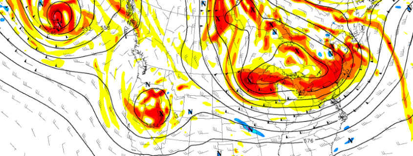
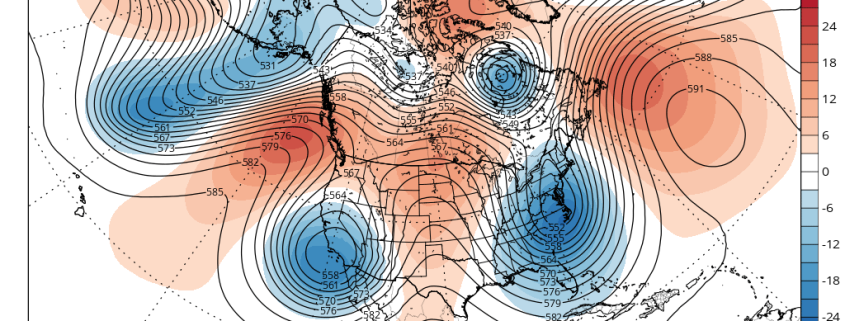
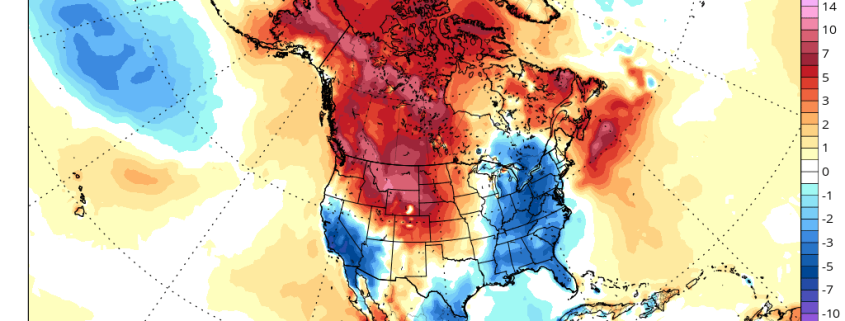
We start with a -EPO blocking ridge over Alaska. Shortwave energy coming downstream of this ridge will phase into a closed upper-level low over the Great Lakes later this week. Initially, this will cause heights to build over the Northeast. At the surface, high pressure will build over the Western Atlantic. More southerly flow around this high pressure will cause temperatures to rise near or slightly above normal for this coming Wednesday and Thursday.

Read more

Premium Weekly Outlook 5/9 – 5/14: More sunshine and warmer temperatures

The omega block pattern that supported that the cool, cloudy wet weather for most of last week, is breaking down. More days with sunshine and warmer temperatures are likely this week, with high pressure or confluence underneath an upper-level low over Southeast Canada, keeping frontal boundary mostly south of the region.  But an -EPO block developing this week may eventually lead some wet weather to return at the end of this week and the start of next weekend. More technical details on the weather will be discussed below.

First off, today will be a beautiful day. High pressure and confluence from the upper-level low over Southeast Canada will keep a frontal boundary to the south of our region. More high to mid-level clouds over Central and Southern New Jersey are expected to remain closer to the frontal boundary, while sunshine dominates farther north over Northern NJ and NYC. West-southwest winds and deep mixing between 750mb and 800mb will cause temperatures to rise into the lower to middle 70s this afternoon. Breezy conditions also likely this afternoon with wind gusts to near 35mph possible. These winds will also likely hold off any sea-breeze to later in the afternoon, so many coastal locations will see warm temperatures as well.

Read more

Premium Weekly Outlook: Omega Block To Cause Unsettled Weather

Model and ensemble guidance are showing an omega blocking developing this week over the North America. This blocking pattern causes shortwave energy to dig into trough or phase into a cut-off low on either of side of large ridge over the Central United States. This pattern can cause cooler, wetter weather to persist for several days over the western and eastern parts of the country. In this case, models are showing waves of low pressure developing along the East Coast this week. Model solutions differ depending on how they handle upstream shortwave energy coming digging into Southeast US.

Read more

(Premium) Will May Be Cooler and Wetter Than Normal?

High-latitude blocking returned this week. After a warm start early this week, confluence from an upper-level over Southeast Canada forced a frontal boundary south of the region. This produced cooler than normal temperatures for the rest of the week. As a result, April will likely finish near or slightly below normal on average. It appears that May will start not only cool, but also wetter. So will May also be a cooler and wetter month as a whole? Or will a warming, drier trend occur again later in the month?

For next week, high-latitude blocking over the AO and NAO regions will start to weaken and an upper-level low moves out of Southeast Canada.  But an active split flow pattern with Pacific energy undercutting the West Coast ridge remains into next week. This pattern will keep a succession of troughs moving over the Central and Eastern United States for the next week or two. These troughs will supports airmasses coming down from Canada with mostly below normal temperatures. There is still the potential for backdoor cold fronts and cut-off lows with this pattern as well.

Read more