From Strong El Nino to Strong La Nina?

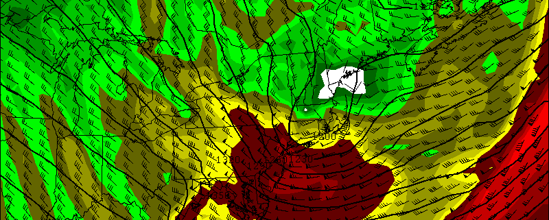
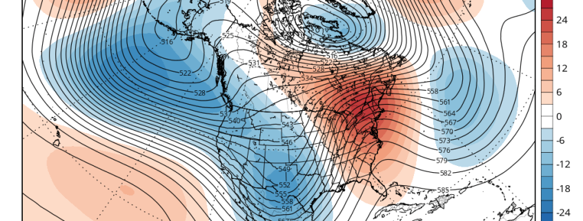
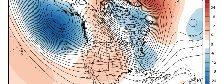
Over the past few months, we have had an El Nino. In fact, it has been one of the strongest El Ninos on record, and is one of the reasons why this past winter was generally quite warm, and why the Pacific Jet stream was so fast and active. It also helped to trigger the historic blizzard we had on January 22nd-23rd. Currently, while we still have an El Nino at the surface, conditions are rapidly flipping towards La Nina when one takes a deeper look at the oceans, as well as the trends in the climate models.

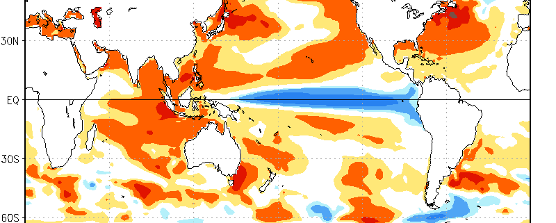
Under “normal” conditions, where there is no El Nino nor a La Nina, the trade winds are persistent in the Equatorial Pacific, which generally blow from east to west. This “pushes” the warmest Equatorial waters further west towards Australia and Indonesia, leaving cooler waters in their wake with more upwelling of subsurface cool water as well. Over the past year or so, these trade winds rapidly weakened and even reversed in some areas, allowing warm water to flow back eastward (instead of getting forced westward) towards the entire Equatorial Pacific, spreading eastward towards Peru. As warmer water builds, Oceanic Kelvin waves, which move from west to east — but also move up (upwelling) and down (downwelling) to transport warm or cool water vertically — are able to push warm water to strong depths and generate “pools” of warm water. This allows an El Nino to sustain itself, as even when a brief period of trade wind acceleration takes place and more upwelling happens, the water upwelled is still warm. It can take months to fully reserve a new El Nino equilibrium.

But finally, the proverbial rubber band is snapping.

Read more

(Premium) Increasing Potential for A Damaging Wind Event Saturday Night & Sunday

Over the past few days, we’ve been discussing on our new hazards dashboard the possibility for high winds for late Saturday night and Sunday. As we’ve gotten closer, model guidance continues to be consistent on this event. Therefore the National Weather Service has issued a High Wind Watch for the entire region late Saturday and Sunday morning. Details are still coming into focus, but confidence is growing that this could be a very strong if not damaging wind event for parts the area.

A vigorous mid-level shortwave will amplify and cause a surface low pressure coming east out the Great Lakes Saturday night to deepen rapidly over Southern New England Sunday morning. This will create extremely low mid-level heights and thus a frigid cold pool aloft — aiding in instability and dynamics, especially when combined with the off-the-charts vorticity being shown. An Arctic front accompanying this low will also move across the region late Saturday night with some rain showers, then perhaps a change to snow showers, during late Saturday night. Steep low-level and mid-level lapse rates and total totals in 50s show enough instability for snow squalls with gusty winds and possibly even thunder.

Read more

(Premium) Long Range: Is the End of Winter in Sight?

In the world of meteorology, Spring begins on March 1st. While the calendar doesn’t turn until the end of the month, meteorologists end winter statistics on the last day of February. Some winters, however, have featured major cold or snowstorms well into March and even April. Remember last year? Still, a year makes a big difference, as they say, and there are growing signs that after this week, cold and snow will become increasingly unlikely.

Looking back at February, temperatures will likely average above normal throughout the area. While we saw the first below zero temperatures in New York City in over two decades on Valentines Day, much of this month featured near or above average temperatures. Artic cold airmasses didn’t hang around for more than a few days. A couple of winter storms we saw earlier in the month tracked too far east to give the entire region of significant snowfall. And in the past two weeks, we have seen a storm track farther west with warmer air and heavy rainfall, as cold air moves in behind the storms.

Read more

(Premium) Will There Be An East Coast Snowstorm March 4th-5th?

After the midweek storm which is likely to be all rain, we are watching for the potential for storm system to develop near the Southeast US in the March 3-5 period.

Strong high pressure with much colder air will follow behind the midweek storm. Meanwhile, a shortwave will dig downstream off the West Coast ridge over the Rockies. This shortwave will become part of the southern stream and cause a low pressure storm system to develop over the Central or Southern Plains. Models indicate this storm will track towards Southeast or Lower Mid-Atlantic coast by Friday.

Read more