After the heat, blocking and wetter weather return

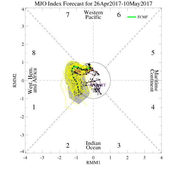
Good evening, everyone! We currently have a lovely stretch of warm weather coming up that already started today, so get out and enjoy it! While we will not necessarily go back to the consistently rainy and very cool weather from early this month, there are plenty of signs that we will go back to a relatively cooler and rainier regime starting this weekend.

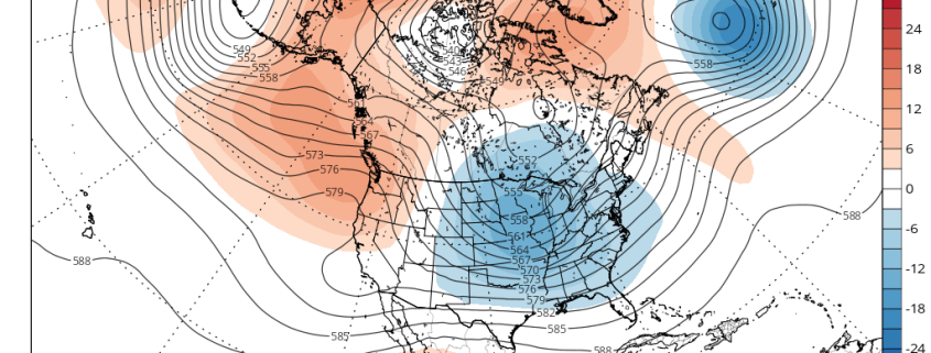
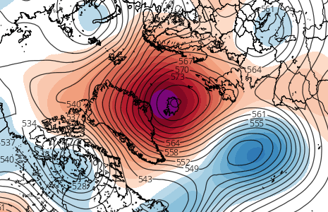
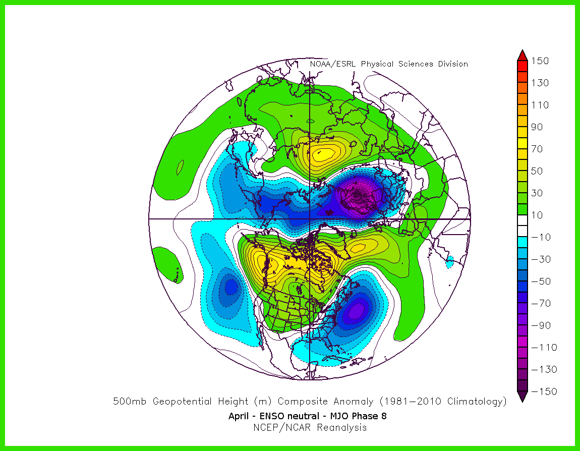
For much of this month, we have had a large blocking pattern near Greenland that gradually retrograded into SE Canada and then the NW Atlantic. It has since dissipated, which allowed for a large ridge to finally move into the East and warm things up. But these blocking patterns often can be persistent and return in a relatively short period of time. We actually had a large blocking pattern in March, too, so this blocking pattern has already repeated itself, which gives more credence to the idea of continued returns of the blocking.

And indeed, that is where we are headed.

Read more

Impactful coastal storm likely this weekend

A happy Wednesday afternoon to you! Relatively calm and stable weather has settled into the Northeast states over the past few days, despite the presence of a cold trough lingering over the region. Higher pressures have remained in control, with only a few weak and dissipating disturbances meandering nearby. This has kept the weather quiet, albeit cooler than normal, and created a bit of a facade in front of how the atmosphere is truly behaving as this week goes on.

In truth, the hemispheric height pattern is in quite a disturbed state as we speak this afternoon. A potent, anomalous high latitude block has developed from Greenland into Central Canada, disrupting the wave pattern and height field throughout the Northern hemisphere. This has led to the development of one of the strongest -NAO’s on record for the month of May, and is the impetus behind the colder than normal air which has settled into the region this week.

Read more

The Return of High Latitude Blocking and Coastal Storms…In May

A big -NAO block in Greenland, a deep 50/50 low, a large +PNA ridge on the West Coast, a deep trough in the East going neutrally tilted in the Mississippi Valley, lots of precipitation streaming up the coast from the Gulf into the area as a deep area of low pressure slowly moves up the coast…

Did we just go back in time to winter? Are we getting another blizzard? Well, not exactly, but the above description certainly sounds like a classic winter storm evolution for the Northeast. And perhaps if this storm were occurring a few months earlier, it would be a major winter storm. But alas, we are moving into May, and the above evolution may lead to a major rain event late next week.

The evolution towards a big blocking pattern is already taking place as the MJO moves towards phase 8. Of course, sometimes oscillations in spring do not have the same correlations as they do during the winter, but the MJO phase 8 in April in an ENSO neutral regime still correlates to a lot of high-latitude blocking. 

Read more

Analysis: Two Disturbances to Watch

Good evening! We had a lovely Spring day with sunny skies and temperatures in the 60s, but winds are picking up a bit along the coast as winds turn more onshore and a marine layer develops. For more on these short term changes including the chance for light rain on Wednesday night into Thursday, please be sure to check the dashboard and read our latest zone article updates! This article will be focused on the two upcoming disturbances: one for Thursday night into Friday, and another one for Sunday into Monday. Both could bring periods of heavy rain, but uncertainty is still high as it’s also still possible that little rain falls from either system.

After the periods of light rain on late Wednesday night into Thursday, a stronger storm system will be traversing the Great Lakes. This will allow a warm front to surge northward towards the area, which may place us in the warm sector. There is still uncertainty with how far north this warm front gets — they often can get a bit hung up this time of year and not progress as far northward as model guidance indicates. This is important because if the warm front stays further south, we may not enter the warm sector and thus may remain too stable for heavy showers and thunderstorms.

Read more