Hurricane Irma a Major Threat to the Southeast US, Cool Weather for the Northeast

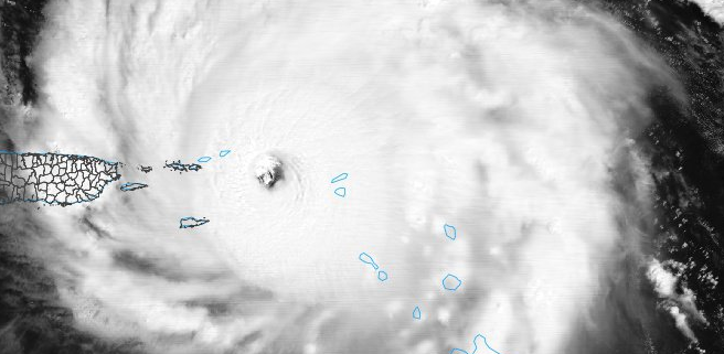
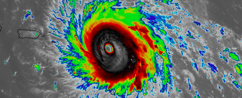
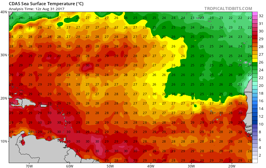
Happy Wednesday! Some unsettled weather continues for the Northeast today. Then improving weather is likely for the rest of the week. But it will feel more likely early Autumn. Hurricane Irma will become a major threat to the Southeast US this weekend and early next week. More detailed analysis on Irma’s potential future is below.

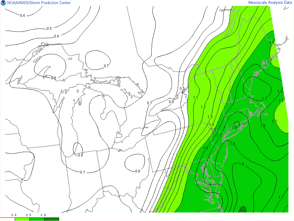
First for today, a few weak waves of low pressure running will be running along a slow-moving cold front. This will result in multiple rounds of showers and/or t-storms will continue moving through parts of the Northeast, especially near I-95 corridor and coastal plain through much of tonight. Instability is marginal at best. So no severe weather hazards are anticipated. However, some locally heavy rainfall and flash flooding is possible with high precipitable water values over 1.50″.

Read more

Irma a powerful Category 5 Hurricane moving toward Caribbean

Hurricane Irma maintained immense strength and power per this evenings 8:00pm National Hurricane Center Advisory, with maximum sustained winds of 185mph. The Hurricane is in the upper echelon of Atlantic-based storms, packing the second highest sustained winds on record since the satellite era of hurricane observations began. Irma will continue on a west/northwest heading this evening, on course for potentially catastrophic impacts in parts of the Caribbean.

Read more

Severe T-Storms Possible for the Northeast Today, Irma Becomes a Category 5 Hurricane

Good morning! Many eyes are on still Hurricane Irma. Which is now a Category 5 hurricane with 175 mph maximum sustained winds, as of latest reconnaissance reports and the 8am EDT advisory from the National Hurricane Center. It continues to move westward at 14mph and is major threat to the Northern Leeward Islands. Hurricane warnings are in effect for those islands, including for Puerto Rico and the Virgin Islands. Meanwhile, more unsettled weather with showers and thunderstorms, is likely over the next few days, with a strong cold front and upper-level trough moving through the Northeast and Mid-Atlantic regions. But there is potential for some severe weather later today, especially over the Interior locations.

Before more thunderstorms, some high level clouds will likely filter with sunshine for much of today. 850mb temperatures between 15°C to 17°C and south-southwest winds will support temperatures to rise into the mid-upper 80s, this afternoon, especially away from the coast. A few spots may approach or reach 90 degrees, before clouds thicken or increase later this afternoon. These temperatures are actually slightly above normal for early September. Humidity will also be increasing this afternoon, with dewpoints rising into the middle to upper 60s. So it will feel like summer again briefly.

Read more

Major Hurricane Irma and Its Potential Future

Good evening! After the devastation and catastrophic flooding from Harvey meandering over South Texas and Southwest Louisiana over the past week, we were finally relieved to see that that storm has now moved out of the Western Gulf of Mexico region. Heavy rainfall will continue over the next few days over the Tennessee Valley from the remnants of Harvey, before it becomes absorbed into a frontal system developing over the Northeast. But as we approach the peak of hurricane season, more tropical threats are rising. One such threat is Hurricane Irma which is becoming a powerful hurricane already today.

Irma has been rapidly intensifying over very warm waters and a favorable atmospheric environment, since it became a tropical storm on Thursday. It is now a major Category 3 hurricane with maximum sustained winds at 115mph. Irma will continue moving on a west-northwest path over the Eastern Atlantic over next few days. It will be moving over slightly cooler waters (still sufficient for maintenance at around 26 C) and some mid-level dry air from ridging, which might at times slow down the rate of intensification over the next 2-3 days.  But overall, an upper-level anti-cyclone will support low shear and more upper-level outflow over the hurricane. So Irma will likely continue to strengthen into a Category 4 by early next week.

Read more