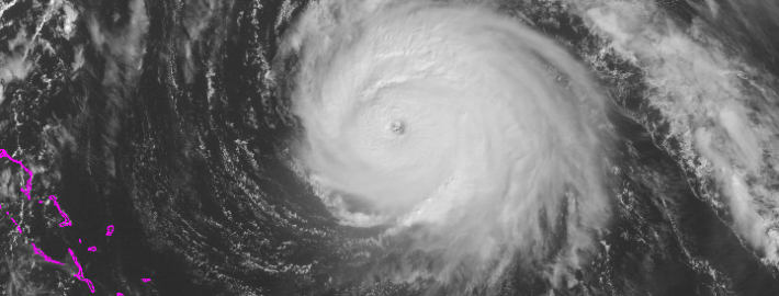
Remnants of TS Bill will impact weekend forecast

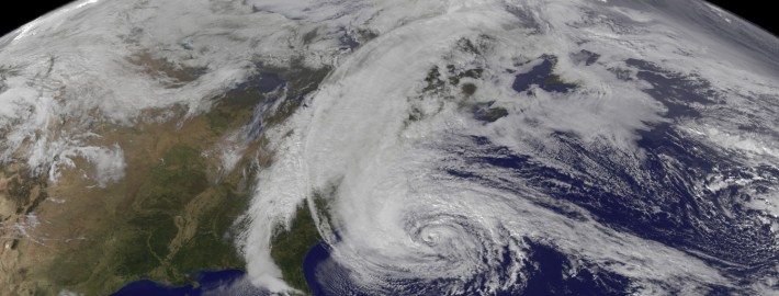
While Tropical Storm Bill is making headlines today impacting parts of Texas, with rains expected in the Plains this week, we aren’t out of the woods here in the Northeast. A Tropical Storm thousands of miles away will eventually become engulfed in the mid and upper level atmospheric flow, bringing tropical moisture northeastward into the Ohio Valley and eventually the Northeast. For our area, this will have a major impact on the weekend forecast.

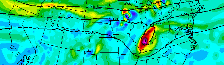
Forecast models are struggling with the exact intensity of TS Bill as it moves inland, as well as the timing of it’s absorption into the mid and upper level atmospheric flow. These two factors are very important for our areas forecast, as they will dictate the timing of a surge of tropical moisture into the Northeast US. Showers, thunderstorms, and even areas of heavy flooding rains are possible near where the center of the remnant low pressure tracks.

Read more

The cost of a decades-worth of hurricanes

It isn’t very often than something as immense as 10 years worth of hurricane’s damages can be visualized. But our friends at the Univeristy of North Carolina have done just that with their latest infographic. More than $310 Billion in damages have been caused by landfalling hurricanes in the United States during the past decade, with notable names such as Katrina, Wilma, and in our area — Sandy. Despite all of those names, many major coastal cities have escaped major damage since the early 2000’s. Hurricane Arthur, which made landfall this summer, was the strongest to make landfall since Ike in 2008. We haven’t seen a Major Hurricane make landfall since Wilma in 2005.

Adam Levenson, Community Manager for the UNC School of Government’s online masters of public administration program, said the research and infographic was a team effort. “Both faculty and staff at the School of Government were involved with the ideation, research, and editing processes”, Adam said. “The graphic itself was designed by ObizMedia. Our MPA program trains many students each year, most of whom go on to serve in local government. We had examined disasters from the local level in the past but wanted to see what insight investigating disasters on the macro level would provide.”

Read more

Gonzalo heads toward Bermuda as a dangerous Category 4

Hurricane Gonzalo strengthened into a Category 4 hurricane this morning, and has since strengthened further. Maximum sustained winds within the storm are 145mph as of 11am, with higher gusts. Most concerningly, the system continues to strengthen and organize as it heads northward. The hurricane will eventually take on a slight northeasterly heading, as it moves along the periphery of both an Atlantic ridge to its east, and troughing to its west over the Western Atlantic Ocean.

Most unsettling, obviously, is the forecast track of the system. Models are in good agreement that the storm will make the aforementioned turn, taking the center near or just west of Bermuda during the mid to late afternoon on Friday. This puts Bermuda in a precarious situation — the worst winds will shift to the east side of the system as it makes this turn. Maximum sustained winds are forecast to remain near 130 mph at the time the storm nears Bermuda.

Read more

What if the 1821 Long Island Hurricane happened today?

The details of this storm remain fuzzy. Based on first hand accounts and somewhat spotty meteorological data, we can only know one thing — the Long Island Hurricane of 1821 was a big deal. It was one of only four known tropical cyclones to make landfall in New York City. It made landfall just several hours prior, near Cape May, New Jersey as what would now be defined a strong Category 3 Hurricane. And then, it tracked northward essentially along the Garden State Parkway, briefly back out into open water and then through New York Harbor. The storm struck at low tide, but still produced a near-30 foot storm surge along much of the New Jersey Coast, obliterating any development there and causing significant overwash past the shores.

Obviously, this storm occurred in 1821 — way, way before any major development by modern standards. Areas which were hammered with unprecedented wind, rain and storm surge from the Hurricane of 1821 now are populated by the millions — with incredible development and modernization. A new report, from the ReInsurance behemoth SwissRe, details what would happen if a storm similar to the Hurricane of 1821 occurred today. And the results are not good.

Read more