-2")

Heavy Rain Threat Friday, Monday’s Eclipse Conditions Coming Into View!
Good Evening!
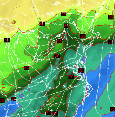
Today was another warm and relatively clear day across the entire northeast, but we did see higher dew points begin to creep in which allowed for a “muggier” feel to the day during the peak of the afternoon. With a northwesterly flow in place in the mid levels of the atmosphere, more dry air from Canada allowed for mostly sunny conditions across the region, with come occasional cumulus clouds rising up and eventually collapsing due to any kind of support. As the day progressed, an area of surface high pressure off to our north and west also helped to keep conditions relatively calm, with light northwesterly winds lasting the entirety of the afternoon. With light winds, dry mid levels, and predominately sunny skies, temperatures were able to gradually rise into the mid to upper 80’s across the area, with cooler temperatures located over portions of interior Connecticut and New York.
Conditions remain quite pleasant this evening as much of the metro area is sandwiched in between two stalled fronts, with the northern front holding back cooler temps and lower dew points, and the southern front holding back oppressive dew points and warmer temperatures. Regardless, as the sun begins to set, the area should be able to cool down quite a bit thanks to a hefty amount of radiational cooling likely to take place due to the aforementioned high pressure, light winds, dry mid levels, and clear skies. This should allow low temperatures to bottom out into the upper 50’s to lower 60’s-with some of the more interior locations possibly dropping into the lower 50’s by early tomorrow morning.

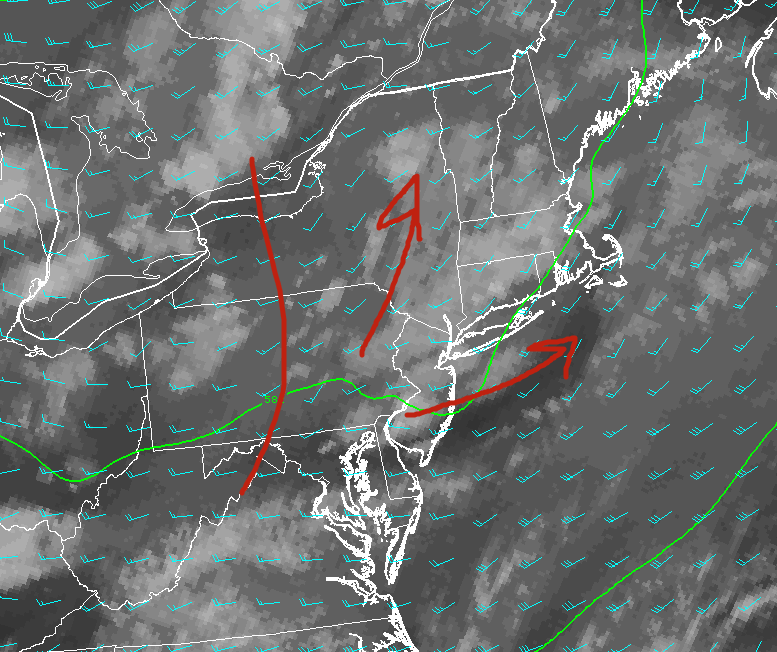
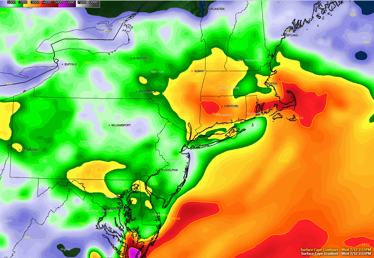
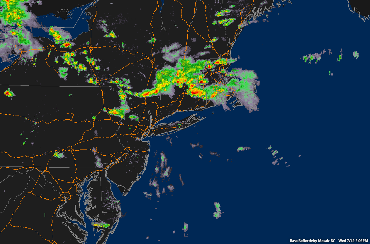
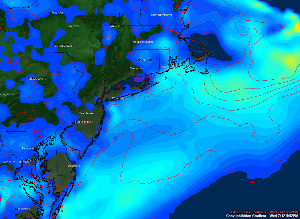
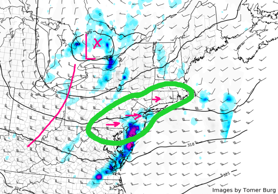
This evenings latest high resolution visible satellite imagery from the GOES 16 satellite, regional radar mosaic, surface observations, and frontal positions from the Weather Prediction Center (courtesy of Simuawips)
Thursday and Friday
Tomorrow morning should start off much like how today did, with relatively clear skies and cool temperatures to begin with. The main difference will be that the area of high pressure will begin to retreat and move off the coast, which will lead to more winds coming from the Atlantic, which will lead to increasing dew points as temperatures begin to rise. While we will have prevalent onshore winds to deal with during the day, a mid level ridge axis will be moving over the area, which should allow temperatures to rise into the low to middle 80’s area-wide-with some cooler conditions possible along the immediate coasts. As the mid level ridge pushes up and over our area early tomorrow afternoon, a shortwave trough will be moving over the Great Lakes region, which will drape a warm front over portions of Pennsylvania and the Mid Atlantic states.
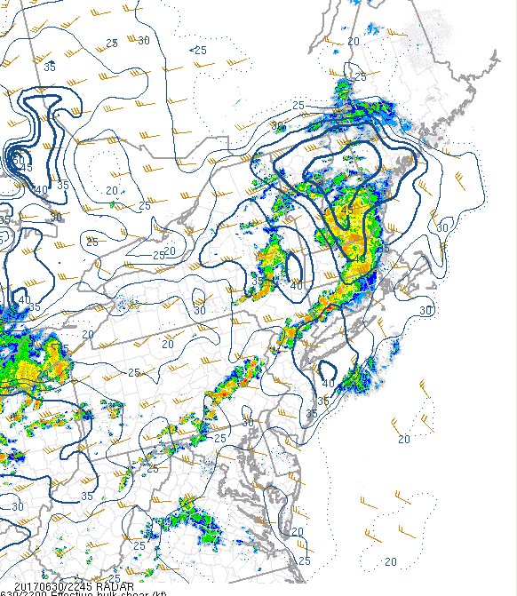
As this front continues to advance east, it will bring an increasing chance of showers and possibly a few thunderstorms over the Northeast. Conditions will likely stay more tame back towards the metro area as the onshore flow keeps the atmosphere relatively stable, so only a gradual increase in mid to high level clouds is expected through the mid to late afternoon hours. Later in the evening, the threat of showers and an isolated thunderstorm will be increasing as the front draws closer and moisture convergence gradually increases. Expect lows to be much more mild Thursday night due to increased cloud cover and the threat for showers-with temps likely staying in the upper 60’s to lower 70’s.
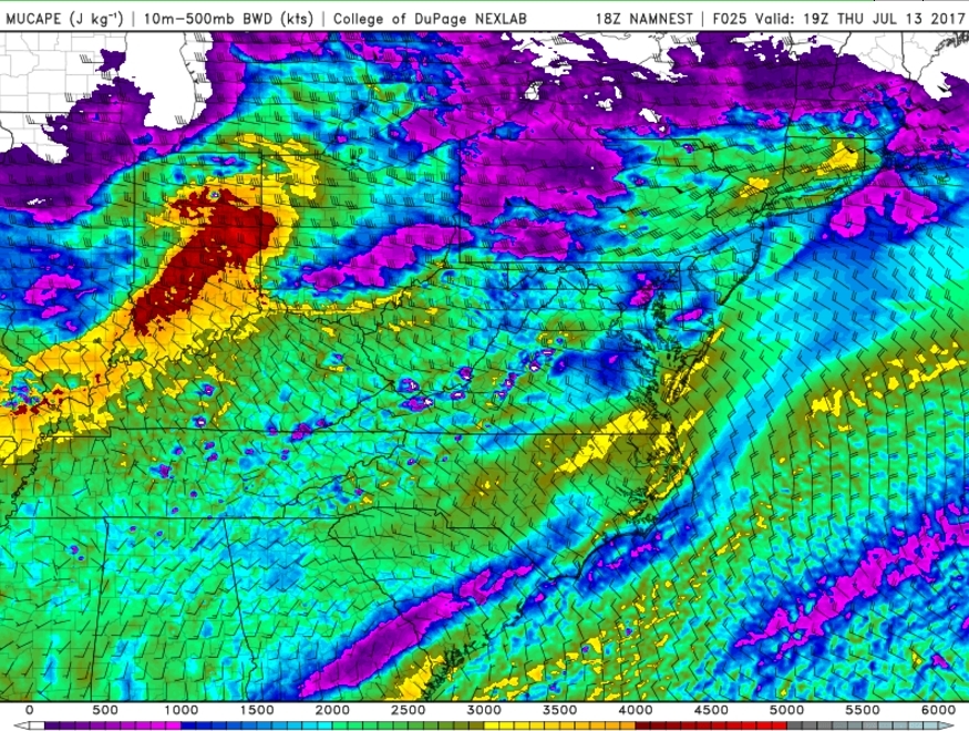
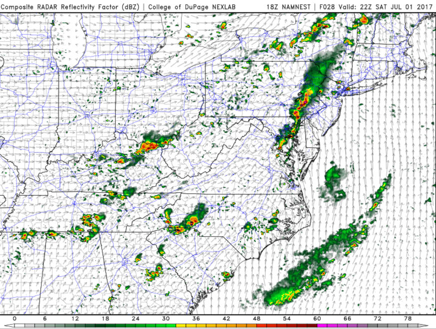
Friday looks to be the most unsettled day in the forecast period as the area of low pressure associated with the large trough over the Great Lakes continues to move to the north and east. This will allow for the warm front to completely overspread the region by early Friday morning, likely bringing a period of locally heavy rainfall with it as it marches north and east. At this time it appears that the heaviest rain may fall over portions of New Jersey, Pennsylvania, C/S New York, and Connecticut, but this could easily change if thunderstorm development becomes more prominent during the morning hours further to the south of the NYC area. Otherwise, Friday will likely feature at least a moderate chance of showers and an isolated thunderstorm up until the later portion of the afternoon, when a renewed threat for heavy showers and thunderstorms may redevelop over Pennsylvania and warm air advection surges north over the Northeast. It seems that the overall severe threat on Friday will be quite low due to the increased cloud cover, but if some patches of sun do develop, then stronger destabilization of the atmosphere may take place, which could lead to more widespread/strong storm development. The primary threat will be heavy rains on Friday, which should last into the evenings hours and possibly even into the early morning on Saturday. Overall, confidence in flash flooding is low at this time, but with deep tropical moisture nearby and forcing from the warm front present, it would not take that much to chance for heavy showers and storms to develop and drop torrential rainfall within a short period of time. Details will likely need to be fine-tuned over the next 48 hours, so be sure to check back for the latest.

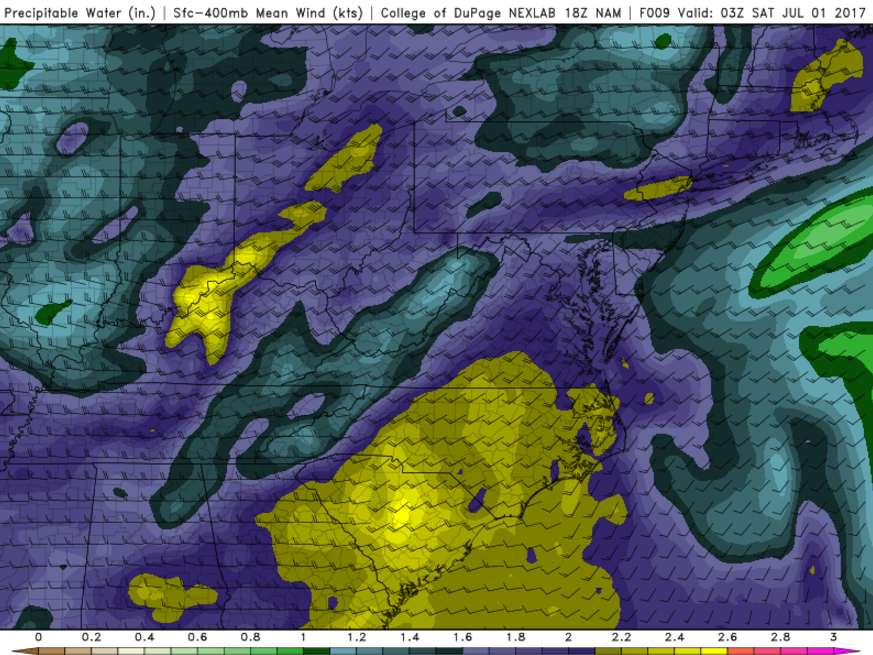
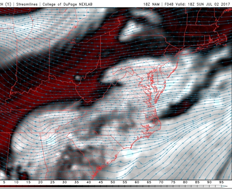
This afternoons European model, showing very high precipitable water values surging in behind a warm front progged to move through the area Friday AM with a chance at some locally torrential rainfall.
Saturday and Beyond
Most of the area should still be within the residual warm sector on Saturday morning, but with the best jet dynamics and lift displaced off to the west, the threat for heavy rain will begin to gradually fall. The shortwave trough should continue to move east during the day, with conditions likely improving as the day goes on. Highs will likely be able to reach into the low to middle 80’s ahead of a cold front tracking east from the Ohio Valley. This front should usher in much drier air and bring in some cooler temperatures as well, as it mixes out the atmosphere.
Sunday will likely be much-improved from the previous two days as high pressure begins to build over the area. This should allow for clear skies, light winds, and generally pleasant conditions across the region, with highs likely reaching into the low to middle 80’s across the area-which is right around normal for this time of year. Conditions will be ripe for radiational cooling on Sunday evening, so expect low temperatures to drop down into the lower 60’s with relatively low dewpoints.
Monday will be the day that will have the most focus on the weather, not for any severe weather or tropical cyclones, but for the partial solar eclipse that will take place during the afternoon hours. While we are not in the path of totality, most of the area will still be able to experience a rather cool and rare occurrence. However, the big question right now looks to be if there will be any cloud cover. As of right now, the conditions look to be quite favorable for safely viewing the partial eclipse, with mid level ridging overhead and surface high pressure just offshore-providing light onshore winds over much of the metro. This is however five days away, and predicting cloud cover for a three-hour window is rather difficult, but we can say that signs are encouraging at this time for a pleasant viewing experience! Be sure to check back over the next few days for updates!

The European 51 member ensembles showing cloud cover percentage. Monday the 21st is highlighted, with little cloud cover expected from a vast majority of the ensembles! (Courtesy of WxBell)
For more information and posts like this one, make sure you sign up for Premium Forecasts — where multiple detailed articles, videos, and interactives are posted each day. Also, come interact with our staff and many other weather enthusiasts at 33andrain.com!
Have a great evening!
Steve Copertino


