Posts

PM Update: Cooler risks linger, is there any change in sight?

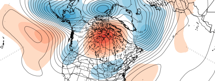
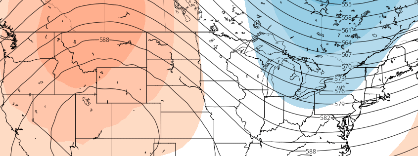
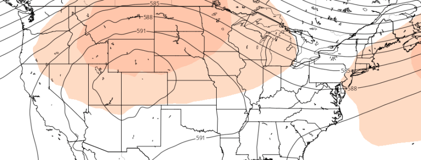
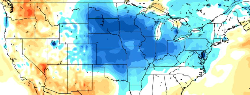
A well documented period of cooler than normal temperatures has taken over the Central and Eastern United states over the past week or two, especially from an anomaly standpoint. Many regions east of the Central and Southern Plains have observed temperatures 2 to 3 degrees below average over multiple days, which obviously leads to impacts both in terms of energy and crop. While precipitation patterns have been a bit more sporadic, the temperature forecast of near or below normal has been fairly consistent.

Read more

Cooler risks likely to continue into medium and long range

Much has been made over the past week or two in regards to a gradual warmup across the United States as we approach the middle of the month of August. With seven days of the month gone by, a notable breadth of cooler than normal air has spread throughout the United States. Despite the persistent forecasts for ridging and higher pressure to develop, an active and progressive pattern has remained in place, keeping things cooler and wetter on average.

As we approach the middle of the month of August, medium range forecast models continue to indicate that the risks for cooler than normal air will continue. Understanding exactly how and why these risks are developing will be a critical component to the forecast moving forward; both in terms of understanding the risk itself, and timing exactly when it will end and a transition to warmth will occur.

Read more

Long Range: How and why this weeks ridge positioning is critical

You may have heard over the past few days (or weeks) that a large ridge is developing throughout the Central portions of the United States. You definitely have heard about this ridge if you have agriculture interests — which is who we’re really speaking to in this afternoon’s Long Range Update. The development and positioning of this ridge has been a hot topic for a while now, and after some forecast models suggested the ridge would encompass much of the Eastern US, it has developed well west of those regions.

But, truth be told, there is a  lot more to the forecast than “the ridge is here” or “the models were wrong”. Many professionals, no matter what sector they focus on, will tell you the same thing: Understanding the process of how things occur is more critical than almost everything else. So while we provide the forecasts each day, we like to take the time to explain why things are happening, how they happen, and how we believe they will unfold down the road.

Read more

Western US Ridge will serve as pattern’s focal point

Much has been made over the past few weeks regarding the potential development of a large ridge, which forecast models once suggested would build into the Ohio Valley and Northeast States, providing widespread heat and humidity. As you may have figured out yourself, this ridge has yet to develop — and it doesn’t look it will at all, succumbing to the overall hemispheric pattern which has kept the ridge angled towards the Western United States.

Medium range forecast models were much too aggressive with the development of the ridge, once suggesting that the core of it would build into the Ohio Valley. In fact, for a few model cycles both the GEFS and ECMWF suggested that heat would build into the Eastern US, but have since backed off. The development of these large ridges is quite common in the summer (in other words, this isn’t all that anomalous), but the positioning of the ridge is often modulated by the surrounding environment. This year is no different.

Read more