Posts

Cooler Conditions Hanging On, Changes Coming This Week

Good Evening! 

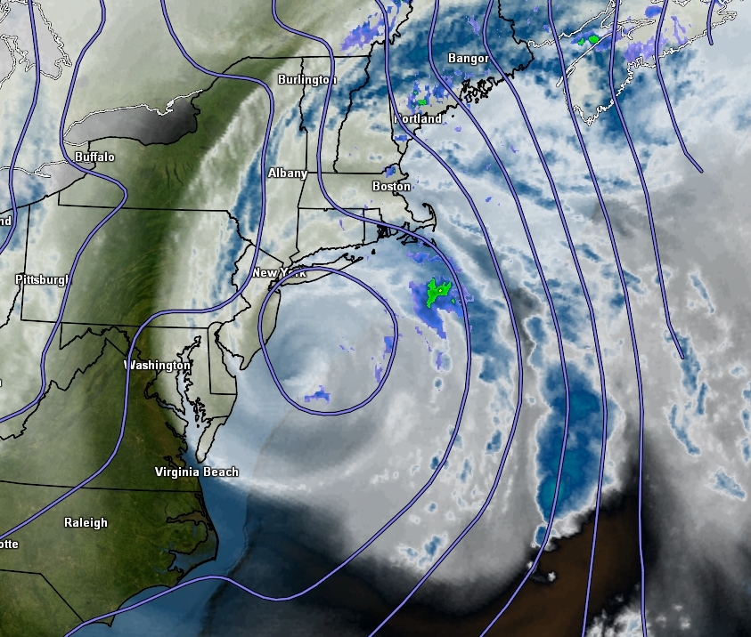
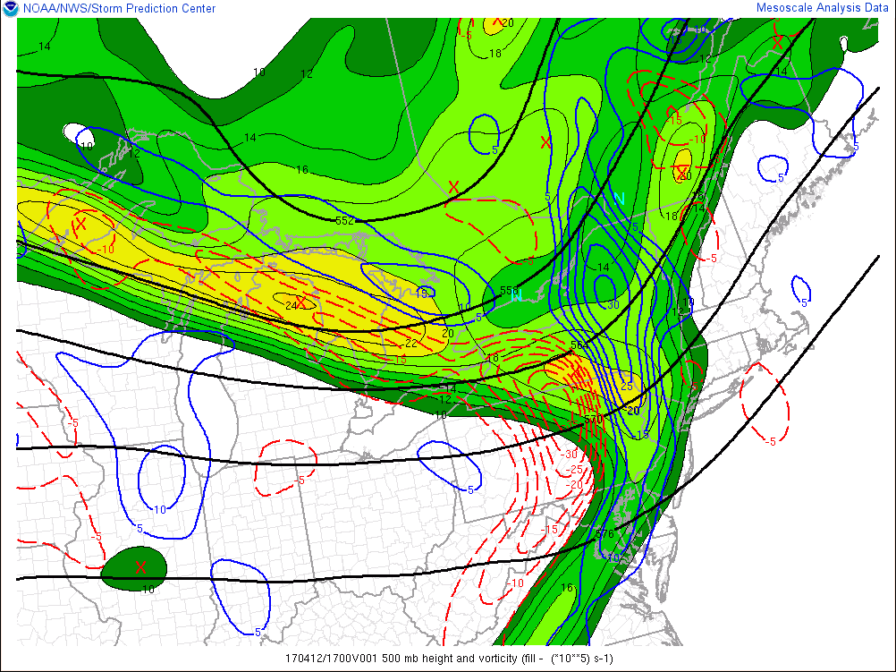
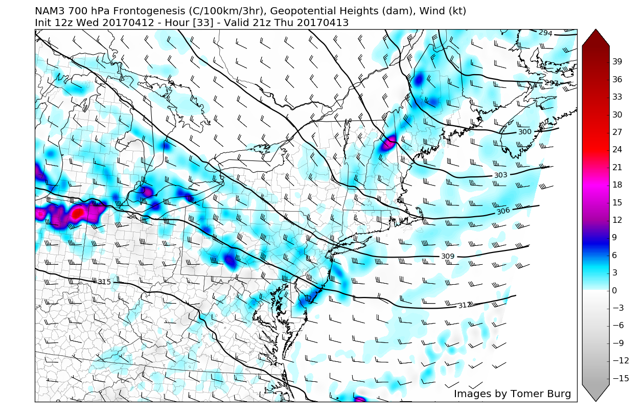
The storm that bombarded portions of the Northeast over the past day is quickly moving out over eastern Canada, but the storm certainly left its mark. Most of the Northeast saw heavy rainfall totals in the range of about 2-5″, but the main event from this system were the winds that roared in overnight last night. As the low pressure area rapidly deepened and moved ashore over NJ and eventually progressed into New York state, it carried a large an impressive area of high winds just above the surface over portions of Long Island, Connecticut, Rhode Island, Massachusetts, Vermont, and Maine. As the storm began to fill in with warmer air and weaken, these winds just above the surface were able to rapidly crash down to the ground and cause an impressive amount of tree damage. Hundreds of thousands of folks are still without power in many of the states above, with over 400,000 customers without power in Maine alone. While these winds were rather impressive, the main story west of the immediate area of low pressure were the torrential rains that fell. Deep tropical moisture streamed northward into the Mid Atlantic and Northeast states, and when this moisture was met with the strong dynamics aloft, heavy rain became focused over New Jersey and portions of New York for several hours. Some locations were able to rack up rain totals in the 4-5″ range when all was said and done, with some minor street and river flooding noted. As we stated last week, the reason that these rains were not a bigger story was because an existing minimal drought muted out the overall impacts.

Sunday nights radar near the peak of the coastal storm that brought heavy rains and high winds over the region

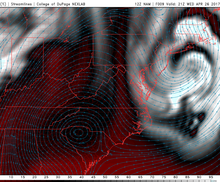
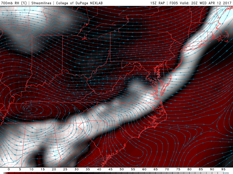
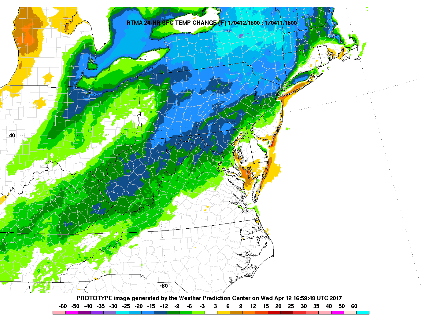
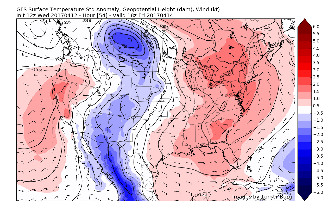
As day broke today, a strong westerly jet associated with the backside of the low pressure system was working its way over the Northeast. Due to more mixing of dry air in the atmosphere, this low level jet was able to bring gusts down to the surface in the range of 30-40 mph, which brought some additional tree damage to the region. It also made for a cooler and more classic fall day as cooler Canadian air was briefly tapped. With partly sunny skies and cooler temperatures aloft, highs were able to make it into the middle 50’s across much of the region, but cooler conditions to the north and west kept highs down in the low to upper 40’s-with some stations in New York state even reporting snow showers! As the massive low pressure system continues to pull away this evening, wind have shifted from northwest to southwest as high pressure begins to build in from the south. As the winds shift, the gusty 20-30 mph conditions will begin to die down as the pressure gradient from the two opposing systems weakens with time. Given the clear skies and low humidity, conditions will be marginally supportive for radiational cooling to occur tonight which should knock temperatures down into the upper 30’s and lower 40’s across the area.

High resolution visible satellite imagery and surface observations over the northeast showing cooling and windy conditions

High resolution visible satellite imagery and surface observations over the northeast showing cooling and windy conditions

Tuesday and Beyond

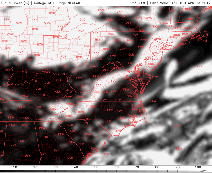
The area of high pressure just south of the area will continue to build north throughout the day tomorrow, which will allow for dry conditions and generally clear skies. Highs will likely be limited to the middle to upper 50’s  during the day tomorrow despite winds coming from southwest winds at the surface, but cooler Canadian air continues to work in at the lower levels of the atmosphere. Winds will also likely die down completely by tomorrow afternoon, so as we work our way into the evening hours, we should see ideal conditions for radiational cooling to take place over the entire area. Low level temperatures will likely be below freezing already, so expect lows to drop into mid to upper 30’s, with some of the more interior locations possibly even dropping below-freezing and into the upper 20’s. With little to no winds, frost will be increasingly likely the farther away from the coast you move.

By Wednesday some changes will be in the works as a large area of low pressure begins to move towards the Great Lakes region. As this low heads northeast, it will bring a surge of warmer air along a warm front over the area, which should work to bring highs back into the upper 60’s and lower 70’s once again. Given the breadth of this system, we will likely be in between the cold front and warm front until Friday, when the cold front will finally pass, bringing a marginal chance of showers during the afternoon hours. Highs will likely remain in the upper 60’s to lower 70’s through this period, before the cold front knocks temperatures back down to more seasonable levels.

By this weekend temperatures should once again cool down with northwesterly flow returning from Canada, but we may have to watch for a threat of showers once again later in the weekend as a potential wave of low pressure rides north along a stalled cold front over the area. There is still considerable uncertainty with this solution and we’ll have more details by Wednesday as the model guidance converges on a more clear solution.

Snapshot from the 12z ECMWF model showing slightly above normal temperatures during next weekend with the return of higher heights in the east

Snapshot from the 12z ECMWF model showing slightly above normal temperatures during next weekend with the return of higher heights in the east

For more information and posts like this one, make sure you sign up for Premium Forecasts — where multiple detailed articles, videos, and interactives are posted each day. Also, come interact with our staff and many other weather enthusiasts at 33andrain.com!

Have a great night!

Steve Copertino

Beautiful Weekend on Tap, Changes Coming Next Week

Good Evening! 

We’ve certainly seen a nice change in sensible weather over the past two days or so, as the warm temperatures and humidity have been funneled out and replaced with much more seasonable conditions. Today was an extension of this seasonable weather, as light winds from the southwest brought in a mild day with highs ranging in the upper 60’s to lower 70’s across much of the Northeast. This is only slightly warmer than what we’ve seen this week due to a slight increased in mid level temperatures as an area of mid level ridging begins to build in off to our south and west. This area of building ridging will also allow for increased subsidence to overwhelm the area, so this contributed to a mainly sunny day with the exception of just a few high level cirrus clouds. Conditions will remain quite calm and clear throughout the evening hours and into the overnight hours as a weak cold front begins to sag into the Northeast over portions of western New York and Pennsylvania. This front will be moving relatively quick, and will also be quite weak, so no noticeable temperature drops will be likely overnight. With generally clear skies, light winds from the southwest switching to northwesterly, and relatively low humidity, temperatures tonight should bottom out in the middle to upper 40’s west of the metro area, and in the upper 40’s to lower 50’s in the immediate NYC area. These conditions will also be quite favorable to view an ongoing meteor shower occurring right around the club of Orion, with the best viewing times happening just after midnight!

Surface observations and high resolution satellite imagery from GOES 16 showing relatively tranquil conditions over much of the Northeast this afternoon/evening with mild temperatures (Simuawips)

Surface observations and high resolution satellite imagery from GOES 16 showing relatively tranquil conditions over much of the Northeast this afternoon/evening with mild temperatures (Simuawips)

Friday Into the Weekend 

Much of the same is likely on Friday, with clear and mild conditions likely starting off the day as the weak cold front quickly passes through during the morning hours. The only notable changes will be a shift in the wind direction from southwest, to northwest, but this should gradually change back as the day progresses. Mid level ridging will continue to build in from the west during the day tomorrow, and this will usher in slightly warmer mid level temperatures over the area. A renewed area of subsidence will also begin to build in, expect a generally sunny day across the entire area with highs in the upper 60’s and lower 70’s once again, with locations closer to the city more likely to see temperatures around the 75 degree mark. Tomorrow should give way to a very nice end to the workweek as the tranquil conditions last into the overnight hours with temperatures likely falling into the upper 40’s and lower 50’s for low temperatures, which is rather seasonable for this time of year.

As we head into Saturday, we should begin to see the mid level ridging that has been building to our west really flex its muscles and start to usher in even warmer mid level temperatures during the day, but also working to keep much of the subsidence and dry weather in place over the region as the stormy/active weather remains well north of the Northeast, over Canada. With the warmer mid level temperatures aloft, highs in the middle 70’s are likely during the day, with some locations near the city likely reaching into the upper 70’s, and possibly even around the 80 degree mark during peak heating hours. Much of the same is expected on Sunday as the crest of the mid level ridge will be located right over the Northeast. Sunday is likely to have more sea-breezes with it, but should be another warm and beautiful day nonetheless to get some work done outside, or just enjoy the day in general. Dewpoints will remain quite comfortable as well, which should lead to both evenings being very pleasant while radiational cooling takes temperatures down into the lower to middle 50’s for lows.

This afternoons ECMWF model showing the building mid level ridge over the Northeast on Sunday afternoon. This ridge should lead to very mild conditions this weekend with very little in the way of cloud cover.

This afternoons ECMWF model showing the building mid level ridge over the Northeast on Sunday afternoon. This ridge should lead to very mild conditions this weekend with very little in the way of cloud cover.

Changes Coming Next Week! 

While the ridging over the Northeast may linger into the early part of next week, large-scale changes will begin as early as Monday. A mid level ridge will begin to set up over the west coast, and this will begin to force the remnants of a large mid level trough in the central part of the country. The remnants will likely become cut off from the overall jet stream while these changes occur and begin to dig into the Ozarks and Tennessee valley. As ridging out west continues to amplify, it will begin to pour in rather energetic Pacific energy coming from the active Pacific jet. This energy, in conjunction with the cut off upper level low will begin to round out a trough in the eastern half of the country starting on Monday night and into Tuesday. As this upper level low begins to interact with the incoming trough and cold front, it will cause rich tropical moisture to stream northward into portions of the Mid-Atlantic and Northeast. This moisture should begin to reach the area on Tuesday morning/afternoon as the primary low pressure system heads north in Canada, with a large cold front pushing into the East. Depending on just when the mid level trough phases with remnant cutoff system will determine the overall timing of this system, but we are looking at increased potential for heavy rainfall early next week, with temperatures likely falling into below-normal territory by the middle of the week.

This models begin to diverge on what exactly happens with this system, as increased blocking could potentially allow the system to slow down enough to potentially cut off from the main flow and meander around the region for at least a few days. This solution is somewhat unlikely as ridging in the west breaks down due to the strong Pacific jet, but will be monitored as this could prolong periods of unsettled weather next week.

We will continue to watch this system over the next few days and will have an update by early next week! Enjoy the weekend!

This afternoons ECMWF model showing a large plume of tropical moisture streaming into the east ahead of a large and mature frontal system

This afternoons ECMWF model showing a large plume of tropical moisture streaming into the east ahead of a large and mature frontal system

For more information and posts like this one, make sure you sign up for Premium Forecasts — where multiple detailed articles, videos, and interactives are posted each day. Also, come interact with our staff and many other weather enthusiasts at 33andrain.com!

Have a great night!

Steve Copertino


Public Analysis: Warm End To the Week, Turning Unsettled Once Again

Good Afternoon!

Things are finally clearing up after the cut-off low pressure system that we talked about on Monday came through the region most of the day yesterday. As stated in the earlier outlook, the precipitation was more on the scattered, but heavier side, so some locations did indeed see higher rainfall totals than other locations. For example, portion of Northwestern New Jersey saw around around a quarter of an inch of rain, while areas just south of the city saw close to 2 inches of rain due to training of showers.

As the area of low pressure continues to decay, it has pretty much rained itself out for the most part, although there is some residual low level moisture hanging around. This residual moisture has brought some light drizzle and even isolated showers to parts of the metro area, but any threat for significant precipitation is pretty much over as dry air works in from the north and west. As the precipitation dies off this afternoon, relatively thick cloud cover associated with the decaying low pressure system will moderate temperatures and keep them limited to the upper 50’s to lower 60’s across the entire area this afternoon.

As we progress into the evening hours, expect the cloudy conditions to continue on through this evening as one last band of moisture trapped in the lower levels of the atmosphere swings through. This last little band of moisture should work to keep skies mostly cloudy and could even produce some areas of fog due to the winds being relatively low this evening. With the cloudiness limiting how much temperatures will be able to fall, lows are expected to remain rather steadfast in the 50’s overnight, which is slightly above normal for this time of year.

Latest visible satellite imagery, regional radar mosaic, surface temperatures, and surface winds for the Northeast this afternoon (Courtesy of GREarth)

Latest visible satellite imagery, regional radar mosaic, surface temperatures, and surface winds for the Northeast this afternoon (Courtesy of GREarth)

Thursday and Friday 

As we head into tomorrow, the cut-off low pressure system should still be located to our east while continuing to dissipate and slowly limp away from the coast. As it does so, the low will still have lingering effects on our area by continuing to bring winds from the southeast off of the Atlantic, which may keep overcast and some broken clouds over the area to start off the first half of the day. Though, as we continue on through the day, more sun should begin to mix in with the clouds and allow things to warm up when compared to today. Highs should reach into the upper 60’s and lower 70’s for most of the area-with the chance at some higher temperatures if the cloud cover is able to erode quicker.

Tomorrow evening should be give way to partly cloudy conditions, especially towards midnight and into very early Friday morning. A weak cold front will be working towards the area from west to east and bring a small chance at some showers and possibly even a weak thunderstorm during the evening hours. Right now it appears that the greatest chance for showers and a weak thunderstorm will be over central and eastern portions of Pennsylvania, but this activity may continue east with time during the early morning hours towards New Jersey and southern New York. However, the rain potential with this front will be severely limited as dry air from Canada works its way into this weak front as it continues east towards the coast by daybreak Friday.

During the late morning on Friday, the remnants of the cold front should be over eastern Long Island and steadily heading out to sea, leaving behind dry and clear conditions. With relatively clear skies and winds from the south/southwest behind the front during Friday afternoon, temperatures should have no problem reaching well into the 70’s and possibly low 80s across portions of southeast Pennsylvania as well as southern New Jersey.

The entire area should see a very nice end to the work week as the warm temperatures and warm skies continue through sunset. Due to a building ridge of high pressure to the south, lows will remain relatively warm, in the 60’s Friday night with light southerly winds.

12z 3km North American Model showing a very pleasant and warm Spring day on Friday with highs in the 70's and 80's across the Northeast (Valid 4pm Friday)

12z 3km North American Model showing a very pleasant and warm Spring day on Friday with highs in the 70’s and 80’s across the Northeast (Valid 4pm Friday)

Saturday and Sunday

With an area of ridging and high pressure building in from the east to west on Saturday morning from off the Mid-Atlantic coast, conditions during the morning hours should be quite warm. Temperatures during the mid morning hours should be in the mid to upper 70’s across the entire area and continuing to climb into the mid 80’s by the afternoon. Due to some winds out of the south, south-facing shores of Long Island and Connecticut may experience somewhat lower temperatures, but overall the majority of Saturday looks to be on track for a very warm Spring day.

As we progress into the mid to late afternoon hours on Saturday, the latest computer model guidance has been showing the possibility of a backdoor cold front moving through the region later in the day. As the cold front begins to push south during the day, there may be enough instability and moisture around for showers and thunderstorms to develop ahead of this frontal system. The exact details of any showers and thunderstorms will have to be worked out over the next few days, but if conditions do come together in the right manner, some strong to possibly severe thunderstorms may exist over portions of the area, with hail and gusty winds.

Otherwise, once the backdoor cold front pushes through the area late Saturday and into Sunday, conditions should once again become much cooler and clear during the day Sunday with high pressure located just to our east. Temperatures will be highly dependant on just how far south the front can get, but right now it seems likely that temperatures across the area should remain in the mid to upper 60’s with isolated areas of 70’s, due to winds coming in from the cooler Atlantic Ocean.

The potential for onshore winds will also bring the chance for some cloudier weather during the day, however if the cold front pushes far enough south then the aforementioned high pressure will be able to position itself over our area, which would allow more sun than clouds. These backdoor fronts are extremely hard to predict, even in the short range, so we will be updating you on the latest over the next few days.

Once we head into Sunday evening a very large and vigorous system will be taking shape over the central part of the country, which is part of this active weather regime we warned of over a week ago now!

12z GFS model showing a very large and impressive system over the central portion of the country poised to impact the Northeast early next week (Valid 8pm Sunday)

12z GFS model showing a very large and impressive system over the central portion of the country poised to impact the Northeast early next week (Valid 8pm Sunday)

Extended Range

The large and potent storm system located over the North Central portion of the country will have the potential to impact our region well before the low pressure nears the area. As the stalled backdoor cold front from Sunday begins to lift north over our area on Monday, warmer temperatures and some clearing may be possible, however if this front is slower or does not progress as far north as currently progged, then conditions may remain cooler with the threat of some showers with increased cloudiness. At this time, we remain skeptical on the northward progress of the warm front, due to departing high pressure, off the New England coast, supporting more onshore winds and cooler temperatures.

As the system in the Plains begins to move east late Monday and Tuesday, a stronger cold front should be approaching the area. This front will have the potential to produce a myriad of impacts such as heavy rains, thunderstorms, and gusty winds. All of this is highly dependant on the timing of the system once it is located in the Plains this weekend, so make sure to check back on Friday and Monday for future updates on this potential system!

————————————-

For more information and posts like this one, make sure you sign up for Zone Forecasts — where multiple detailed articles, videos, and interactives are posted each day. Also, come interact with our staff and many other weather enthusiasts at 33andrain.com!

Have a great evening!

Steve Copertino

Public Analysis: Brief Cooldown, Followed By More Warm and Unstable Weather

Good Afternoon!

After temperatures in the mid to upper 80’s yesterday across much of the region, a weak cold front and some weak showers will bring temperatures back down to more seasonable levels starting this evening and lasting through Saturday. However, by Easter Sunday we may see a return to much above-normal temperatures with a chance of showers and thunderstorms.

This Afternoon and Evening 

The weak upper level system that we talked about back on Monday has moved through the NYC metro area this afternoon and has brought some light to moderate showers, with even a few very isolated rumbles of thunder. As of 2pm, this activity was heading east at a pretty decent speed while it also outruns the best upper-level support to sustain these showers. This area currently situated over Long Island and Connecticut should continue to progressively move east this afternoon and eventually move offshore while continuing to weaken in the process.

Rapid clearing is taking place behind this area of showers, as dry air begins to settle in from the north and west. As skies continue to clear this afternoon, temperatures should be able to rise into the upper 60’s and lower 70’s across the area, with coastal locations staying on the cooler side once again. Even with temperatures currently in the mid 60’s  and lower 70’s across the area, this is still a good 10-20 degrees below what temperatures were just 24 hours ago.

As was mentioned back on Monday, the actual cooler air with this front is lagging behind the shower activity by quite a bit, but as high pressure begins to drop down from Canada late this evening, temperatures should be able to fall into the 40’s across the entire area, with an outside chance of upper 30’s across the interior sections of NY.

Current surface temperatures, regional radar mosaic, and visible satellite imagery showing rather rapid clearing taking place behind the weak upper-level disturbance (Courtesy of GREarth)

Current surface temperatures, regional radar mosaic, and visible satellite imagery showing rather rapid clearing taking place behind the weak upper-level disturbance (Courtesy of GREarth)

Thursday and Friday 

High pressure will be in control in time for the morning commute tomorrow, with relatively cool temperatures likely by 8am, ranging from the mid to upper 40’s across the area. Some overcast and broken clouds are possible tomorrow morning and into early afternoon, before a brief break giving way to mostly clear conditions. This should allow temperatures to easily rise into the upper 50’s and low to mid 60’s across the area by late tomorrow afternoon.

Another weak cold front will be set to move through tomorrow afternoon and evening, bringing some more broken clouds and winds of about 10-15 mph sustained out of the northwest. The lack of moisture and lift associated with this front will forbid the development of showers, so only increased cloudiness is expected into tomorrow evening.

The lack of clouds and light to moderate winds underneath the area of high pressure will allow temperatures to fall into the low to middle 40’s tomorrow evening, with inland sections of northern New Jersey and New York possibly slipping back down into the 30’s for lows.

Friday should be a relatively tranquil day as the area of high pressure continues to remain in control over our area. Mostly sunny conditions are expected with a few clouds possible over the south and west portions of the area. Calm winds and clear skies should give way to seasonable temperatures Friday afternoon, with highs ranging from the upper 50’s to mid 60’s across the entire area. As we head into the evening, the same calm conditions will allow for temperatures to slip into the 40’s for lows once again, with 30’s possible in the interior sections.

12z European model showing the area of high pressure centered over the Northeast on Friday afternoon. (Courtesy of Accuweather Pro)

12z European model showing the area of high pressure centered over the Northeast on Friday afternoon. (Courtesy of Accuweather Pro)

Saturday and Beyond 

The area of high pressure that will have been in control for Thursday and Friday will finally move offshore to the Mid Atlantic coast on Saturday, and this will begin to bring quite a few changes for this holiday weekend. As the area of high pressure begins to shift off to our east, winds will change from the north and west, to more southerly/southwesterly during the morning and afternoon hours. This change to more southerly winds will allow warmer air to work its way in during the day, with a warm front progged to move through by 2pm or so.

This warm front will bring an increase in clouds, with a chance at some showers and even some weak thunderstorms during the late afternoon hours. Instability will be quite weak and there really shouldn’t be change from that thinking so at this time it does not seem like these showers and possible thunderstorms will capable of anything outside of some heavy downpours and very isolated gusty winds. Otherwise, temperatures should be able to reach the mid to upper 60’s across the area on Saturday, with coastal locations possibly seeing more prolonged cloudiness which may lead to highs only in the upper 50’s to low 60’s.

As we move into Easter Sunday, much above-normal temperatures seem quite likely as the aforementioned high pressure system located off the east coast continues to funnel warm and moist air from the south and into our area. Some dry/sinking air behind the warm front that passed through on Saturday may allow for a break in the clouds in the early afternoon on Sunday, and this should usher in a mix of sun and clouds to start off the day.

Strong southwesterly winds in the lower levels of the atmosphere will continue to bring in very warm temperatures across the area during the heart of the day, which could allow for temperatures to reach into the low to mid 80’s for locations that see more sunshine and are further away from the coast. Regardless, temperatures will be very warm on East Sunday with the entire area likely experiencing highs in the upper 70’s to mid 80’s, with the exception of coastal locations who may have to deal with a seabreeze later on in the afternoon which could knock temperatures down quite a bit.

As a cold front begins to work its way in towards area of Upstate New York later in the afternoon and evening some more showers and thunderstorms will be possible, but at this time the main focus of this activity  should be off to our north and west as the best forcing for storms looks to be displaced from our area.

12z European model showing temperature anomalies ranging from 20-30 degrees above normal on Sunday afternoon with temperatures possibly reaching into the 80's once again (Courtesy of Accuweather Pro)

12z European model showing temperature anomalies ranging from 20-30 degrees above normal on Sunday afternoon with temperatures possibly reaching into the 80’s once again (Courtesy of Accuweather Pro)

With the Holiday Weekend coming closer and the threat for some shower and thunderstorms on Easter, make sure to check back for further updates!

For more information and posts like this one, make sure you sign up for Zone Forecasts — where multiple detailed articles, videos, and interactives are posted each day. Also, come interact with our staff and many other weather enthusiasts at 33andrain.com!

Have a great day!

Steve Copertino