-2")
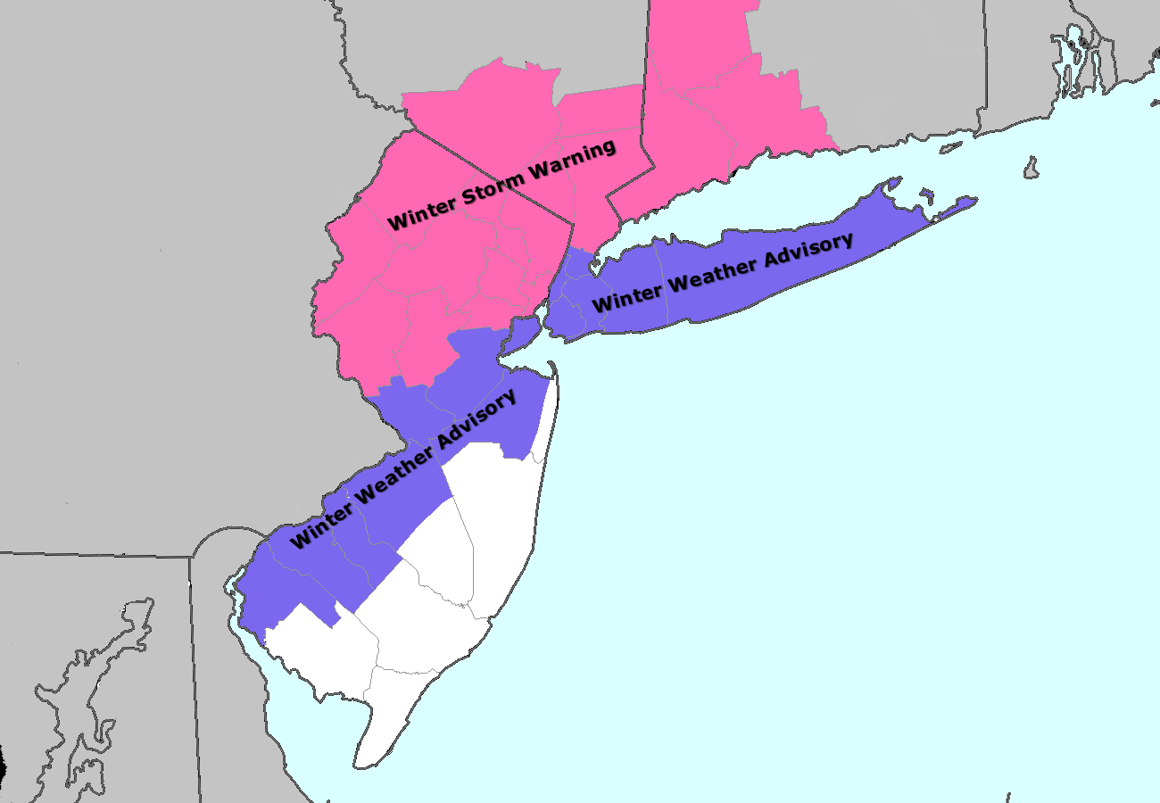
Blizzard Warnings issued ahead of major snowstorm
Forecast models have come into better agreement on a more organized snowstorm impacting the region primarily from tomorrow evening through Friday morning. Uncertainties still remain regarding specific details and whether the storm will track closer to the coast than modeled, but we have laid out some of the essential details in a public overview below.
Potential Hazards: Significant snow, with a general 6-10″ of snow expected across the region. There is the potential for snowfall amounts of 12″ or higher in the Hudson Valley, southern CT, and eastern Long Island. The cold temperatures will lead to a powdery snow, and combined with northerly winds around 20mph with gusts to near 40mph, will lead to blizzard conditions at times, particularly closer to the coast. Roadways will become quite slick, and wind chills will be in the single digits and even below zero at times during the storm. If you are out, make sure to bundle up with several layers. Travel is likely to become very difficult at times.

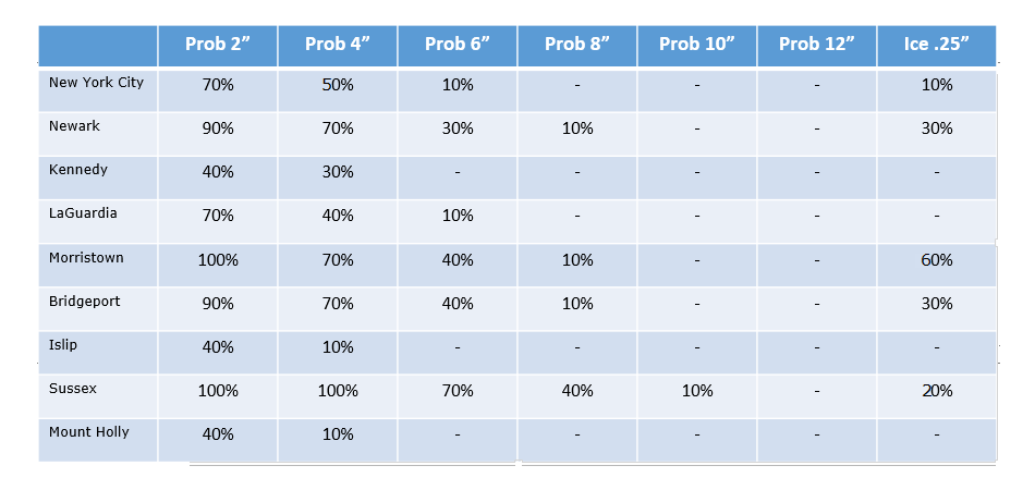
NAM model showing heavy snow throughout the area on Thursday night into Friday morning.


