Forecast: Potential for strong storms Tuesday

It has been over a week since the area was last plagued by tumultuous weather. Mid to upper 70’s temperatures during the majority of the daytime hours, clear blue skies and light winds have been a staple in the areas weather for the majority of
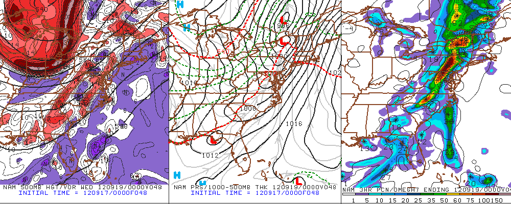
NAM Model showing the storm system forecast to impact the area on Tuesday, with a powerful mid level trough (left), strong surface low and cold front (center) and potential for heavy rain (right).

the aforementioned stretch of pleasant conditions. Even more impressive is the lack of precipitation — not even isolated showers or thunderstorms have been present since the big cold front with severe thunderstorms crossed the area a few weekends ago. However, the atmosphere is reloading and the potential for a more significant storm will once again rear its head early this coming week. Gulf moisture will surge north ahead of a large upper level trough which is expected to drop south/southeast into the Great Lakes before lifting northeast again into Southeast Canada. However, a strong surface low is forecast to develop over Western New York and drag a cold front from Western Pennsylvania and New York through New England and the Mid-Atlantic states. The cold front will serve as the focal point for the development of heavy rain and thunderstorms.

Storm Prediction Center Day 2 Outlook showing a Slight Risk for severe weather in the Northeast. Categorical (left) and probabilistic (right).

Quite possibly the most interesting development on forecast models, even moreso than the potential for heavy rain, is the magnitude of winds which exist just above the surface. Forecast models are indicating a powerful low level jet (a fast moving ribbon of air in the lower levels of the atmosphere) directly along and head of the cold front…with 50 to 60 knot winds at 900-950mb. Whenever these type of winds exist just above the surface, forecasters look for the potential for thunderstorms and convection to mix them down (as they could potentially cause damaging strong winds if that were to occur). In this situation, the forecast remains somewhat uncertain. The missing piece of the puzzle for a more widespread damaging wind event throughout the Northeast US seems to be the development of instability at the surface to help develop the thunderstorms. Without this, the storms will remain elevated and are much less likely to mix the strong winds down to the surface. Regardless, the Storm Prediction Center has placed our area in a “Slight Risk” for the potential of severe thunderstorms capable of producing damaging winds on Tuesday.

With all of this uncertainty, and talk of potential hazardous weather, it’s certainly important to reiterate that the main story with this storm will be the moderate to heavy rain which will be possible beginning around mid-day on Tuesday and continuing into early Wednesday. The change in weather from the last several days will be quite drastic, with gusty winds even ahead of the cold front and unrelated to thunderstorms. And, as we mentioned above, there is the potential for some hazardous weather (including damaging winds and isolated tornadoes) if some meteorological puzzle pieces fall into place. We’ll be sure to keep you updated with more details as the event draws closer. Remember to follow us on Twitter and Facebook for constant updates.

A Reanalysis of the Saturday September 8 Severe Weather Event

In some ways, the Saturday, September 8 Severe Weather Event exceeded expectations regarding the 70mph EF0 tornado in Breezy Point, NY and the 110mph EF1 (one MPH away from being an EF2) tornado in Canarsie, NY. In other ways, though, the severe weather event was underwhelming since the squall line weakened well before reaching the Metro region.

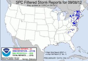
SPC Filtered Severe Storm Reports from Saturday, September 8th

Here are the SPC filtered severe weather reports from the event. There is a decent amount of coverage. However, notice the relative minimums in Pennsylvania, New Jersey, Long Island, and most of central and eastern New England. Additionally, notice that there were no high wind reports (65 knots or greater) and zero hail reports.

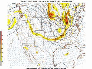
RAP 500mb Analysis from 15z, or 11am Saturday, September 8th

However, let’s start with the two tornadoes in Brooklyn. They occurred around 11am, which is 15z.


RAP analysis at 500mb showed a robust shortwave in the Great Lakes in association with a potent longwave trough. The shortwave was at our latitude at this point, which is important because this helped the synoptic scale forcing for lift stay at our latitude, at the time. Of course, the trough is still well west of the region, so the best forcing was closer to the base of the trough. But considering how potent the trough is, synoptic scale forcing can run out well ahead of the trough base, and combine that with surface-based instability, and lift is generated.


Read more

PM Update: Gorgeous weather to welcome the new week

Behind a cold front which brought widespread severe weather to the Northeast US on Saturday, a fresh new airmass has settled in, and it is expected to stick around for a while and provide gorgeous precipitation-free weather through the new

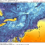
NAM Model showing low temperatures in the 40’s and 50’s throughout the area on Tuesday morning. Click for high resolution.

work week. High temperatures in the upper 70’s will kick things off on Monday and Tuesday, and crisp air with low humidity will make it feel even nicer. Overnight lows will actually be, dare we say it, “cool” with temperatures dropping into the mid 40’s in some rural areas away from the shore and the city. Mornings will feel much more like autumn at the start of the week as temperatures will be climbing out of the 40’s and 50’s to start, and eventually ending up in the aforementioned upper 70’s.

A bit of moderation in temperature is likely by the middle and end of the week, still, as mid level heights begin to rise and a ridge builds into the area. The increase in warmth will bring high temperatures into the 80’s. But as far as atmospheric disturbances go, things will remain mostly quiet. Thus, very little precipitation is expected through the end of the week. Its not often, especially in this area, to see a stretch of such gorgeous weather. So we hope you all are able to enjoy it.

Monday: A perfect day. High near 75 in the city, possibly a little cooler inland. North winds will be a little breezy at times, around 10 to 15 miles per hour. Low humidity, very comfortable.

Monday Night: Cool, clear. Lows in the 50’s in the city, possibly 40’s in some spots inland. North winds remaining a bit breezy around 10 miles per hour.

Tuesday: Another gem. Highs a degree or two warmer, but still near 76-77 degrees in many locations. Light north winds.

Wednesday: Trending warmer, with highs nearer to 80. Plenty of sun, and a light wind.

Tornado Watch for NYC until 9:00pm

The Storm Prediction Center has issued a Tornado Watch for the NYC area that is in effect until 9:00pm tonight. Already this morning, several tornado warnings have been issued across Brooklyn and Queens. Strong rotation in thunderstorms

Storm Prediction Center Tornado Watch #635 in effect for NYC, NJ, and CT until 9pm.

was detected beginning around 10:30am. The NYFD has reported a possible tornado near Breezy Point, Rockaway, and Flatbush. The threat for strong to severe thunderstorms, capable of producing strong damaging winds and isolated tornadoes will continue through late this evening. Please keep abreast of the situation and stay alert for the issuance of any further watches or warnings. If a severe thunderstorm or tornado warning is issued for your location, take cover immediately. These are dangerous storms that are capable of producing significant damage.