-2")
What caused the tornado warnings in New Jersey on Tuesday?
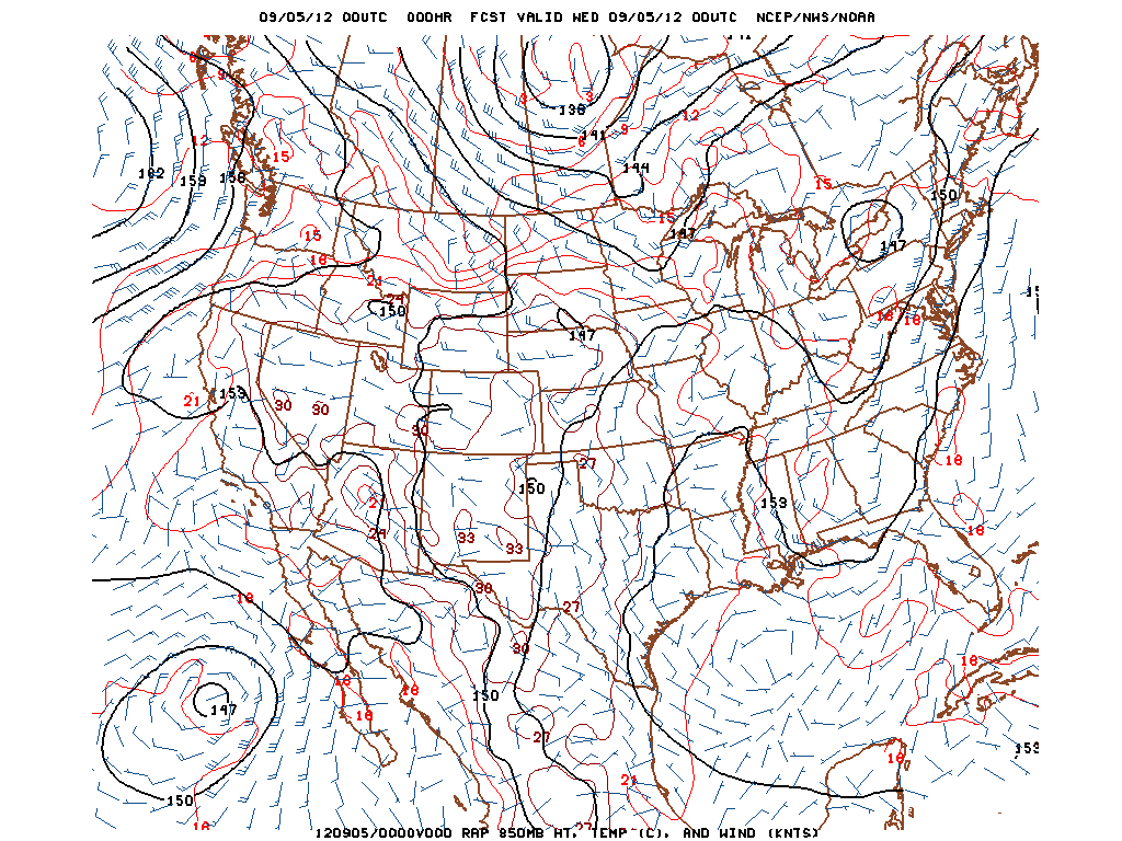
RAP 850mb Analysis for 00z Wednesday, September 5th or 8pm EDT Tuesday, September 4th 2012.
“Tornado Warning” has always been an ominous phrase. When you hear those words, things generally tend to get a little more serious. On Tuesday, there were more than three Tornado Warnings issued throughout the state of New Jersey, beginning in the afternoon and continuing into the evening hours. Although the area did not see much in the way of severe weather reports in a quantitative sense, there were several reports of low-level mesocyclones, funnel clouds, and even tornadoes in the general extreme Eastern PA and NJ areas. In hindsight, this was actually a pretty good setup for low-level mesocyclones and tornadoes, and I’ll explain why.
Synoptically, we had a surface low that slowly deepened to around 1006mb located in Western Upstate New York, along with a closed 850mb low located in the same area. This placed our area in a pressure trough, and also resulted in a warm front that moved to the north across our region. Warm fronts are generally a better lifting mechanism for rotating thunderstorms than cold fronts. This closed 850mb low helped to provide a nice low-level jet, as 850mb winds were around 30 knots in most locations.
Additionally, there was some helicity as well, which is an indicator of rotation in the low levels of the atmosphere. What is also interesting to note is the light SE surface winds, and the importance of that will be explained in a bit. Click “Read More” below to read the full article..
")
 showing highs in the 70's on Monday")