Summer Outlook 2013

Below, you will find our 2013 Summer Outlook. We’ve laid out the details and broken down the expected temperatures and precipitation, as well as factors and reasoning involved in the outlook. We encourage your comments, thoughts and feedback!

Factors/Expectations:

1) Neutral ENSO conditions should persist through the upcoming summer with sea surface temperature anomalies (SSTA) not far from normal in the tropical Pacific.

2) The negative Pacific Decadal Oscillation (PDO), or cold eastern Pacific, that we saw through winter has weakened somewhat, but will continue to be slightly negative/cold this summer season.

3) The Atlantic Multidecadal Oscillation (AMO) continues to run slightly positive/warm, with a SSTA profile of warmth near the East Coast, cold in the central Atlantic, and warm in the deep tropics.

4) The strong blocking pattern of negative North Atlantic Oscillation (NAO) and negative Arctic Oscillation (AO) that yielded a very cold late winter/early winter has since dissipated. Both indices have been predominately neutral to slightly positive over the past several weeks, and the historical tendency is for this to continue into the ensuing summer. There may be a one month period of –NAO/AO, but the overall signaling should be near neutral or slightly positive in terms of the NAO/AO blocking indicators.

5) The closest, most similar analog to the present conditions in terms of PDO, NAO, AO, PNA, ENSO, and other factors appears to be 2001. Note that analogs are utilized as tools to identify patterns and obtain clues from the past that may enable us to more accurately forecast the future. No one year is identical in pattern to another year.

6) Palmer Drought Index and Standardized Precipitation Index for the month of May have shown to be excellent foretellers of the June-July-August (JJA) temperature anomalies across the Continental United States (CONUS). The correlation is a strong one, when examining the past 20 years. Areas of drought/dry persistence in May tend to be the breeding grounds for heat in the summer and strong ridging. Likewise, areas of wetness / high soil moisture in the late meteorological spring tend to indicate an ensuing summer of coolness or at least less frequent heat spells.

7) Patterns of strong blocking in the late spring often foretell summers of strong USA heat while patterns devoid of blocking in late spring tend to yield summers of weaker USA heat.

Read more

Update: Slight Risk of severe storms from SPC

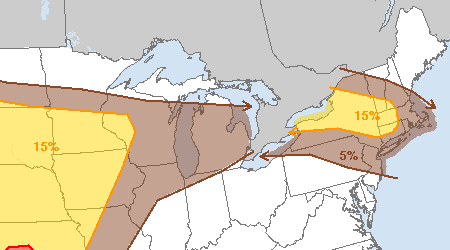
The Storm Prediction Center has placed parts of Northern New Jersey, Southeast New York ,Connecticut, and the New York City Metro Area in a “Slight Risk” for severe thunderstorms Wednesday afternoon and evening. The “Slight Risk” category is triggered by probabilities of severe weather within 25 miles of a point — and in this case the SPC indicates a 15%-30% chance of severe storms within 25 miles of any point in that area.

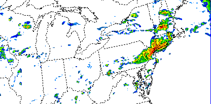
Scattered thunderstorms are expected to develop over Pennsylvania and New York later this afternoon before moving into Western New England and Southeast New York. The storms may then eventually drop south and east towards Northern NJ and New York City. However, confidence is higher in the potential for storms to the north of our area. Here, better shear and instability parameters are juxtaposed to support organized severe thunderstorm potential. One forecast model, run for the Storm Prediction Center, suggests the storms may move farther south — into Northern NJ and NYC ( see below ).

SPC-WRF model, forecasting strong thunderstorms impacting the NYC Area Wednesday evening.

SPC-WRF model, forecasting strong thunderstorms impacting the NYC Area Wednesday evening.

After a warm front passed the area this morning, southwesterly winds ushered in a much warmer and more humid airmass. So, the potential exists for the strong storms to move into the NYC Area later this evening despite the fact that the better support for severe weather remains to the north.

Stay tuned for updates on potential watches and warnings from the National Weather Service through the afternoon (this post will be updated).

Damp Tuesday, but big warmup en route

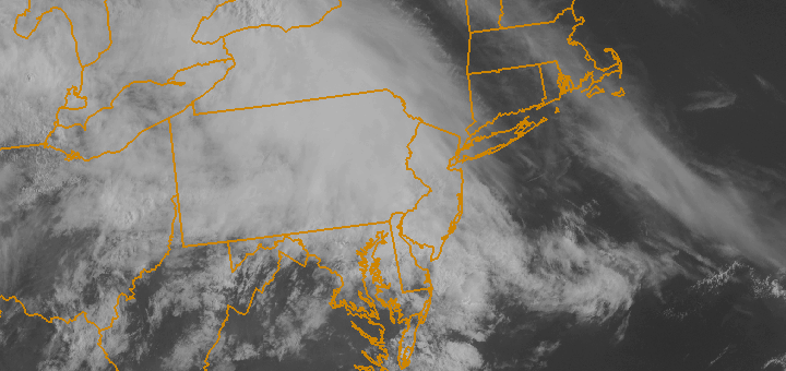
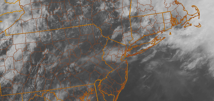
Warm fronts can be pretty deceiving. Depending on the positioning of the front at the surface, and the amount of warm air that looms behind the front, conditions can seem fairly raw and damp near and ahead it. Much of the same is true in our area today, as east winds ahead of a surface warm front to our south along with a weak low pressure system riding along the front itself will provide cooler conditions and periods of rain.

Waiting behind the front, which will pass the area early Wednesday, is a surge of warm air. Temperatures at the 850mb level will rise from around 8-9 C Tuesday morning, to 15-16 C by Wednesday — and even warmer on Thursday. At the surface, highs in the 60’s on Tuesday with clouds will rapidly rise into the upper 80’s and lower 90’s later this week. In addition, a westerly wind component should help the warmth get all the way to the coast — and limit the inland extent of the seabreeze.

Showers and storms, however, will linger through Wednesday before the heat arrives. In fact, the Storm Prediction Center suggests a small chance (5-15%) of a severe thunderstorm in the area as the warm front passes on Wednesday. Stay tuned for further updates. Their probabilistic outlook, shown below, suggests the best chance for severe thunderstorms will be farther north — where the warm front will be Wednesday afternoon. A slight chance of storms capable of producing gusty winds exists as far south as New Jersey.

Storm Prediction Center Day 2 Outlook, valid for May 29th, 2013. The probability of any severe weather within 25 miles of a point is shown. A 15% probability (yellow) triggers a "Slight Risk" of severe weather.

Storm Prediction Center Day 2 Outlook, valid for May 29th, 2013. The probability of any severe weather within 25 miles of a point is shown. A 15% probability (yellow) triggers a “Slight Risk” of severe weather.

Stay tuned for further updates on not only the potential for storms, but the impending warmup and warm frontal passage on Wednesday. You can follow our social media accounts on Facebook and Twitter for more frequent updates and posts throughout each day.

Clouds, drizzle will give way to a warm Thursday


Spring 2013 certainly has not been “warm” by definition, with plenty of transitions and colder than normal airmasses moving through the Northern tier of the United States. There have, however, been a fair share of warmer than normal days — with several featuring high temperatures well into the 70’s across parts of New Jersey and New York City. Thursday will be another one of those days.

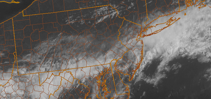
With a warm front moving through the area, some clouds and spotty showers are expected through the morning hours. With time, these clouds will burn off and give way to partly cloudy skies. Temperatures will rise into the mid to upper 70’s throughout much of the area, with parts of New Jersey potentially approaching the lower 80’s. A frontal zone moves through later Thursday Night with a period of clouds (but little precipitation expected), and Friday will end up several degrees cooler — but still pleasant with highs in the lower 70’s.

The main noticeable change will be the wind direction, as west-southwesterly winds on Thursday will give way to northerly winds behind the front on Friday. Looking ahead, some more unsettled weather with showers and storms is expected as we move into the weekend. Details on the weekend forecast are forthcoming in a blog post later this evening!