-2")
PM Update: Winter weather set to impact the area
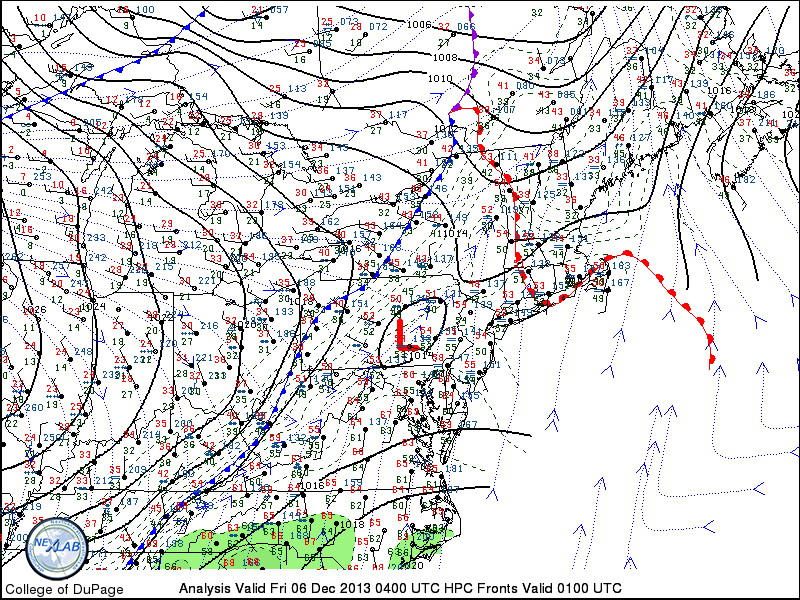
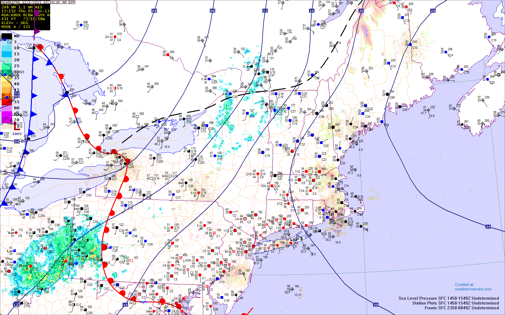
A strong cold front, which crossed the region earlier today, is ushering in a much colder airmass — and a record breaking arctic airmass to the Central and Western United States. A developing disturbance along the front will touch off more precipitation in our area later this evening into Saturday. The dramatic cold front has not yet delivered arctic air to the East Coast, but the arctic gates have opened over much of the Midwest, Northwest and North-Central United States.
Some fascinating numbers evidencing the strength of the cold front include:
1) A minimum temperature reading of 28 degrees in NW Mississippi, and a maximum temperature reading of 84 degrees in SE Mississippi.
2) Temperatures in the upper single digits and lower teens as far south as Oklahoma, Texas, and Arkansas, where several inches of snow has fallen.
3) A minimum temperature reading of -23 degrees in Montana, and a maximum temperature reading of 87 degrees in Florida. A 110-degree temperature gradient across the country!
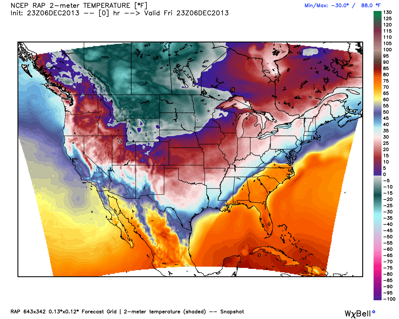
RAP analysis on Friday evening, showing a dramatic cold front over the Eastern US and an arctic airmass over the Central and Western US.