Pleasant weather, warming trend expected this week

The return of high latitude blocking (or above normal height anomalies over the higher latitudes from Greenland into Canada and the North Atlantic) has slowed the progress of spring, or at least the warmth which typically comes with it over much of the Northeast United States. While much of the Western, Southern and Central United States have already experienced widespread warmth with several days over 80 degrees, persistent troughiness and meandering upper level lows have meant cooler than normal temperatures and frequent cold fronts in the Northeast. A change is in order during this week, but will occur over the span of a few days as a warm front slowly pushes northward.

Initial conditions on Monday will be pleasant, but again dry and breezy. The National Weather Service warns of enhanced fire danger once again. The low humidity values and stiff breeze will allow for rapid spread of any fire after ignition. As recently as last week, Red Flag Warnings were issued throughout the area and several brush fires spread rapidly in parts of New Jersey. Other than the fire danger, Monday looks quite pleasant with high temperatures well into the 60’s and plenty of sun — with no chance of showers or thunderstorms during the afternoon as was the case this weekend.

Read more

Pleasant weather in control this weekend

After a weeks worth of unsettled weather, including prolific rains which ended as the 10th wettest day ever at New York City, the upcoming stretch of more pleasant weather will certainly be welcomed with open arms. Despite an elongating upper level low to our north, Friday will be the start of the generally pleasant stretch of weather. Behind a cold front, dry westerly winds will alleviate any precipitation concerns. High temperatures will still be able to rebound into the upper 60s — making for a pleasant day with a mix of clouds and sun.

The upcoming weekend days look to feature a very similar mix of sun and clouds. The upper level energy, elongated and meandering to our north, will allow for the chances of showers and possibly a rumble of thunder during the afternoon on Saturday and Sunday. But these showers and storms won’t be “organized” per se, and will weaken with the loss of daytime heating. High temperatures in the upper 60s to lower 70s will feel refreshingly good, so the showers shouldn’t be too much of a nuisance.

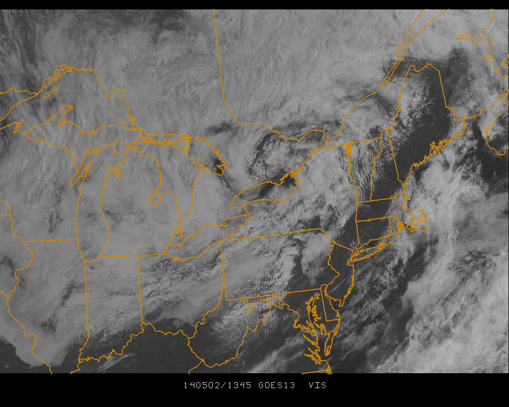
Visible satellite imagery showing partly cloudy skies in the area Friday morning.

Visible satellite imagery showing partly cloudy skies in the area Friday morning.

Read more

Flooding rains give way to storms, warmer air

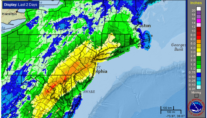
Widespread flooding rains occurred on Wednesday as a significant plume of tropical moisture surged northward along a frontal zone, which was draped near the area. Heavy rain “trained” northeastward from the Mid-Atlantic states towards New Jersey, New York City and parts of Southern New England. Rainfall amounts over 4″ were widespread, especially in parts of Central and Northeastern New Jersey. The result of prolonged heavy rain was widespread river, creek and poor drainage flooding which resulted in some property damage and a significant amount of road closures.

The rainfall, in fact, was as prolific as it seemed. The 4.97″ which fell at New York City’s Central Park was the 10th highest daily rainfall total in the reporting stations history, and the 2nd highest during the month of April. The 7.85″ which fell during the month of April made it the 6th wettest April in the reporting stations history.

24 Hour radar estimated rainfall totals, courtesy of the National Weather Service.

24 Hour radar estimated rainfall totals, courtesy of the National Weather Service.

Read more