Gusty winds, isolated tornadoes possible Wednesday AM

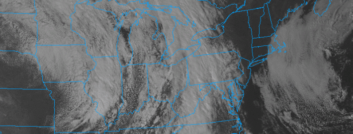
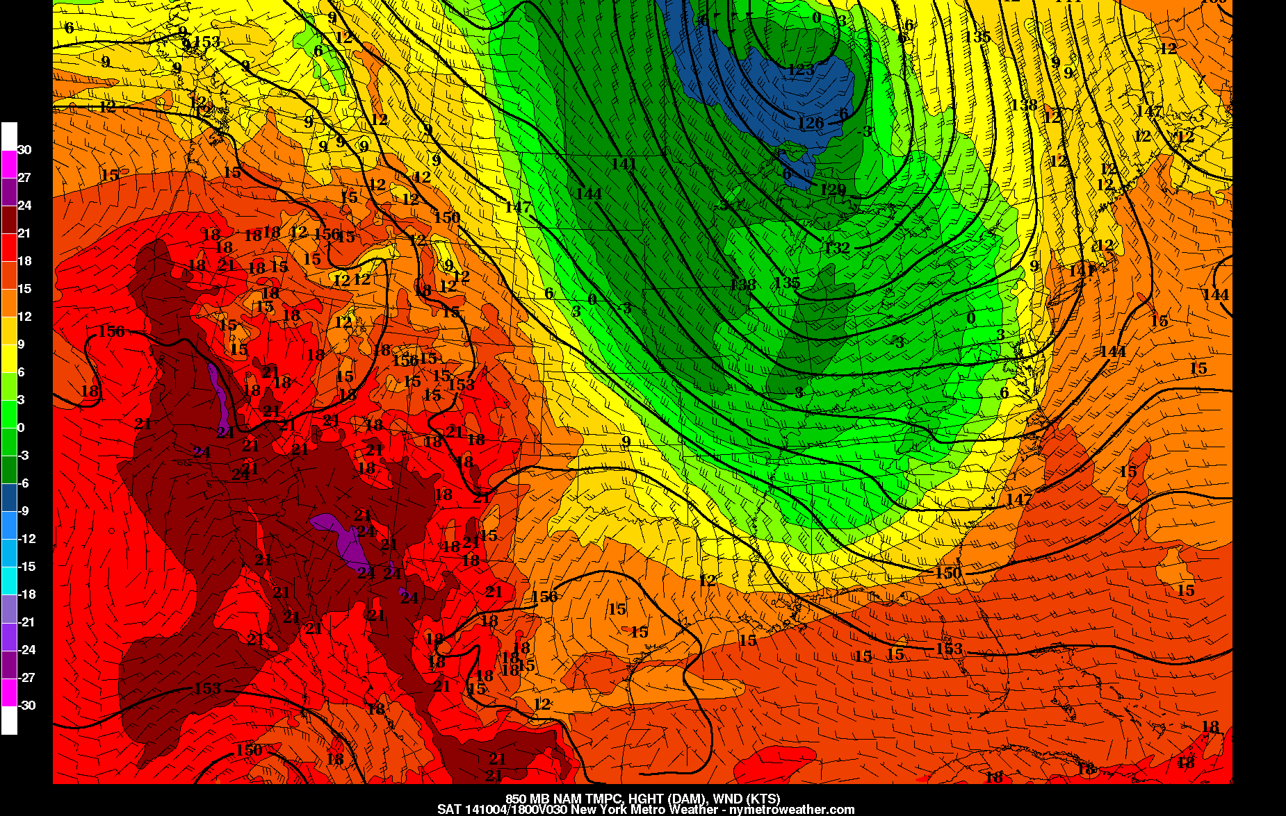
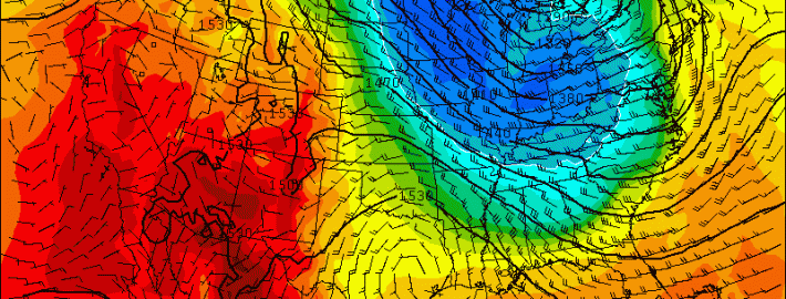
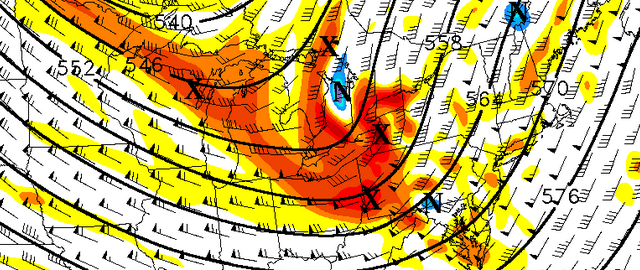
It’s not often that we talk of severe weather potential this late in the season, but the upcoming meteorological setup argues for a bit of anomalous potential. A potent mid level distubrance and associated height falls will approach the area from Tuesday Night into Wednesday morning. More notably, a juxtaposition of instability and shear on most forecast models is likely to create a corridor of severe weather potential. Exactly where, and when, this corridor develops will obviously have major impacts on our forecast. Today, forecast models have come into better agreement on the idea that this corridor could traverse from New Jersey through NYC, Long Island and parts of Southern New England early Wednesday morning.

The main potential for severe weather will come Tuesday Night into Wednesday morning as a surface low passes just to our northwest, over the interior Northeast. As it does so, maximized forcing will pass through the area from southwest to northeast. Forecast models agree that southerly winds ahead of this front will lead to moisture return and developing instability. In addition favorable kinematics including veering/backing low level winds, favorable low level and bulk shear, will juxtapose with the developing instability to support the potential for severe weather.

Read more

Strong cold front to bring rain, thunderstorms, late tonight and Saturday

The persistent cloud-cover over much of the region during the past several days finally broke today, leading to a beautiful fall day. However, as the evening progresses, clouds will be on the increase due to a strong low pressure system in Ontario, Canada, and its associated strong cold frontal boundary dragging to its south. These features will be moving eastward throughout the night and approach our area during the day tomorrow.

Today's NAM Model valid for 2:00pm tomorrow afternoon shows the strong cold front crossing our area, with much colder 850mb temperatures about to move in.

Today’s NAM Model valid for 2:00pm tomorrow afternoon shows the strong cold front crossing our area, with much colder 850mb temperatures about to move in.

Fortunately, for people going out tonight, any rain should hold off until midnight or slightly later for western sections, and after 2:00am for NYC and east. Plus, given that we are still on the warm side of the cold front, temperatures will not be all that chilly tonight, with lows around 60.

7:00pm: Mostly cloudy skies, temperatures in the low to mid 60s.

10:00pm: Cloudy skies, temperatures in the low 60s.

Midnight: Cloudy skies, temperatures in the low 60s. A 30% chance of showers for western zones, with only about a 10% chance of showers for NYC and east.

2:00am: A 60% chance of rain for western zones, with a 30% chance of rain for NYC and east, and temperatures around 60.

4:00am: An 80% chance of rain for western zones with a rumble of thunder possible, and a 60% chance of rain for NYC and east, with temperatures around 60.

Read more

Plummeting AO could offer some winter hints

As we’ve spoken about several times already this Autumn, our winter forecast doesn’t typically come out until the first week of November. Although some will bark at us for this — we’ve been hearing it already this Autumn — there are reasons for it. Mainly, our forecasters have recognized the importance of analyzing the pattern during October and the ideas moving into November. The recognition of the pattern during the next few weeks will be immensely important to understanding how things will shake down this winter. And our first “hint” could be offered during the next several days, as the AO — or Arctic Oscillation — is forecast to take a nose-dive.

The Arctic Oscillation is a large scale monitor of climate variability, also referred to as the Northern Hemisphere Annual mode. More simply, it’s a climate pattern characterized by winds circulating counterclockwise around the Arctic — typically at around 55°N latitude. In even more simple terms — the negative phase of the AO typically displaces cold air farther south in North America, while the positive phase keeps the colder air farther north, nearer to the poles and arctic regions. Forecast models are in good agreement that the AO will nosedive over the next several days — and not surprisingly, a major shot of below-normal temperatures is expected late this weekend into early next week. 

Read more

Here comes the Autumns first big cold front

Right on cue. We spoke about this potential a few days ago when we noted the medium range forecast models suggesting the presence of high latitude ridging and blocking. These some models now agree that a significant cold front will shift from the Great Lakes and Central United States through the Northeastern United States this weekend; plowing through our area from Saturday Night into Sunday. Showers and some thunderstorms are possible with its passage, right on the periphery of a major mid and upper level trough.

The temperature different won’t really be felt on Saturday despite the fronts passage. Initially warmer air, streaming in with a southerly flow ahead of the front, will keep temperatures in the 60’s and 70’s on Saturday. After some showers and maybe an isolated storm with gusty winds, the difference will become noticeable as winds shift to west-northwesterly and much, much cooler air begins moving in aloft.

Read more