Showers and storms with gusty winds, small hail today

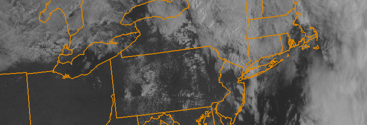
3:00pm Update: Showers and embedded thunderstorms continue to approach the area, now in Western New Jersey and shifting eastward. While radar presentation isn’t necessarily eye-grabbing, the winds just above the surface that are mixing down to the surface are impressive.

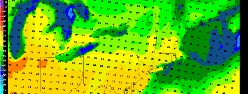
Philadelphia International Airport recently gusted to 71 miles per hour as thunderstorms passed through. Multiple gusts over 45 miles per hour have been reported in Eastern Pennsylvania. As storms continue to shift eastward toward the axis of more favorable instability and lapse rates, expect these gusts to continue.

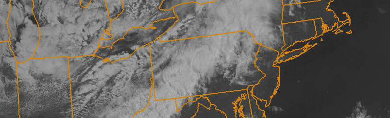
None of these storms are currently producing sustained severe-level winds, but we are continuing to monitor the situation. Stay tuned for future updates over the next few hours.

Read more

Photos: Double rainbow shines over NYC Tuesday morning

Behind a round of thunderstorms which produced frequent lightning, heavy rain and even some small hail, drier air worked into the area earlier this morning. As it did so, rain continued to fall from remaining updrafts and downdrafts associated with thunderstorms that were weakening over the area. The result, as the sun began to shine, were beautiful rainbows which stretched across the sky in New Jersey and New York City.

Readers on our website, Facebook, Twitter and other social media outlets took to posting their pictures of the rainbows (in some cases, double rainbows) as they stretched across the sky. If you have any pictures of your own, share them with us in the comments section below!

Read more

Clearing behind front, pleasant Tuesday

After elevated thunderstorms brought a prolonged period of rain, lightning and thunder late Monday Night into early Tuesday morning, clearing is expected from west to east by later Tuesday morning. Drier air will surge toward the coast as an upper level system shifts eastward, and the weather will become much more pleasant. Highs in the 60’s are expected as warm mid level temperatures stick around during the early afternoon hours.

The weather on Tuesday afternoon will likely be the nicest of the week, unfortunately. An active and persistent weather pattern is forecast to continue. Making matters worse? High latitude blocking will force an upper level trough underneath it, into Eastern Canada, bringing colder than normal air to much of the Northern 1/3 of the United States. On Wednesday afternoon, a secondary cold front will cross the area — again with potential thunderstorms — and usher in a much cooler airmass.

Read more

Showers tomorrow, upper 70s Saturday, heavy rain on Monday

Finally, we’ve had some consistent signs of Spring.

1) We’ve posted our “Winter 2014-2015 in Review” article instead of constantly talking about the next snow event.

2) On Wednesday, NYC had its first 70+ degree day (a high of 72) since October 29, 2014, when they also hit 72 degrees.

3) Upper 70s are likely on Saturday.

Today is a bit colder than it was yesterday due to a High Pressure system sliding offshore, and providing winds from the cold ocean. As this High Pressure continues to slide away from us, it will temporarily lose control over our weather, and instead a wave of energy along a front will be moving in late tonight and during the day tomorrow.

Read more