-2")
Joaquin likely to impact US East Coast, local impacts uncertain
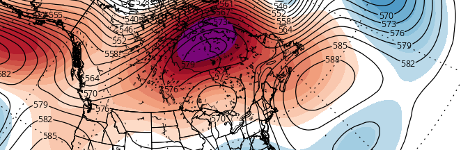
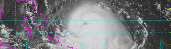
Hurricane Joaquin strengthened this morning, with maximum sustained winds of 80 miles per hour, in the Caribbean. The hurricane is expected to strengthen further over the next few days as it meanders in the Southwest Atlantic. Warm waters and minimal shear will continue to support storm organization. Thereafter, Joaquin is expected to make a turn northward, moving into the Southwest Atlantic Ocean. As it does so, an energetic disturbance over the Southeast States will race toward the storm. As the two phase, Joaquin is expected to accelerate and make a rapid turn west toward the Mid-Atlantic coast.
Exactly where the storm tracks, and how strong it is, remains highly uncertain at the present time. Forecast models are struggling with intricate details of the atmospheric setup. Unsurprisingly, small changes in the atmospheric interactions will have big changes on the eventual outcome and effects along the East Coast. The potential envelope of solutions remains extremely large — and so this post will attempt to explain the atmospheric setup, potential scenarios, and possible hazards in our area