Good afternoon! In case you haven’t noticed, it’s still quite hot outside, as temperatures are around 90 degrees with mostly sunny skies. It is somewhat humid, though the humidity is not unbearable, as heat indexes will generally be right around the actual air temperatures. This is why despite the prolonged stretch of hot weather, we have not had any heat advisories issued for the area. That being said, this weather is still much more suitable for the beach and the pool than for doing any strenuous outdoor activities.
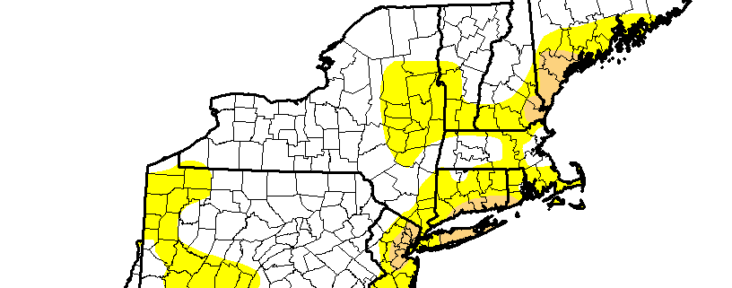
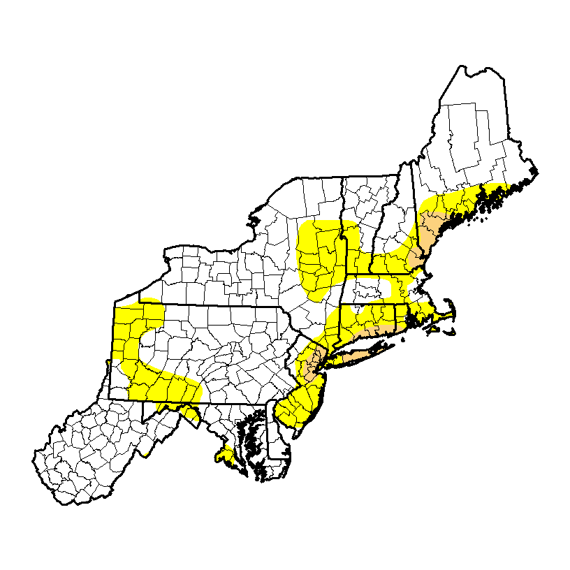
Fortunately, some temporary relief is on the way, as a cold front will be approaching the area tonight. It has Canadian origins, so the front is moisture-starved. This will prevent widespread thunderstorms, but clouds may increase during the late afternoon, through the night, and tomorrow. The front’s biggest effects will be a change to much cooler and less humid conditions for Friday and Saturday. Of course, without any true rainfall in the forecast, the drought will continue. Most areas are in the “abnormally dry” category, indicated by the yellow, but there is a growing area of “moderate” drought, which is indicated by the tan area. Over the next couple of weeks, it is possible that the entire area will be under a moderate drought.
Here are the weather highlights over the next few days:
- Isolated showers and thunderstorms are possible tonight, but they will not be widespread enough for anyone to cancel their plans. Clouds and a couple of isolated showers could linger into Friday morning.
- With the front to our south on Friday, it will be much cooler with very low humidity. Skies will start out mostly cloudy but will eventually become partly sunny as the afternoon goes on; the clouds will never completely burn off. High temperatures will be in the low 80s, as the flow will become onshore. The onshore flow will help make coastal areas be somewhat breezy at times throughout the day.
- Friday night will have a cooler, crisper feel, with temperatures generally falling into the upper 50s, but low to mid 60s in urban areas.
- Saturday looks gorgeous, with mostly sunny skies and highs in the low 80s, with continued low humidity as high pressure will dominate. Overnight lows will fall into the 50s in most locations, with 60s in urban locations.
- The high pressure will slide offshore on Sunday, leading to a return flow and thus the return of heat and humidity. Sunday will be the transition day, so it still looks to be a nice day with highs in the mid to upper 80s with still somewhat low humidity. The true heat and humidity will be arriving on Sunday night through much of next week.
- Sunday night will see increasing humidity, and Labor Day through most of next week could have temperatures around 90 degrees once again, with haze and humidity as well. There will unfortunately be too much large-scale ridging to support any widespread rainfall chances, which means that the drought will continue to get worse. A true autumn-like blast of air may not arrive until the middle of the month.
-2")