Draconid meteor shower peaks tonight, storms tomorrow

While the focus usually remains set on the “bigger” meteor showers of the year (see: Perseids), the Draconid meteor shower is drawing some additional attention this season, mostly due to the anticipated favorable weather conditions. The annual meteor shower produces, on average, between 10 and 20 meteors per hour during its peak intensity. The peak of the shower occurs from tonight, October 8th, through Friday morning, October 9th.

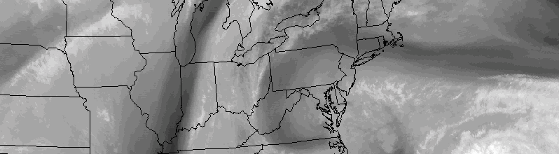
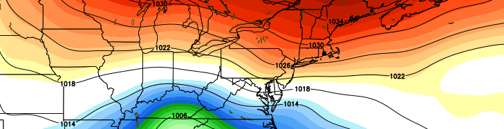
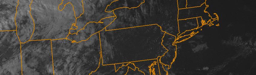
Weather conditions are expected to be favorable for viewing — at least for the first several hours. While a frontal system will be approaching late, the peak of the meteor shower actually occurs during nightfall and the early evening hours. This is somewhat atypical, as most meteor showers feature pre-dawn peaks, making viewing less ideal for those who can’t set the alarms for 3:00am. Tonight, the timing and weather conditions look good, so we suggest heading outside and away from the city lights if you have some time.

Read more

Colorful clouds could appear tonight after NASA rocket launch

NASA will launch a sounding rocket from it’s Wallops Island, VA facility tonight, and the result of intentional testing after the rocket deploys could bring a colorful cloud into the night sky from Virginia to Long Island.

Between 7 and 9pm (no specific time has yet been set), NASA will launch the suborbital rocket. Approximately 6 minutes after launch, the sounding rocket will deploy four sub-payloads containing “mixtures of barium and strontium”.

Read more

Pleasant, seasonable weather will return this week

After a tumultuous series of events last week, including the potential for Hurricane Joaquin to significantly impact our area, this week is sure to feel extra-relaxing, especially for meteorologists. While the impacts of Joaquin remained mostly here-say, the intricacies of how close the storm really was to impacting the East Coast has left meteorologists breathing a sigh of relief.

Luckily, the week looks likely to feature much more pleasant and quiet weather. Although we didn’t totally escape impacts from the anomalous pattern (See: Dangerous coastal and tidal flooding over the past several days), the upcoming one will be much quieter as a whole. High pressure will build in, with seasonable temperatures continuing. Precipitation is expected to stay out of the forecast until the latter half of the week.

Read more

Prolonged onshore winds, tidal flooding on area shores

While the main story of the past several days has obviously been Hurricane Joaquin, the synoptic pattern results in several weather hazards regardless of the storms path. As mentioned a few days ago, the path of Joaquin was a concern, but hazardous weather was likely to occur whether the storm tracked toward our area or not.

As a large high pressure system builds from our north toward Southeast Canada and New England, the lowering pressures to our south and east will aid in a continually tightening pressure gradient. At the surface, east/northeasterly winds will continue to surge toward the area coasts — specifically the New Jersey coast — resulting in increased wave heights. With rising tides and seas, coastal flooding is likely to occur through the weekend.

Read more