Weekend Overview: Heat wave continues into early next week

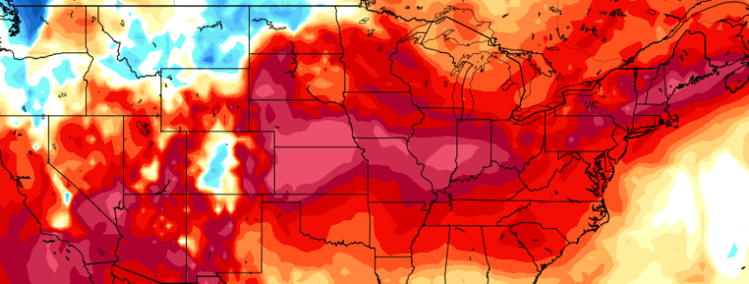
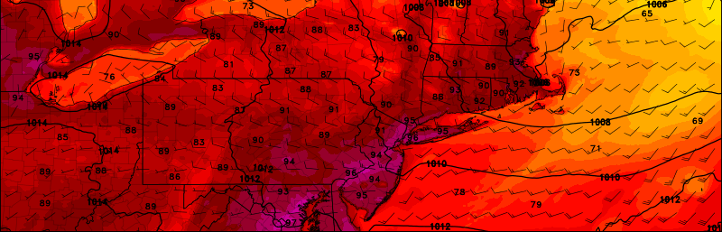
The heat wave started on Friday for most of the region with temperatures reaching the middle to upper 90s. Fortunately some strong to severe thunderstorms stayed mostly northeast of region last night. Today will be another very hot day, with sunshine and temperatures rising into middle to upper 90s again this afternoon — perhaps even touching 100°F in a few spots such as JFK and EWR. It will actually be less humid today than on Friday with drier, gusty west-northwest winds this afternoon. But heat index values will still be near 100°F this afternoon, with the very hot temperatures.

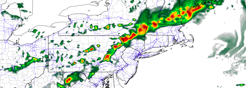
A weak cold front will pass through this evening, but we will remain dry. A slightly cooler and drier airmass behind it will be coming behind this cold front tonight and Sunday. It will still be very warm overnight then hot again on Sunday with temperatures reaching the lower to middle 90s again, over much of New Jersey and NYC metro. Some afternoon sea-breezes may bring some cooler relief near the coast. But humidity will also increase for those areas. Some other highlights for next few days below:

Read more

Multiple rounds of strong storms possible this weekend

A well advertised weather pattern, featuring a large ridge over the Central United States and building heat in the Northeast US, will come to fruition this week. Temperatures will increase fairly dramatically as the end of the week and weekend approaches, with high temperatures reaching into the middle to upper 90s from Friday through Sunday. In addition to the discussed heat has been a well advertised threat for strong and severe thunderstorms.

Along the top of the mentioned ridge will come several atmospheric disturbances, riding along the ridges periphery as the jet stream is shoved to the north with the ridges development. The positioning of the ridge over the Central US suggests these disturbances will slide from Southern Canada, through the Great Lakes, and into the Northeast states late this week and weekend.

Read more

Heat wave, severe storms highlight upcoming weekend

Stock up on the sunscreen.

Forecast models are in good agreement that a large, anomalous ridge over the Central United States will build eastward toward the Mid Atlantic and Northeast states during the middle to latter part of this week. As it does so, very warm temperatures in the mid and low levels of the atmosphere will surge toward the area, and high temperatures at the surface will climb fairly rapidly as the weekend approaches — a heat wave.

By the weekend itself, high temperatures may approach or exceed 100 degrees in many locations, with a piece of the core of the aforementioned ridge settling overhead. West winds — even with a northwesterly component at times — will help to suppress any seabreeze or ocean influence, and keep the air extremely hot, and even dry for a day or two.

Read more

Monday Overview: Hot again, strong storms possible late

The heat is back on, and it’s showing no signs of letting up. After a hot day on Sunday, Monday looks likely to be several degrees warmer throughout much of the area. High temperatures will approach the middle and upper 90’s, especially away from the area coasts. Heat index values in the upper 90’s, occasionally near 100, will make it feel oppressive at times.

In addition to the heat, a threat of strong to severe thunderstorms exists during the late afternoon and evening. This will be especially true across western portions of the forecast area. The Storm Prediction Center has placed western parts of New Jersey and Southeast New York in a Slight Risk for severe thunderstorms on Monday afternoon and evening. Some highlights below:

Read more