-2")
Tuesday Overview: After rain, heat builds this week
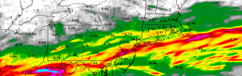
We hope you had a great July 4th weekend! The weather cooperated for most part for outdoor activities over the holiday weekend. But rain with a wave of low pressure moved into the region overnight. Some areas received 0.50″ to 1.50″ of rainfall including parts of Central NJ, NYC and Long Island. Which will only put a small dent in moderate drought conditions in the area. Other areas, especially further north have seen much lighter rainfall.
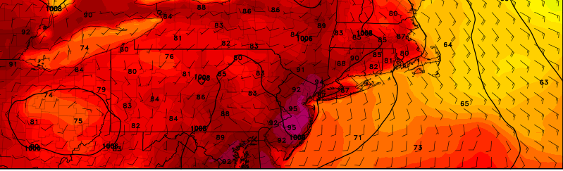
Rain is now ending from west to east over the region this morning. A ridge building over region will cause skies clear for more sunshine this afternoon. Temperature will rise into in the middle to upper 80s. Humidity levels will remain high. Thus, there is slight chance that that a shower or thunderstorm could still pop up around the region later this afternoon or early evening. However, the ridge will continue build with hotter and humid conditions likely for the rest of the week. Some thunderstorms may also be around as well. Here are some highlights for later this week: