Bouts of heat, multiple MCS threats to end July

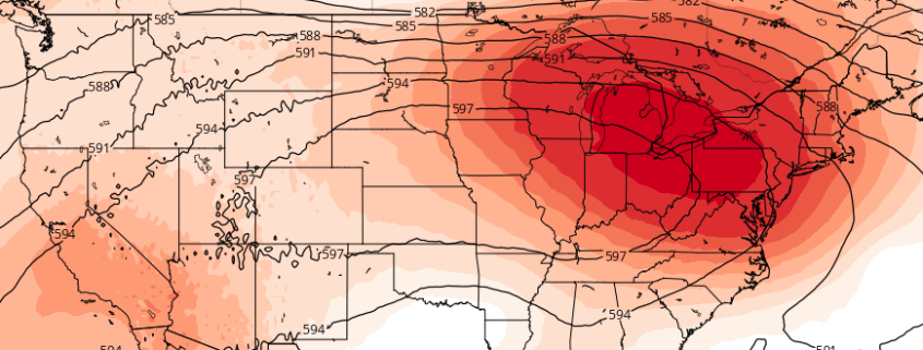
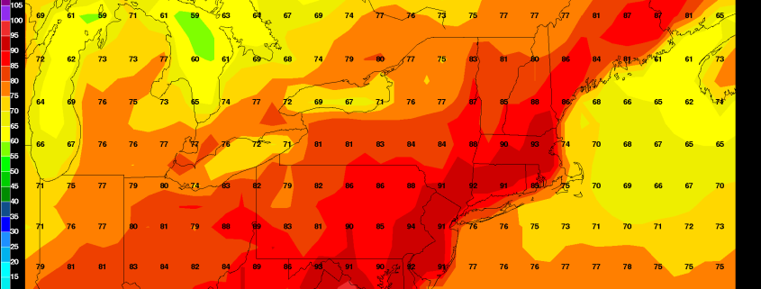
The hot weather is here — and as we have mentioned in our posts for the past week or so, it isn’t expected to go anywhere any time soon. While the pattern will remain somewhat transitional this weekend, a tremendous mid level ridge is forecast to build across the Central United States by the middle part of this upcoming week. This ridge will become the dominant feature in the jet stream and weather pattern throughout the Contiguous United States during this time frame.

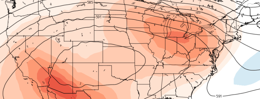
The core of the ridge, and the center of the big-time heat, is likely to stay well to our west. The ridge center is expected to drift from the Mississippi River Valley westward toward the Plains states during the week ahead. However, the breadth of the ridge is likely to grow during this time frame, with rising mid level heights extending all the way to the Northeast United States.

Read more

Weekend Overview: Hot, unsettled pattern takes hold

After strong and severe thunderstorms brought fairly widespread wind damage reports to the area on Thursday, many woke up expecting much cooler air this morning. They were wrong: Temperatures remained in the 70’s and even low 80’s in some spots overnight. Hot weather is again expected on Friday, with highs in the middle 90’s, and it may even be warmer than Thursday near the coast. The culprit? West offshore winds, keeping any seabreeze boundaries right near the coast.

The good news is that the ridiculous, nearly tropical airmass with dew points near 75 will be ushered out of the area by these westerly winds. Although high temperatures will reach into the 90’s, dew points closer to the middle 60’s are likely throughout the area, which will feel like a bit of a relief. A few scattered showers are possible Friday afternoon, but overall, calm and hot weather will be in control. The rest of the weekend looks likely to remain transitional and unsettled. We’ve got the highlights below:

Read more

Alt

Heat, storms increasingly likely the next two weeks

A large and anomalous heat ridge is forecast by most mid-range operational and ensemble model guidance to build over the Central United States. The process will actually begin by early next week, as heights in the mid and upper levels of the atmosphere rapidly increase over the Central United States. Troughing over the Northwest United States will act to enhance this ridging, with mid and upper level heights approaching anomalous levels by the middle to end of next week.

Medium range ensemble support, at this range, is actually quite remarkable. Both the GFS and ECMWF ensemble means (the averages of multiple-member ensemble runs) show a tremendous ridge over the Central US, pulsing and expanding northeastward toward the Great Lakes and Northeast. While the brunt of the unbearable heat will likely miss our area to the south and west, the heat will still be felt. More notably, however, is the fact that our area will likely lie along the periphery of this ridge, in the path of multiple atmospheric disturbances.

Read more

Monday Overview: Pleasant weather today…warming trend for the week

This past weekend was kind of dreary overall with more clouds and showers around. But early this week, is look more beautiful. Some clouds may mix with sunshine at times today. But more sunshine is anticipated today with high pressure over the region. Temperatures will rise into lower 80s over much of region this afternoon with light northerly winds. These temperature are few degrees below average. But it will still feel pleasant overall with low humidity.

This pleasant weather will continue into tonight, with any clouds during the evening hours clearing overnight. Temperatures dropping into the middle to upper 60s over much of the region. Overall this week’s weather looks benign, until Thursday and Friday when some heat and thunderstorms likely return to region. Here are some highlights for this week:

Read more