-2")
Premium: Late month pattern change likely to be gradual
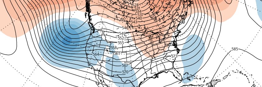
As discussed in the winter forecast, the stratospheric polar vortex has been weakened since late October. A wave-breaking event, mainly induced by a large ridge in the Kara Sea, has resulted in 100mb heat fluxes remaining above average. We still believe the polar vortex is likely to be weaker and more disturbed going into this winter, especially compared to the past several years. However, some resistance from the polar vortex and tropical forcing influences will likely result in more gradual step down into pattern changes over next several weeks.
While westerly zonal winds have decreased to below average levels, a wind reversal or easterly winds aren’t being forecasted, particularly around 10mb and 60N. EPV at 10hpa also appears to shift from being poleward to more equatorward by the third week of November. Despite being severely disrupted; these winds allow for the polar vortex to remain quite large and profound over the high-latitudes. This will likely result in more neutral modality with the AO/NAO over next few weeks.