-2")
Premium: More heat, storm chances on the horizon
The atmospheric pattern so far, for the majority of Spring and now into the first week or two of calendar summer, has been a bit of an enigma. There have been transient bouts of warmth, with showers and thunderstorms, but cooler periods have followed. For the most part, our area has avoided widespread or organized severe weather events as well. Over the next few weeks, that pattern looks to slowly undergo some changes.
While these changes aren’t expected to be sudden or dramatic, the gradual transition will certainly have an impact on the weather that our local area experiences. In todays premium post, we break down what is driving the changes to the pattern, how we anticipate it will evolve, and what the effects on our sensible weather will be — including temperatures, precipitation, and hazardous weather opportunities.
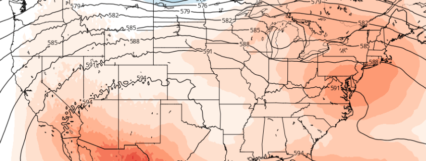
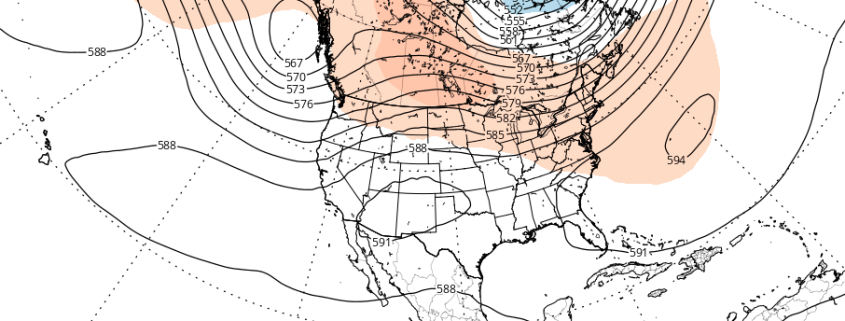
Since the Spring, the pattern has been dominated by a recurring theme of troughiness in Southeast Canada. While ridging has become established over the Central United States, at times, higher latitude blocking — and, often times, an amplified northern jet stream — has allowed for troughs in Southeast Canada to impede the northward extension of that ridging.
