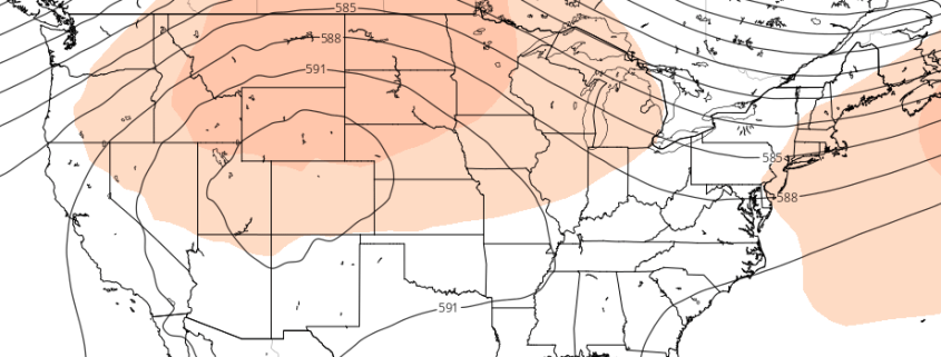
Western US Ridge will serve as pattern’s focal point
Much has been made over the past few weeks regarding the potential development of a large ridge, which forecast models once suggested would build into the Ohio Valley and Northeast States, providing widespread heat and humidity. As you may have figured out yourself, this ridge has yet to develop — and it doesn’t look it will at all, succumbing to the overall hemispheric pattern which has kept the ridge angled towards the Western United States.
Medium range forecast models were much too aggressive with the development of the ridge, once suggesting that the core of it would build into the Ohio Valley. In fact, for a few model cycles both the GEFS and ECMWF suggested that heat would build into the Eastern US, but have since backed off. The development of these large ridges is quite common in the summer (in other words, this isn’t all that anomalous), but the positioning of the ridge is often modulated by the surrounding environment. This year is no different.


