-2")
Public Analysis: Potentially Active Week Ahead With Multiple Thunderstorm Threats
Good Evening!
This morning we saw rather pleasant conditions set up over the area as an area of weak high pressure off the Mid Atlantic coast continues to back towards the east, which has been feeding in southerly/easterly winds from off the ocean. With relatively modest humidity and low level moisture, we saw partly cloudy skies with some more sustained periods of sunshine persist for locations well-removed from the coast. This partly cloudy environment, with a few more clear locations allowed high temperatures to rise into the low to middle 80’s across much of the area. Locations around Long Island and Connecticut saw slightly lower highs due to a more persistent southerly wind, bringing in more a maritime airmass.
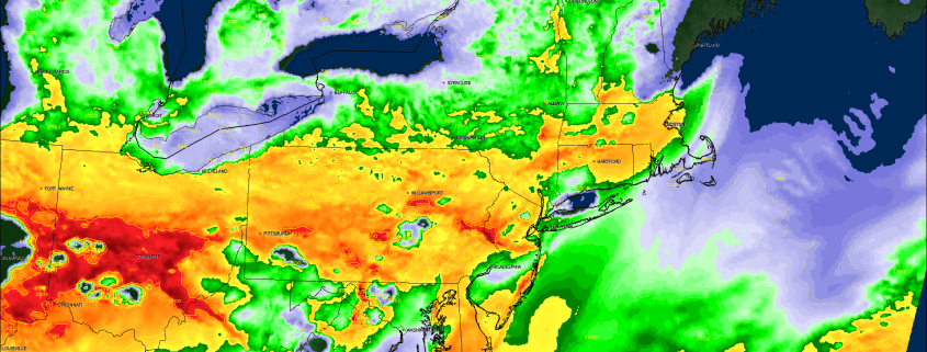
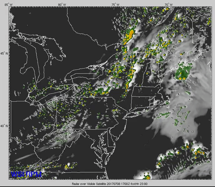
For much of the afternoon this maritime airmass has kept a pretty stout lid on the atmosphere, not allowing any shower activity to develop, but as we can see from the loop below, the dew points (in green) have begun to rise quite a bit due to a weak surface warm front ahead of a mid level shortwave currently located over the Ohio Valley. This surface warm front has some very meager lift associated with it, and with the increased moisture advecting north, it seems likely that some showers and even a brief thunderstorms may develop this evening. Nothing too extreme is expected to develop outside of a locally heavy rain threat as the atmosphere remains in a minimally supportive environment for shower development.
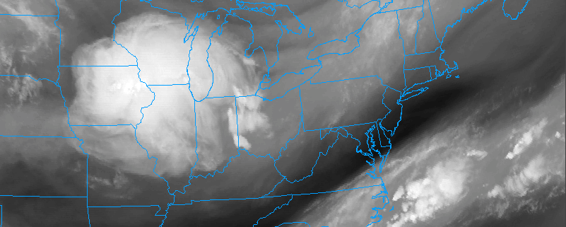
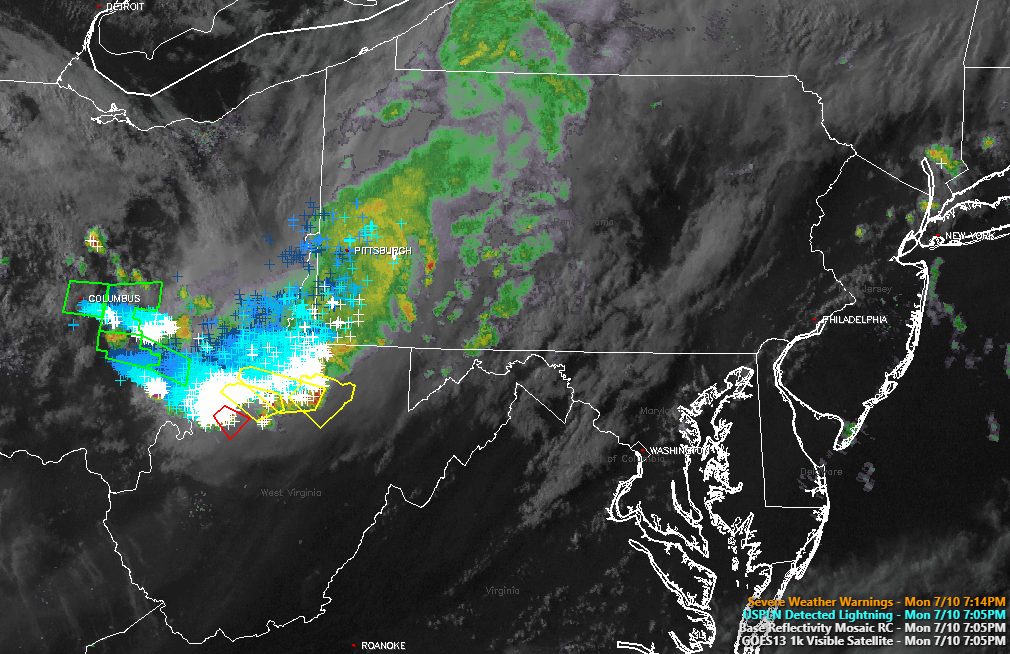
After sunset, the complex located in the Ohio Valley that currently has numerous severe thunderstorm and tornado warnings will continue to move eastward in the aforementioned stable airmass. This will cause complex to weaken significantly, and there has already been a noticeable decrease in lightning activity noted on the regional mosaic. It appears that this afternoons model guidance has been rather poor with its overall performance in handling the shortwave responsible for generating these storms, but it appears that at the very least that an increase in clouds is expected for the Tuesday AM hours.
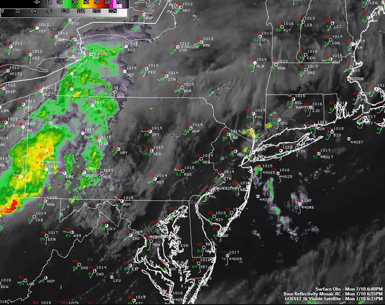
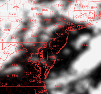
This afternoon/evenings latest high resolution visible satellite, regional radar mosaic, and surface observations showing some weak showers breaking out over New Jersey, with more showers and thunderstorms moving in from the Ohio Valley (Courtesy of Simuawips.com)
Tuesday Into Tuesday Evening
Tuesday morning looks to start off with partly sunny skies, with some heavier areas of cloudiness likely near the coast as moisture continues to increase in the mid to lower levels in the atmosphere through the early morning hours. This moisture will be coming in from the south and west as another shortwave trough and its associated mid level energy quickly moved east during the late morning hours and into the early afternoon. Earlier model guidance had this initial shortwave arriving later in the day on Tuesday, but as I mentioned earlier, these shortwave disturbances in the general flow over the country have not been modeled well, with all the disturbances actually progressing much quicker than originally thought.
So what does this mean for tomorrow? Well, with the first disturbance likely coming through around 11am-2pm, this will mean the area has much less time than originally thought to destabilize through daytime heating. Additionally, it will mean that any shower and thunderstorms that do form will also be able to use up any marginal parameter space that may be present by that time. After this initial passage of showers and thunderstorms, it will be crucial to see whether or not we can lose any left over cloud cover. With winds out of the south/southwest, conditions could be favorable for instability to once again rebound over the area, but this will be very highly dependent on how the initial morning shortwave behaves.
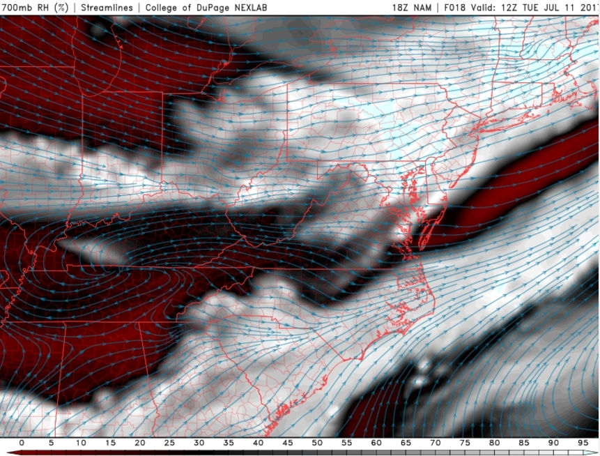
If the area does indeed destabilize to what the NAM and other computer model guidance shows, then forecast soundings from across NJ/NY/CT suggest that showers and thunderstorms could develop off to our west and then begin to gradually move east during the mid to late afternoon hours. As these storms move into a potentially more unstable airmass with modest levels of unidirectional shear, they could grow into mutil-cell clusters, as well as pulse-type cells. The main threat with these storms will be locally damaging winds, very heavy downpours, and even some small hail in the more intense updrafts. While not explicity likely, there may be just enough low-level turning in the atmosphere to support some more robust mesocyclones, but high cloud bases may preclude any outright tornado threat tomorrow. We will likely have to revisit this threat tomorrow morning and afternoon just to get a sense of what the overall threat will be after the initial shortwave passage.
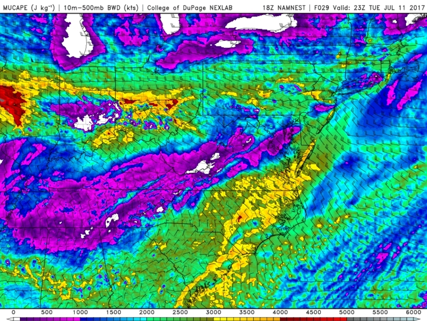
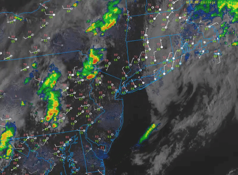
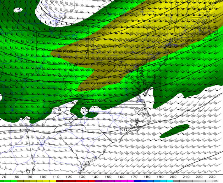
This afternoons NAM model showing the area destabilizing quite nicely after an initial round of showers and storms moving through the area. The situation will have to be monitored closely tomorrow afternoon to gauge the overall threat
Wednesday and Beyond
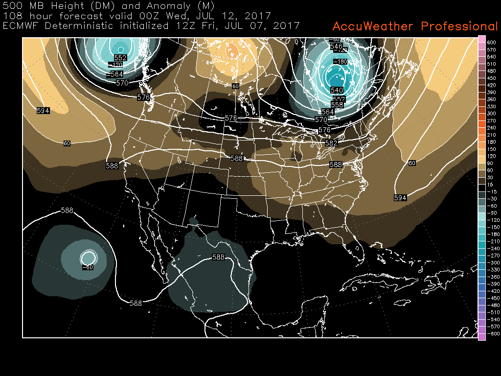
After a calmer and more seasonable day Wednesday, another disturbance approaches the region on Thursday with a surface low tracking north into Western New York State. While it is too early to discuss individual parameters, especially given the degree of uncertainty surrounding convective evolutions prior to the disturbances approach, it appears probable that another threat for strong to severe thunderstorms will evolve during the afternoon and evening hours throughout the Northeast.
Notable height falls are present on most models and ensembles during the afternoon and evening hours, with marginally favorable instability parameters (again including a modified elevated mixed layer and favorable surface instability. Future forecast shifts will have to monitor trends among ensembles and models to attempt to identify local threat regions.
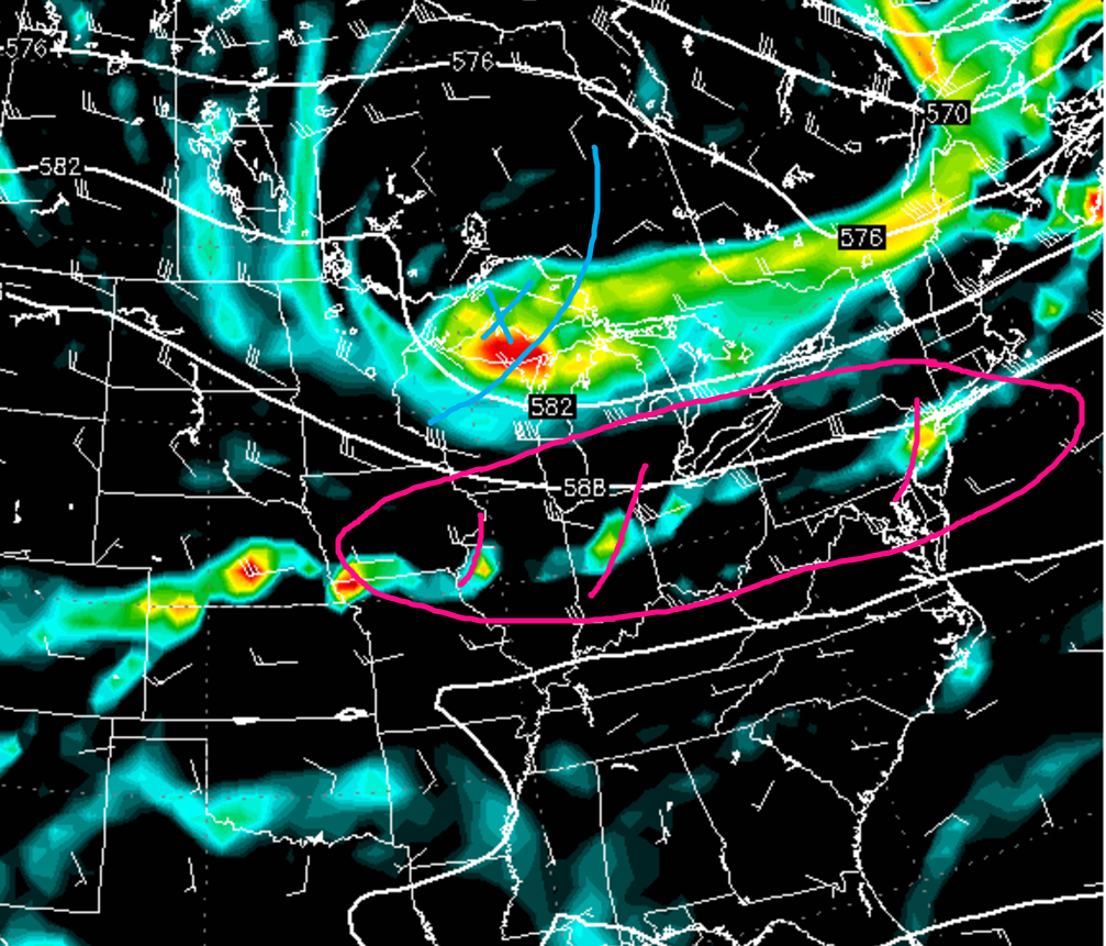
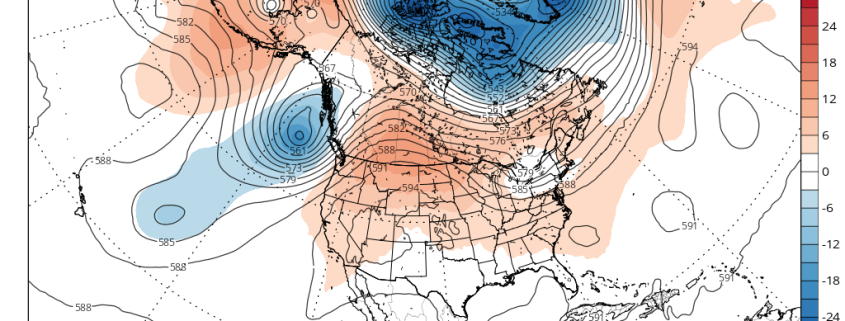
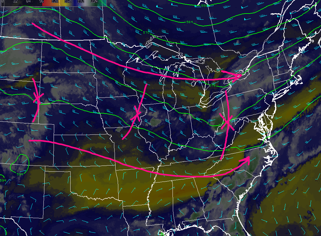
The European model showing another shortwave trough setting up in the Great Lakes region, with multiple disturbances embedded in a west to east flow. This would make it possible for at least a few storm chances later in the week
For more information and posts like this one, make sure you sign up for Premium Forecasts — where multiple detailed articles, videos, and interactives are posted each day. Also, come interact with our staff and many other weather enthusiasts at 33andrain.com!
Have a great evening!
Steve Copertino