Long Range: How and why this weeks ridge positioning is critical

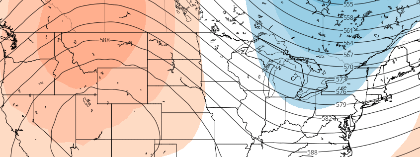
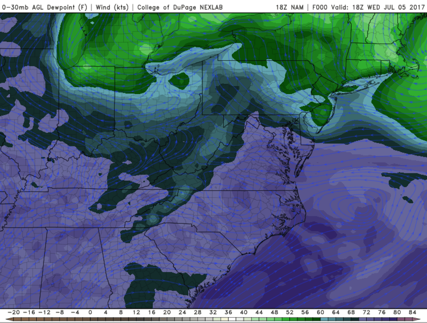
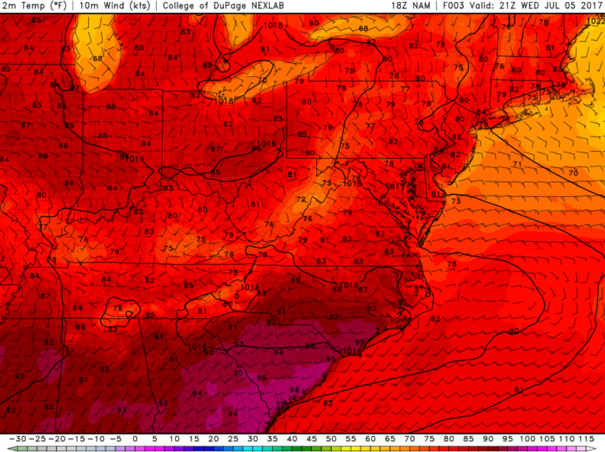
You may have heard over the past few days (or weeks) that a large ridge is developing throughout the Central portions of the United States. You definitely have heard about this ridge if you have agriculture interests — which is who we’re really speaking to in this afternoon’s Long Range Update. The development and positioning of this ridge has been a hot topic for a while now, and after some forecast models suggested the ridge would encompass much of the Eastern US, it has developed well west of those regions.

But, truth be told, there is a  lot more to the forecast than “the ridge is here” or “the models were wrong”. Many professionals, no matter what sector they focus on, will tell you the same thing: Understanding the process of how things occur is more critical than almost everything else. So while we provide the forecasts each day, we like to take the time to explain why things are happening, how they happen, and how we believe they will unfold down the road.

Read more

AM Update: Heavy rain with localized flooding possible tonight

Good morning and Happy Thursday! As we move forward towards the end of the week, which seems to be approaching rapidly after Tuesday’s holiday, the weather has been continually pleasant throughout the majority of the Northeast States. Aside for a few local exceptions, seasonable weather has been the beat of the drum over the past 48 hours, with just a few isolated showers and storms in the Mid Atlantic up until Wednesday Night.

Things have already begun to change, as you may have noticed by a newly southeast wind direction along the shores which is pushing inland. This is known more affectionately as an “onshore flow” and it often signals changing weather in the Northeast, when high pressure systems are beginning to lose their grip or control on the area’s weather. Today is no different: Clouds will increase and the onshore flow will begin to aid in moisture advecting towards the region.

Read more

Public Analysis: Increasing Heavy Rain Threat Thursday, Seasonable Conditions Likely This Weekend

Good Evening! 

We hope you had an excellent holiday weekend over the past few days and managed to dodge any showers and thunderstorms that popped up during Monday and Tuesday!

After some relatively hot and humid days on Monday and Tuesday, today was quite the improvement as a weak area of high pressure off of the Northeast coast moved offshore this morning and ushered in winds from the ocean, which were able to drop dewpoints by quite a bit across the area. A frontal boundary rode northward through the area earlier this morning and into the afternoon hours, which increased clouds briefly, but with the easterly winds coming off the Atlantic, the atmosphere was able to stay relatively stable and prevented the development of showers. The cooler marine airmass and relatively sunny skies allowed temperatures to climb into the upper 70’s and middle 80’s across the region this afternoon, which is just slightly below normal for this time of year.

Read more

Storms may return late Thursday into Friday

Enjoy the pleasant, warm weather over the next 24 hours: Unsettled weather is likely to return over the days that follow as  disturbances begin moving into the Northeast and Mid-Atlantic from the west on Thursday. There’s now an increasing likelihood of a period of heavy rainfall with some thunderstorms in the parts of the region later Thursday night into Friday morning.

Some mid-level warm air advection and sheared vorticity will cause cloud cover to increase throughout the Northeast tomorrow. A few showers are possible over the interior during the afternoon or evening, though high pressure offshore will likely provide enough subsidence (sinking air) to keep most of the region dry. Temperatures tomorrow will reach the mid to upper 70s near the coast and lower 80s inland, with more cloud cover along the coast and an onshore flow.

Read more