Good Evening!
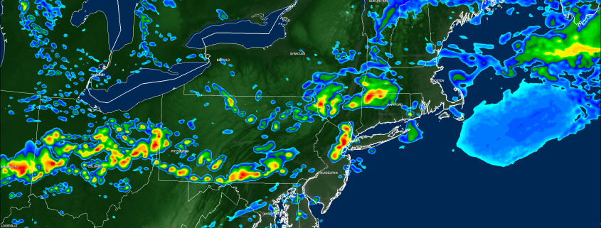
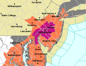
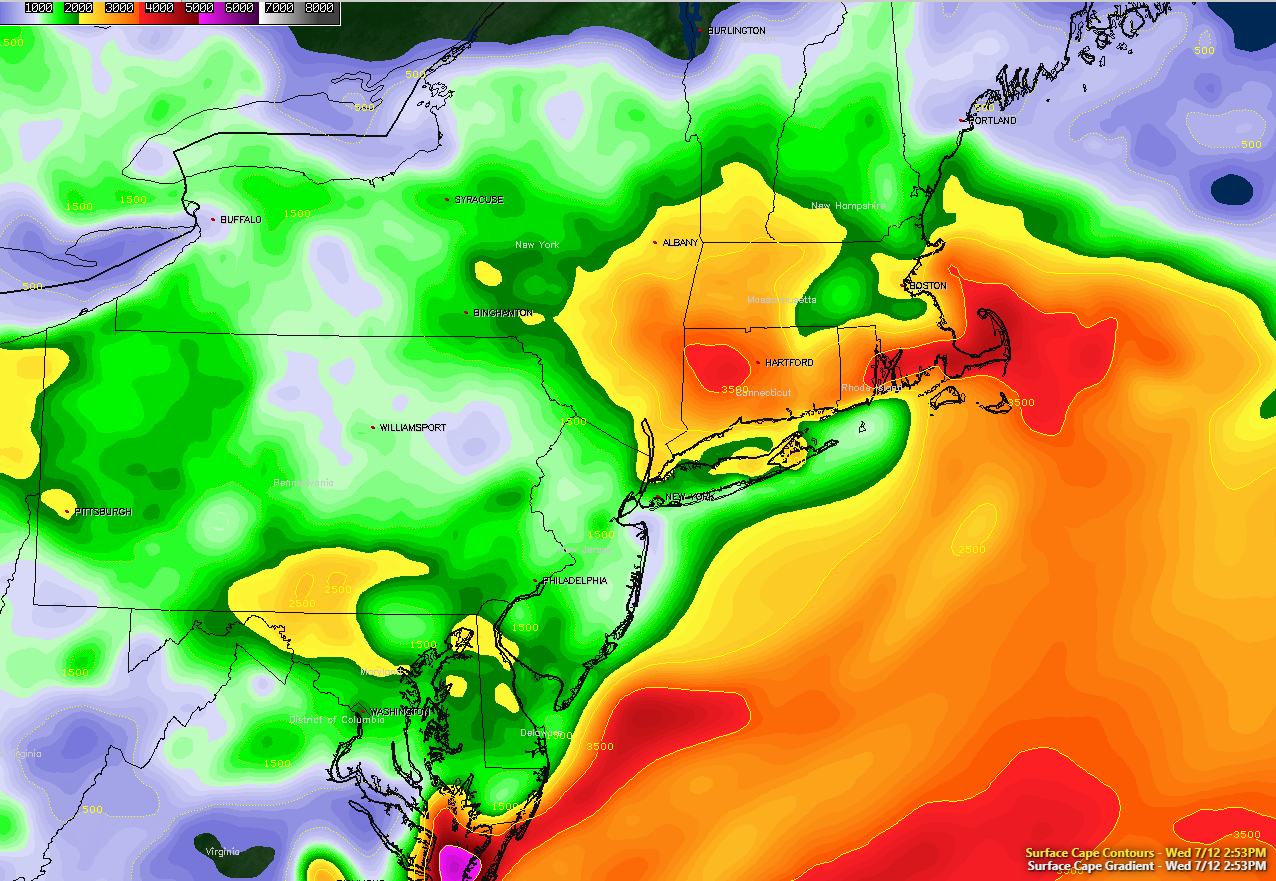
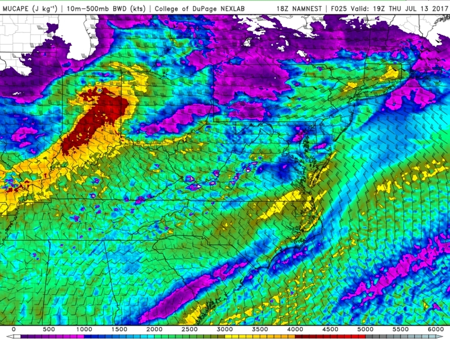
Today we saw the development of numerous showers and thunderstorms across the southern half of the metro area, with some of the storms being on the strong to severe side. These storms were fueled by the remnant frontal boundary that sank southward to portions of southern NJ earlier this morning. Deep tropical moisture was able to remain anchored within this boundary, and as daytime heating took over, instability was able to increase quite markedly over portions of southern Pennsylvania and New Jersey. As the last in the long series of mid level disturbances embedded in the west to east flow approached this very moist and unstable airmass, thunderstorms rapidly developed-bringing large hail, damaging winds, and very heavy rainfall. Some localized reports of wind damage were reported in Pennsylvania, Delaware, and portions of New Jersey, but overall it wasn’t a huge day for severe weather.
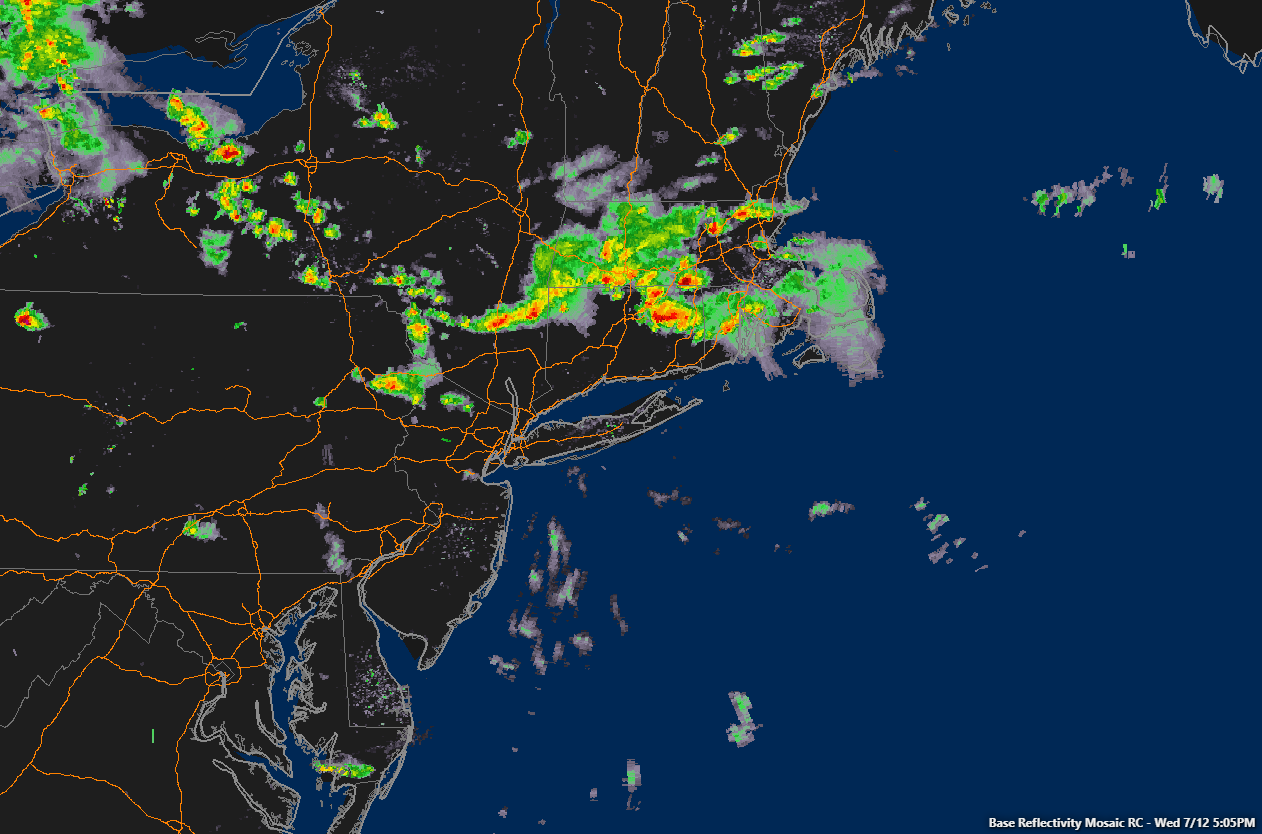
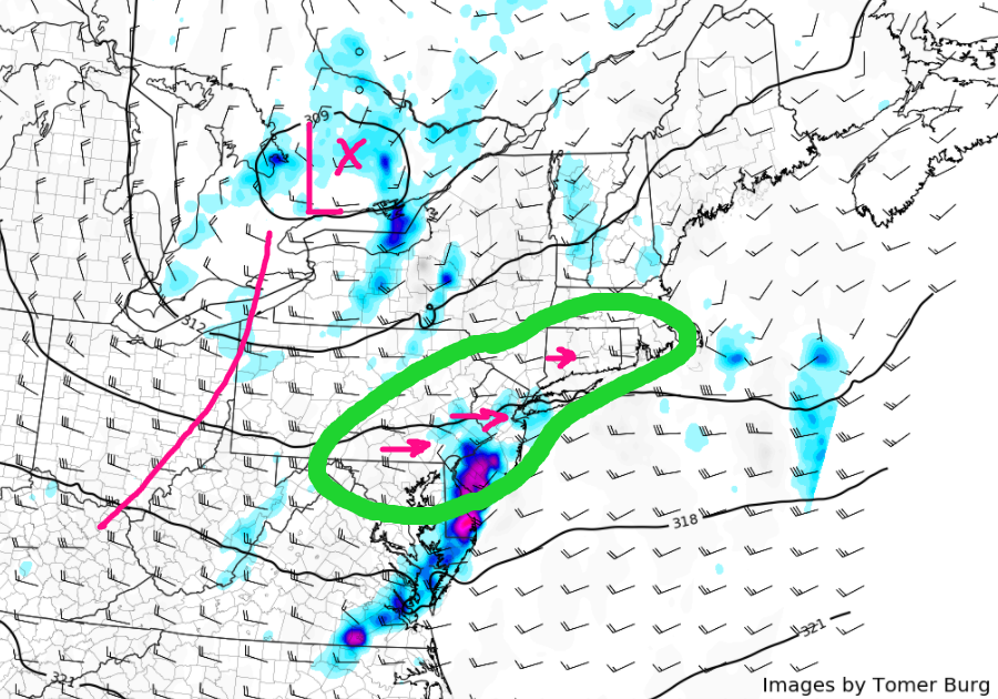
The showers and thunderstorms gradually moved into a more stable marine airmass near the coast, which caused them to weaken below severe thresholds and limited impacts to mainly heavy rain and frequent lightning. These showers will continue to head off the coast later this evening, giving way to more mild and cloudy conditions. As we head deeper into the evening, a shortwave trough and the accompanying energy will begin to push into the region, and due to the fact that there is still some residual moisture/instability, we cannot rule out a couple showers and even a late thunderstorm developing. Any storms that form would almost certainly remain below severe limits, with the main threats just being heavy rain and gusty winds.
Lows this evening will remain right around what the current temperatures are due to thick cloud cover and residual low level moisture trapped due to a temperature inversion a few thousand feet up in the atmosphere. Some patchy fog may try to develop this evening for some locations, but overall development should not be all that widespread.

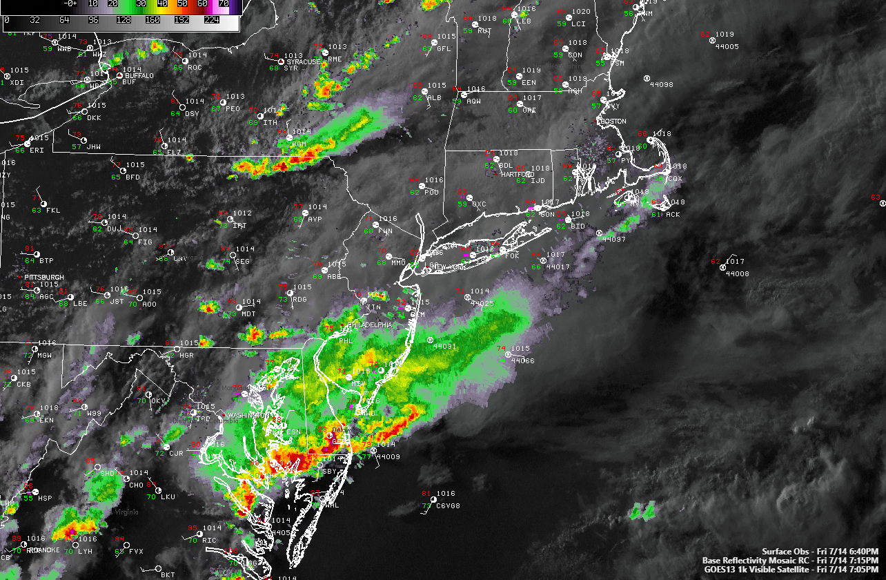
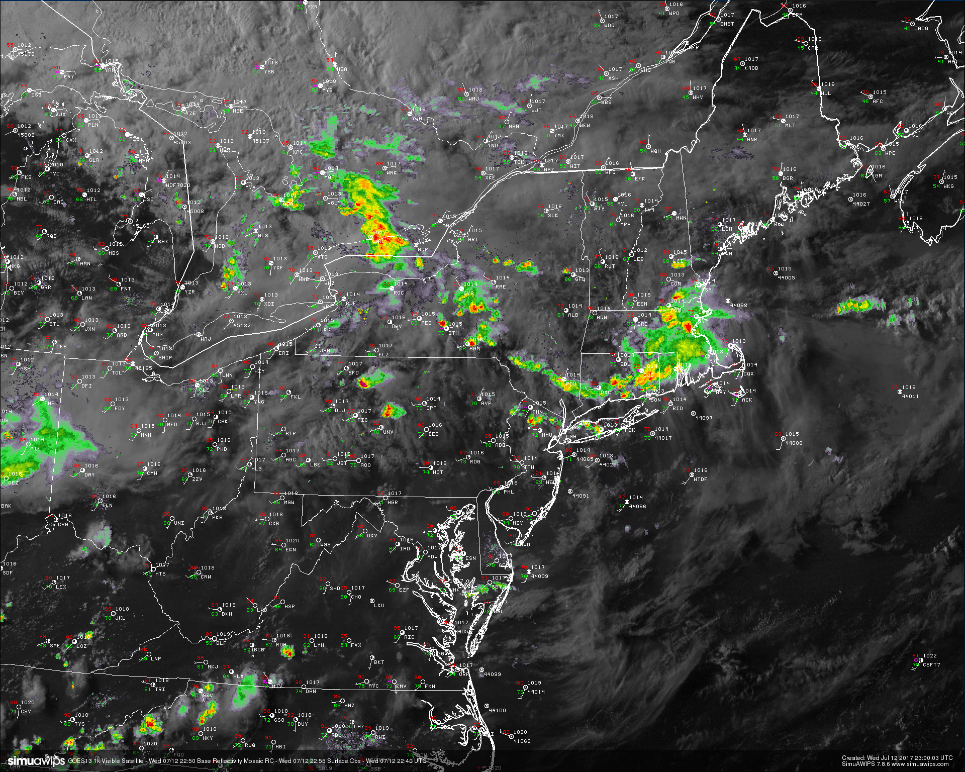
This evenings latest regional radar mosaic, surface observations, and high resolution visible satellite imagery, showing the bulk of the showers and thunderstorms moving off the Mid Atlantic coast (Courtesy of Simuawips)
This Weekend
Improving conditions are expected starting on Saturday as the upper level trough that has been providing the area with numerous rain chances finally swings through early in the morning hours. This will cause any residual fog to quickly dissipate as the low level moisture is quickly swept out of the region. Clouds should also begin to decrease in earnest as an area of high pressure begins to gradually build in from the west, centered over the Ohio Valley. Conditions tomorrow should feel much improved from the past few days, with dewpoints dropping quite considerably, giving way to a much more comfortable airmass. With increasing sunshine, a warm mid level airmass, and low moisture content in the atmosphere, temperatures should be able to rise to around seasonable levels-with lower to middle 80’s likely areawide.
High pressure will continue to build over the area as we head into the evening hours, allowing for even clearer conditions to develop just in time for sunset. The high pressure will also allow winds to become quite calm by the early evening hours, and with calm winds, low dewpoints, and clear skies, its looking quite likely that some radiational cooling will take place tomorrow evening, which should allow temperatures to drop into the middle 60’s across the entire area, which is just around normal for this time of year.
Sunday will likely be repeat of Saturday, with clear skies, low dewpoints, and light winds being the theme once again. The mid level airmass will be a little warmer on Sunday due to winds shifting to the west/southwest, so we expect highs on Sunday to be a little warmer, with temps reaching into the upper 80’s and lower 90’s across the region. Sunday evening will also be near-perfect, with clear skies and light winds, which will allow for cooler temperatures to return. Overall, it’s looking likely that this weekend will be quite beautiful and should be great for any outdoor activities as we undergo a temporary airmass change!

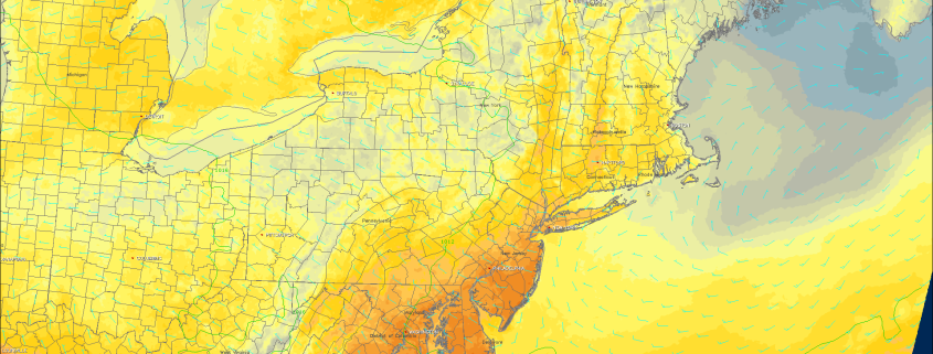
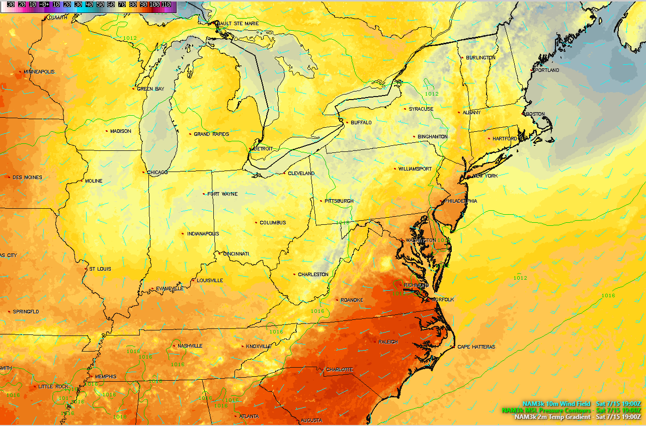
This afternoons high resolution North American Model, showing light northwesterly winds, warm temperatures, and an overall pleasant airmass over the area, which should make for a beautiful day!
Next Week
The next threat of rain looks to come early in the week next week, as an upper level trough approaches from the west and drags another humid airmass from the south. This will greatly increase instability over our area, which will set the stage for afternoon thunderstorms, capable of heavy rain and gusty winds. This afternoons model guidance disagrees with regards to the handling of this piece of energy as it heads towards our area, but it seems possible that the threat of showers and thunderstorms stays around until at least Tuesday. Temperatures for the beginning half of the week should be around-normal, but this will be highly dependent on the amount of cloud cover and rainfall that we may receive.
For more information and posts like this one, make sure you sign up for Premium Forecasts — where multiple detailed articles, videos, and interactives are posted each day. Also, come interact with our staff and many other weather enthusiasts at 33andrain.com!
Have a great evening!
Steve Copertino
-2")
