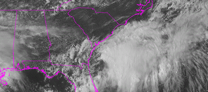
Potential Tropical Cyclone Ten: Significant Impacts in the Carolinas Possible

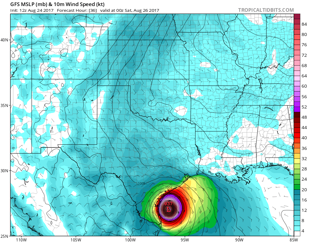
Plenty of attention has been on Harvey this weekend making landfall as a major Category 4 hurricane near Rockport, Texas, and then causing catastrophic flooding in and near the Houston Metropolitan area. This will likely not change over the next several days, as Harvey continues to meander over South Texas, dumping waves of heavy rainfall. But another storm is beginning to take shape off the Southeast Coast. This storm has been classified by the National Hurricane Center as Potential Tropical Cyclone Ten, which was previously invest 92L that was followed since it was way out in the Atlantic. Wind shear and dry air over much of the Western and Central Atlantic had kept this system from organizing. However, this system has become better organized just off the South Carolina and Georgia coasts this afternoon.

Read more

Hurricane Harvey Midday Update: Devastating Impacts Expected in South Texas

About six days ago, our forecasting team got together to discuss the possibility of tropical development in the Gulf of Mexico. After some debate, we decided to push an update out to clients that detailed the potential for Harvey — then an open wave — to regenerate into a tropical storm again and pose a threat to the Gulf Coast, perhaps reaching minimal hurricane strength. However, we never could have imagined, at the time, that the situation would become this dire or significant, as Harvey rapidly intensified from a tropical depression into a category 2/3 borderline hurricane over the past 24-36 hours. It’s usually quite difficult for an open wave to rapidly intensify after days of weakening over the Yucatan Peninsula. But Harvey defied those odds, which will result in devastating impacts.

Hurricane Harvey continued to strengthen slowly this morning, with the pressure slowly dropping into the 940mbs. As of 11am maximum sustained winds were still at 110mph, just underneath Category 3 strength. The hurricane continues to move north-northwest with outer rain bands now reaching the Texas Coast, with some tropical storm force winds. Harvey is expected to continue to intensify today into a major hurricane, while it moves over very warm sea-surface temperatures and heat content over the Western Gulf of Mexico, with a continued very favorable mid-upper atmosphere for strengthening.

Read more

Midday Update: Harvey now a hurricane, major hurricane likely before landfall

Harvey has been strengthening this morning, with dropping pressure and increasing winds per the latest information from the hurricane hunter aircraft and dropsondes. In fact, a special 1:00pm EDT update has confirmed that Harvey has already strengthened into a hurricane, with winds of 80mph and a pressure down to 981mb. Based on latest satellite imagery, which shows thunderstorms exploding around the eye, as well as the aforementioned new observations, Harvey may be starting to rapidly intensify. It is now expected that the storm will strengthen into a Major Hurricane prior to landfall in Texas.

The potential for the storm to strengthen into a Major Hurricane prior to landfall has been present all along, but remains highly dependent on the exact speed and track of the tropical system. As it stands today, however, the conditions surrounding Harvey are highly favorable for rapid intensification. Within a low shear environment and underneath a larger, broad anticyclone, Harvey appears likely to develop asymmetrical outflow characteristics with a strong, deep core and eyewall.

Read more

AG/Energy AM Update: Harvey Strengthening & Expected to Become a Hurricane

Good morning! This is a special morning update on Harvey in the Western Gulf of Mexico. Harvey became a tropical storm overnight and continues to strengthen this morning, as convection increased and deepened around the center. As of the 8am advisory from the National Hurricane Center, the storm has maximum sustained winds of 60mph, minimum central pressure has dropped to 986mb and the storm moving north-northwest at 10mph. Further strengthening is likely today, as the storm continues to move over very warm waters in the Western Gulf of Mexico and the atmospheric environment becomes more favorable. Harvey is now expected to become a hurricane by tonight or Friday. Thus a Hurricane Warning has been issued for Port Mansfield to Matagorda along the South Texas coast. Hurricane Watches and Tropical Storm Warnings are now in effect for other parts of Texas and Northeast Mexico coast.

Read more