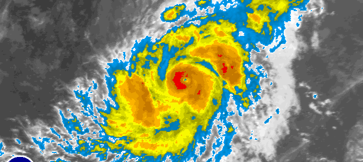
Major Hurricane Irma and Its Potential Future

Good evening! After the devastation and catastrophic flooding from Harvey meandering over South Texas and Southwest Louisiana over the past week, we were finally relieved to see that that storm has now moved out of the Western Gulf of Mexico region. Heavy rainfall will continue over the next few days over the Tennessee Valley from the remnants of Harvey, before it becomes absorbed into a frontal system developing over the Northeast. But as we approach the peak of hurricane season, more tropical threats are rising. One such threat is Hurricane Irma which is becoming a powerful hurricane already today.

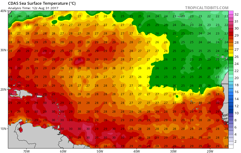
Irma has been rapidly intensifying over very warm waters and a favorable atmospheric environment, since it became a tropical storm on Thursday. It is now a major Category 3 hurricane with maximum sustained winds at 115mph. Irma will continue moving on a west-northwest path over the Eastern Atlantic over next few days. It will be moving over slightly cooler waters (still sufficient for maintenance at around 26 C) and some mid-level dry air from ridging, which might at times slow down the rate of intensification over the next 2-3 days.  But overall, an upper-level anti-cyclone will support low shear and more upper-level outflow over the hurricane. So Irma will likely continue to strengthen into a Category 4 by early next week.

Read more

More Tranquil Weather Returns, Harvey’s Remnants Possible for the Weekend

Good morning! After a cloudy, wet day on Tuesday, today will much improved, as a Nor’easter moves farther into the Atlantic. Mostly sunny skies are expected with dry westerly winds by this afternoon. These conditions will help temperatures rise into the middle to upper 70s, with some spots possibly reaching 80 degrees. These temperatures are near or slightly below normal.

Clear skies and light winds are expected for most of the night. This will lead to some radiational cooling with temperatures dropping into the 50s over the Interior Valleys and Pine Barrens and into the lower to middle 60s over more urban and coastal areas.  Then a cold front associated with a shortwave trough will be moving through the Northeast on Thursday. More clouds are likely to mix with sunshine with temperatures rising into the upper 70s to lower 80s, ahead of the cold front.

Read more

Cool risks exacerbated by recurving typhoon in the Western Pacific

While much of the focus over the past few days has been on Hurricane Harvey, and rightfully so, another tropical cyclone will have an impact on the weather in the United States. We have spoken many times in the past regarding the importance of re-curving typhoons in the Pacific Ocean. These tropical systems can have major impacts on the mid level atmospheric patterns there, which eventually results in changes downwind over the United States.

Read more

Potential Tropical Cyclone Ten Update: Rain, Winds, Rough Surf for the Mid-Atlantic Coast Tuesday

Good afternoon! Our forecasting team continues to monitor Potential Tropical Cyclone Ten, currently sitting off the South Carolina coast. The system still looks lacks a well-defined center of circulation this afternoon. However, deep convection has increased around and east of the center. It still possible that storm will gain enough organization for it to be classified as tropical depression or Tropical Storm Irma tonight or Tuesday. Tropical Storm Warnings have now been issued for parts of the North Carolina coast.

The storm is still underneath some strong west-southwesterly shear. If this becomes a tropical cyclone, it’s unlikely that this system will intensify into a hurricane before becoming a non-tropical storm or Nor’easter by Tuesday night or Wednesday off the Delmarva. Regardless of classification, potential impacts are not likely to change along the Mid-Atlantic and Southern New England Coasts. Heavy rainfall will likely spread northward over Eastern North Carolina and Southeast Virginia later tonight. Rainfall totals between 2” to 4” with locally higher amounts are likely. East-northeast winds will likely gust to tropical storm force between 40mph and 60mph.

Read more