We are already rapidly approaching a new time of year — Meteorological Fall — which starts on September 1st. As the seasons begins to turn, we always find a little extra excitement in issuing our September outlook. There is something inherently more significant about it; maybe the colder trend in temperature, the approaching change in wavelength, or the growing hum of conversation about the winter ahead.
The beauty of meteorology is that each year, month, week, and even day have their own flavors that make every forecast a unique challenge. At the same time, there are also some general themes and correlations that one can continually follow with reliance as the forecasting process unfolds. One of these correlations (which will appear in our monthly and seasonal outlooks quite frequently, but remains especially important here) is the MJO — the Madden Julian Oscillation. Meanwhile, one of the unique flavors will be an inherently increased propensity for ridging in the West and some high-latitude blocking in Canada. The goal is to combine the correlation and the unique flavor to create with discernible ideas on tangible, sensible weather effects.
Without getting into too much technicality, MJO represents the activity of thunderstorms and convection at or near the Equatorial latitudes. As latent heat gets released from this convection, it can have a big effect on the associated ridges and troughs across the entire globe. The MJO is broken down into 8 phases, which depend on the location of this convection.
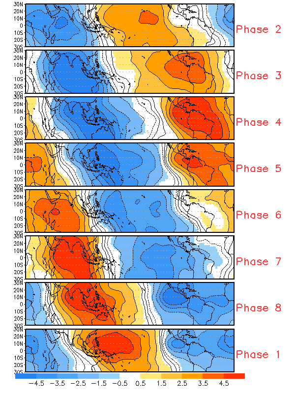
A plot correlating where convection is located and the associated phase of the MJO (CPC).
In the above image, the blue colors represent areas of enhanced convection, and the red colors represent enhanced subsidence. Let’s compare this to where we may potentially be headed to start September — the first panel displays today, the last panel (bottom) displays the September ideas amongst forecast model guidance.
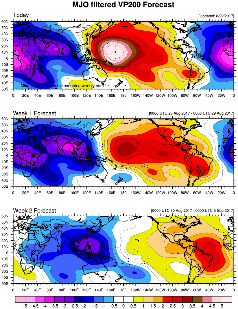
The MJO forecast for the next two weeks shows most of the convection being focused in the Indian Ocean (Michael Ventrice).
Again, the blue colors represent enhanced convection, and the red colors represent more subsidence or sinking air. The above panel shows most of the convection being focused in the Indian Ocean, which is associated with MJO Phases 3, 4, and 5, based on the prior image. It does appear that the convection will be focused a bit east of where phase 3 historically resides, so we can focus on phases 4 and 5 with more confidence.
Now that we can at the very least start September with the MJO in phases 4 and 5, we can correlate these phases of the MJO with the general ridge and trough patterns across the globe.
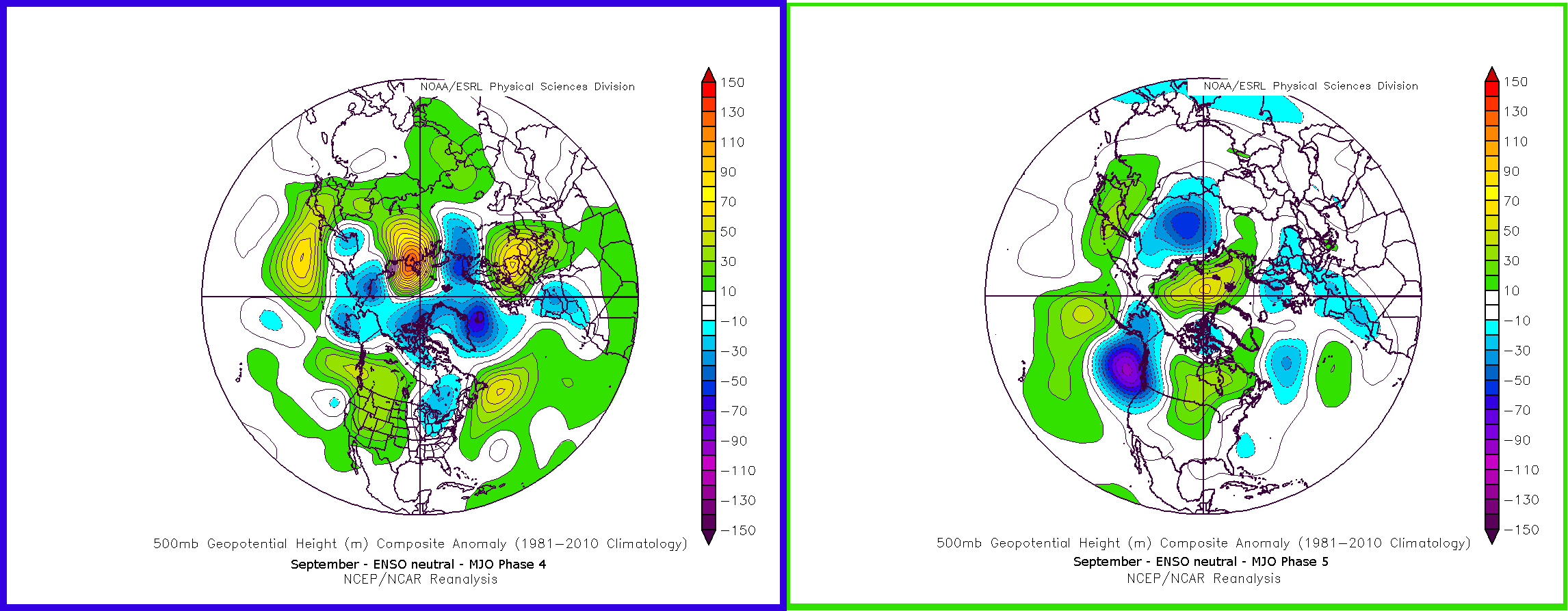
These are composites showing the MJO phases 4 and 5 and their associated 500mb ridge and trough patterns across the globe (Meteo Network).
MJO phase 4 analogs show a clear, large ridge in the Western US, with troughing in the Midwest — pretty similar to the pattern that is currently developing, though there are some subtle differences (our current pattern has more blocking in Canada). MJO phase 5 analogs show the ridge in the West progressing east towards Southern Canada — possibly the result of a decaying Omega Block in Canada as well, which also is part of the current pattern progression we are seeing in medium-range model guidance.
The fact that we are already seeing hints of the MJO phase 4 and 5 patterns developing without necessarily being in those phases today shows that there are other facets to the pattern that may be “teaming up” with the MJO to amplify these effects. This lends more credence to these general ideas going forward to September. But the aforementioned MJO forecast image only runs through September 5th — what about the rest of the month?
Although on different time scales, convection in the Indian Ocean is generally associated with a La Nina, which thus adds credence to the idea that there are La Nina aspects to the developing pattern. Further examples of this are seen from the AAM — Atmospheric Angular Momentum. Again, without getting overly technical, the positive phase of the AAM is generally associated with El Nino, and the negative phase of the AAM is generally associated with La Nina.
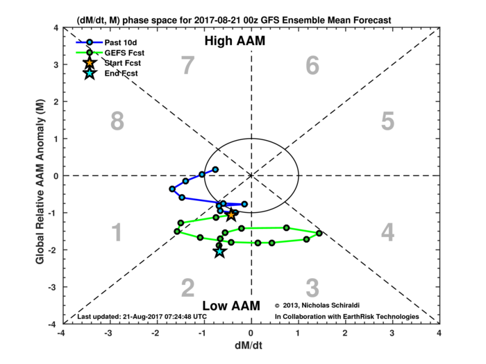
The GFS ensemble forecast strongly suggests the AAM is heading into a negative state, which is consistent with La Nina conditions (Albany/Nicholas Schiraldi).
The above GFS ensemble forecast strongly suggests that the AAM is going to be headed negative, and perhaps staying there for quite some time. It is, undoubtedly, evidence that the pattern is going to be shifting towards a general La Nina base state, even without an official La Nina designation. This can help provide a feedback mechanism to enhance the MJO in its currently evolving phase 4 and 5 state as well as keep it there in the longer term. Thus, while the MJO may at times briefly show some phase 6 characteristics as it “progresses”, the La Nina base state developing will generally mean that phase 4 and 5 forcing should be the general rule, at least for a good part of September, rather than just the first week of the month.
This again lends credence to the idea that September should feature, on average, a strong ridge in the Western US which may at times bleed east and interact with an Omega block in Canada, encouraging further amplification. In other words, or laymen terms, the overall ridge axis near the Rockies appears likely to remain stagnant for much of September, despite the possibility of some variation from west to east at times.
When considering a few other technical factors (QBO, summer wavelength trends, stratosphere), we expect a ridge to generally be over the West in the means — perhaps for about two thirds of the month. The other third of the month may see this ridge shift a bit further eastward in the means as it readily interacts with the high-latitude blocking pattern in Canada. This will at times create a trough West –> ridge Central US –> trough East pattern. Additionally, high-latitude blocking in general, regardless of the exact ridge positioning, may allow some lower heights to progress eastward towards the Great Lakes and Northeast, underneath the blocking and downstream of the ridging.
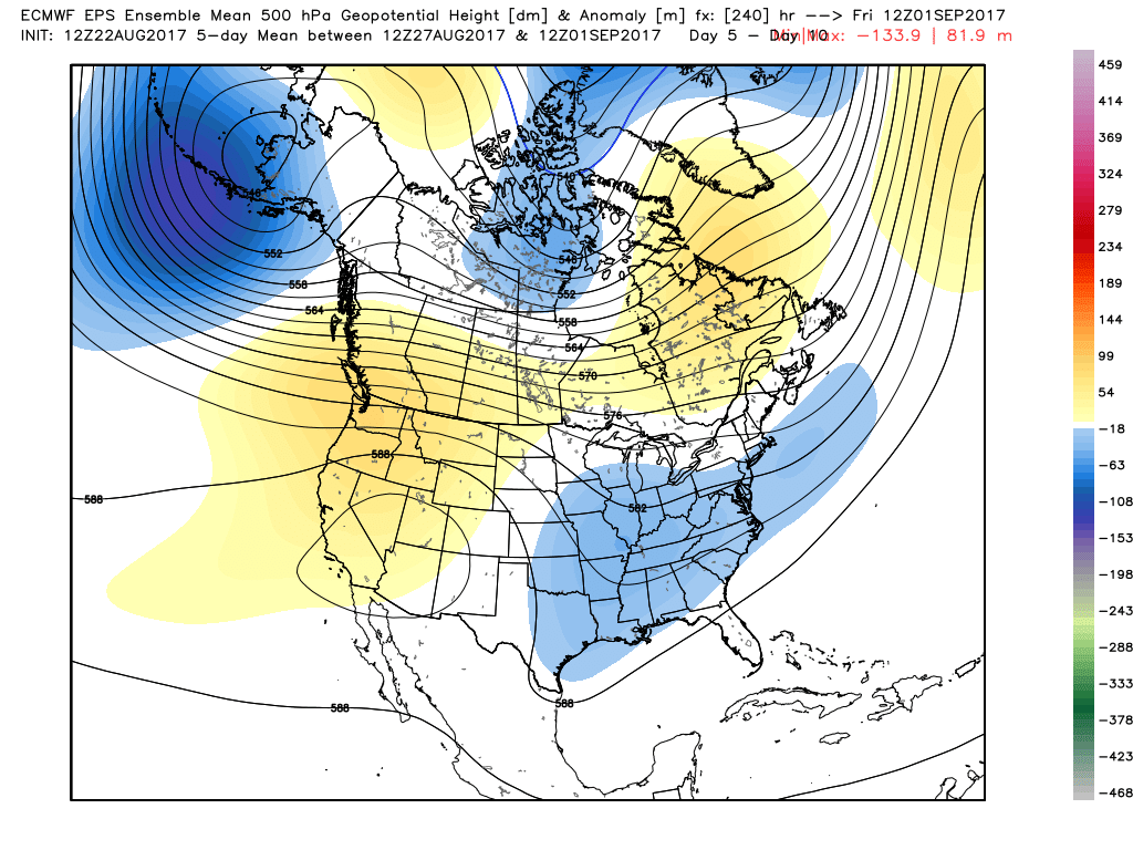
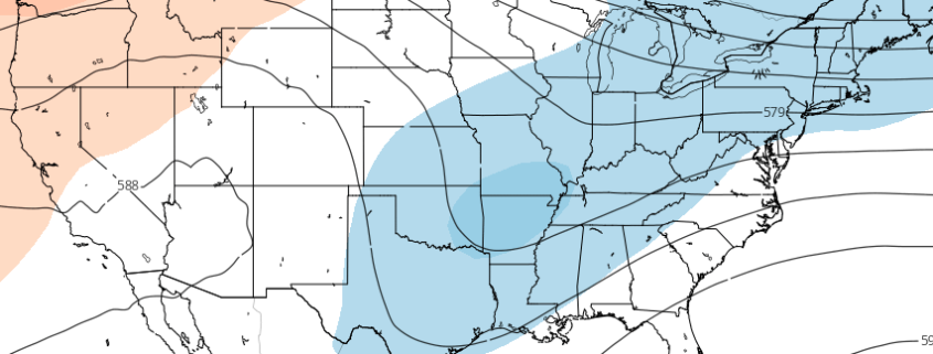
Forecast model guidance is already catching on to the idea of a Western USA ridge and Central USA trough through September.
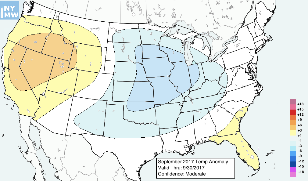
This actually suggests, despite initial forecasts and forecast models, a somewhat dry pattern for a large portion of the Corn Belt — more so the western half of it — as it oscillates from being on the upstream side of a trough (cool and dry) and on the downstream side of a ridge (seasonable and dry). It leads to a warm pattern for much of the West, and somewhat cool anomalies in most of the Central US as well, though with perhaps the core of the cool anomalies shifting a tad east into the eastern Corn Belt/Missouri/Tennessee/Ohio Valleys late.
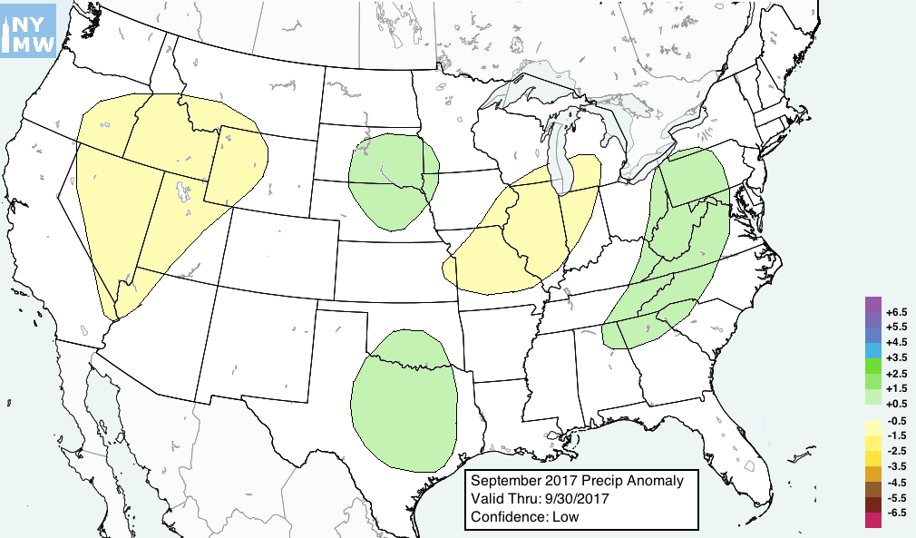
On the downstream side of these troughs — in the Deep South, the eastern Corn Belt and Ohio Valley and even parts of the Northeast at times, precipitation events can be focused — though the immediate Eastern Seaboard may be a tad east of the core of the action. Temperatures on the East Coast are likely to remain transient and nearer to average than areas to the west, as periodical southwest flows develop allowing for warmer anomalies to offset the cooler air otherwise in place.
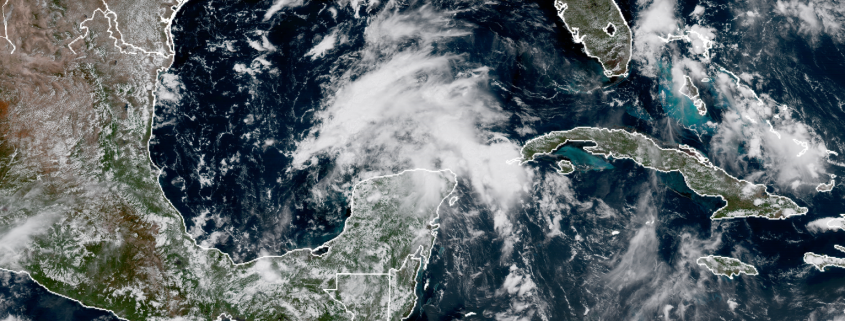
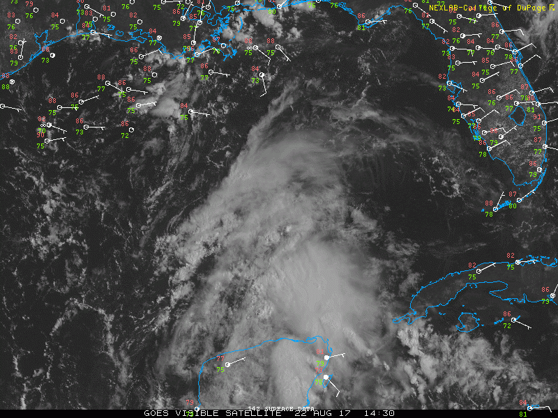
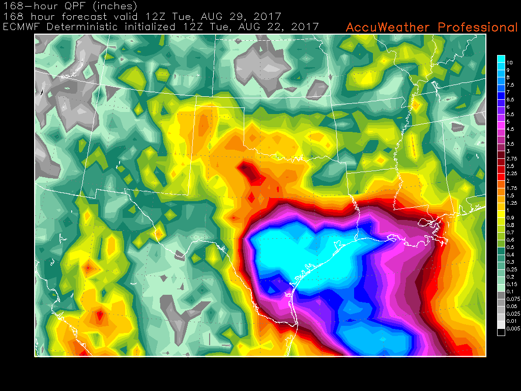
Some variables remain uncertain — especially including the tropics, which obviously cannot be fully accounted for in precipitation outlooks throughout the month. However, our confidence on this forecast is higher than moderate, especially given the overall wavelength pattern and spatial distribution of anomalies. Maps are included below.
-2")