3/26 All Zones AM Update: Cold & Dreary Today with Showers into Monday

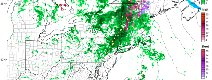
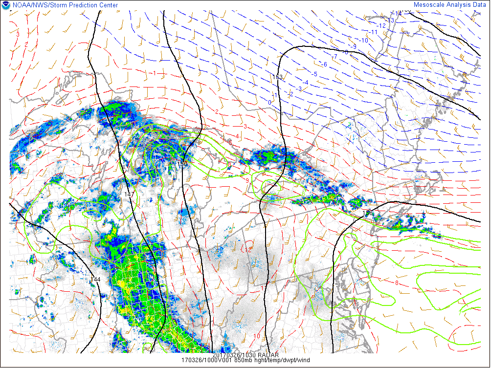
Happy Sunday morning! Thanks to strong high pressure over Southeast Canada, a backdoor cold front has pushed well south into the Mid-Atlantic region this morning. This has caused a colder marine airmass with cloudy skies and light northeast winds move into region. A band of rain showers along a 850mb thermal boundary have been running over Southeast New York and Northern New Jersey since the overnight hours and is now slowly moving northeast. Some of the highest elevations over the Interior, may even see some freezing rain with these showers  this morning, with surface temperatures near freezing early this morning. Which could lead to icy spots on some roads.

Read more

3.25 AM LR/AG: Wet, active pattern still likely to develop

Good morning! While Saturday mornings are a bit more quiet for our AG/Long Range friends — we didn’t forget about you! Hopefully you’re able to grab a cup of coffee and enjoy a quick discussion with us. Our article this morning will be a bit shorter, as we briefly detail some updates and the latest information we’re analyzing on the pattern ahead. The pattern change we have been discussing for a few weeks is already underway.

Yesterday we spoke at length about the upcoming pattern and why we believe it will feature more active, stormy tendencies across the Plains and the Central United States including the Southern and Central Corn Belt. Not much has changed with our current thinking moving forward over the next week or two. As we move into the upcoming weekend, multiple storm threats will have already evolved across the Central United States.

Read more

3.25 AM Zones: Fleeting warmth as backdoor cold front approaches

Good morning! Warm weather will move into the Mid Atlantic and parts of Southern and Central New Jersey today (it already has) as a warm front slowly creeps northward into New England. It will only be there very briefly, much to the disappointment of those who are hoping for the quick arrival of Spring. Instead a cold front/backdoor cold front hybrid will sink southward from Ontario into New England as the day goes on today.

The cold air to the north and well developed southerly flow with warm air to the south will create quite a thermal gradient as the day goes on today. Unfortunately, for most, this means the return of clouds and showers as the colder airmass will win out over time. The backdoor cold front will sink southward from New Jersey and New York City back into the Mid Atlantic States as the day goes on today.

Read more

3.24 PM Zone Update: Difficult, unsettled forecast this weekend

A wonderful Friday evening to you all! The weather was quite unsettled and wintery this morning across the interior, where a mix of sleet and rain fell across the higher elevations. A larger and more significant threat was inhibited by warmer temperatures near the coast as well as limited moisture in the atmosphere. Showers then become more common throughout the area, but have since tapered this afternoon and will continue to do so this evening.

Some limited moisture still exists, but not enough lift is present in the atmosphere to produce precipitation through the area. This moisture is associated with a warm front which will be pushing northward through the Northeast states this evening. Its progress will be noted by a change in the airmass, especially across the Mid Atlantic and Southern/Central New Jersey. But its northward movement will be significantly hindered by Saturday.

Read more