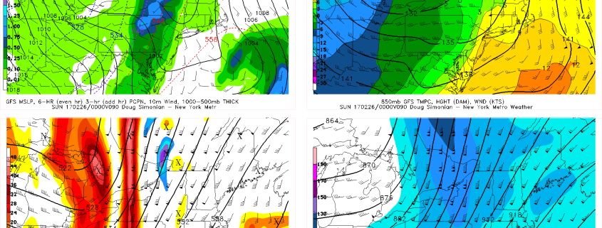
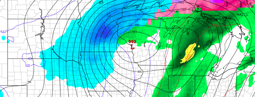
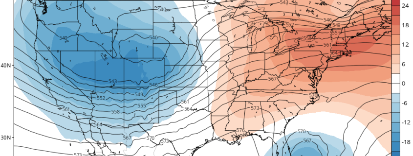
2/22 AM All Zones: Warmer Temperatures…T-Storms With Heavy Rain Possible Saturday

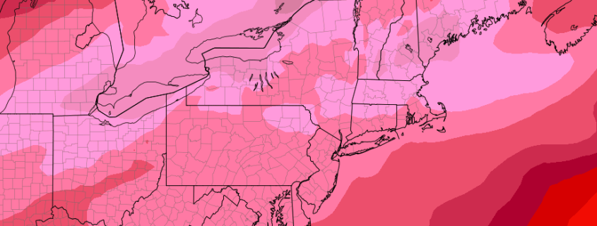
More unseasonable mild temperatures return again today with rising mid-level heights and southwest winds. Low clouds this morning, will break for some sunshine this afternoon with temperatures rising into the upper 50s to lower 60s over many parts of the region.

It will remain mild into tonight. Low temperatures with a southwest flow will only be lower to middle 40s near the coast and upper 30s inland. Some low clouds and patchy fog could also develop later tonight into early tomorrow morning.

Read more

Threat Analysis: Northern Plains/Lakes winter storm this week

A potent disturbance is forecast to eject eastwards from the Pacific Ocean this week, reaching the Western United States and eventually moving northeastwards towards the Rockies during the middle of the week ahead. Meanwhile, northern stream energy (associated with the colder, northern jet stream) will be sliding across the Southern parts of Central Canada, just north of the international border. This reinforcing cold air, combined with the disturbance ejecting from the rockies, will lead to the potential for a winter storm in the Northern Plains and Great Lakes late this week.

A low pressure system will eject from the Central Rockies into the Plains states from midweek onward — essentially from Thursday into Friday. This low pressure area is expected to strengthen as it moves through parts of the Central Plains (Nebraska and Kansas) north-eastwards towards Iowa. Forecast models have struggled to pin down exactly where the low pressure center will track, which has led to considerable forecast uncertainty.

Read more

2/21 AM All Zones: Record Warmth Possible Thursday, Stormy Saturday?

Temperatures today will again be several degrees above normal for this of year. But some mid-high level clouds increasing out ahead of warm front approaching will likely keep highs a little lower then yesterday, in upper 40s to lower 50s.

Mostly cloudy skies are expected tonight, as the warm front and shortwave trough move through. Lift and moisture become more limited as they run into the upper-level ridging. But a few scattered light rain showers are still possible, especially northwest of NYC. Temperatures will likely only drop into the upper 30s to lower 40s tonight.

Read more

2.20 PM All Zones: Warm, tranquil weather will continue

A warmer, tranquil weather pattern has settled into the Northeast US over the past several days, and despite a cooling trend over the past few days, the pattern is expected to generally continue. A cold front moved through the area last night, bringing cold air advection (movement of colder air), and the cooler air aloft quickly brought warm temperatures down towards average. Highs today were 10-15 degrees colder than yesterday in many areas.

The relatively normal temperatures will warm gradually over the next few days, while generally tranquil weather will also persist. Why the change? The answers lie in the Pacific Ocean. A changed pattern there has allowed disturbances, which were previously moving quickly eastwards towards our area, to remain much farther west and approach the U.S.A more slowly.

Read more