The general theme of the winter of 2016-2017 continues this week.
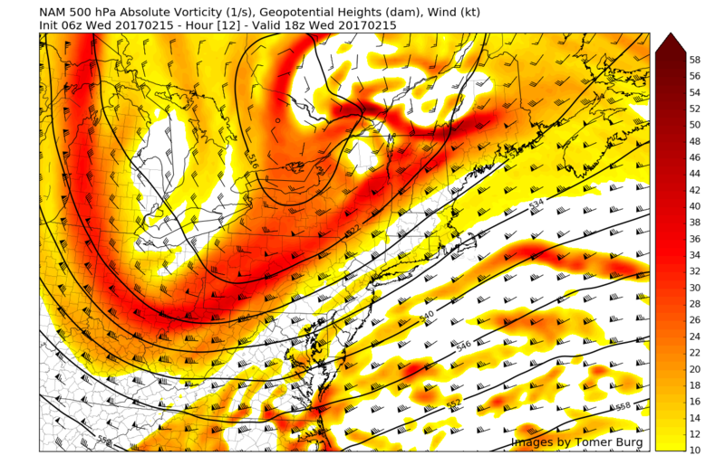
Due to a lack of blocking that would normally work to slow individual pieces of energy within the jetstream down, we have once again missed out on a sizeable storm for the Northeast. As you can see down below, we have two separate pieces of energy that were quite literally just 12-18 hours away from being able to interact with one another and produce a snowstorm for the Northeast US. The computer models were in excellent agreement over the past five days that instead, these two pieces would not be able to interact in time due to the very quick flow, and would instead come together this evening to produce a low pressure system that will track to the east of the 40N/70W benchmark while rapidly strengthening and deliver sizeable snows to southern New England and portions of Maine.
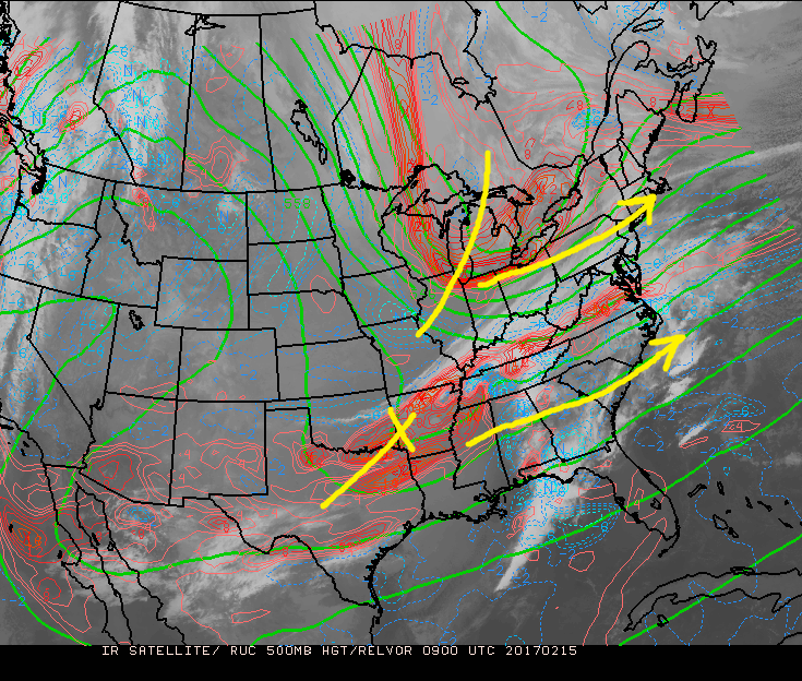
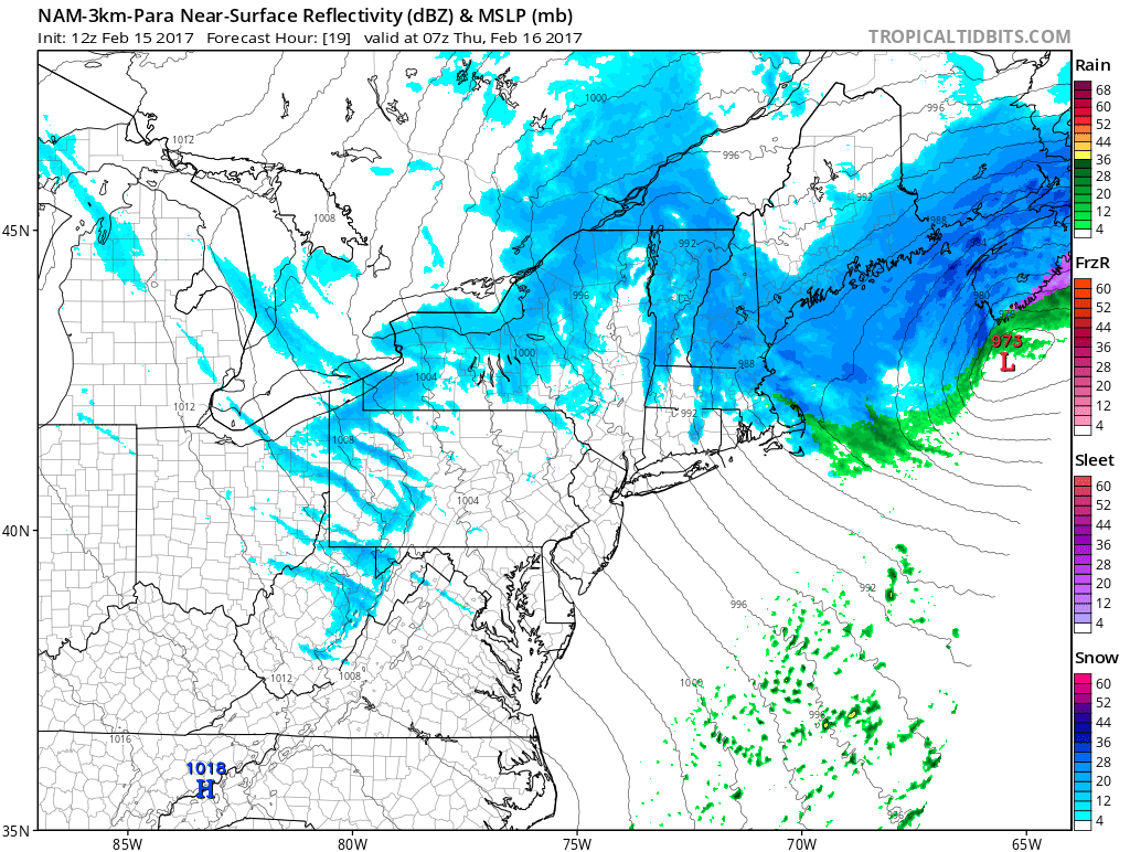
500mb map highlighting the two disturbances that were able to remain just far enough apart to prevent another snowstorm for our area (Valid 4am this morning)
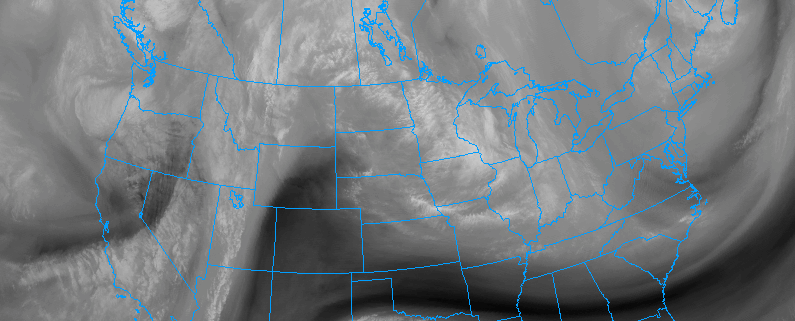
Even though we miss out on a large storm, the northern piece of energy moving over our area today is
quite vigorous and will be accompanied by a strong cold front. This cold front was located in central Pennsylvania as of 1pm this afternoon with numerous showers noted across the region. In conjunction with the strong mid level disturbance, we have
strong low-level lapse rates, which are basically the change in temperature within an area from the surface to a few thousand feet above our heads. When there is a healthy difference in temperatures with increasing height, we see upward motion take place in the atmosphere which promotes shower development like we are seeing ahead, as well as behind this cold front. This afternoons
short range computer models have been keying in on these showers and the associated cold front impacting the NYC region by 3pm or so. The entire region should expect showers lasting through the evening commute, but due to the factors mentioned above, it would not be impossible for the northern sections of the area to see some graupel or even snow mixed in with these showers as the front passes and temperatures begin to drop. Those traveling should pay attention for possibly slick road conditions in the heavier rain/snow showers this afternoon and evening. As the precipitation moves out later this evening, expect gusty winds on the order of 25-35 mph from the WNW to take over and last into tomorrow due to yet another tight pressure gradient over the area associated with the strong low exiting to our east.

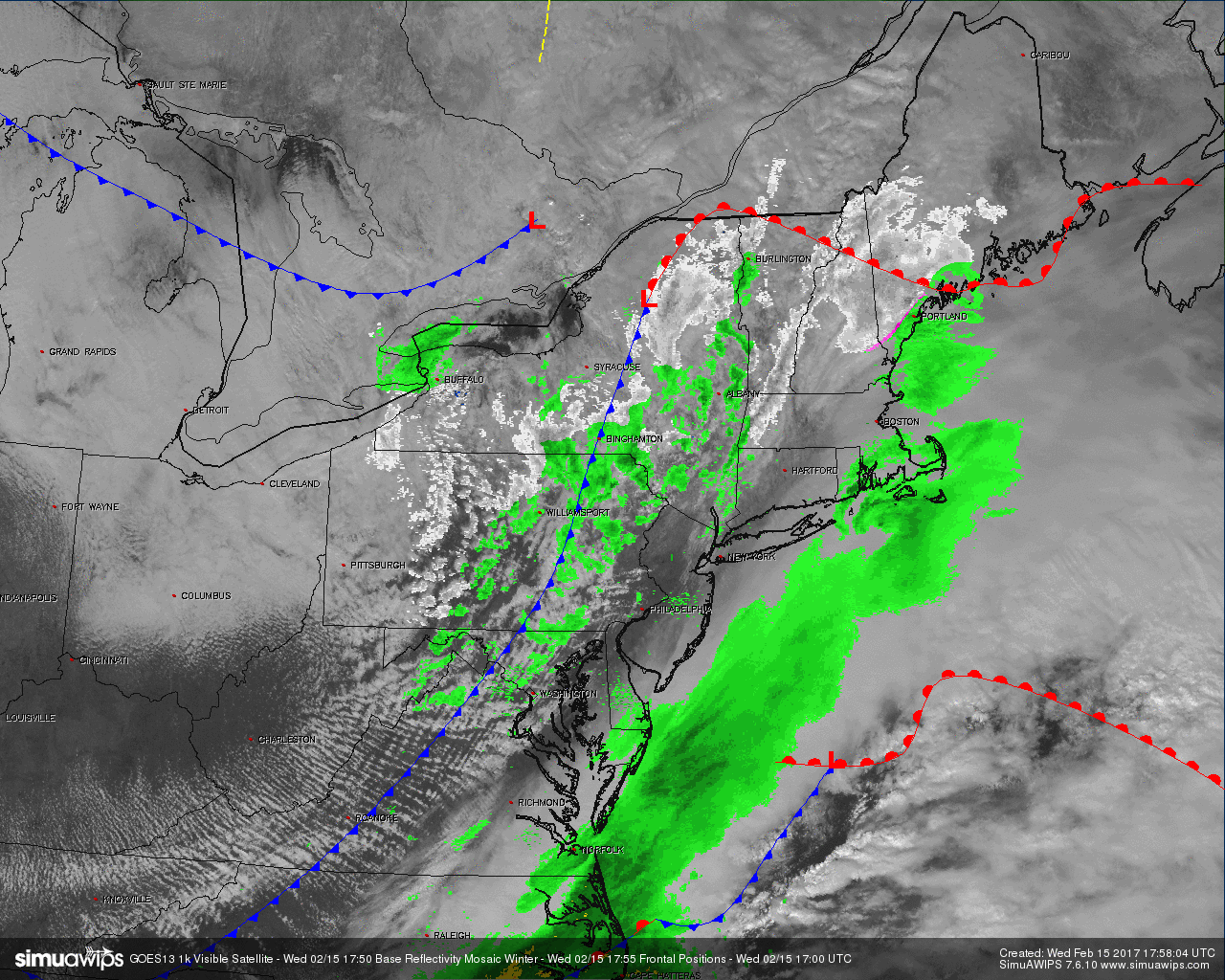
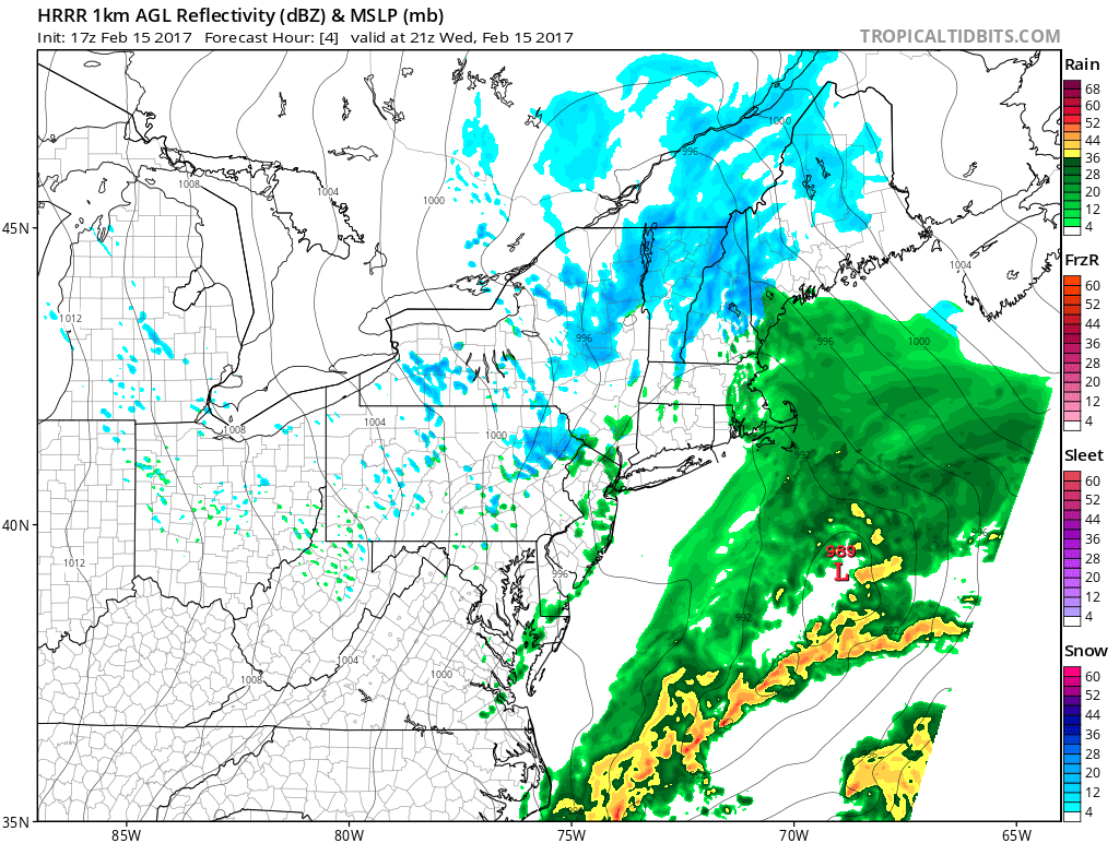
Current surface map showing the location of the cold front and associated showers set to move over the region this afternoon (Courtesy of Simuawips.com)
With temperatures this afternoon in the 30’s to middle and upper 40’s across the area, the cold front passage later today should provide a good contrast as temps fall into the low 30’s and into the 20’s for inland sections this evening. Thursday and Friday will feature a more seasonable airmass in place with highs in the middle to upper 30’s across the entire region with mostly dry weather expected for both days. As we move into the weekend, a broad area of
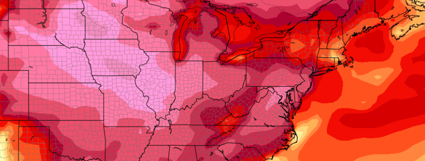
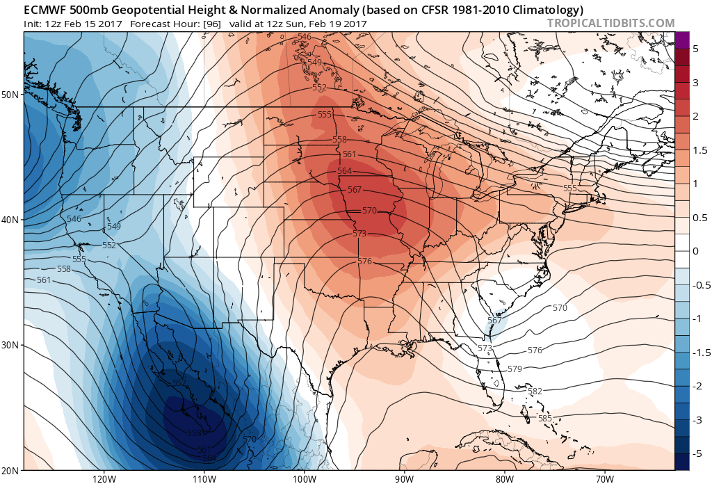
mid level ridging will move in from the west and continue east over our area. Winds from the south/southwest will send temperatures well-above normal on both Saturday and Sunday with highs deep into the 50’s across the area. Some southern locations may possibly sneak into the 60’s by Sunday afternoon if stronger southwest winds are realized. Due to the aforementioned ridging, conditions should remain dry with mostly clear skies, so this weekend should be an excellent one to enjoy the warmer weather before things turn a bit cooler and unsettled into the work week next week.
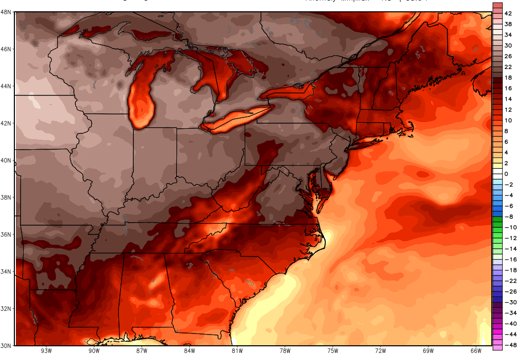
Afternoon European model showing temperatures on Sunday possibly reaching 18-24 degrees above normal (Centered on 1pm Sunday)
For more information and posts like this one, make sure you sign up for
Zone Forecasts — where multiple detailed articles, videos, and interactives are posted each day.
Have a great day!
-2")