A very dynamic work week is taking shape as both near-record high temperatures as well as a threat for accumulating snow seems to be possible by Thursday.
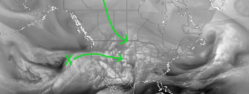
As we head into Wednesday, our attention turns toward two key pieces of energy that could possibly come together and strengthen over the Midwest/Great Lake states to produce an area-wide accumulating snow event Wednesday evening and into the day on Thursday. As of this afternoon, the first piece of energy for this potential storm system was located well offshore the California coastline. This first piece will likely come ashore on Wednesday afternoon and continue to move briskly into the Rocky Mountain region while a second piece of energy begins to dive down from the far northern territories of Canada. Today’s model guidance has shown us a wide range of possible solutions for what happens when/if these two pieces interact on Wednesday, but right now a blend of today’s models would show that these two pieces would begin to come together late Wednesday evening, which would produce the beginnings of our potential storm in the form of a surface low over the Tennessee valley.

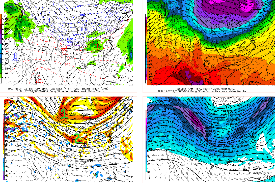
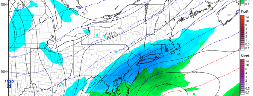
18z NAM showing interaction between the northern stream and Pacific energy and formation of a surface low (Valid 8pm Wednesday)
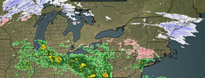
This newly-formed surface low would then have the potential to track quickly to the east/northeast during the very early morning hours of Thursday as precipitation starts to break out from southwest to northeast. Guidance shows that possible moderate precip could overspread at least the southern half of the New York metro by the time the morning commute begins on Thursday. As this system continues to head to the northeast and eventually off to the coast, the models have been hinting at the presence of an organized upper-level jet streak that would promote a strong amount of divergence (or ventilation of air) in the atmosphere which would in turn intensify precipitation at the surface as well as work to expand the extent of the precipitation to the north/west during the afternoon on Thursday into most of the area. One aspect of this system to keep an eye on is that a blend of the recent guidance as well as a look at the upper level jet configuration would suggest that as this system intensifies, there exists the potential that bands of snow may set up over the locations where forcing and precipitation are strongest, but these features in determining where the steadiest snow would exist can easily shift over the next few days and will be difficult to nail down. Though the finder details and timing of precipitation are still subject to change, it does look like the threat for at least light to moderate accumulating snowfall is increasing for Thursday.

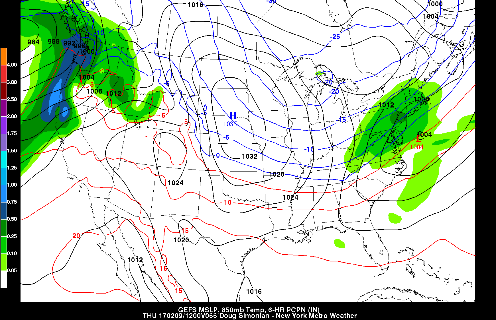
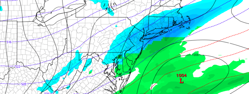
12z GFS Ensembles Mean showing a blend of various solutions for Thursday potential system (Valid 8am Thursday)
While it’s important to mention the possible impacts for this system, it’s also very important to mention what could, and more than likely will change from what we see right now. As mentioned earlier in this post, we have two key pieces of energy for this potential system that are coming from deep in the Pacific as well as deep in the northern territories of Canada. The first potential problem is that both areas are currently in regions where we have very limited methods of sampling these each feature so that we can hope to have our model guidance get an idea of what they may do in the future. As of this evening, it looks like the Pacific energy will be onshore and available for sampling sometime tomorrow evening, and the northern stream should be available around that same time. Once we can get more accurate sampling of these features, we should begin to see the guidance converge on a solution. Our second potential problem is that the Pacific energy is embedded within a very quick flow, and once it comes onshore, the energy may continue along at a quick pace and miss the essential interaction with the northern stream energy, resulting in a much weaker and drier system than is currently shown. Another issue that we saw happen just last week in quite a similar fashion was that the Pacific energy that came ashore was much weaker than what was forecast by the models, and this would lead to a solution where a weaker and more suppressed system would be likely. With these features still quite literally up in the air, make sure to check back over the next few days as this storm could trend in either direction for our area. Posts like this one are available multiple times each day to Personal and Commercial clients, including
Zone Forecast subscribers. Contact us today for more info!
Have a great evening!
-2")