1/5 PM All Zones: Active, complicated forecast through midweek

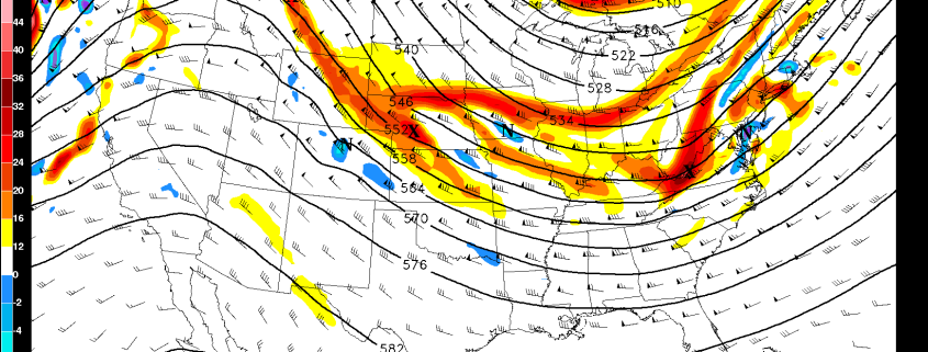
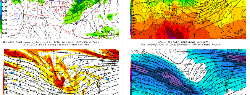
A transitional weather pattern will continue over the next few days, and multiple storm systems are expected to impact the area over the next few days. Quiet weather through Monday will give way to a developing storm system in the Great Lakes, which will move into Southeast Canada on Tuesday. Warmer air will be drawn into the Northeast US as the storm develops, and rain will spread throughout the area on Tuesday.

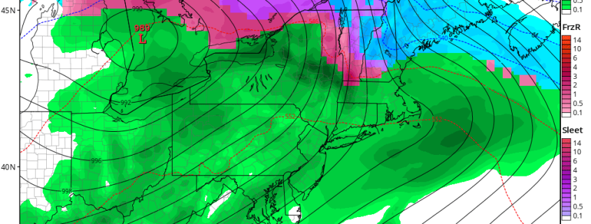
A threat for wintry precipitation will develop throughout New England on the front end of the storm system, as a cold high pressure over Canada shifts away from the area. This will be most prevalent across interior portions of NY State, Connecticut and areas further north into New England. Cold air in the lower levels will be more stout here, and multiple precipitation types are possible — including snow, sleet, and freezing rain.

Read more

AM All Zones Update: Clouds Today, More Rain by Tuesday, Another Storm Midweek?

Today will be mostly cloudy, as a weak frontal boundary moves through region. A few light snow showers, flurries or sprinkles are possible, during the day today. But these aren’t expected to amount to much, with warmer temperatures. Temperatures with southwesterly winds will be rising into upper 30s to near 40 over the Interior to lower to middle 40s today along the coast this afternoon.

High pressure begins build over the region, with drier northwest winds tonight. This lead clearing skies and overnight low temperatures in the middle 20s to lower 30s, from the interior to coastal areas. Tomorrow skies will be mostly sunny with high pressure in control. A slightly colder air mass form the north will keep upper 30s to lower 40s around the region tomorrow.

Read more

AM All Zones Update: Few Snow Showers Possible Sunday, Rain Likely Tuesday & Wednesday

Large high pressure over the Lower Ohio Valley and Mid-Atlantic regions, will provide mostly sunny skies today. But a deep northwest flow, will keep a cold airmass with temperatures several degrees below seasonal averages, over the region. High temperatures will be in the lower to middle 30s, again by this afternoon.

Then high pressure starts moving offshore tonight. It remain cold and dry. But the flow with turn more southerly. Some clouds will increase during the evening and overnight hours, well ahead of a weak storm system to the west. More cloud cover and a light southerly flow, will likely keep low temperatures a little warmer tonight. Lows will likely be somewhere in the 20s, for most of the region.

Read more

AM All Zones Update: Cold Weekend, Tuesday & Wednesday Storm

A colder than normal airmass will be over the region through at least Saturday night. Some more clouds will be around later today and early tonight with weak shortwave trough and cold front moving through the region. A few widely scattered snow showers can’t be ruled out again, especially over the Interior. But high pressure over the Ohio Valley and Mid-Atlantic regions will largely be in control with dry weather over the next few days.

Read more