One thing that is always a daunting task as a storm chaser is heading out when you know your chase is heavily weighted on high resolution models. It’s something I have found most chasers unwilling to admit, especially on days that feature more conditional threats. This was exactly the case on July 11th, 2017. I departed Minneapolis in the mid morning hours understanding that the threat for severe weather and tornadoes was highly conditional. Part of my confidence was based on synoptics, but a large majority of it was also based on the behavior of CAM’s (convective allowing models), suggesting the development of monster supercells in North Dakota that afternoon. I would not be disappointed.
[mapplic id=”29256″]
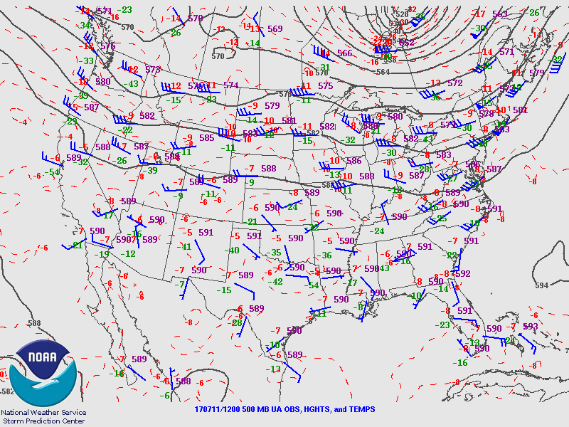
The synoptic setup was characterized mostly by a weak area of height falls and an associated shortwave trough moving through Southern Canada and into parts of the Dakotas. The airmass in place was extremely unstable prior to the disturbances arrival. Forecast models int he days prior, however, had struggled in their suggestion of storm development. Some showed almost none at all, with very limited influence from the incoming disturbance. Others showed storms congealing rapidly into a complex of supercells – I wanted no part of that.
I decided to hedge my bets that storms would initiate discretely in North Dakota and push southeastward. The terrain out here is great, sans for one river that runs along the Dakota/Minnesota border on a north to south gradient toward Fargo. Of course, this is exactly where a tornadic storm would develop. We’ll get to that later.
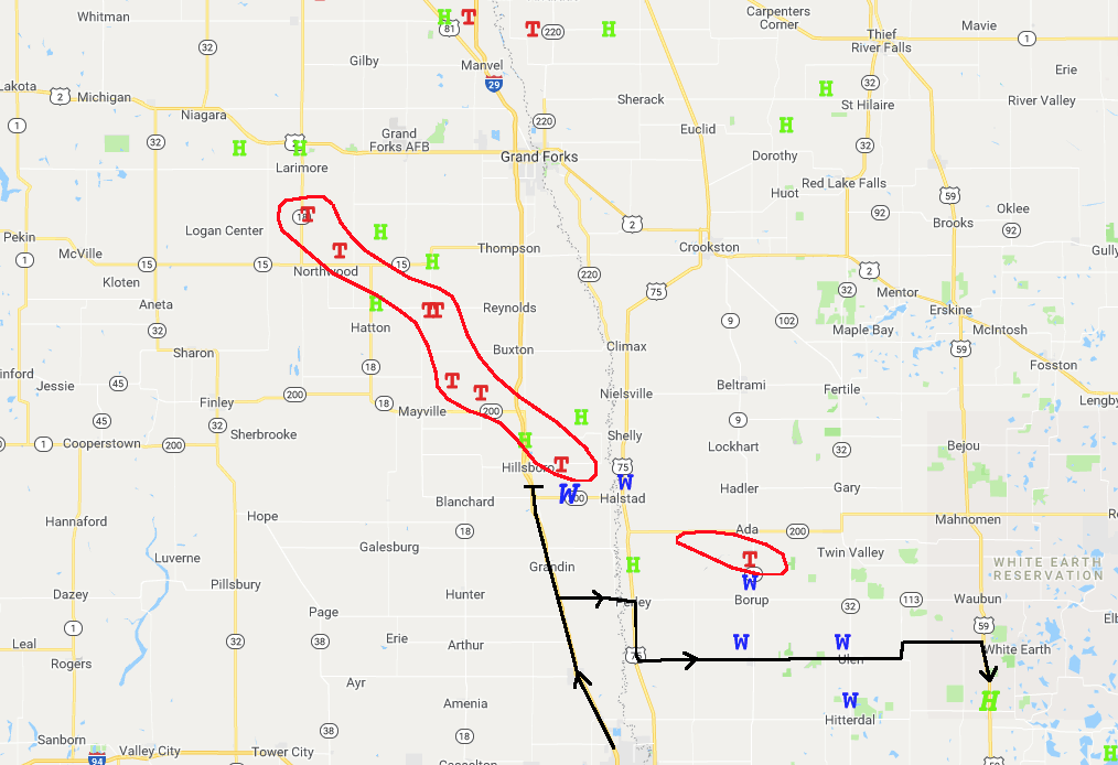
The tornado’s path (outlined in red, not meant to scale the size of the tornado), and my path outlined in black.
I chose during the afternoon to take a northward position near Fargo. There was another area of potential activity further south that many storm chasers were targeting for more discrete activity. This was removed from the best kinematics, however, and given the fragile setup I did not want to gamble any further away from the best wind fields. This turned out to be a good decision. Convective imitation occurred rapidly during the mid afternoon hours and supercells in North Dakota quickly started rotating.
I was able to position south the “main” supercell that was tracking southeastward from near Larimore towards Mayville. As mentioned earlier, there was unfortunate placement here, with a river running to my east and only a few roads crossing it. Given storm motions angling southeast (toward the river), I became cautious as my escape routes were much more limited than on a typical road grid. Nevertheless I decided to move slightly further north toward Hillsboro and approach the storm that was producing a tornado.
As I got there, however, the storm rapidly transitioned to high-precipitation in nature. This is a bad sign – the “bears cage” (Where the RFD and tornado exist) started to rapidly expand in front of me and I noticed very little lateral movement to my left or right. The low level rotation was moving towards me on a south-of-southeast angle. I decided to bail. I turned south and drove a bit of a ways away from the storm, which I maintain was a smart decision.
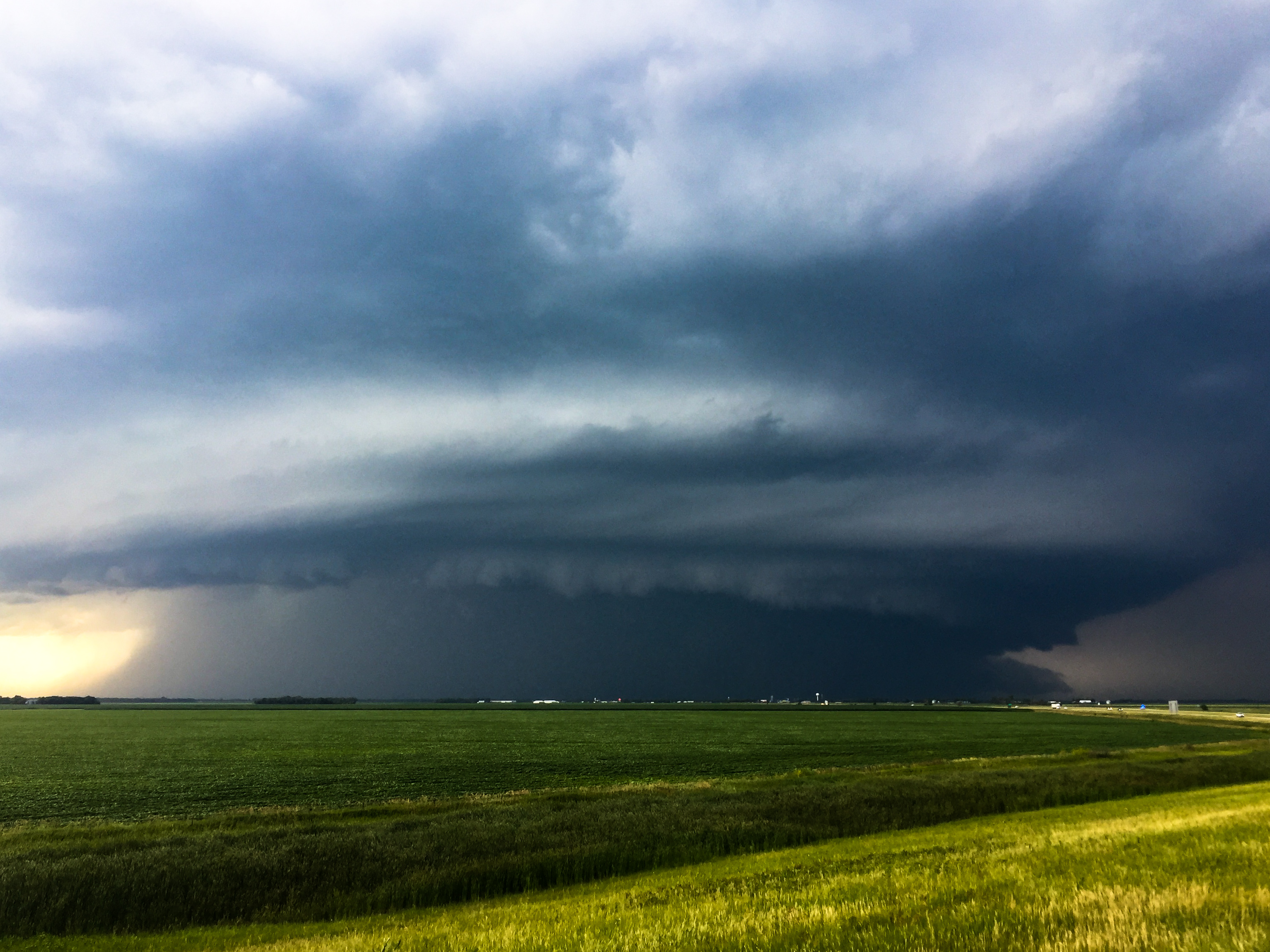
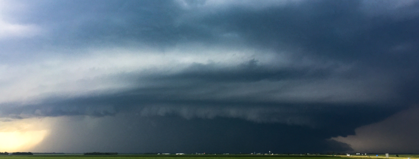
The tornado-producing storm in North Dakota.
Comfortably out of the bears cage, the storm began to transition back on a southeast heading. This gave me some time to move east near the river. Still, the tornado was completely rain wrapped and the bears cage was very dangerous. The storm was beginning to wrap up and I could sense the cooler outflow developing. I decided, again, to bail eastward away from the large hail and strong winds.
I maintained excellent structural views, but was never truly able to capture the tornado. While it may seem that it “Alluded” me, what actually transpired was a hedge towards safety. I could have very easily pushed closer to the storm, but given the high precipitation transition and southerly turn, I was not comfortable doing so. I’ll remember this chase fondly as the structure I observed was the best I had ever seen – high precipitation beauty. There was a tornado in there somewhere, I was just not willing to risk my safety to see it.
-2")
 2018 John Homenuk
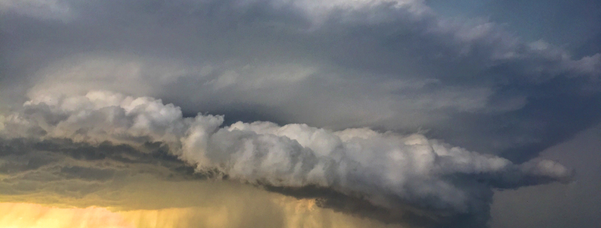 2018 John Homenuk