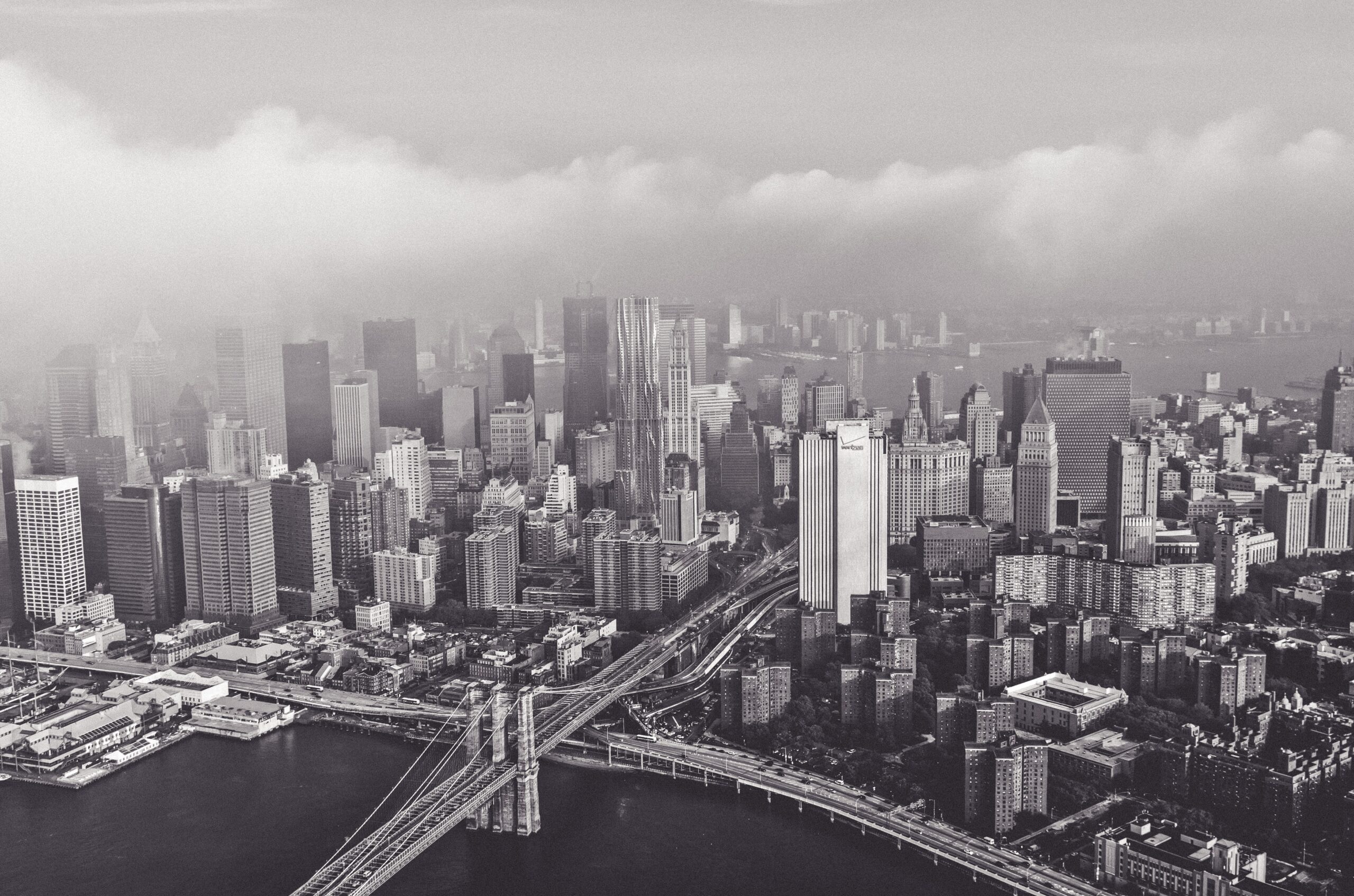
After what has been an unseasonably warm October so far, we have finally seen temperatures feeling more like Autumn over the past couple of days. A strong area of low pressure associated with the rain and cold front on Saturday has departed into Canada, dragging down cool, Canadian air behind it via northerly winds. A pressure gradient between this area of low pressure and high pressure in the Tennessee Valley will keep a blustery north wind in place this morning.
https://www.nymetroweather.com/wp-content/uploads/2021/10/daniel-frank-UoUqvOOwDh8-unsplash-scaled.jpg17072560Doug Simonianhttps://www.nymetroweather.com/wp-content/uploads/2024/02/Empire-2000-x-300-px-2.pngDoug Simonian2021-10-19 09:17:472021-10-19 13:12:58Fall weather is finally here, rain takes a hiatus for now
Hello NYC, and welcome to our third summer of the year. It’s warm and humid out there this afternoon – again. It’s not all bad news though, as a cold front will swing through the area later Saturday. Cooler and much more pleasant air will follow behind it on Sunday and Monday.
In the meantime, we’ve got the second edition of our Weather Mailbag ready to roll. You hit us with some great questions this week. We tried to answer them all, but we had to push some of them back for next weeks mailbag – we promise we will answer them! Here goes nothin’
https://www.nymetroweather.com/wp-content/uploads/2019/10/ezra-jeffrey-comeau-a-xLhxNzixQ-unsplash.jpg28484288John Homenukhttps://www.nymetroweather.com/wp-content/uploads/2024/02/Empire-2000-x-300-px-2.pngJohn Homenuk2021-10-15 15:03:312021-10-15 15:10:05Mailbag: When will it feel like fall outside?
Happy Friday! High pressure will allow for more sunshine to mix with clouds through this afternoon. High temperatures will reach the middle 70s, which is several degrees above normal. For tonight, clouds and onshore flow will increase, as a backdoor cold front moves through the area. Temperatures will drop overnight into the upper 50s and lower 60s.
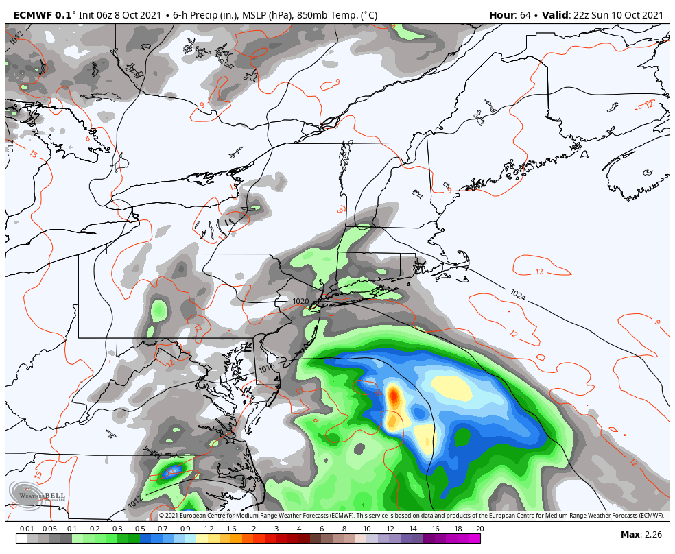
For this weekend, an onshore flow will continue to persist between high pressure to the northeast and a coastal storm developing off the Carolina coast. This will likely keep cloudy, cool dreary conditions for much of the weekend. Temperatures will likely struggle to get out of 60s in the area on Saturday and Sunday.
A few showers could develop over parts of the area later in the day on Saturday, as moisture convergence from the onshore flow increases. Then chances for showers will increase again on Sunday, as the coastal storm tracks a little further northeast and interacts with an upper-level trough passing to the north. But stronger high pressure to the northeast will likely keep any bands of heavy rain disorganized and south of the NYC metro area.
ECMWF model suggests showers in the NYC metro area on Sunday with a broad, disorganized coastal storm to our south
Some showers could linger into Sunday night. Then on Monday the coastal storm will begin weakening and heading further offshore. Chances for showers will decrease and skies could begin clearing by Monday afternoon. High temperatures will likely reach the upper 60s or lower 70s again with more sunshine.
Then a stronger upper-level ridge will build over the Northeast for rest of the next week. This will allow for warmer conditions to return with temperatures likely reaching the middle 70s again on Tuesday and Wednesday. A weak cold front may approach with few showers later on Wednesday. But temperatures will likely remain warmer than normal into late next week.
Good afternoon, NYC! While today is not overly warm, it is quite muggy with dewpoints in the mid 60s. This is because there is a large trough situated in the Ohio Valley extending into the Southeast US, which is sending a moist airmass from south to north, into our area.
This moist airmass is important to the forecast, as it helps to trigger showers and thunderstorms — warm and moist air has the tendency to rise, potentially into thunderstorm clouds. You then just need a “trigger” — an ignition to the weather pattern aids the lift further to allow this lift to result in clouds, rain, and thunderstorms.
https://www.nymetroweather.com/wp-content/uploads/2021/10/img_8557.jpg7951296Doug Simonianhttps://www.nymetroweather.com/wp-content/uploads/2024/02/Empire-2000-x-300-px-2.pngDoug Simonian2021-10-04 13:43:572021-10-04 13:48:33Locally Strong T-Storms Possible Today, Mainly Dry Rest of This Week
Hi friends! Our website uses cookies to provide an optimal browsing experience for you. New "Cookie Consent" laws mandate us to inform you of this. As long as you're cool with it, just hit OK. You'll only see this message once.
We may request cookies to be set on your device. We use cookies to let us know when you visit our websites, how you interact with us, to enrich your user experience, and to customize your relationship with our website.
Click on the different category headings to find out more. You can also change some of your preferences. Note that blocking some types of cookies may impact your experience on our websites and the services we are able to offer.
Essential Website Cookies
These cookies are strictly necessary to provide you with services available through our website and to use some of its features.
Because these cookies are strictly necessary to deliver the website, refusing them will have impact how our site functions. You always can block or delete cookies by changing your browser settings and force blocking all cookies on this website. But this will always prompt you to accept/refuse cookies when revisiting our site.
We fully respect if you want to refuse cookies but to avoid asking you again and again kindly allow us to store a cookie for that. You are free to opt out any time or opt in for other cookies to get a better experience. If you refuse cookies we will remove all set cookies in our domain.
We provide you with a list of stored cookies on your computer in our domain so you can check what we stored. Due to security reasons we are not able to show or modify cookies from other domains. You can check these in your browser security settings.
Other external services
We also use different external services like Google Webfonts, Google Maps, and external Video providers. Since these providers may collect personal data like your IP address we allow you to block them here. Please be aware that this might heavily reduce the functionality and appearance of our site. Changes will take effect once you reload the page.
-2")